
On Friday morning, 9/6/19, we were dropped by taxi back at the Crone car park and it was a short walk to get back on the Wicklow Way.
Just like the first two days, the third day was wonderful from start to finish. At just over 14 miles it was the shortest day, which gave our aching feet (legs were fine but some toes and arches were starting to complain) just a bit of a break.
As we headed up the shoulder of Dublin Mountain, nearing the end of the journey, we saw a sign that reminded me of a friend with whom I had had lunch the previous week who, upon hearing I was going to hike in Ireland, said ‘At least it will be a level walk because there are no mountains in Ireland.’

It was with mixed feelings that we approached the end of our journey. We hated to admit the amazing experience was ending, but our bodies (particularly the old man’s) were suggesting we take a bit of a rest.

One visual guide for us was the mountain above, which we saw repeatedly from different elevations and points of view. It is not all that far west of the Irish Sea and it looks like a great destination for a future trip.
We did not hike the entire length of the Wicklow Way; we did a bit more than half, 53 miles/85 km. At one point we passed a sign that marked the exact middle of the Wicklow Way.
All along the way are helpful trail markers. When in doubt, look for one of these signs:

To Wicklow walkers I suggest using a great map guide, such as the guide we were supplied by Hillwalk Tours as a supplement. Not every sign is very obviously visible (undergrowth expands, of course) but if you follow your progress on the map and know where to expect twists and turns, the maps plus the Wicklow posts are pretty much on the money. We grew to love that little yellow walker.
Finally, we came down and down and down and landed in Marley Park which, we noticed, adjoins a nice looking golf course, as seen on Google Earth below this picture of the Marley Park map:


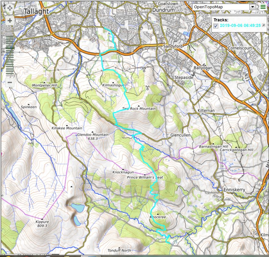
Here are the topo and Google Earth tracks:

According to the MyGPS web site, the combined elevation gain for all three days was 12,342 feet. That kind of feels like more than it was. On the other hand, the Wicklow Way is (look at an elevation profile online if you choose) quite a bit of up and down and up and down.
One of the steepest sections was at Miner’s Way, which we did in the teeth of yet another tough wind and sideways rain. In fact, I was wearing my jacket around my waist and was in short sleeves during the worst of this stretch. I knew I should put on the jacket but it was so windy I was afraid if I tried to put it on it would blow away. So I just got cold and wet.
So it goes on the Wicklow Way.
Finally, this was without a doubt the greatest road experience of my life and, I believe I can say the same for Derek. We have no specific plans to do anything like this again, but we were idly speculating about a possible future trip to the west coast of Ireland, in the area of Dingle Town….