It is my fault, not Derek’s. We did not reach the Mt. Washington summit. At the last opportunity to take a wrong turn I steered us wrong. And I had to be home by 4PM (we hit the trail at 9:10 AM, and it is a long drive home on a weekday afternoon) so when we figured out what we should have done it was too late to do it right.
Getting to the summit via Great Wall is for next time.
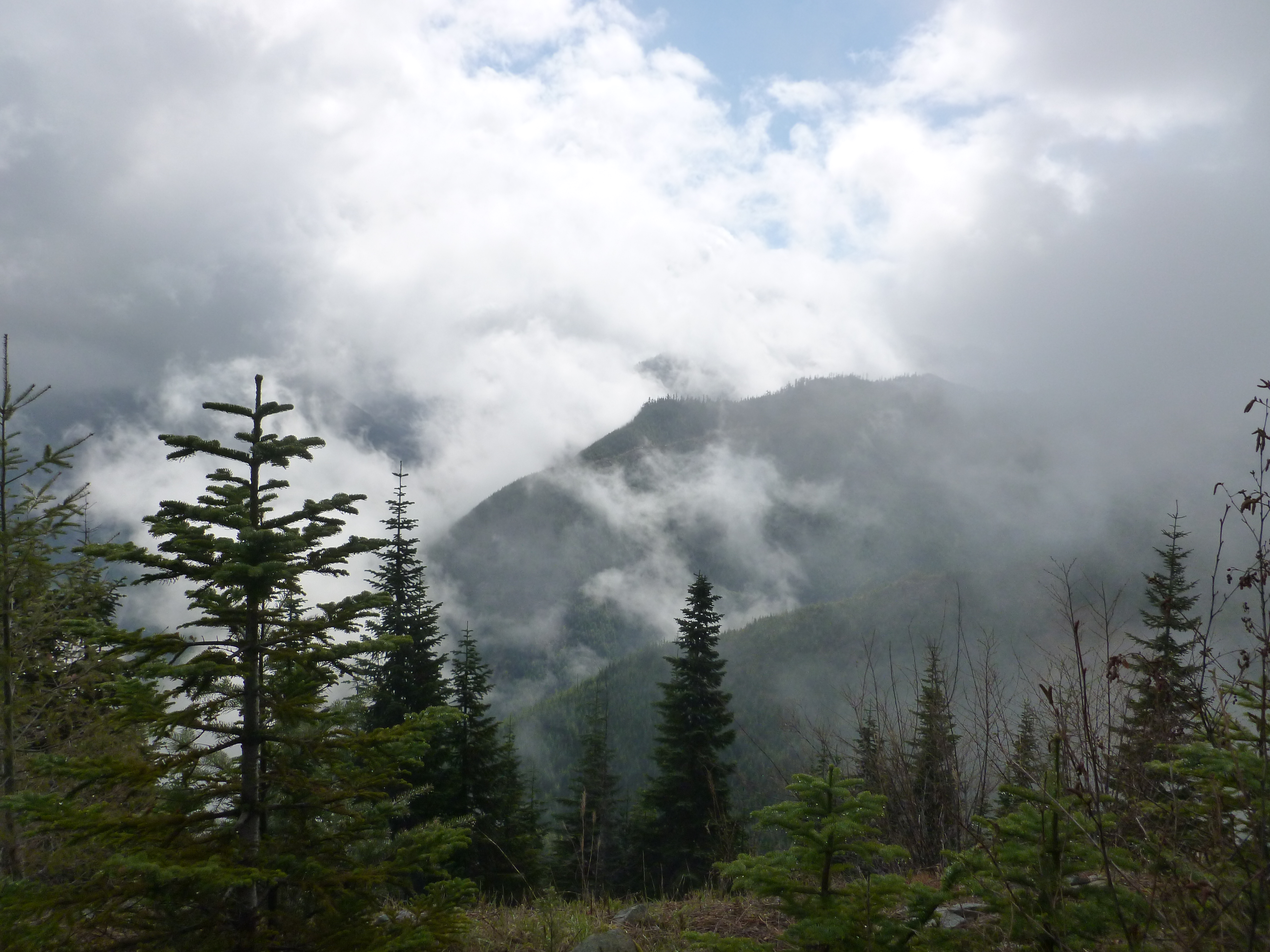
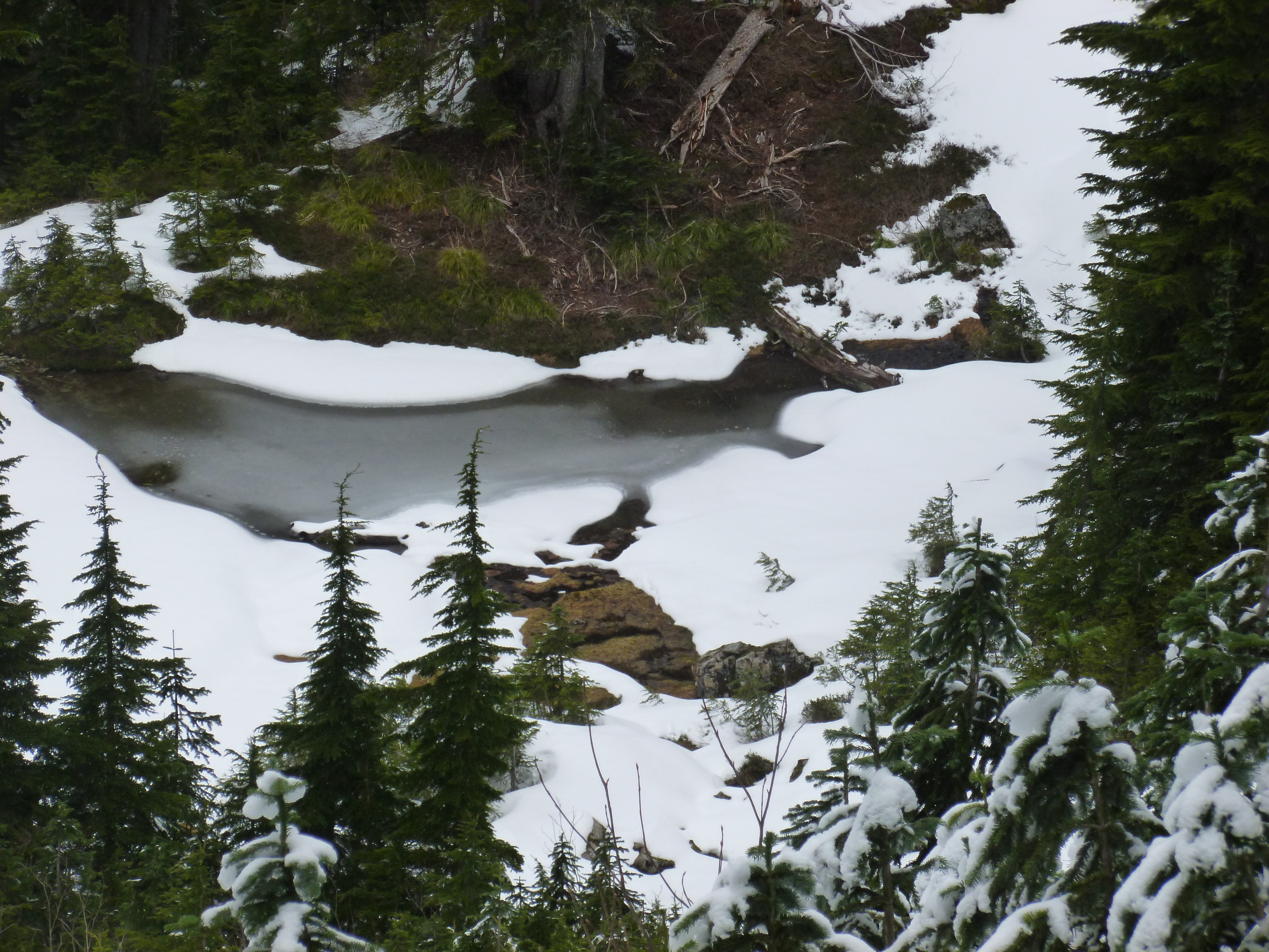
But what a fun day anyway. 10 miles round trip, nice and steep much of the way and those views! Every day is different. No snow yesterday and I was amazed that so much snow can melt in only 2 days. There were misty clouds floating around that really gave the scene a wonderful touch:
Mysterious sky
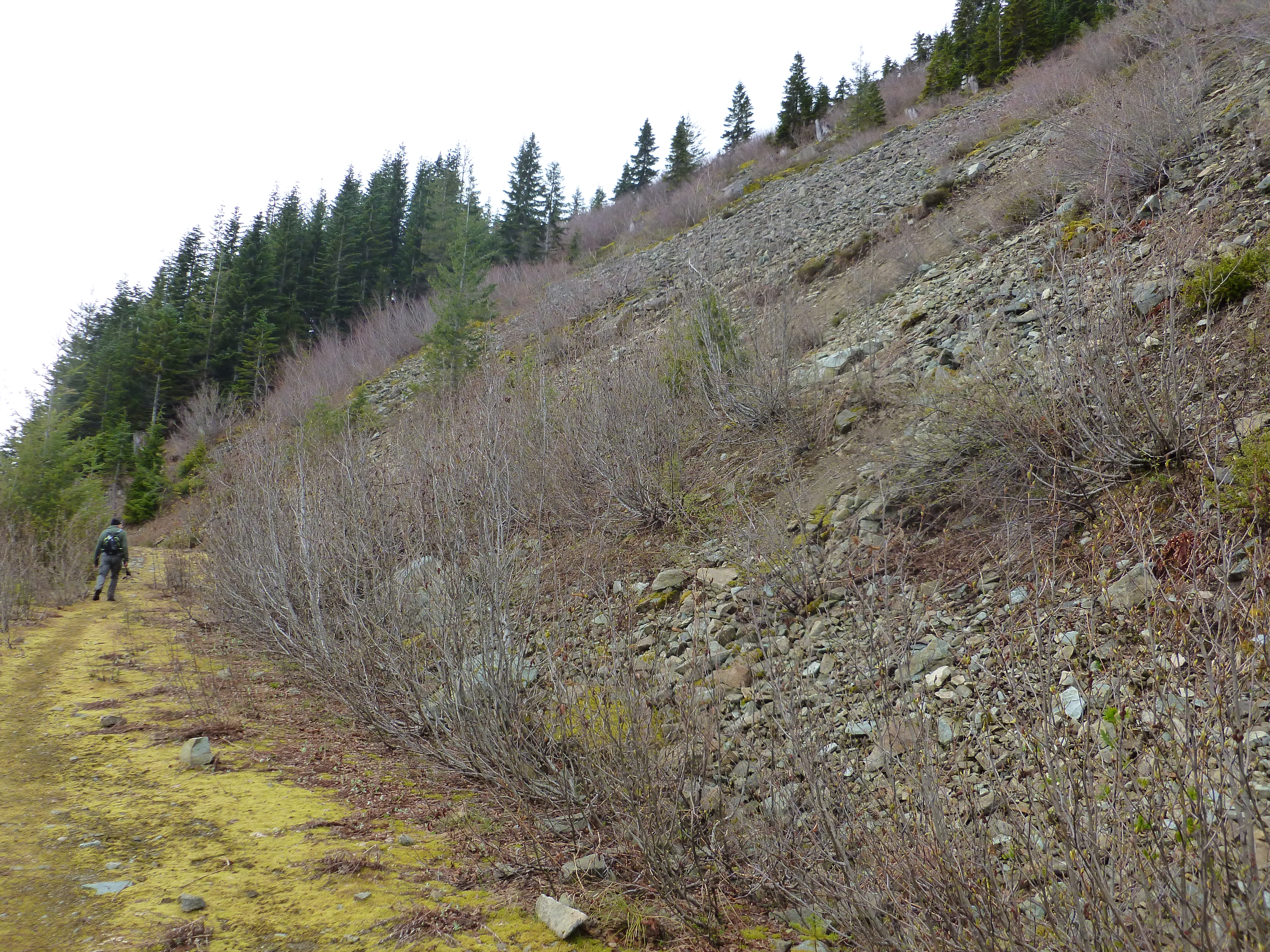
Walking along the ‘great wall’ section of the Great Wall trail inspires a little focus, because you wonder if this is the moment when some of those rocks and boulders decide to take the path of least resistance, give up the fight, and roll downhill?
Good news: easy trail Bad news: what if those rocks decide to tumble?
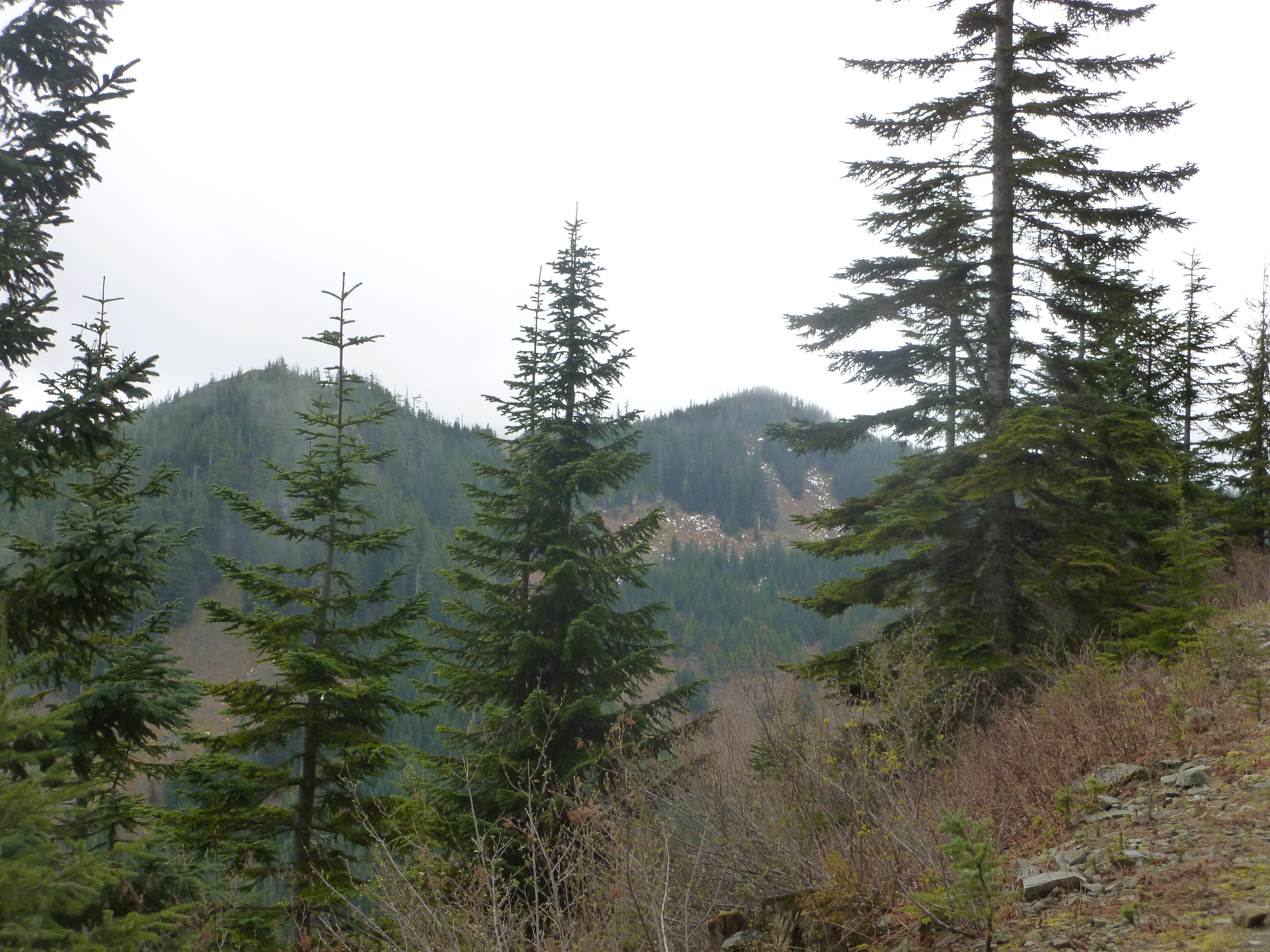
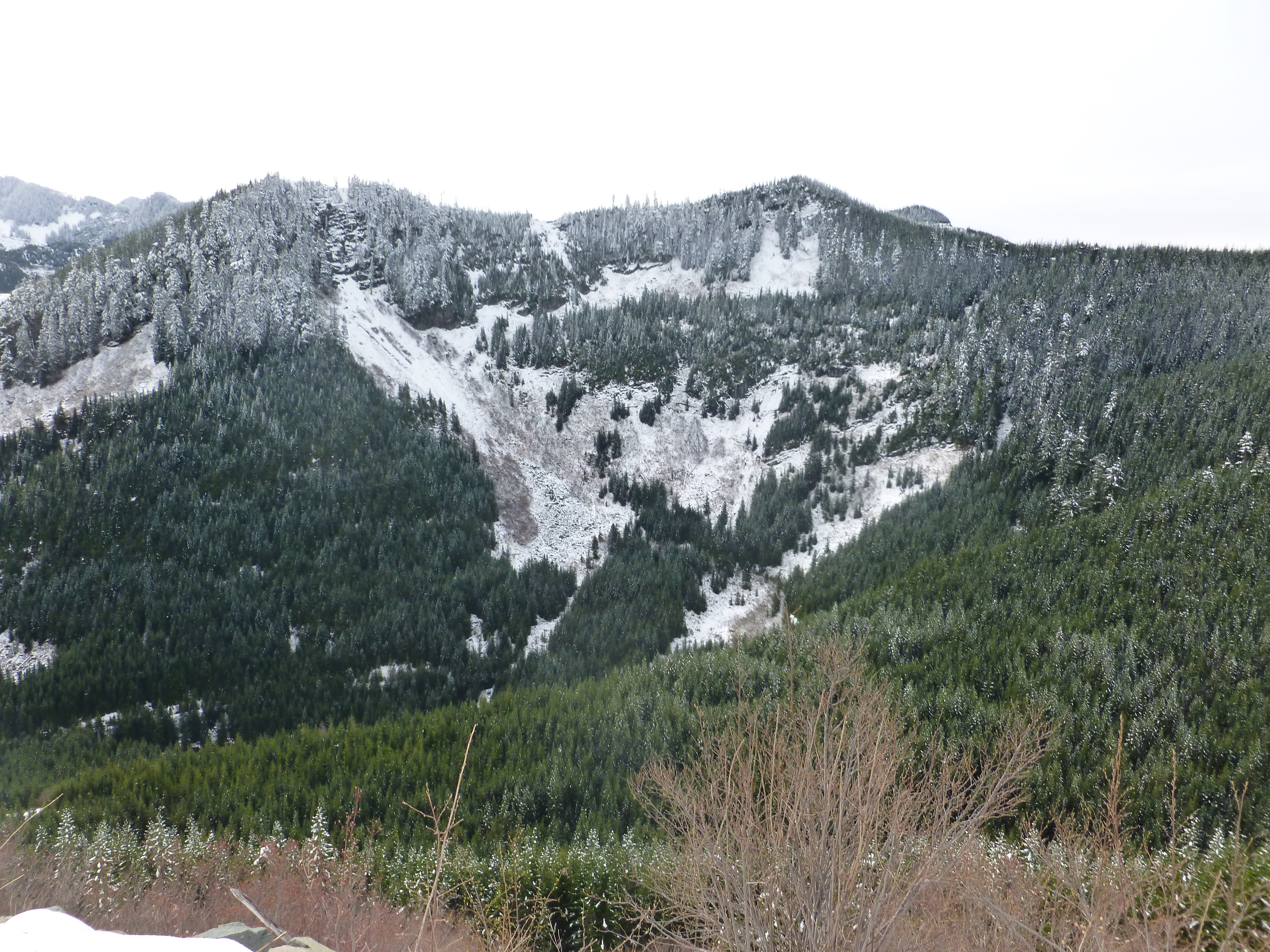
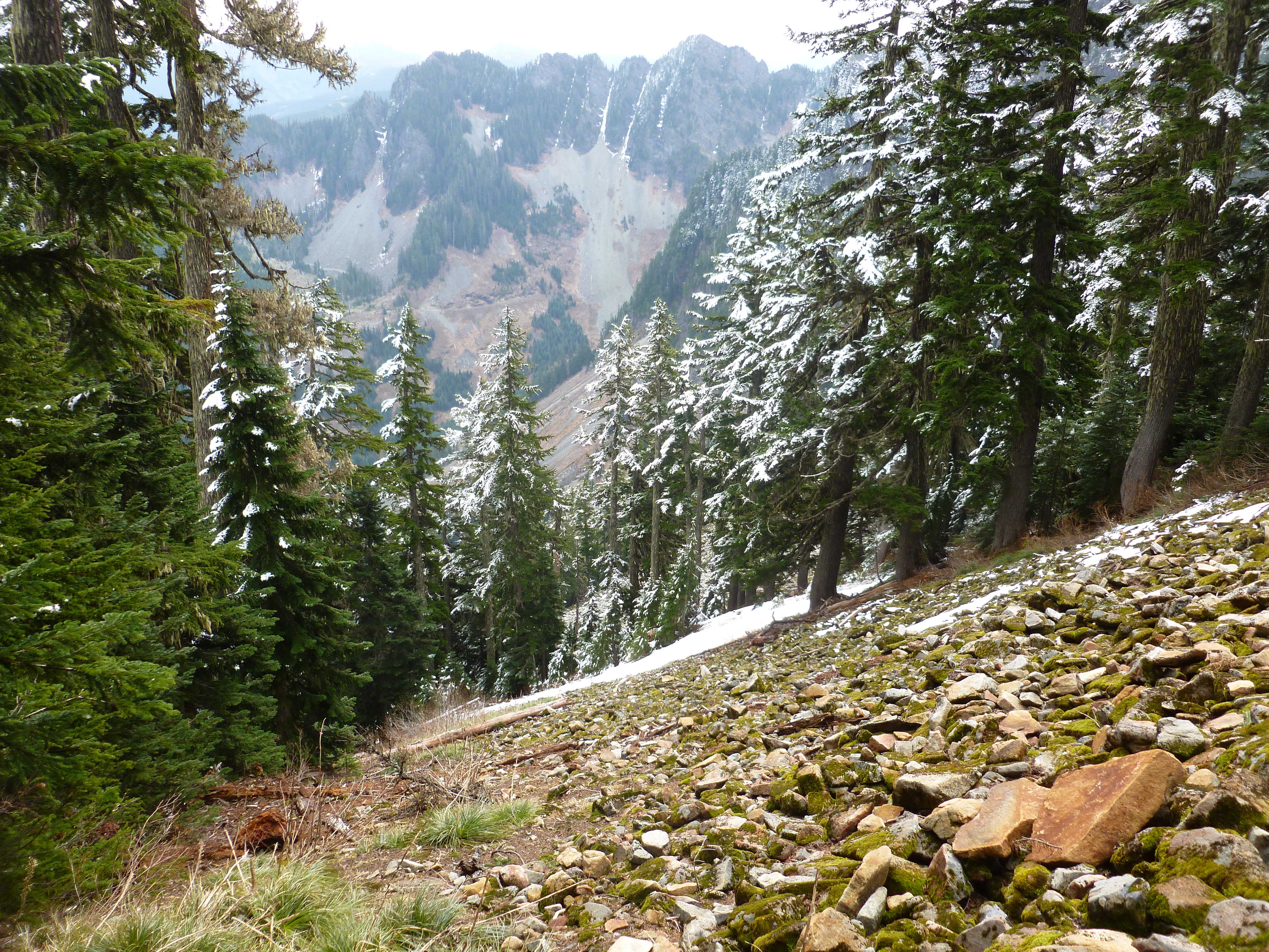
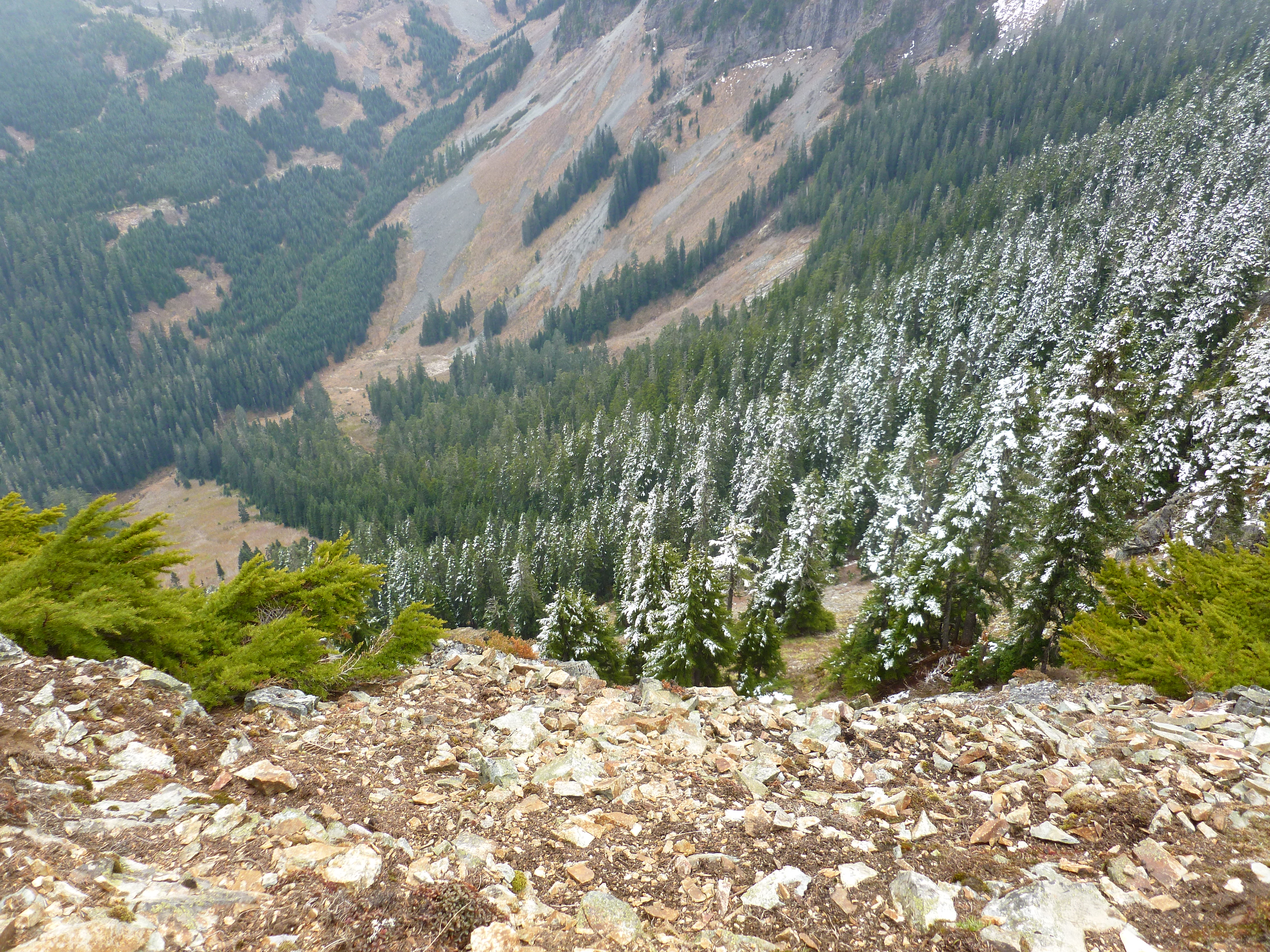
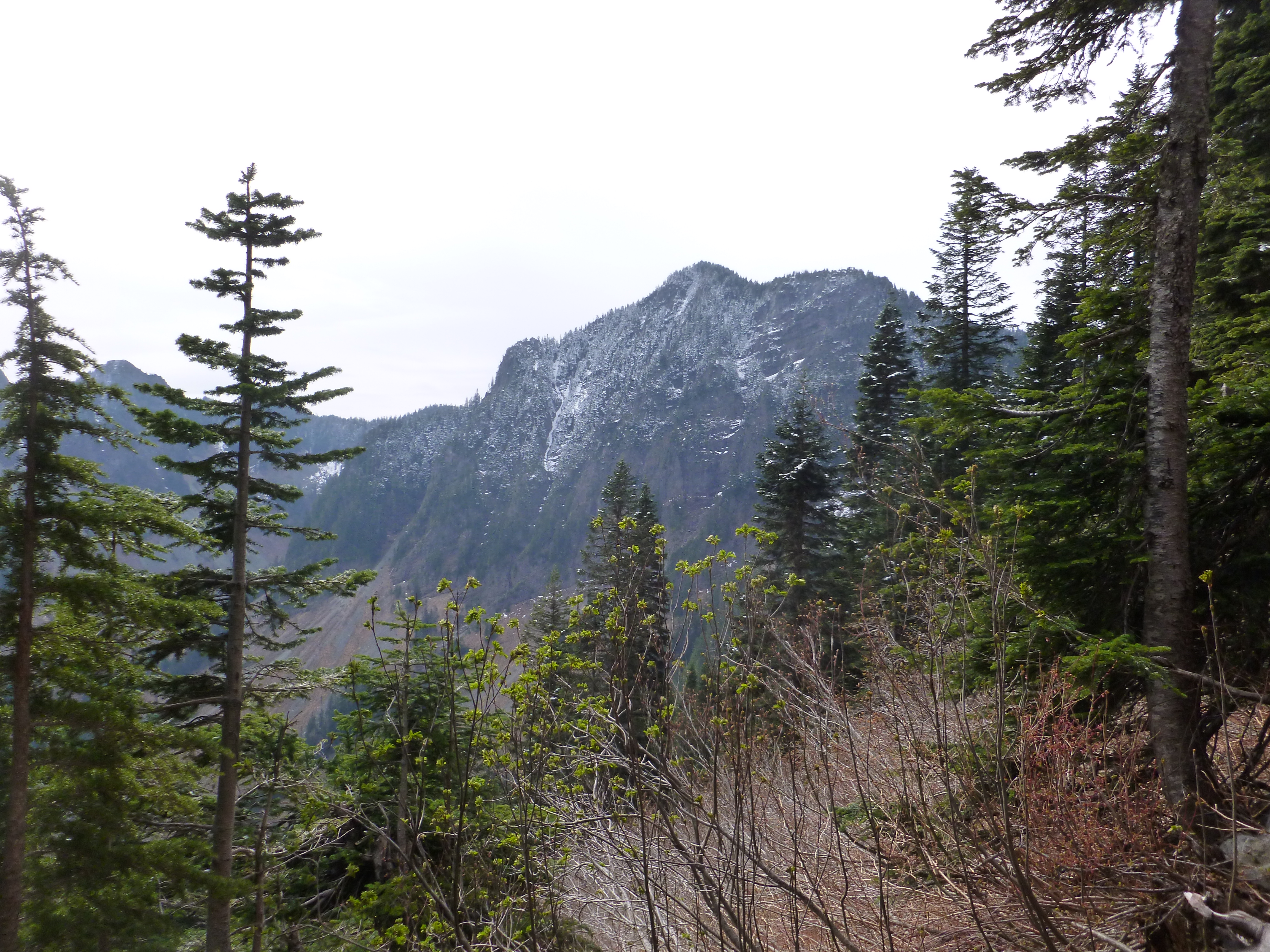
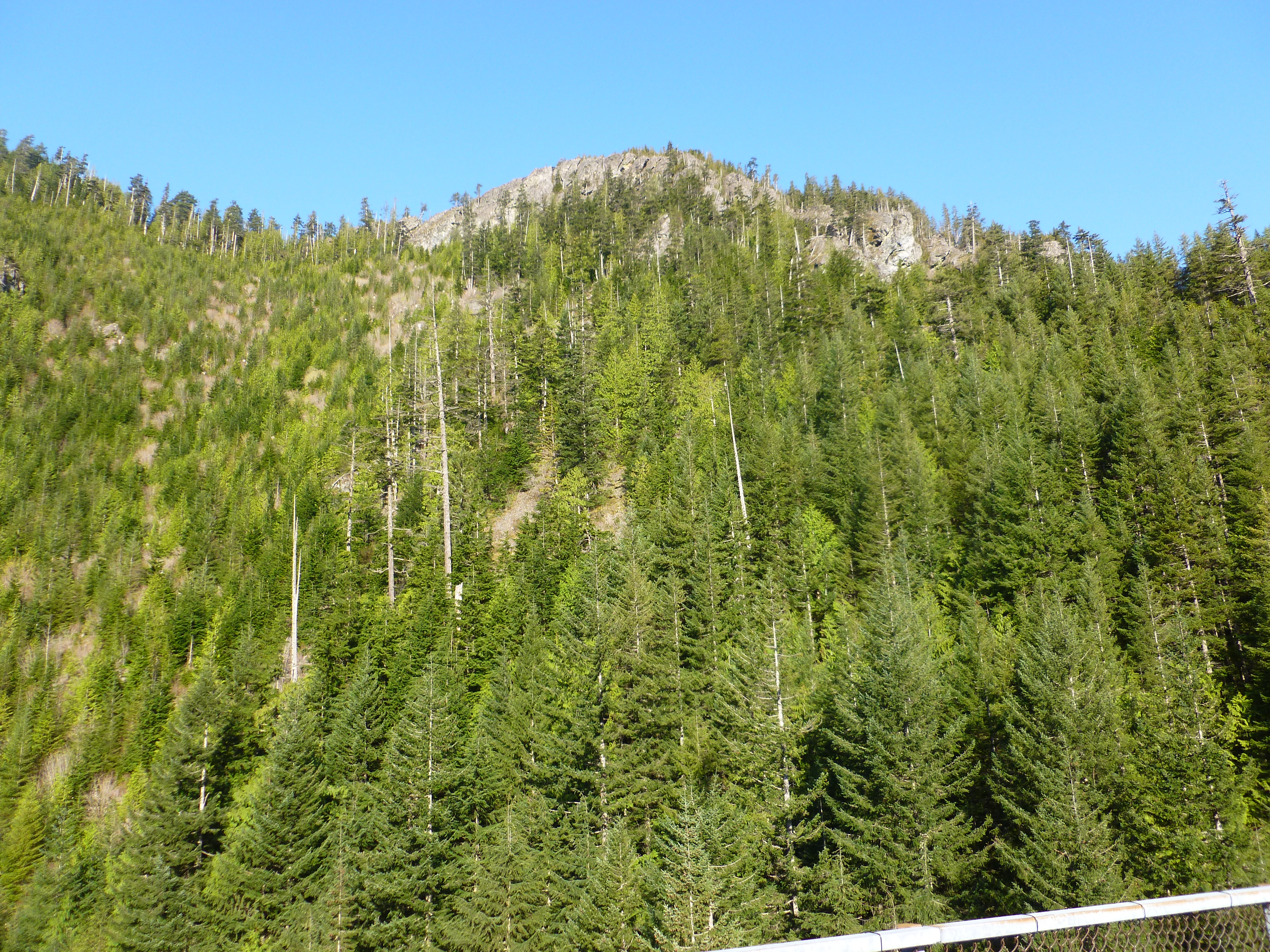
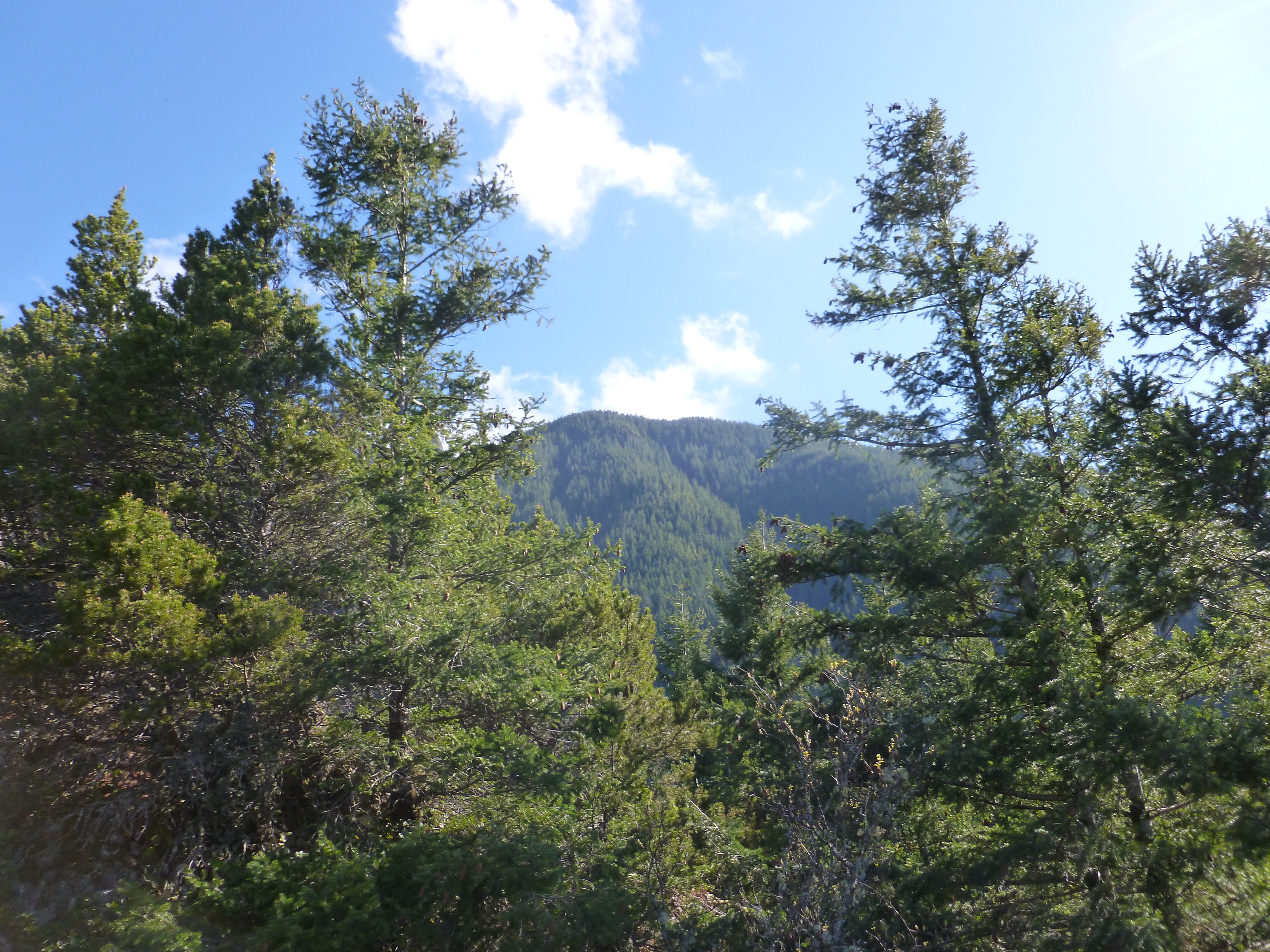
But it is all too easy to let your attention drift from the mountain above to the mountains nearby:
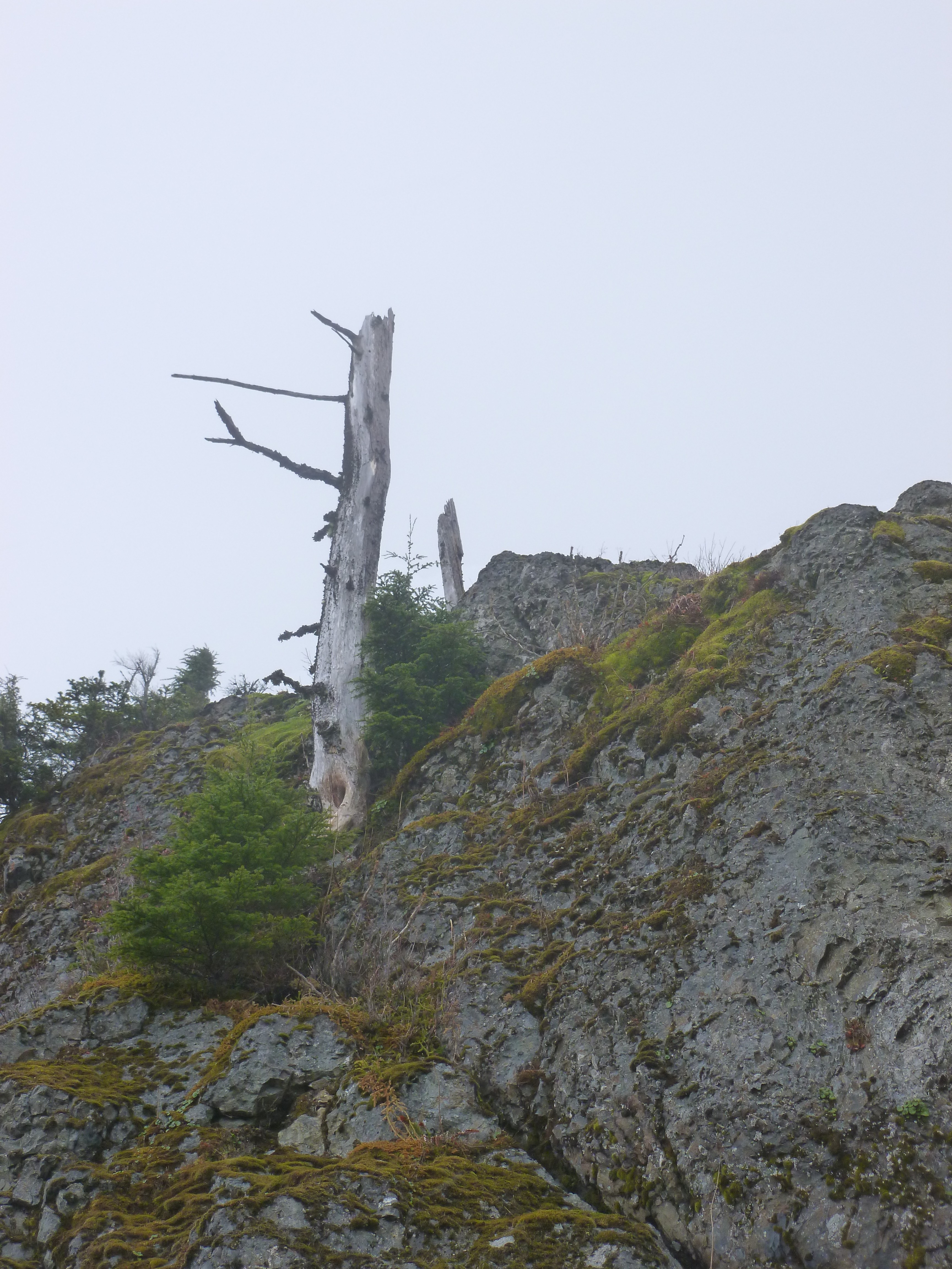
Naked slashes on a neighboring mountain
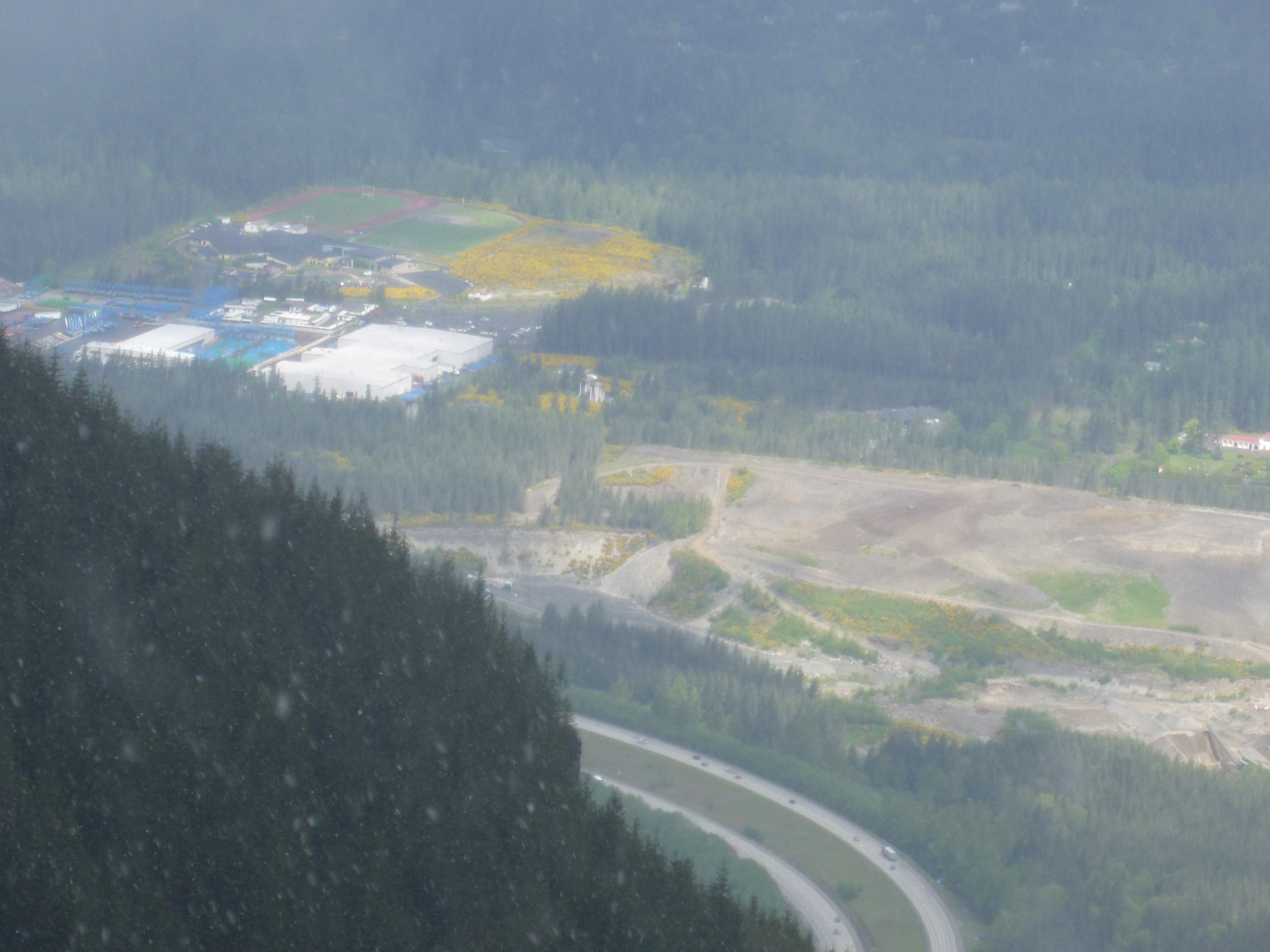
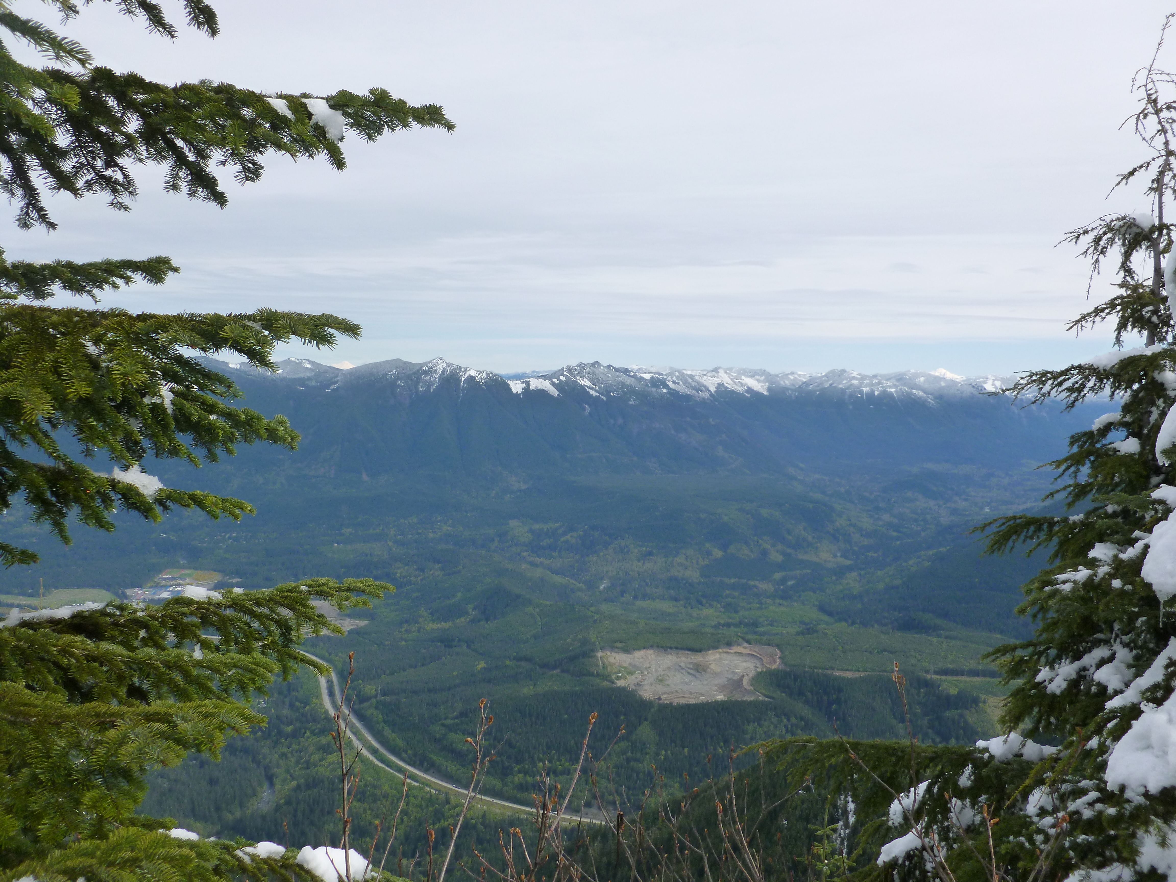
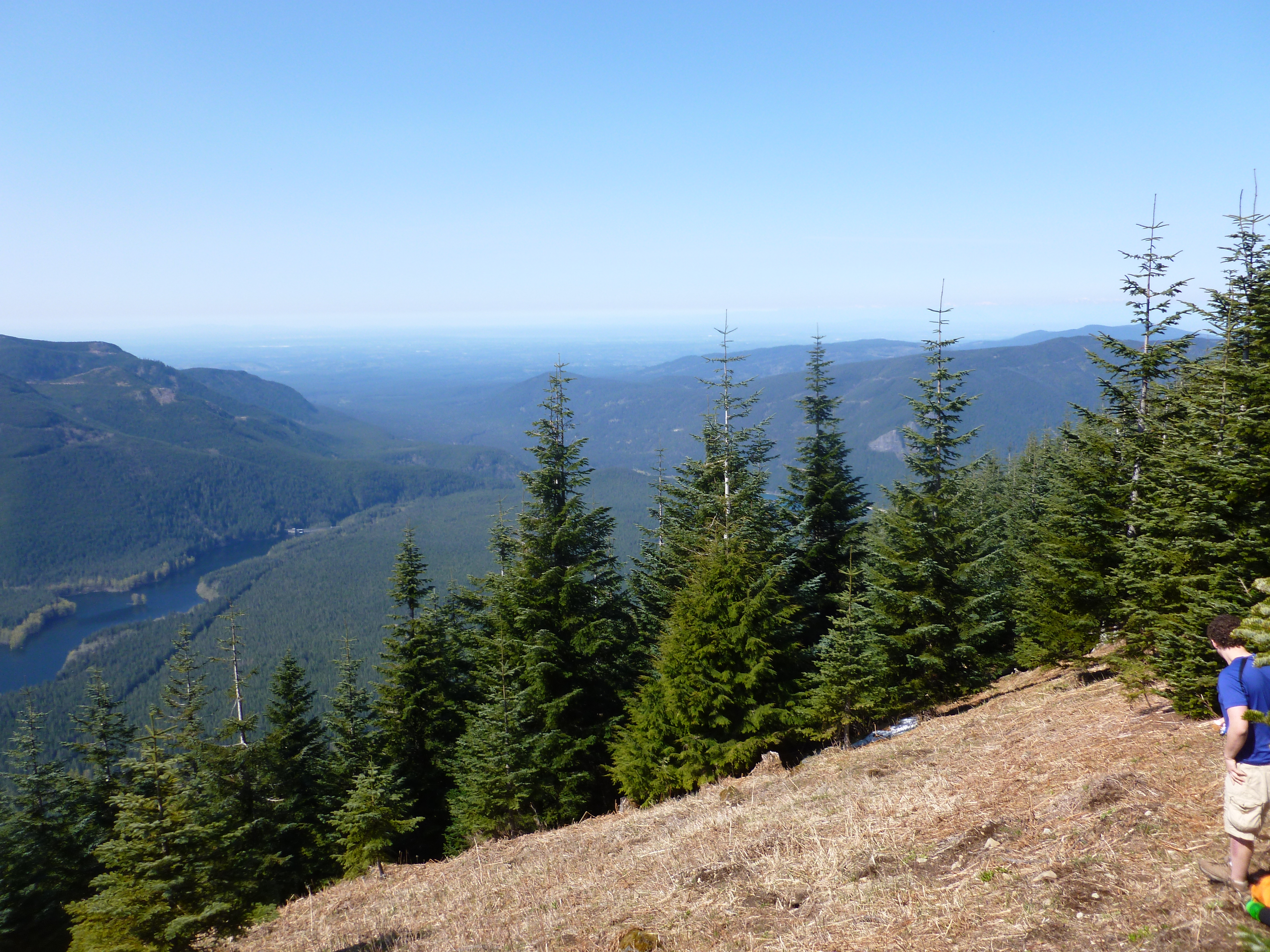
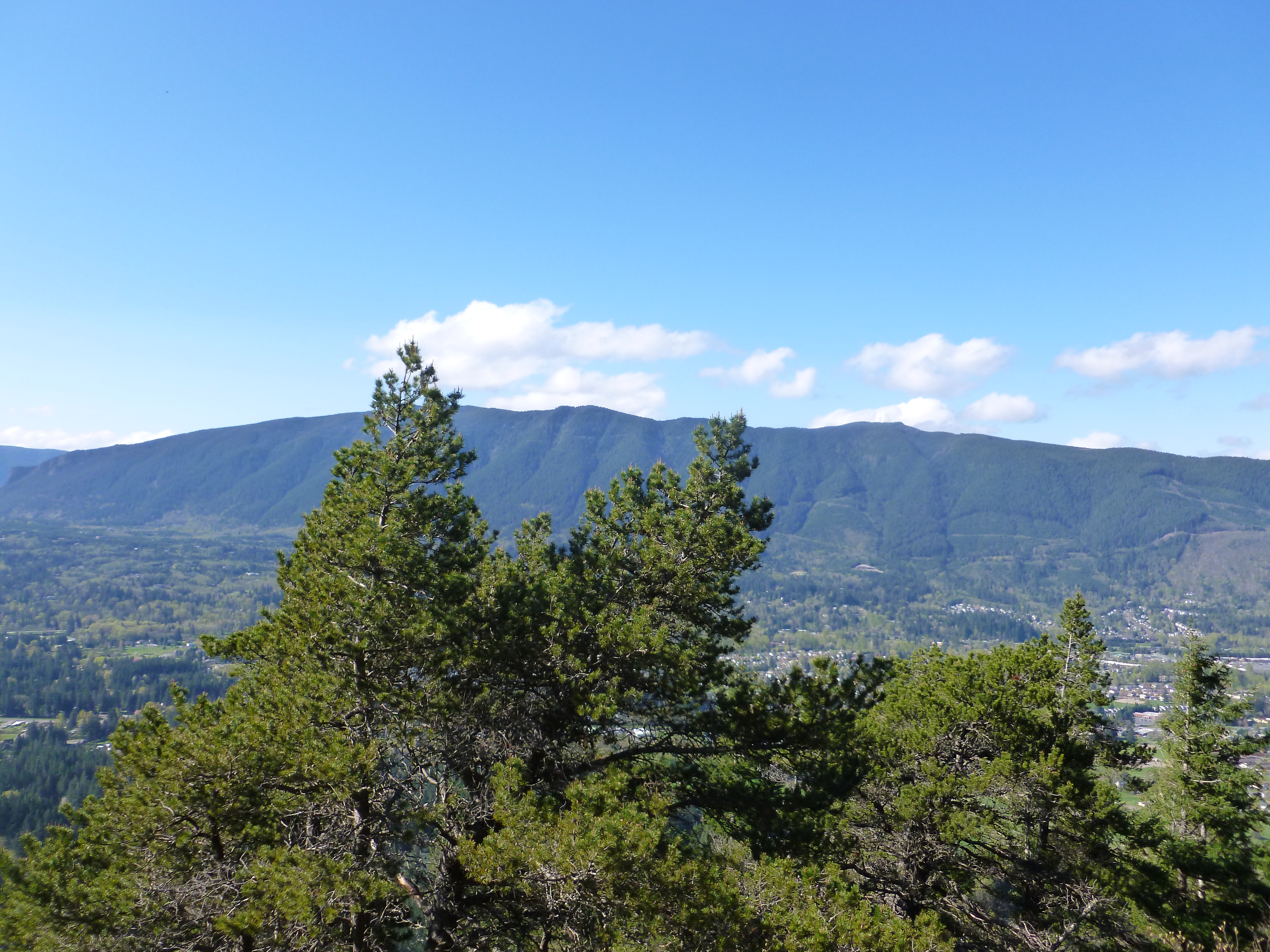
Of course, it only LOOKS like we are in the middle of nowwhere. At some points you can shift perspective entirely:
Looking down – in every sense of the term – on civilization
But Derek has a wonderful way to find great photos and, as Jan said last night, he has a real talent for framing them. I love this picture of some lonesome trees:
Lonesome trees
We are planning on the notoriously steep Mailbox Peak hike next Thursday. We have not finalized our plans for the weekend but it looks like Granny and Grampy are going to get a friendly visitor for the weekend, so no hike until next week.
Looking forward to testing our legs on Mailbox Peak (and yes, someone put an actual mailbox on the summit and we will put the picture right here).
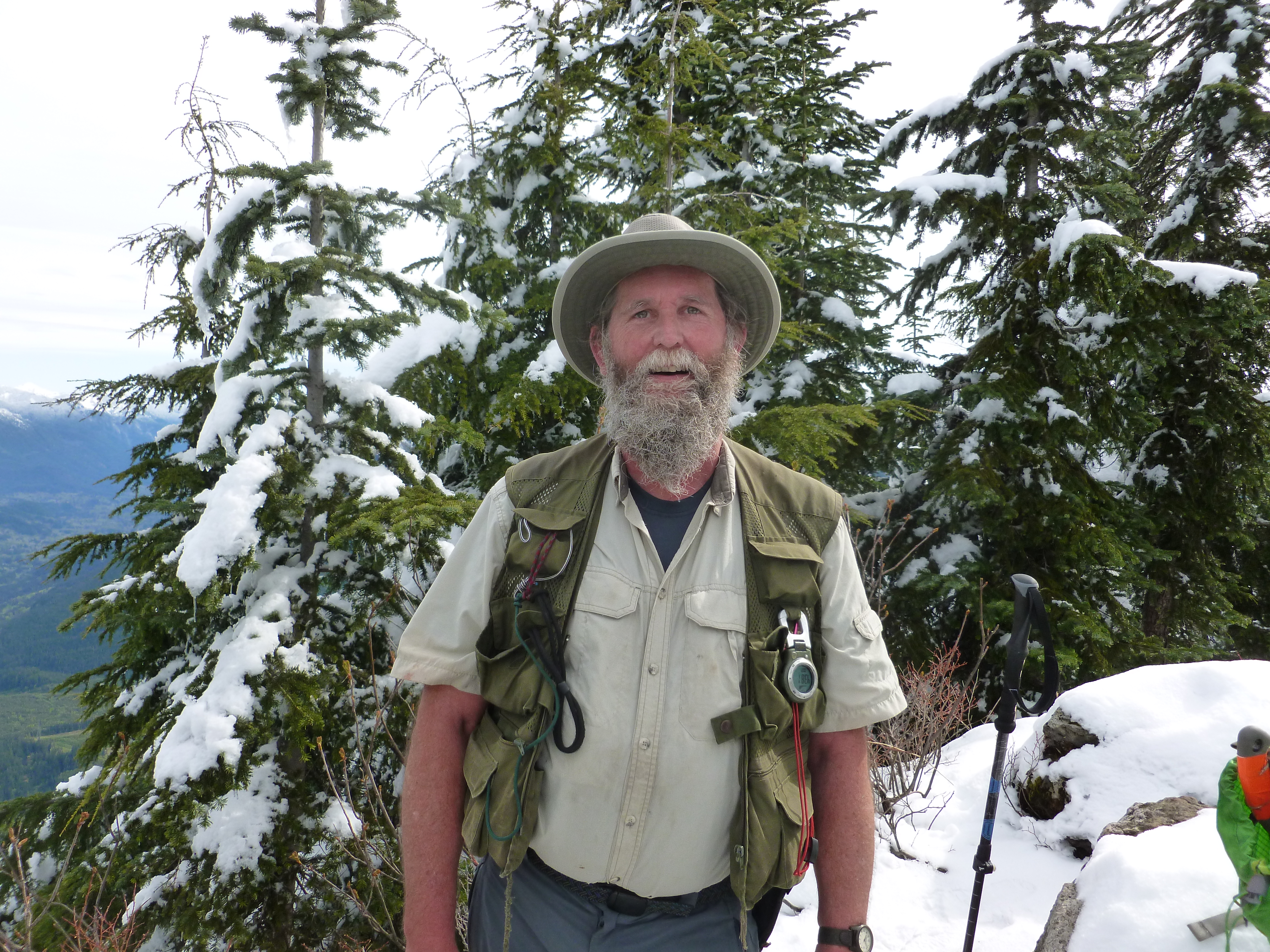
Many thanks to Steve who was able to re-route me and get me to the Mt. Washington summit. But I am getting ahead of myself.
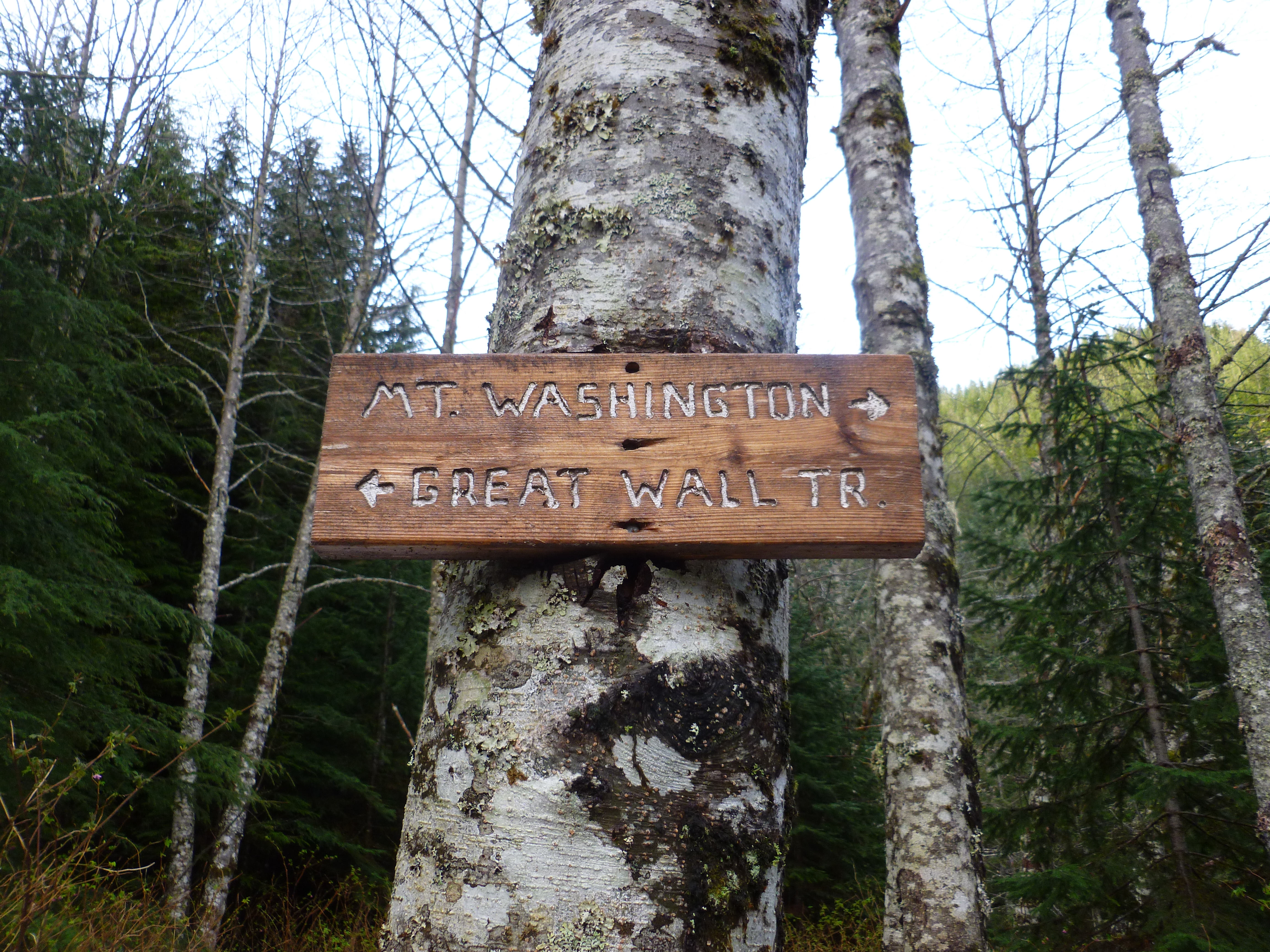
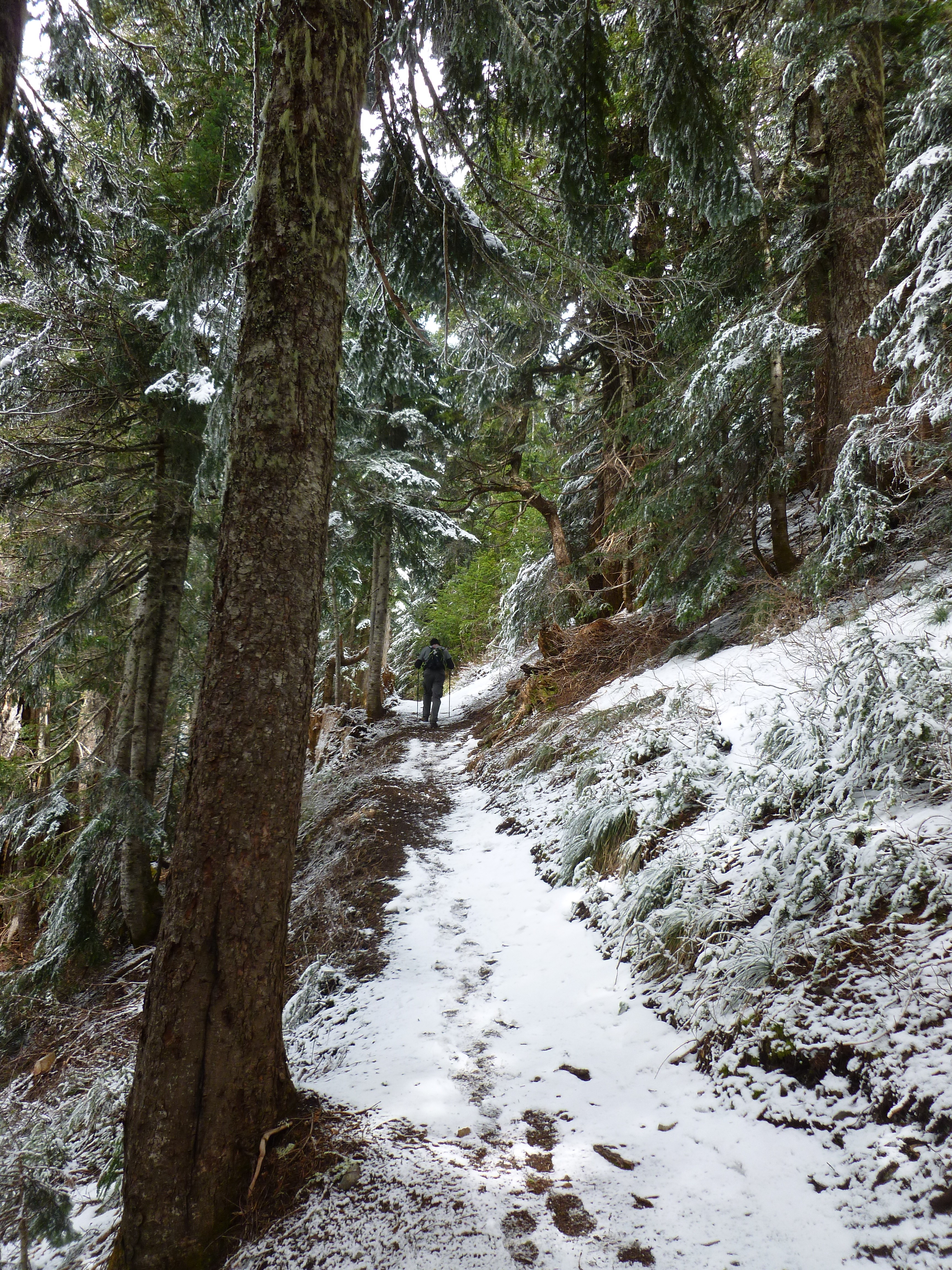
My plan today was to hike Mt. Washington again but this time via a route that Derek and I had noticed, the Great Wall trail:
This way to the Great Wall
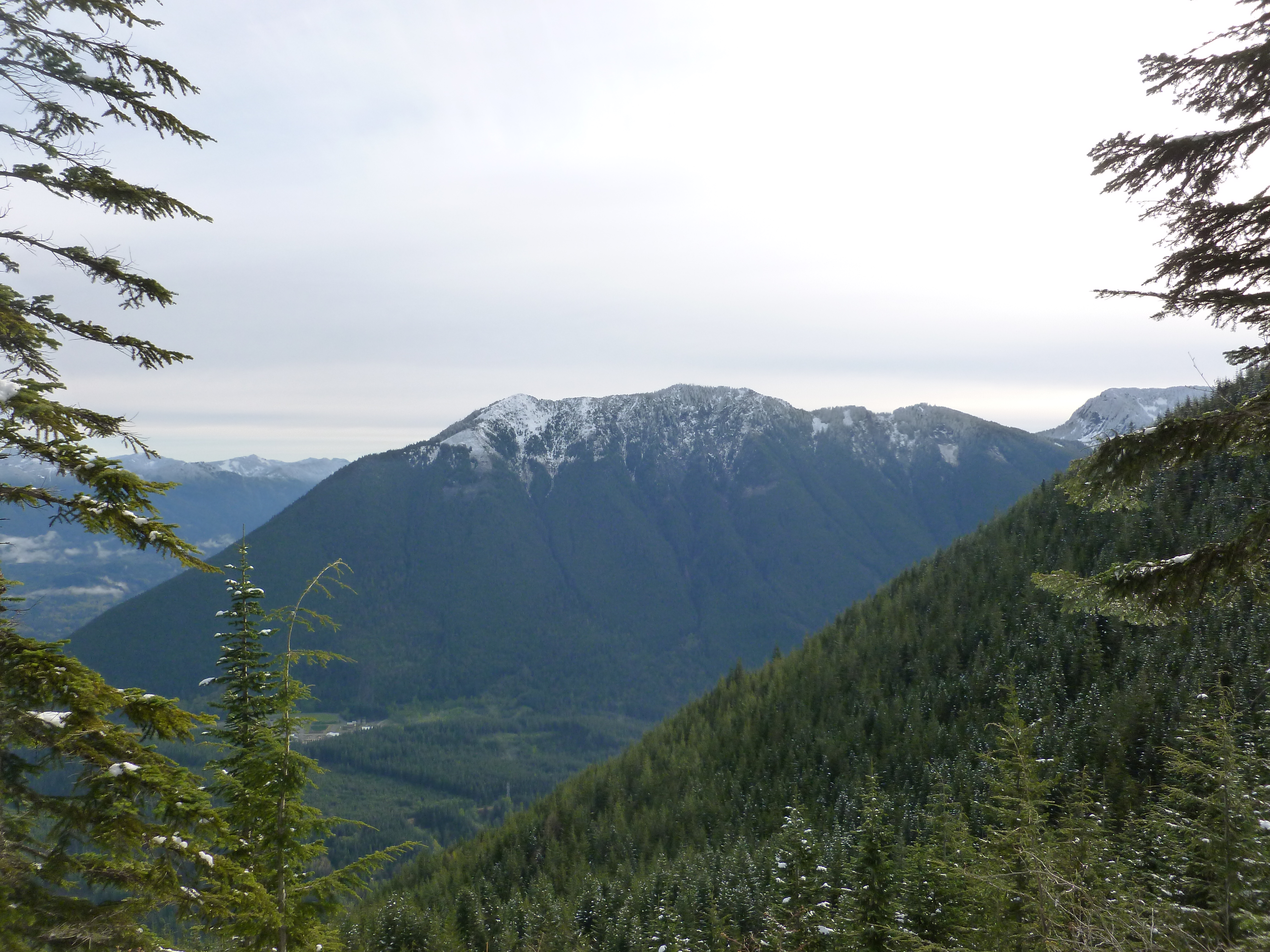
The trail is awesome with views, on average, much better that the main trail. For example:
Typical sublime view
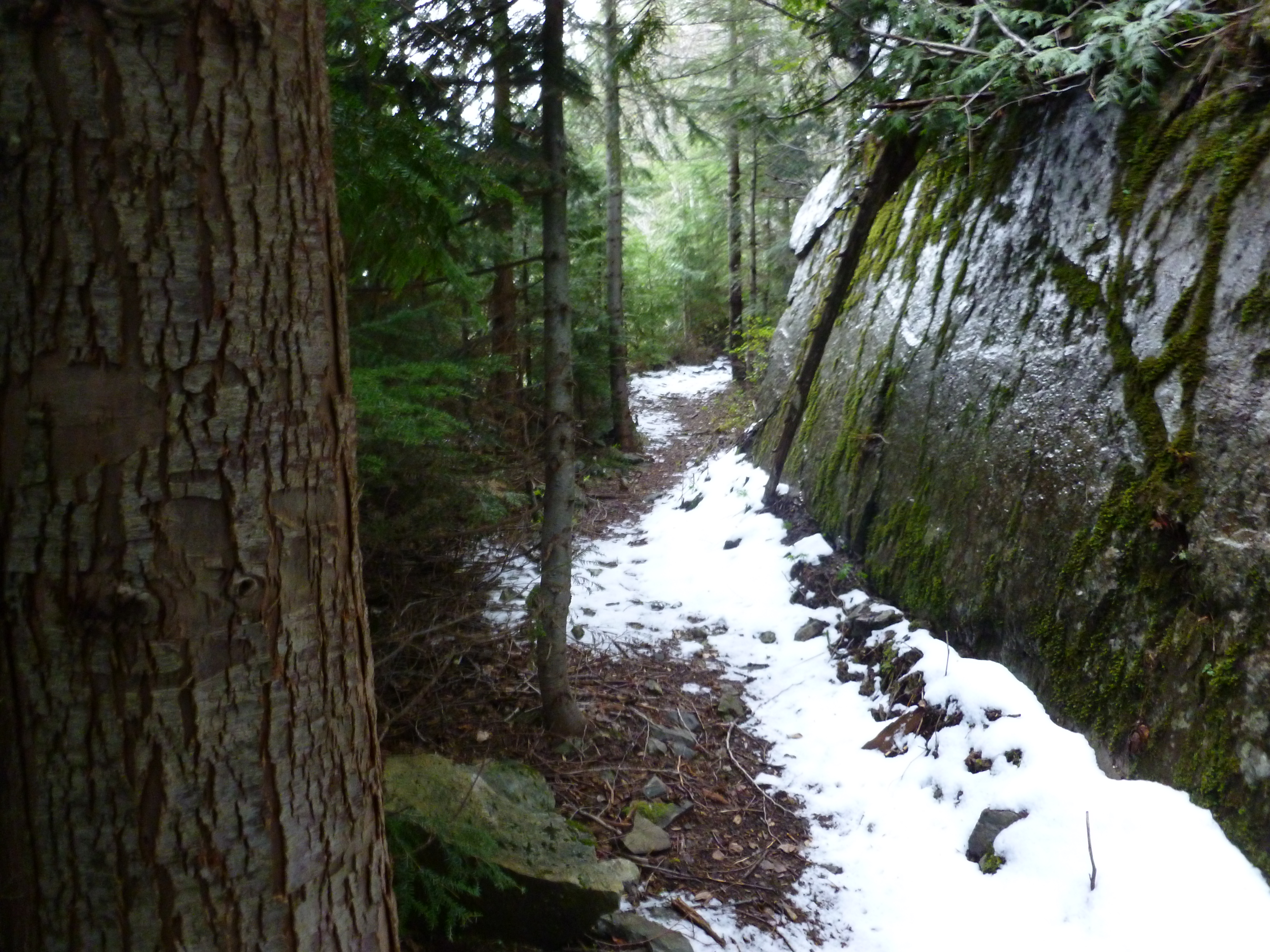
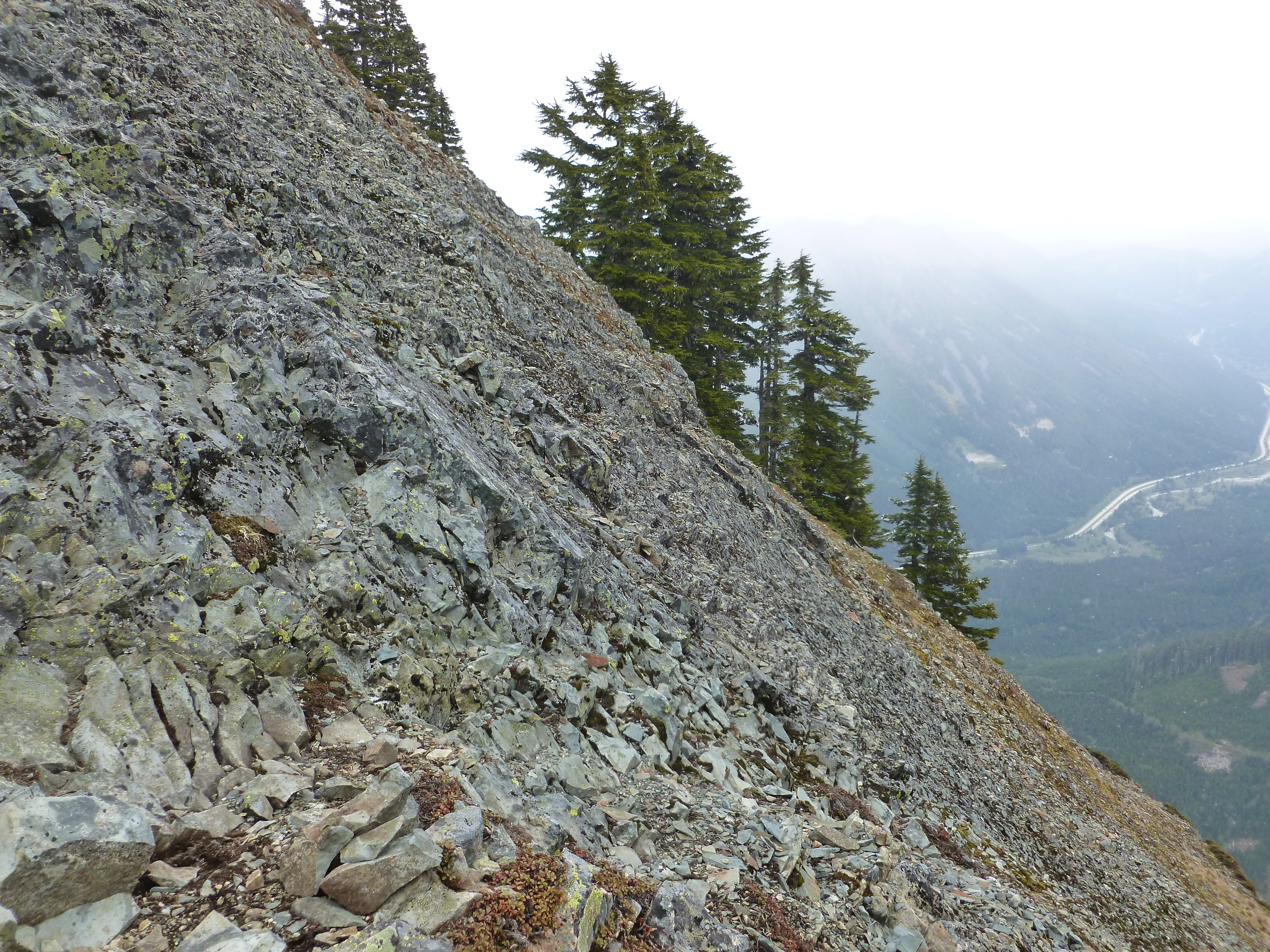
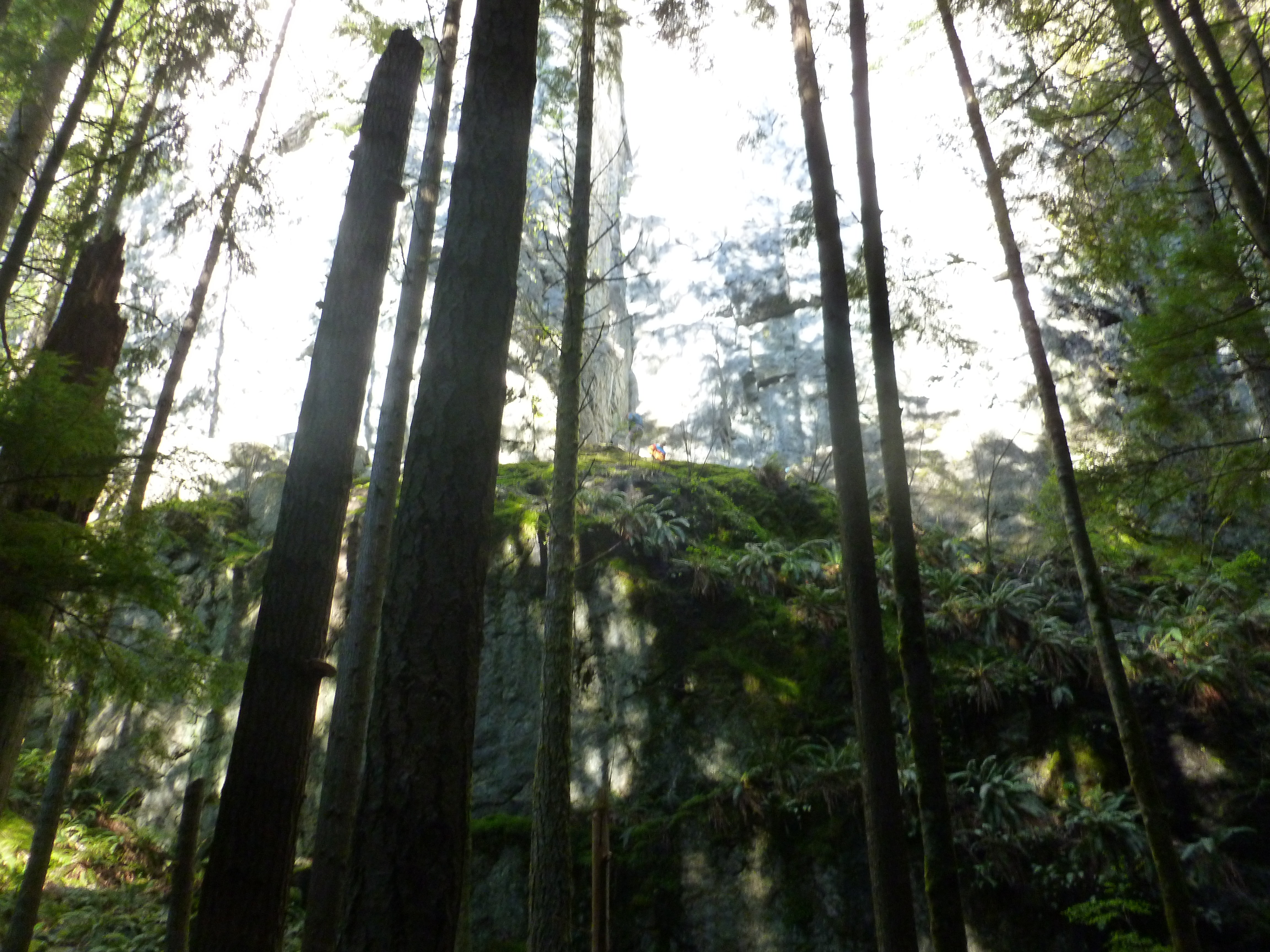
A couple of sections of the trail are closely bordered by what I would categorize as, well, as great walls:
Part of the actual Great Wall
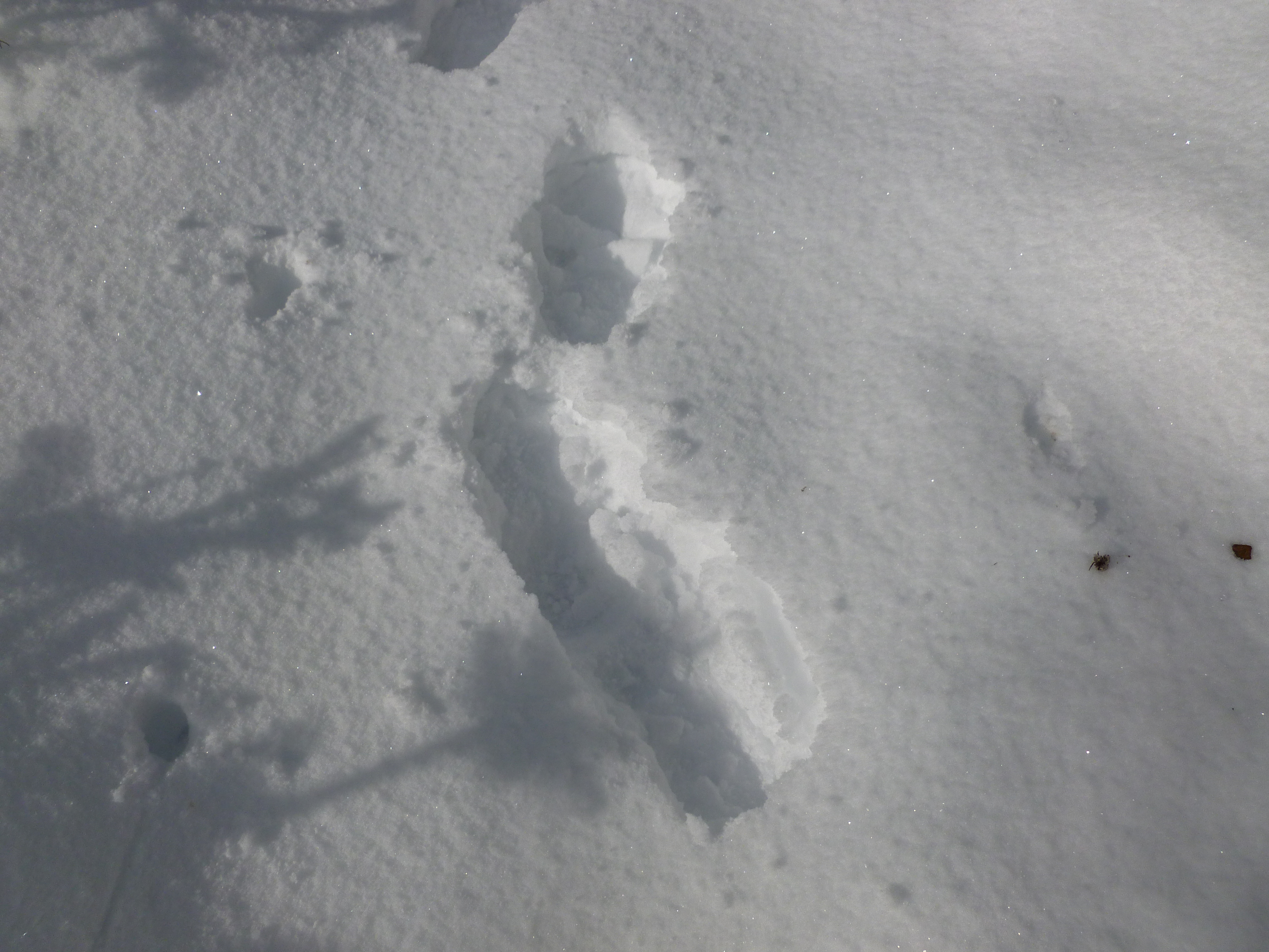
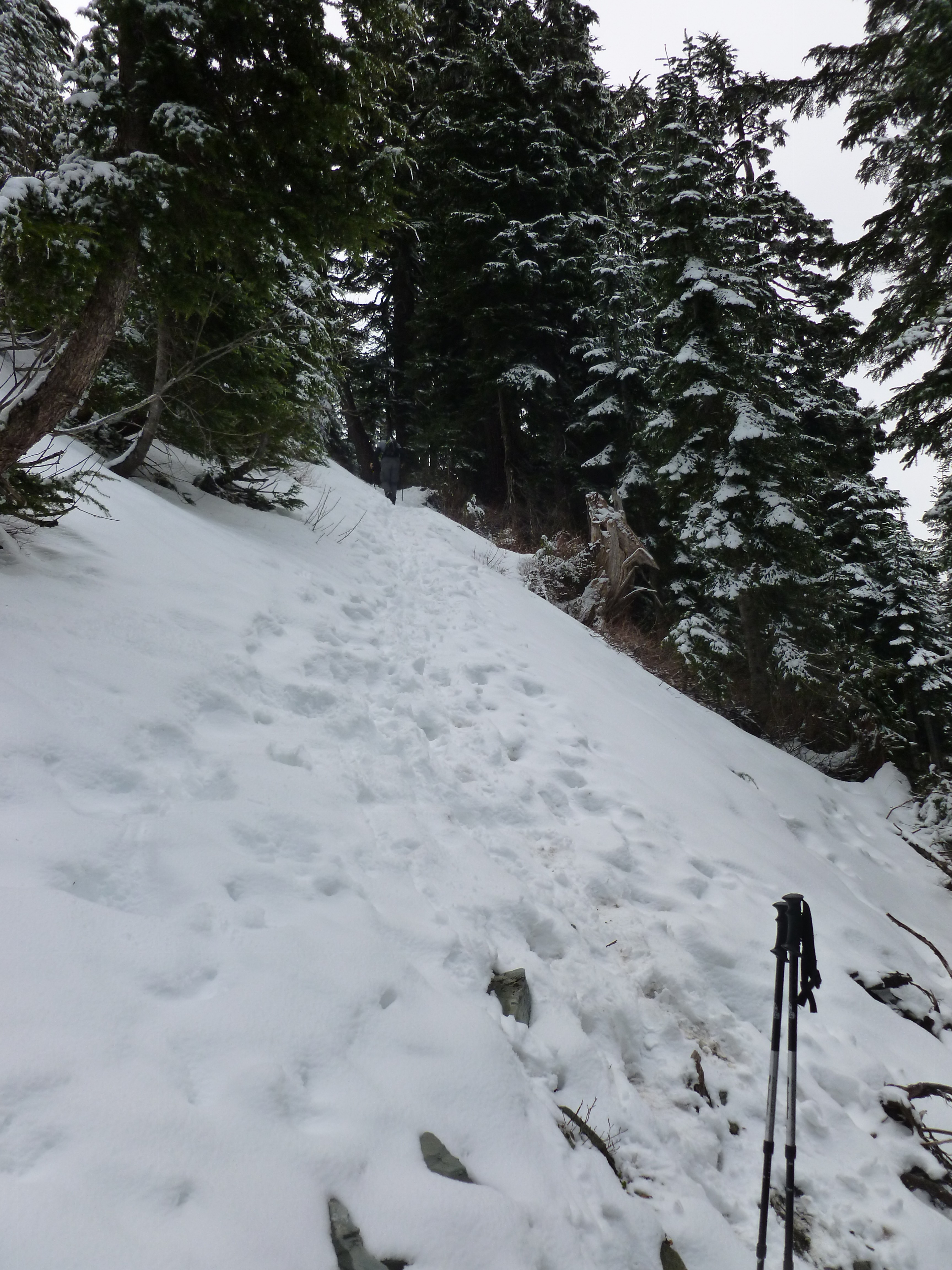
I was following footprints. There was so much snow, and I did not know the way, so the “trail” for me was footprints from someone a few days previously who had blazed the way:
My map
Ultimately the footprints just stopped and doubled-back. Uh oh! But I pushed on (and on and on) and finally got to a rocky outcrop just below a summit. It was a summit but not the one I was looking for. That’s when I turned around and decided to back-track to the main trail and go up to the summit from there.
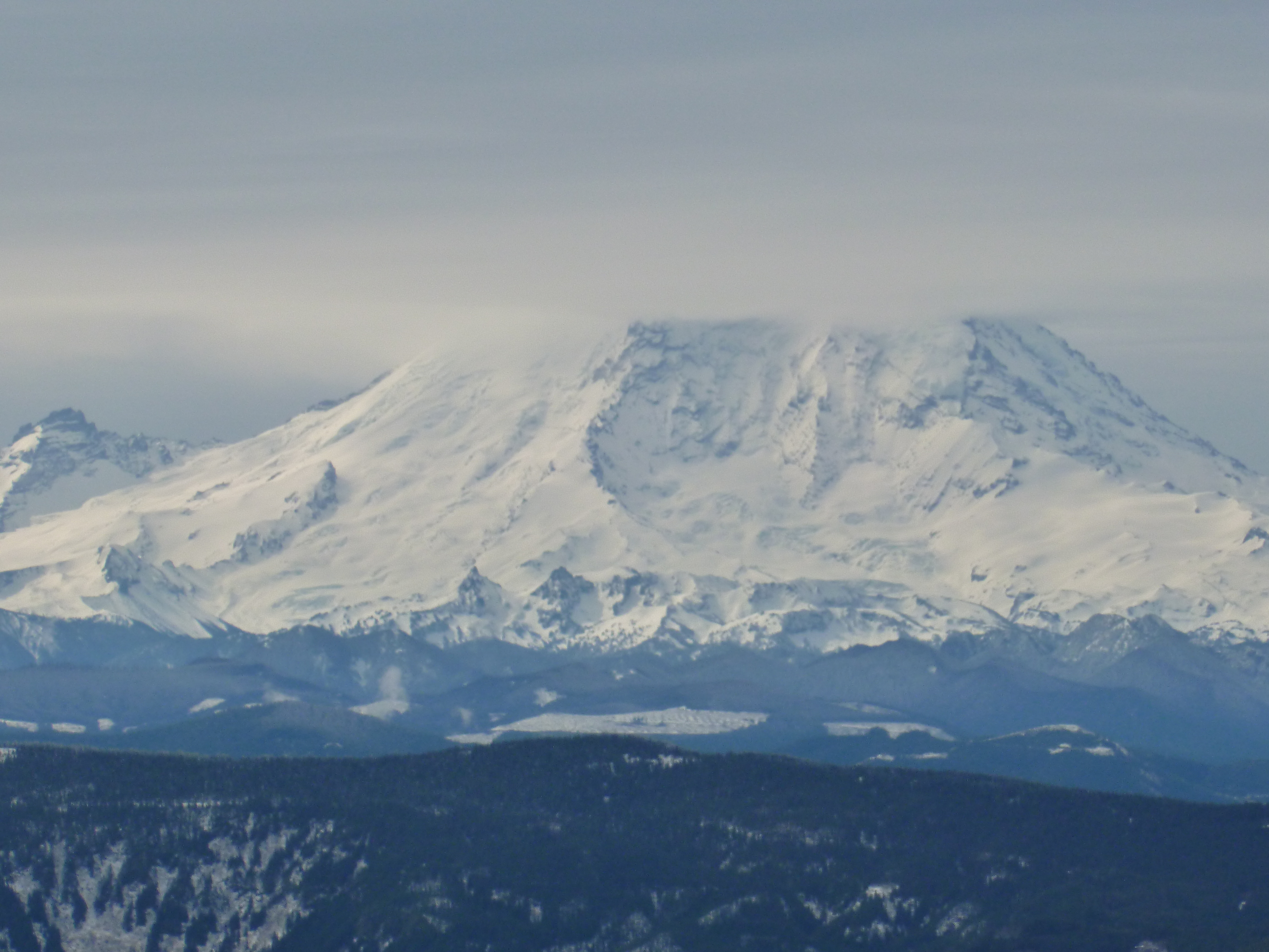
But, luckily for me, I ran into Steve, who showed me the correct route. This is a marvelous trail, and it gets ultra-steep right at the end. But well worth it for the views on the top:
Mt. Rainier from Mt. Washington summit
And:
Great Wall view
And:
Mt. WA view
I was hoping to do this route and get back to the car in 5 hours, because I am only going to have 5 hours to hike on Wednesday. I think this route is a bit long for 5 hours but – this hike is great via both trails, we could do the main trail up and down (perhaps that jog to the right at the pond for a switch) in 5 hours no sweat.
Looking forward to Wednesday and thanks again to Steve! Without Steve I would have failed in my mission of getting to the summit via Great Wall
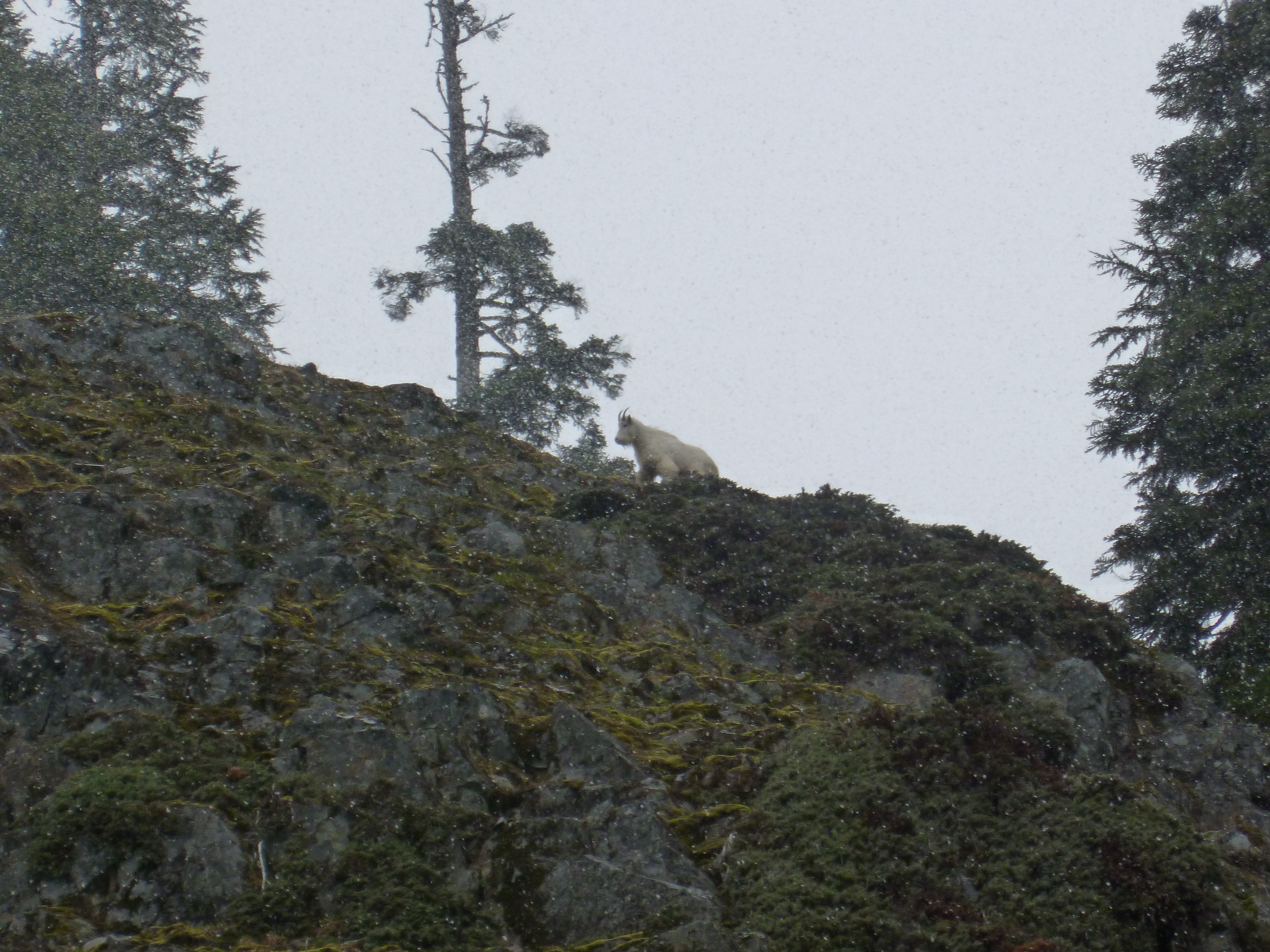
How fitting we would encounter a mountain goat on Shakespeare’s birthday, as one of his great insults (from Henry V) is: “Thou damned and luxurious mountain goat….”
We saw the goat on the way down. He kept moving around to get a better view of us so we decided to leave him to his own devices.
It was a great day to hike, perfect weather and views to begin with:
Is this great or what?
McClellan Butte has some very steep sections and we were not hiking fast:
If you look closely you can see one of us way up the trail; this is called ‘steep’
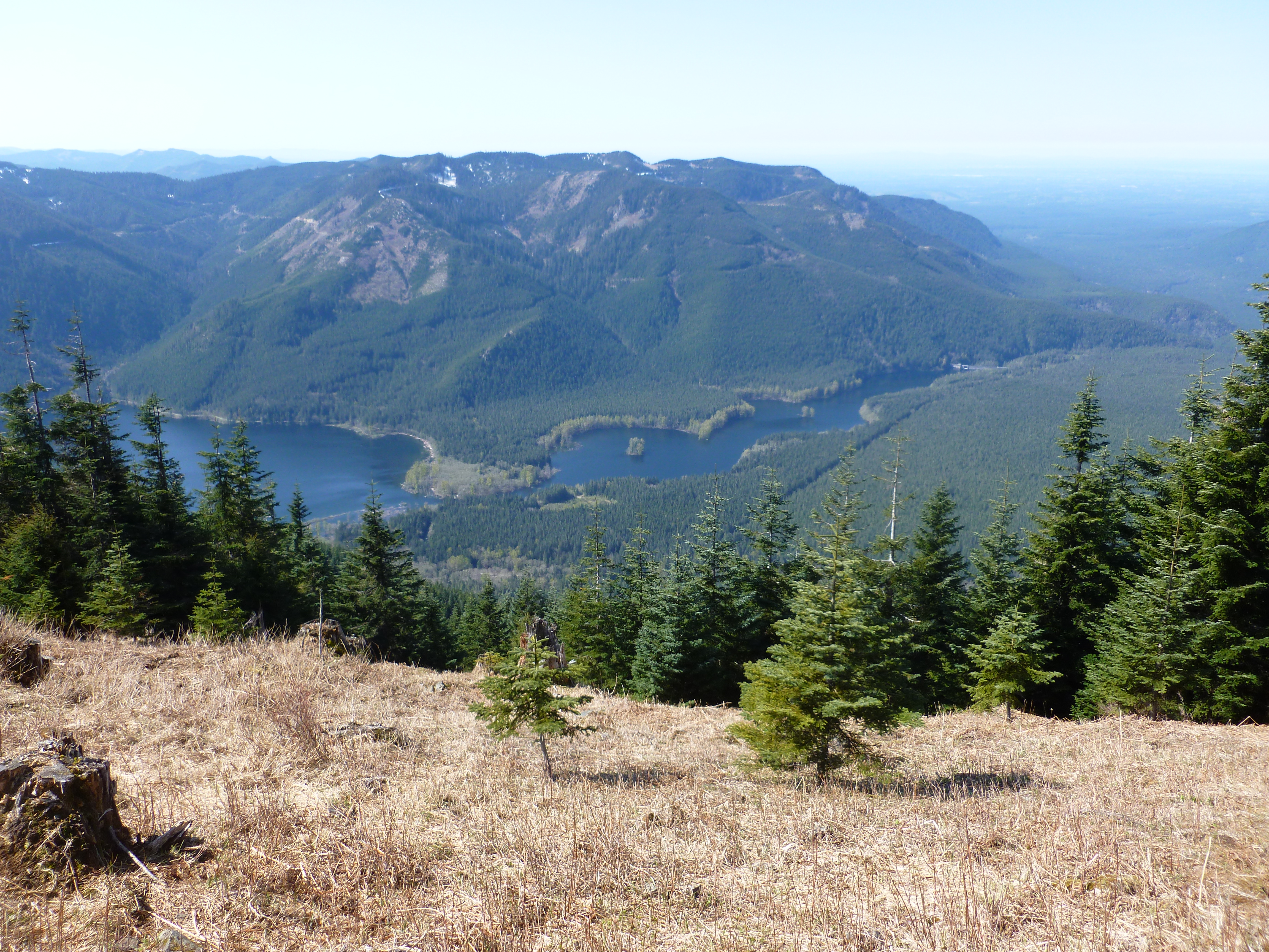
We saw a really cool little lake that is shaped like a salmon:
This pond looks like a salmon
The trail has many very nice sections:
Typical view of the trail
We did not do the famous “scramble” at the top. The scramble is a final rock pile of 200 or 300 feet that looks like it would be very doable except for one thing, namely, if you slip you die. We skipped it:
Final scramble – we skipped this one
But we got close and the view from here is amazing:
Looking down from the top
All in all, this is a very steep and very tough hike and we loved every minute. We will definitely do it again when the snow is gone to see if we can improve upon our round-trip time of 6 hours.
It’s a beautiful day in the Issaquah Alps neighborhood
We have hikes scheduled for this Sunday, the 26th and Wednesday the 29th. Should be fun!
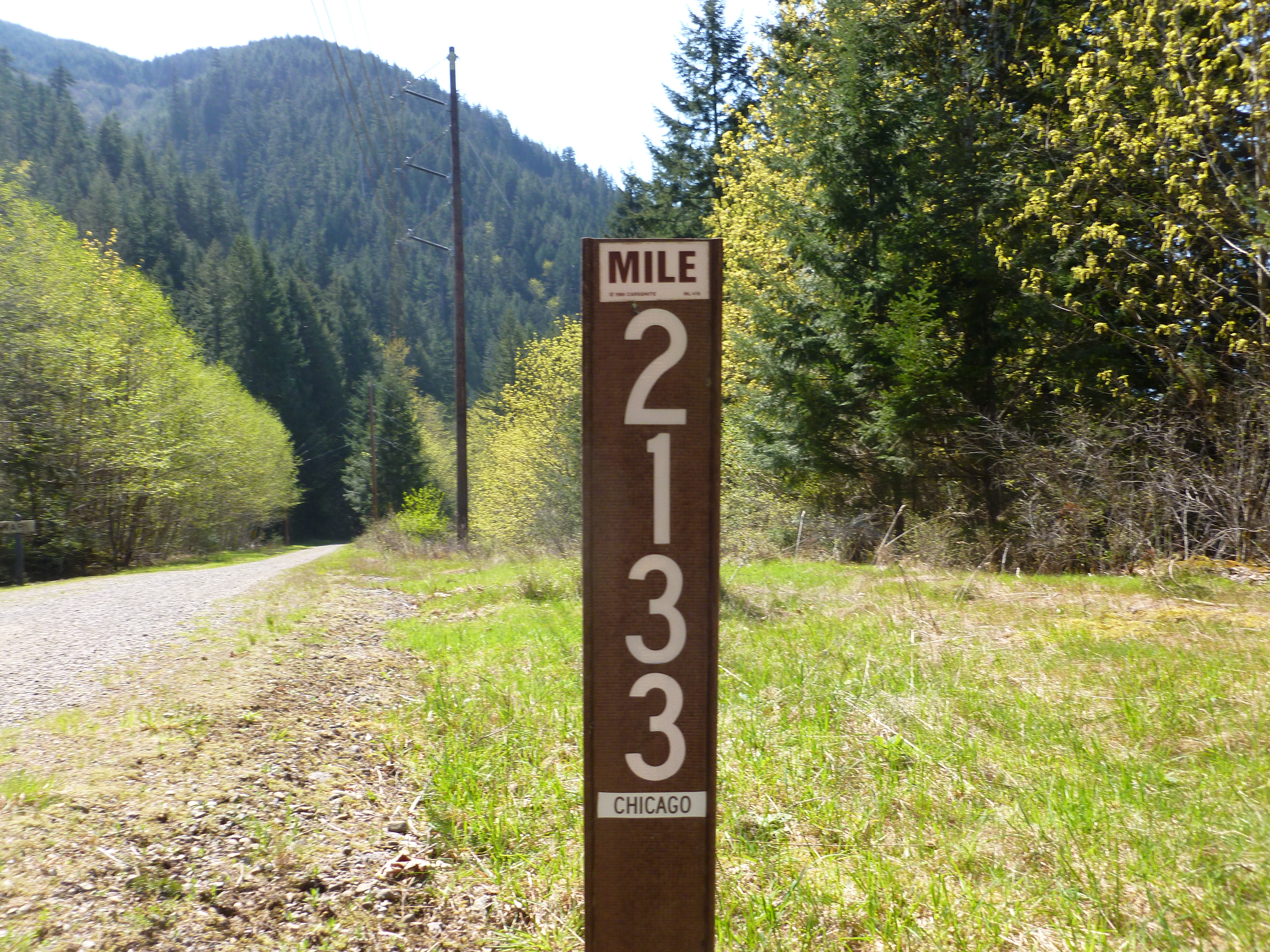
2133 miles to Chicago via the old Chicago-Milwaukee-St. Paul-Pacific Railroad
(click on any photo to enlarge and use the ‘back’ button to return)
I would at least entertain the possibility that I overdid it just a little bit today, but it wasn’t all my fault.
Derek is on call this weekend so I wanted to plan a solo hike. I needed a hike with a trail on which I couldn’t get lost, and I wanted to train for the next hike we have planned (a steep one, McClellan Butte next Thursday, the 23rd) so what the heck.
I parked near Rattlesnake Lake, which is supposed to be about a 5 mile hike down the Iron Horse Trail to the Mt. Washington trailhead. Iron Horse is the former route of the Chicago-Milwaukee-St. Paul-Pacific railroad, and dead flat for many miles. It is a sub-trail of the John Wayne trail – a trail that is far longer than The Duke’s military service.
Anyway, I hiked Mt. Washington a few weeks ago with Derek and we did it the normal way, parking near the trailhead and walking down Iron Horse from west to east maybe 100 yards to the second little trail on the left.
Derek knew what he was looking for and it was easy. Alas, this morning, walking from east to west I missed the little trailhead and went an extra mile before I realized I was a dunderhead.
So what I planned as 10 miles round trip on Iron Horse plus 8 miles up and down Mt. Washington wound up being 12 miles on Iron Horse plus Mt. Washington for a total hike today of 20 miles.
It actually wasn’t that bad and I am raring to go for Thursday’s challenge.
From the Mt. Washington trailhead to the top was 2:15 minutes, an hour faster than Derek and I did it before. I have learned the lesson of walking slowly when it gets steep, just trudge along, get into a Zen-like state of one foot after the other. It wasn’t so bad, 4 hours and 10 minutes round trip.
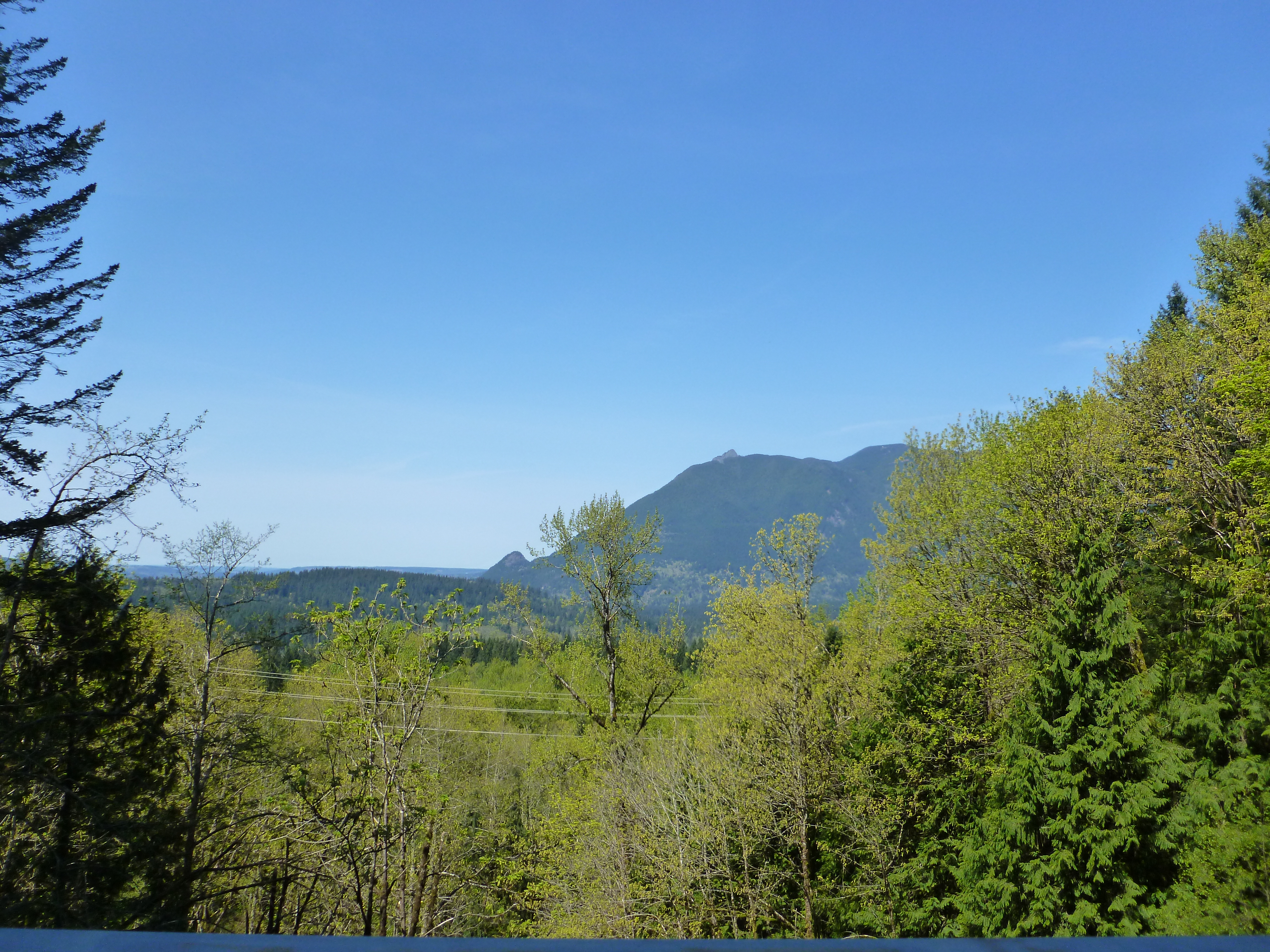
Just hiking along Iron Horse is nice. It is dead level, but about 1100 feet elevation, with a north view (your left as you walk towards Mt. Washington) that is beautiful. For example, check out this perspective on the previously hiked and blogged Mt. Si and Little Si:
Little Si on the left, Mt. Si on top
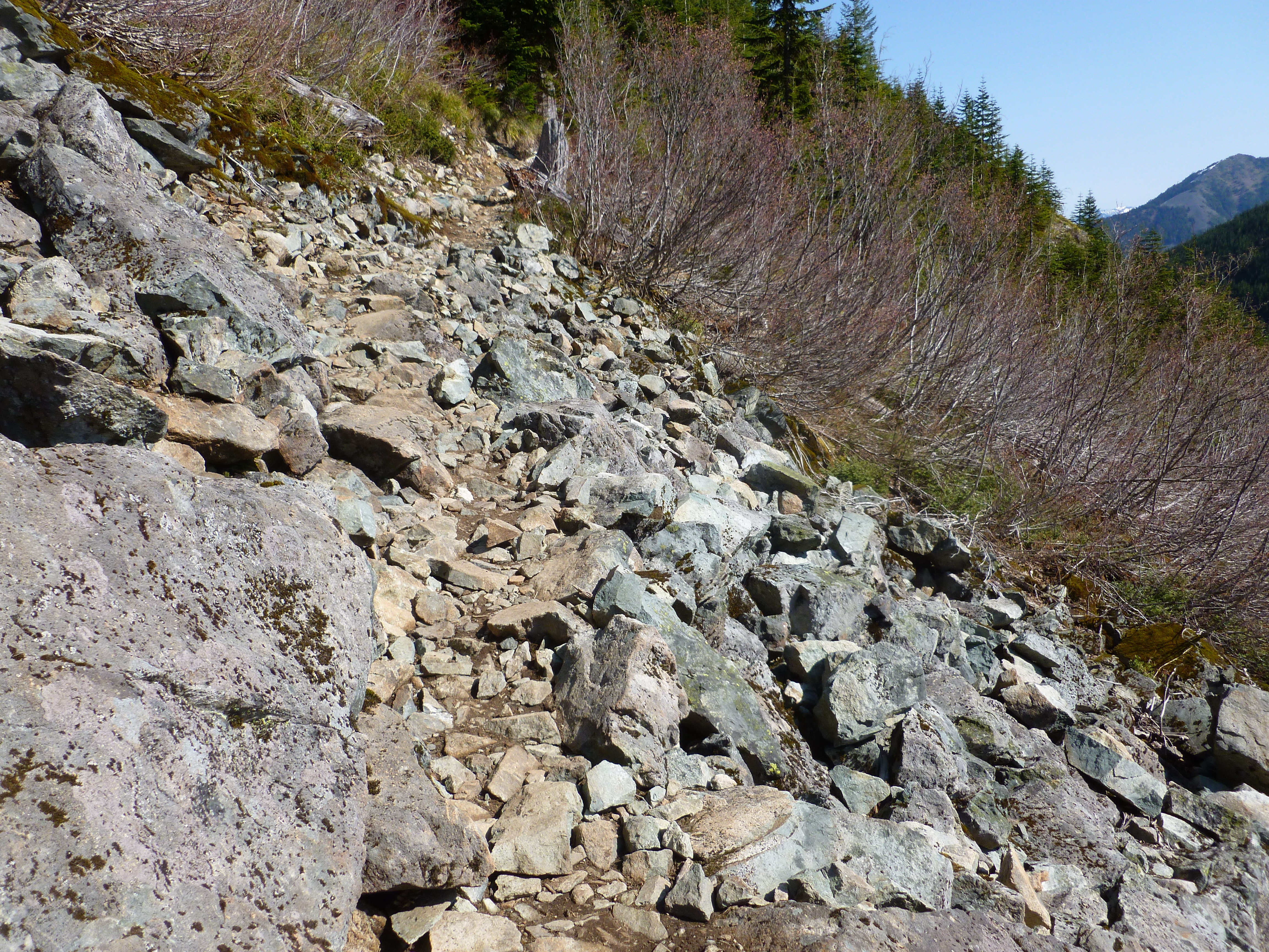
There are some tough sections of the trail on the way up:
I call this “trail”
Things are also looking very good about halfway up:
The ‘hood
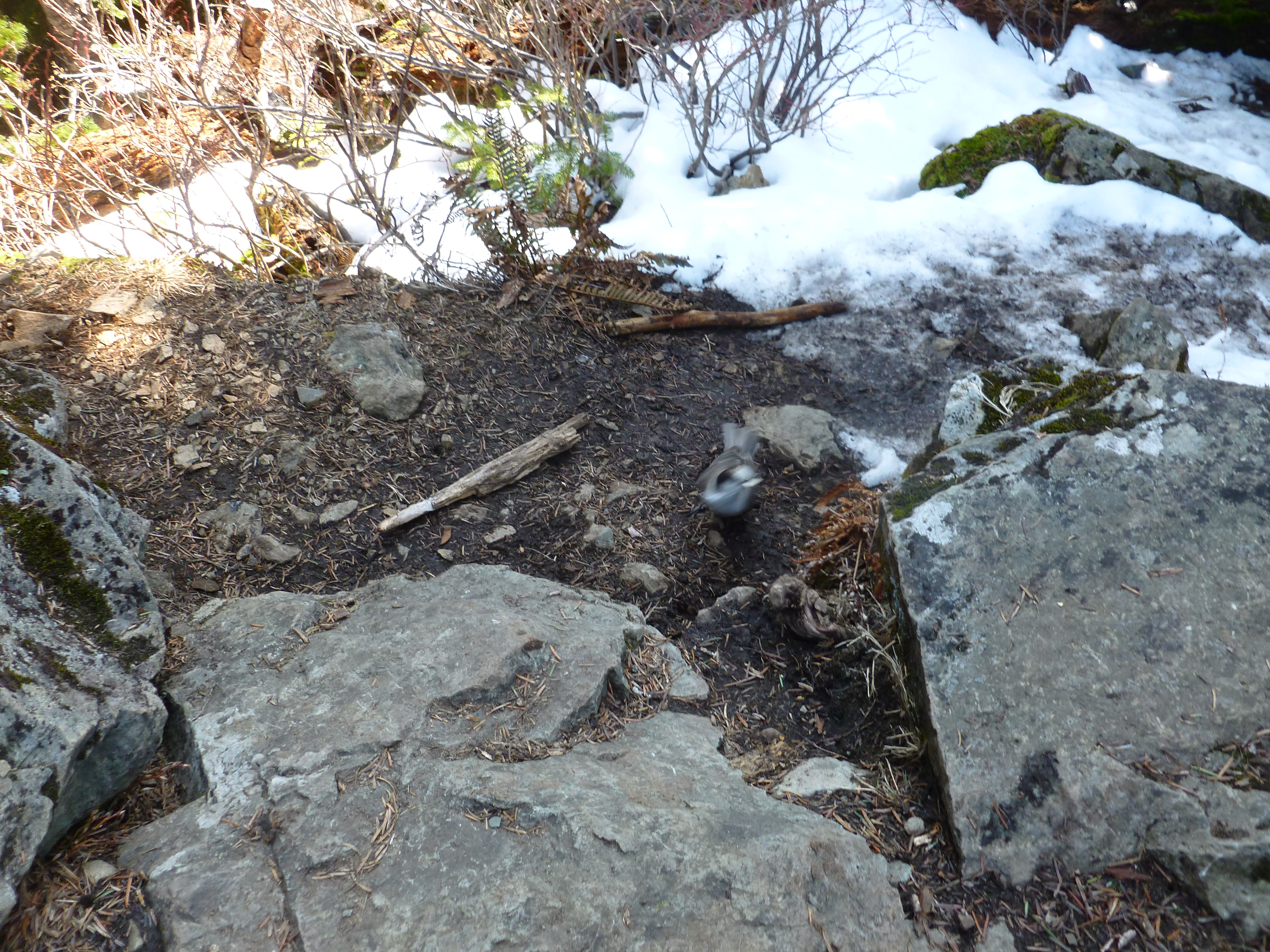
I had a couple of friends at the very top, two birds I tried to photograph as they ate the bread I shared (they have been fed before and know the drill). They were pretty quick and hard to photograph with our less-than-professional camera:
Trying to get a picture of one of the birds who was begging for food (I gave the two of them some bread)
Here is the view from the toppermost-of-the-poppermost:
View from Mt. Washington summit
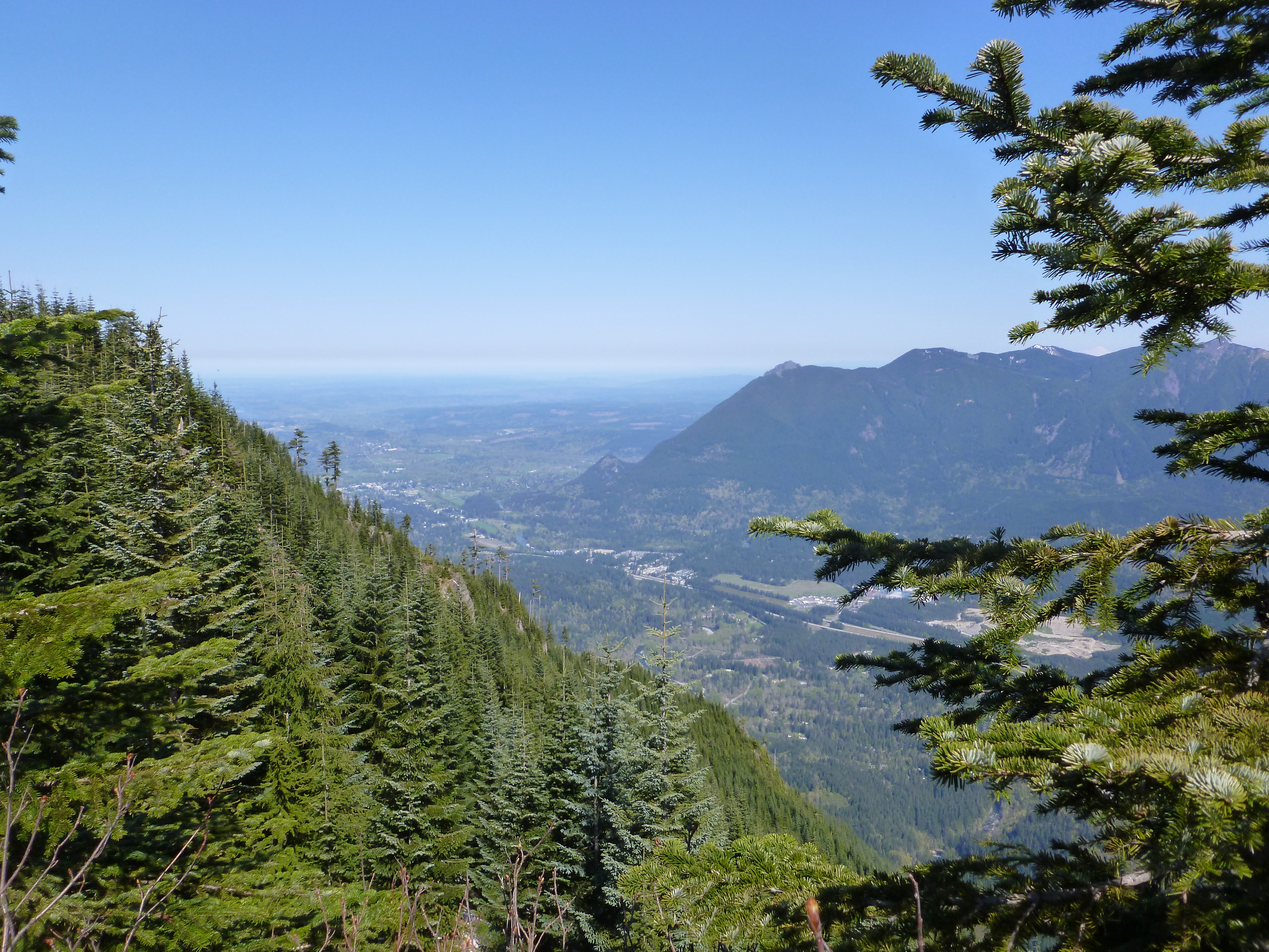
And here are a couple of nice views from just below the summit, where the view is less constricted:
Amazing view from just below the Mt. Washington summit
And:
Beautiful view just below Mt. Washington summit
What is the difference between a ‘beautiful’ view and an ‘amazing’ view? – you tell me.
I made it back to the car about 8 hours after I pushed off and immediately fell back to earth. The Rattlesnake Lake area is popular to put it mildly. For a mile or more there were cars parked bumper-to-bumper just off both lanes of the narrow two-lane highway, with people hiking on the road. It took me 15 minutes in the car to go about a mile, which is my pace on Iron Horse.
Then, the freeway back home was gridlocked thanks to some construction and concomitant lane closures.
Oh, well. These hikes are wonderful mini-vacations from modern life and every moment is precious.
And those mileage-to-Chicago signs are a reminder of just how far Jan and I have traveled from home.
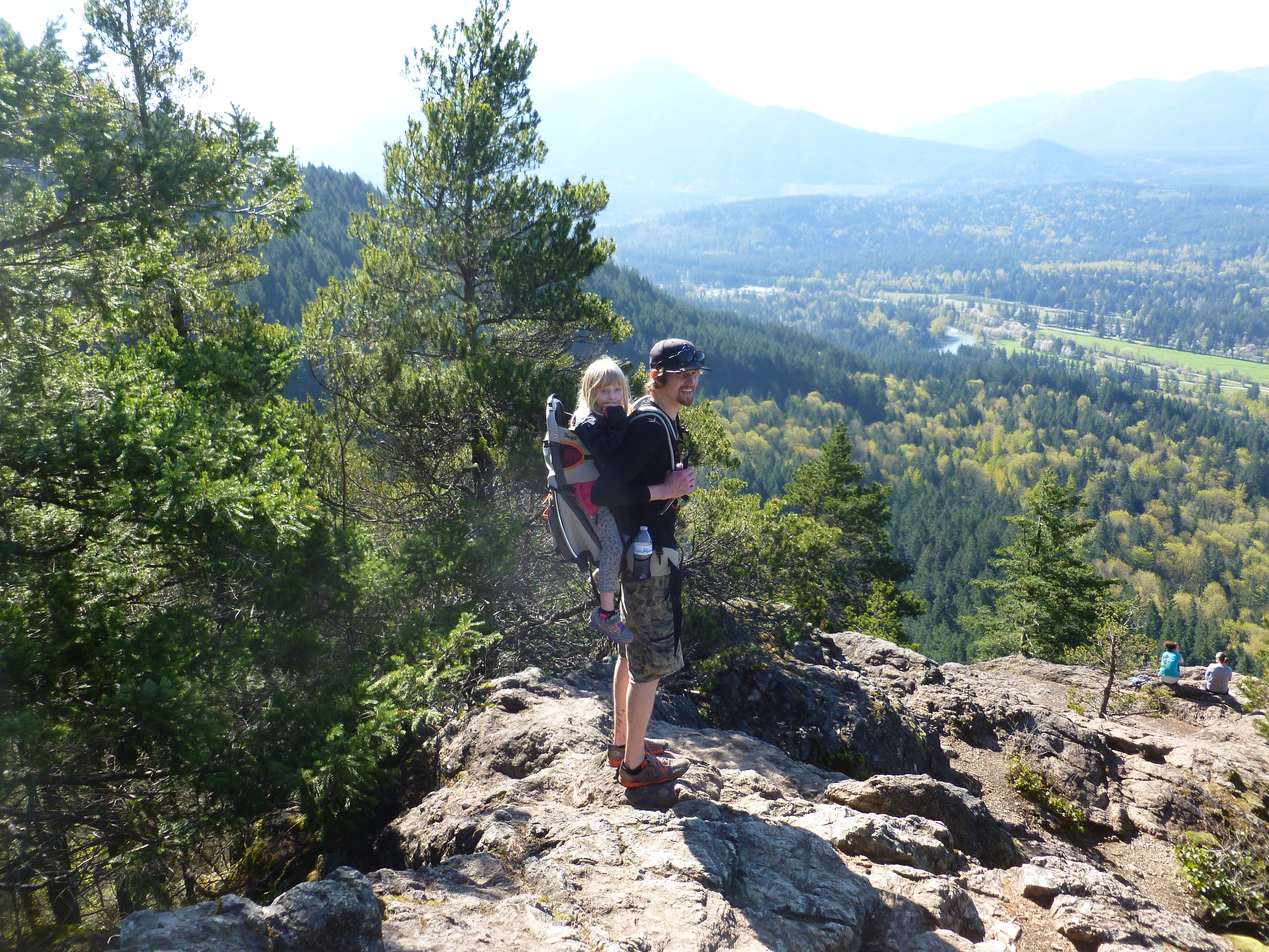
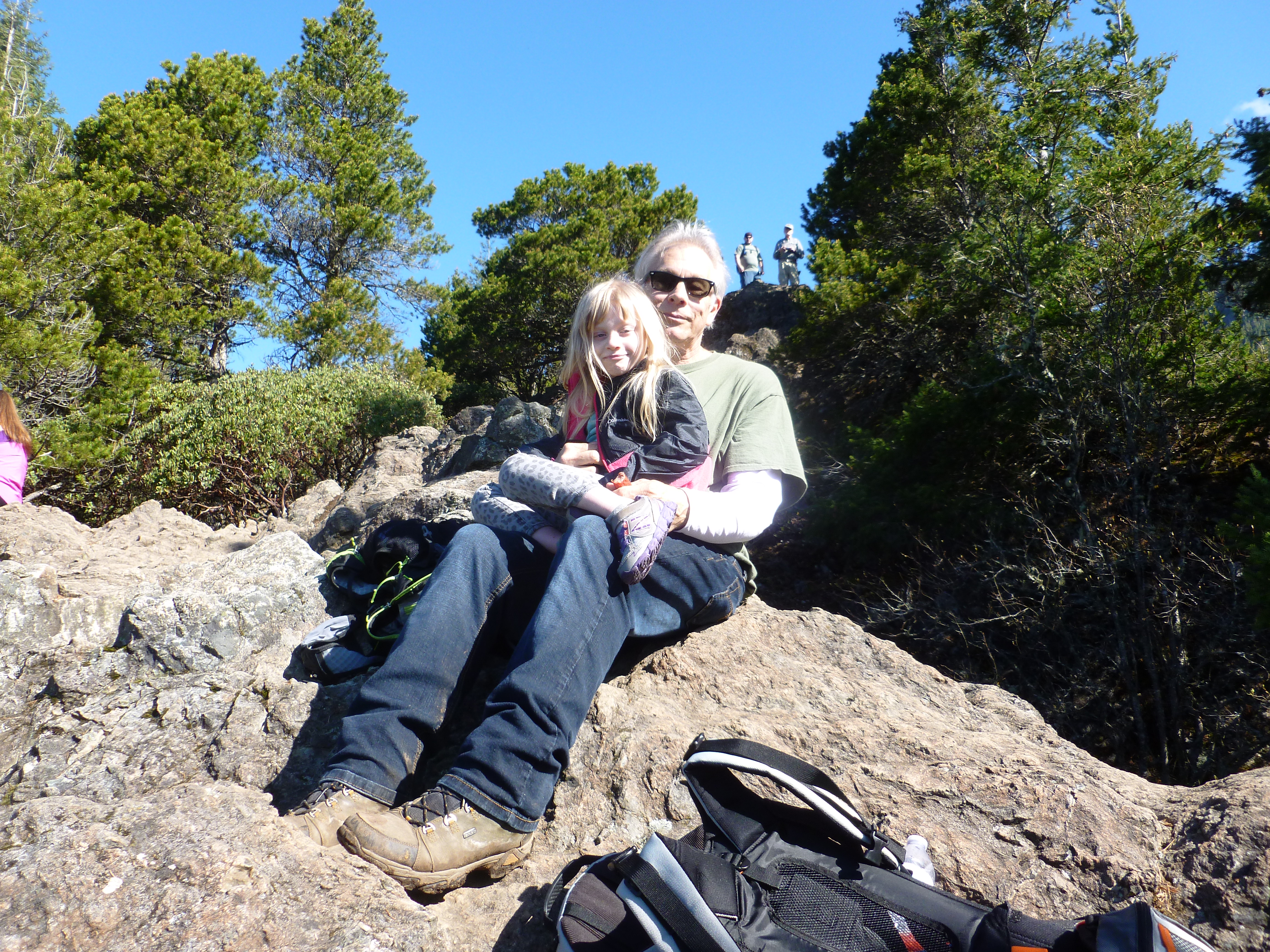
Little Si is possibly the most popular hike in the area. Relatively speaking it is a gentle hike – Little Si is the little brother of Mount Si – but it is far from flat, and is challenging enough that the hike to the top is terrific exercise.
Particularly for Derek, who carried Fin on his back the whole way.
A boulder in the boulder garden
Typical forest sceneThe summit is in sightOn top!Grampy and Fin made it to the top as wellLittle Si’s big brotherWe hiked across this one and are going to do it again soon
We went from bottom to top (with a detour through the Boulder Garden) and back down in just over 3 hours. From there we went to the local excellent Mexican Restaurant (Ana’s, for the record) and from there up to a nearby playground because Derek and Grampy wanted to play.
A wonderful day – we have many more hikes we want to do, and our next planned hike is a week from Sunday, the 19th, while Jill, Brittany, Finley, Granny Janny and many others celebrate the little new guy who is coming in June.
Yesterday Derek and I did a nice ~16 mile hike up and down and around Tiger Mountain. We would need one those GPS devices that integrates with mapping software to show the route we took but this Washington Trail Association description is pretty close:
I arrived at Derek’s house at 6 and we were on the trail at 6:25. It was just a bit dark (we have headlamps but didn’t bring them along) when we started and somehow, we learned on the way back, we completely missed a beautiful little pond not far from the trail head.
The weather was wonderful. It was not warm and sunny during the entire 8-hour hike. But the variety was fun – grey and cloudy, some rain, some sleet, some hail, a reasonably fierce snow squall, followed by warm and sunny at the end.
The elevation gain on this hike was not in the league of Mt. Washington or Mt. Si (or McClellan Butte, which we are going to tackle as soon as the weather permits) but there were seven or eight sections with enough elevation gain to get our attention.
We have been experimenting with pace. When you hike mountains you have to pace yourself appropriately. We met one guy yesterday whose pace was a run. He ran from the bottom to the top and back down again.
That is not our pace.
We have to go at my pace (Derek can go faster than me, and with Finley on his back!) because I am a decrepit old man. During the week I practice my pace on a hilly training walk in my neighborhood.
I power-walk downhill and level, but slow down considerably on the hills.
Yesterday, that pacing strategy worked great. We did a very long and steep section at one point without a single break to calm down the calves or catch our breath. Slow and steady when it is steep, faster on the kinder sections works fine.
We are doing another hike on Thursday, the Ninth, and since Finley is on spring break next week, if she wants, we could be a threesome. One option is to drive to the base of Cougar Mountain (not a very tall “mountain”, at least in this part of the world) and hike to the little Cougar Mountain Zoo, hang out there for awhile, and hike back.
But we will see if she wants to go. If not – well, if the recent snowfall up in the Issaquah Alps has melted we might try the mighty McClellan Butte.
No camera yesterday, still trying to figure out how to show the awesomeiositude of the beautiful environment we are so lucky to be able to enjoy.