Heart Attack Hill 6/30/2019

Balloon

I wanted a good workout but I was not in the mood for a long drive (most of the hikes I do are 30 to 50 miles away) so I drove to the next town, Woodinville, to hike the Tolt Pipeline Trail, going up and down Heart Attack Hill.

Here is the hill, looking down:

Heart Attack Hill

As I was going down, shortly after I took this picture, I saw a guy on a bike at the bottom, trying to ride up the hill. Even though he was decked out in the full regalia of Spandex and what-not, and had a very expensive-looking bike, he just couldn’t get the momentum to go up.

He was frustrated and vented to me on the design of the gate at the bottom of the hill. He said you couldn’t fit the bike through it and therefore could not get much of a running start. He was disgusted with the design and suggested that whoever did it was not a cyclist.

I can’t blame him for not being able to go up this hill from a stopped position. At least he tried, which is more than I would care to do.

This hill is about a twenty degree grade – so it is not drastic – but it is just plain steep and it is about .4 mile from bottom to top. It is a grind. It always feels pretty good when you get to the top.

My route takes me about 3.5 miles out, so 7 miles out-and-back and along the way there are numerous long ups and downs. It is definitely a good workout and on a nice day like today there were plenty of runners, walkers, and cyclists (and evidence of equine activity as well).

On the way back, nearing the parking lot, I noticed cows and sheep in a pasture off the trail:

Bucolic Scene

I should do this one more often, I tend not to think of it but it is a nice walk with plenty of elevation gain and loss. No awesome forest or mountain peaks but it is nice anyway.

Tiger Mountain 6/23/2019

Derek and Ellie

Finley and Camden were staying with Derek’s mom, Jill was at work as usual on a weekend, so Derek had a hiking opportunity and we did not pass it up.

Because it was raining and because we wanted to hike with their little mutt Eleanor (Ellie or Ell-Dog) we chose a 5.5 mile Tiger Mountain hike. We did my typical conditioning hike, including the extra mile and steep trail section via the Talus Rocks Trail – it is about .5 mile and connects the Nook Trail to the Tiger 3 trail, and it is a very fun .5 mile – and Ellie did great.

You wouldn’t think such a tiny pooch could heave her legs over 5.5 miles, including about 1.5 miles of steepness but she does it. Good dog!

A fun way to start a Sunday.

Granite Lakes 6/20/2019

Upper Granite Lake

I hiked to Granite Lakes today with Carl. We got pretty soaked because it was raining from the car all the way to the lakes and back. It isn’t as bad as it might sound because when you are in the forest, the canopy keeps most of the rain out.

However, much of this trail is very brushy and overgrown so we got soaked from that anyway.

When we got to the lakes we couldn’t see much of the peaks above us:

Cloudy Day

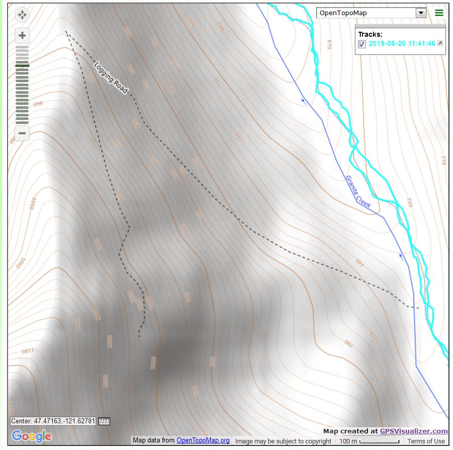
I have read about an abandoned logging road that allegedly leads to what used to be a mine. Based on the description of where the (former) road intersects the Granite Creek Trail, Carl and I believe we have found the spot. The route, if it exists, is on the map as per below (see the dotted line called ‘Logging Road’):

Is This the Route?
Carl on the Bridge

A very nice hike, just over 8 miles, 2,500 feet of elevation gain. We got wet, sure, but we didn’t melt.

Thompson Lake 6/17/19

Approaching Thompson Lake

This was one of those hikes that showed me I am not as fit as I thought.

The Thompson Lake hike is about 12 miles out and back, which is a nice long way but nothing outrageous. The first 5 miles of the trail go from 890 feet in the parking lot to just over 4,000 feet. So that’s 3,100 feet of elevation gain, nothing to sneeze at but hardly a killer.

The challenge of this hike comes in the last mile. From the point where the Thompson Lake Trail intersects the Thompson Point Trail to Thompson Lake is about a mile. During that mile you go steeply down about 200 feet in a hurry then steeply up 400 feet in another hurry, and the last section, between .4 and .5 miles goes down yet another 600 feet.

And that’s 600 feet back up on the way back, then down again, and then 200 feet up before you get back to a less drastic grade. I was sucking wind.

However, the lake itself is fabulous to visit:


Thompson Lake

Looking up at various points on this trail show how high local peaks like Dirty Harry’s, Dirtybox and Mailbox Peak really are:

Looking Up

The flowers are still out and being impressive, for example:

Flowers


To this non-botanist it seems like different flowers like different altitudes. And not just the flowers – the various bushes and weeds and trees change the higher you go. Aside from being assaulted by the steepness of the last mile of trail, this hike was just a wonderful meander to a peaceful sub-alpine (about 3,600 foot) lake.

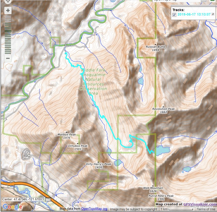
A picture of the track:

Track

All in all an exceedingly worthwhile workout.

Tiger Mountain 6/15/19

Lupine

I did a relatively moderate conditioning hike on Tiger this morning – the typical Section Line, with a little additional elevation and mileage via the Talus Rocks Trail, to Tiger 3 and back the usual way.

The intersection of the Section Line Connector and Talus/Nook shows a busy intersection:

Busy Intersection

A fairly decent workout. I am thinking of doing Thompson Lake on Monday – based on trip reports and maps this is a tough one – and I am scheduled to do Thompson with Carl on Thursday. Monday will be a nice scouting expedition.

West Tiger #3 6/11/2019

West Tiger #2 from Tiger #3 Trail

I did a nice hike today, I parked at the High Point Trailhead and hiked up the W. Tiger #3 trail to the summit. I went down via the first section of the Section Line Trail to the Railroad Grade Trail where I went west to hook back up with the Tiger #3 Trail down.

Today was just about the exact opposite of Sunday’s hike. There, I was way off trail, bushwhacking and almost getting lost, but today I was on Tiger Mountain and on obvious trail the entire time. Plus, I have been on these trails many times so there was never the slightest question of being lost.

The view from the Tiger #3 summit is not exactly awe-inspiring:


View from Tiger #3 Summit

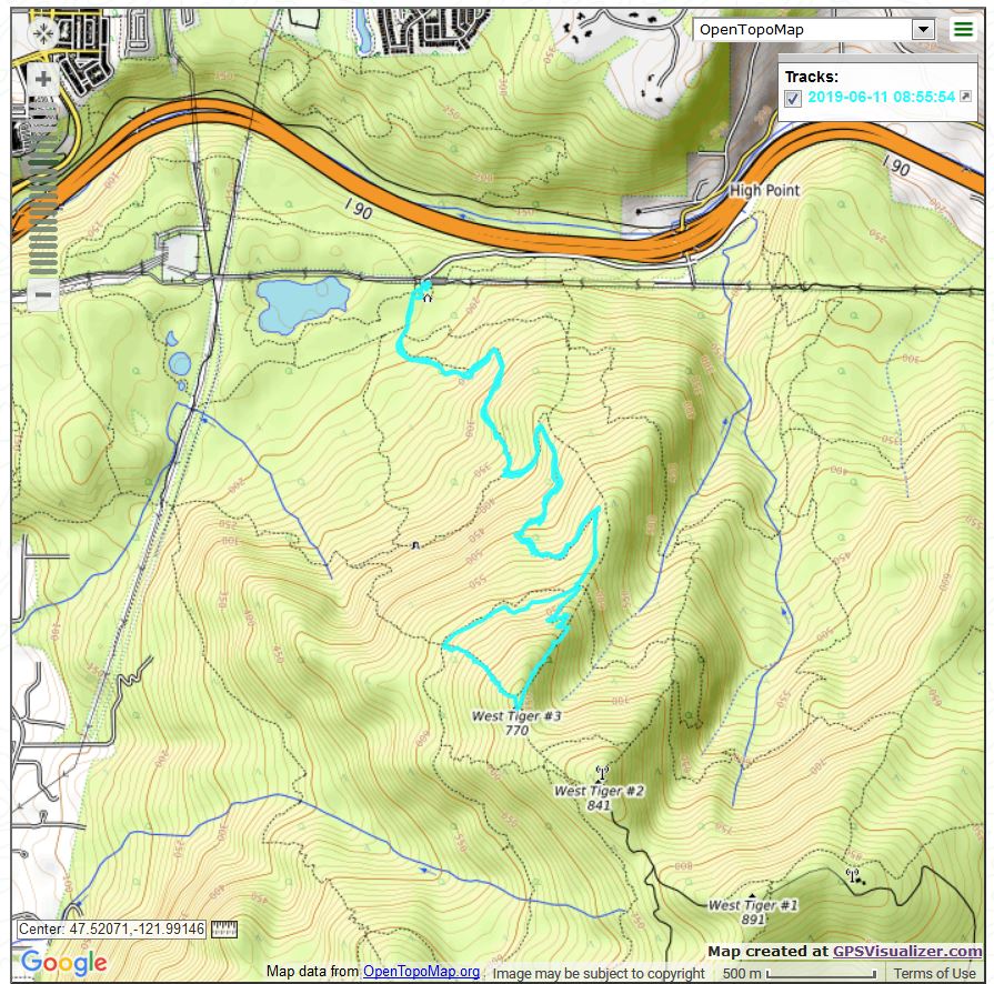
About 6 miles, 2K elevation gain, a nice workout. Pic of track right here:

Track

Backcountry Bushwhack 6/9/2019

Goats

I was way off-trail today but on the way down, when I was finally back in familiar surroundings I passed a hiker going up with her 3 (one is behind her) goats. Cool!

I thought yesterday I might be hiking with Derek today – he is my off-trail bushwhacking companion – but he couldn’t make it so, perhaps unwisely, I stuck to my plan.

I had long noticed, on topo and other maps, that a very old and de-commissioned logging road came near the McClellan Butte trail. I had previously discovered where, on the McClellan Butte trail the former road came relatively close, and on yet another occasion I learned where the old road intersected the road designated NF110, up and down which I and Derek had hiked previously.

So I thought I had figured it out.

Not so much.

I went up the McClellan Butte trail and, just short of where I planned to start route-finding, I stopped to snap a picture of the neighborhood:


East

There were also some very nice flowers right there:

Flowers

Immediately upon leaving the trail the going was rough. Right there were a series of large trees that had been cut down and left to decompose. Nice to look at but not easy getting over.

When I got over all the trees I was headed towards an unfordable creek (Wood Creek, according to the maps) so I had to bear right and try to find the least obnoxiously overgrown path. At this point, I knew the former road had petered out; I was looking to intersect it.

I assumed it would be de-commissioned but, having seen quite a few such former roads, I figured it wouldn’t be too bad. Wrong! Wrong! Wrong!

When I finally found what, according to my Gaia mapping/tracking app told me was the former road, there was nothing to see. At one point there was a faint outline of the olden days:

As Good As It Got

Getting back to a normal trail (NF110) was a long series of back-and-forths and looking for traces of the old roads. At one point I wound up getting turned around and went in a circle. My track reflects my confusion but, fortunately, Gaia bailed me out.

I was very happy to get back to a real trail and even happier to leave the bushwhacking behind. At one point, I had to cross Wood Creek, hopping over slippery rocks while trying to fight off closely overgrown bushes peppered with very nasty prickly needles. Glad I am that no one was around to hear my curses.

Once I got back to NF110 it was fine, not exciting, but a nice long walk back to the car. I got to see the wonderful mountains to the north:

North

Here is the strange track:

Track

About 7.5 miles, 2,500 feet of elevation gain. I made it back so it’s all good!


Rattlesnake Mountain 6/5/2019

Rattlesnake Lake

I am ramping up my training hikes. Instead of my standard Tiger Mountain conditioning hike I was on Rattlesnake Mountain this morning.

I left the car about 7:30 and that was a decent time. I saw a bunch of high school age boys coming down (I presume they were some local sports team) but otherwise the trail was not crowded at all. I mention this because this trail, on the weekends, is like downtown Seattle with the crowds. By 7:30 on a weekend, both sides of the road leading into the Rattlesnake Lake area are covered with cars. But today, it was nice.

I started up the new/official trail but quickly veered off-course and used the first section of the old trail, which is much steeper. I then used the official trail all the way up to the first anti-horse and anti-bike fence, which, using the official trail (which is longer) was about 3.6 miles.

On the way back I veered from the official trail farther up, mainly because I could hear a bunch of people coming up the trail and I was not inclined to navigate that situation.

On the way up I stopped at the upper ledge and looked north to see Mount Si and Mount Teneriffe – I love seeing mountains I recently hiked, and Teneriffe (on the right in the picture below) was my hike last Saturday.

Mount Teneriffe

Just over 6 miles, 3K elevation gain, 3.5 hours, a nice workout.

Mt. Teneriffe 6/1/2019

Mailbox Peak and Friends

Great hike today. I went to the summit of Mount Teneriffe, going the long way both directions (no Kamikaze Trail today, I won’t do that one solo). Beautiful day and perhaps a tad too beautiful. I totally soaked two sweat bands on the way up.

Teneriffe is one of those summits that is above the tree line and taller than everything in the immediate vicinity. And so you get an amazing 360 degree view.

The trail and the summit were packed. Here is the view looking south towards Rainier:


Rainier and South

You can see Teneriffe’s near western neighbor, Mount Si:

Mount Si

And the view north is also spectacular, featuring nearby Green Mountain:

North From Summit

Just under 14 miles, about 4,200 feet of elevation gain (parking lot is 830, summit is, per my Garmin, 4,750, plus there are quite a few ups and downs along the trail). A nice workout.

And when I was done I got to attend Finley and Camden’s joint birthday party. Great food, fun people, and plenty of presents to open.

Not sure what hikes I will be doing next week but none of them will measure up to this one. A really good hike.