I figured to be hiking more often after retirement but I didn’t get out at all last week. I am changing that formula as of today.
I met Carl and Mike this morning at the Park ‘n Ride and we drove up to the upper Rattlesnake Lake parking lot. As usual, this one was empty.
Carl had knee surgery a few weeks ago and is in rehab mode so we did a family-friendly hike, east on IHT, Christmas Lake, then up to the Cedar River Watershed Education Center. Mike had never visited and he was impressed. It truly is a wonderful place to visit.
Not sure how long, just a bit more than 4 miles I am sure, and tons of fun. Just a great time.
I forgot my camera today – oh, well! – but there was nothing particularly photogenic anyway.
I met Mark and Ken at the E Sunset Way parking lot/trail head. Our plan was to go this route to Poo Poo Point but when we hit the spot where the trail splits, right to Poo Poo, left to Section Line, we went left since Mark had never been on the Section Line from that direction.
We extended it by doing the Talus Loop trail to Tiger 3, then down to Bus Line, etc. etc. back to Puget Power.
A nice workout, about 6.5 miles, we are planning a Tuesday hike as well. Now that so many of us are retired, well, why not?
As usual when I purposely leave my camera behind (I don’t have a camera phone) some great photo op appears and I have to skip it. Today, I saw a huge woodpecker pecking wood not far from the trail and he wasn’t bothered by my presence. Would have made a great shot.
Anyway, I am not going to add a new trip report for every Section Line hike I do; I will just bookmark this one and update it as I do it.
This is the hike from E. Sunset Way: connector trail to Puget Power Trail, to Adventure Trail to High School Trail to Section Line trail (this is the workout of this hike, about .8 mile of fairly steep and steady climbing) down the Nook Trail to the Bus Trail.
Today, instead of taking the Bus Trail to the Bonneville Powerline Trail back to Puget Power, I took the Around The Lake trail back to the Puget Power trail.
There are plenty of variations, but the hike is 2 hours 15 minutes give or take and a nice mid-week workout.
UPDATE – 2/13/2018 – did this today with a little twist at the end. Went down to Bus Trail, took it to its western terminus at the Bonneville Power trail, then took the Wetlands Trail, passing by Round Lake, which is a very nice little lake just west of Tradition Lake.
UPDATE: 2/23/2018 – Did a reverse-direction variation this morning, early (6:40 leaving car) because of babysitting duties. Started Adventure Trail but quickly went left up the Wetlands trail and went up rather than down the Nook Trail.
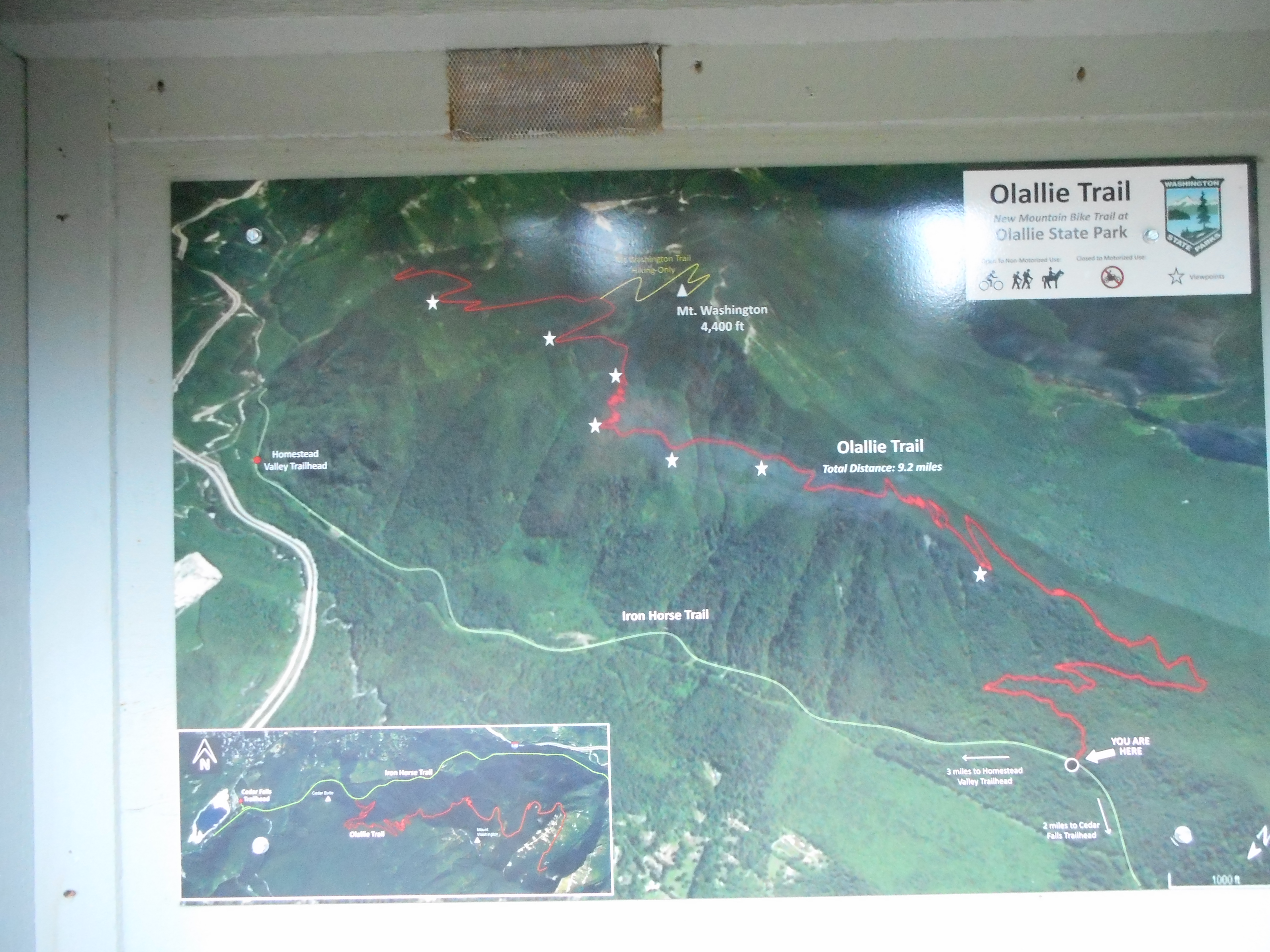
After a few close encounters with the pre-opening mountain bike trail in 2016 I finally got to hike the official trail today.
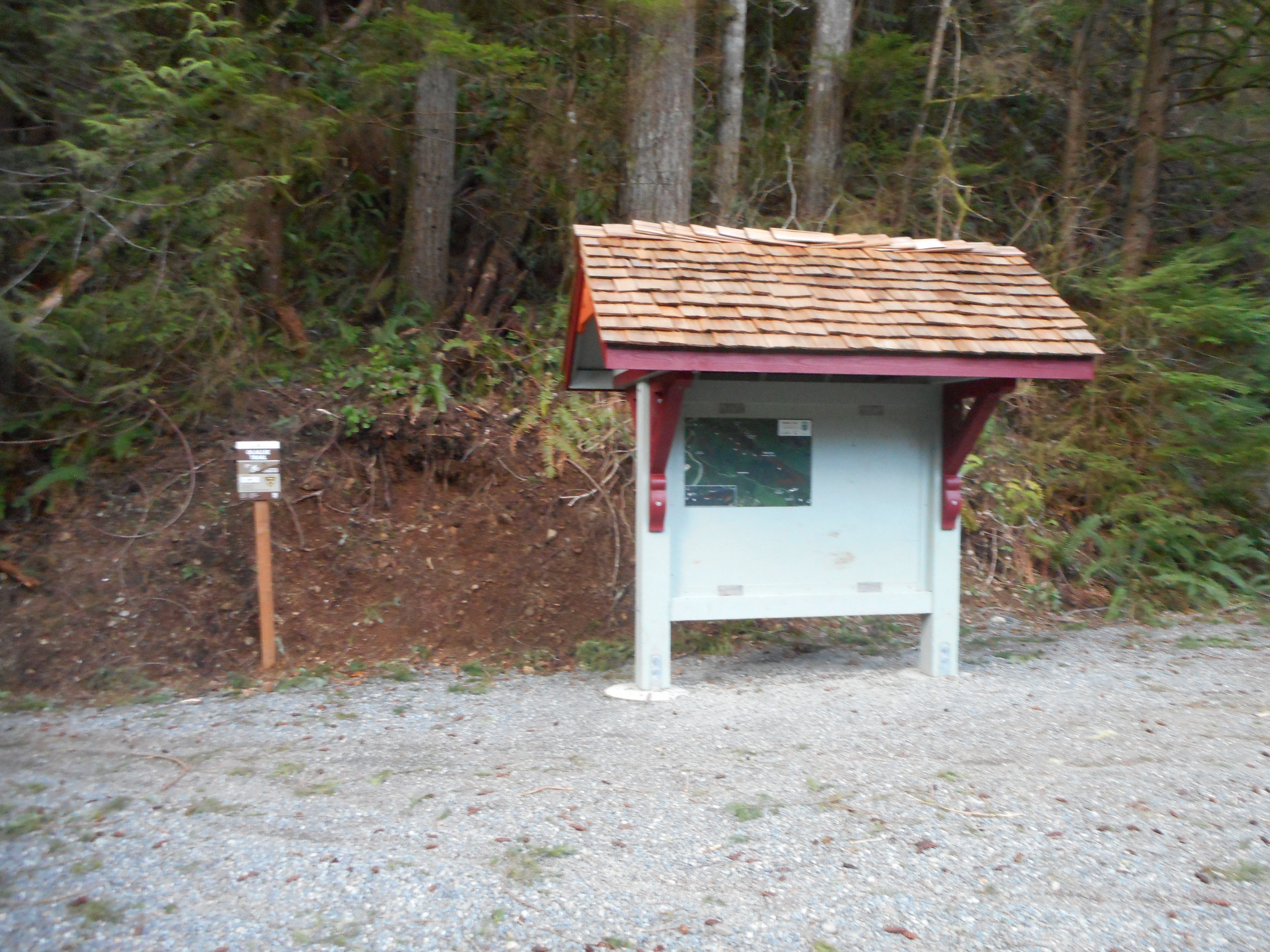
Before it opened you had to look for a muddy spot on the IHT about 2 miles from the parking lot and bushwhack up to the under-construction trail but now that it is open the trail head could hardly be more obvious:
New Trail Head
As of now, this trail goes east and intersects the Mt. Washington trail at the pond, then goes across the northern face at that level (probably about 3400 feet) and then down to just south of what the Olallie map calls Change Lake, aka The Pond.
Last summer Carl and I accidentally found the current eastern terminus; within a year they expect it to go to McClellan Butte.
A good hiking trail but for the mountain bikers among us, this trail seems to be top rate. Three bikers passed me as I was hiking back west, and I asked them how they liked the trail. I got a great five-word review: “Beautiful. Well maintained. Drains well.”
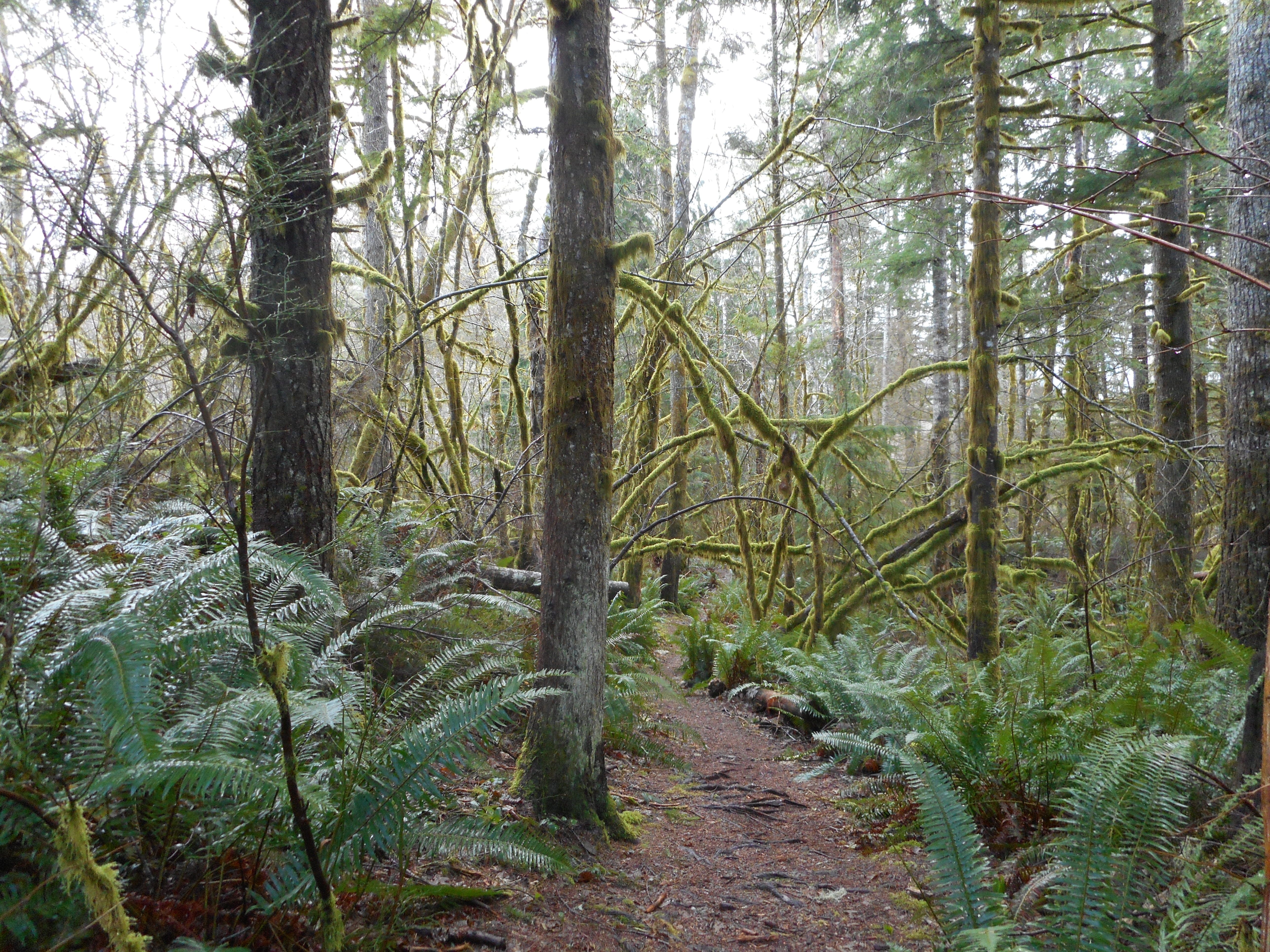
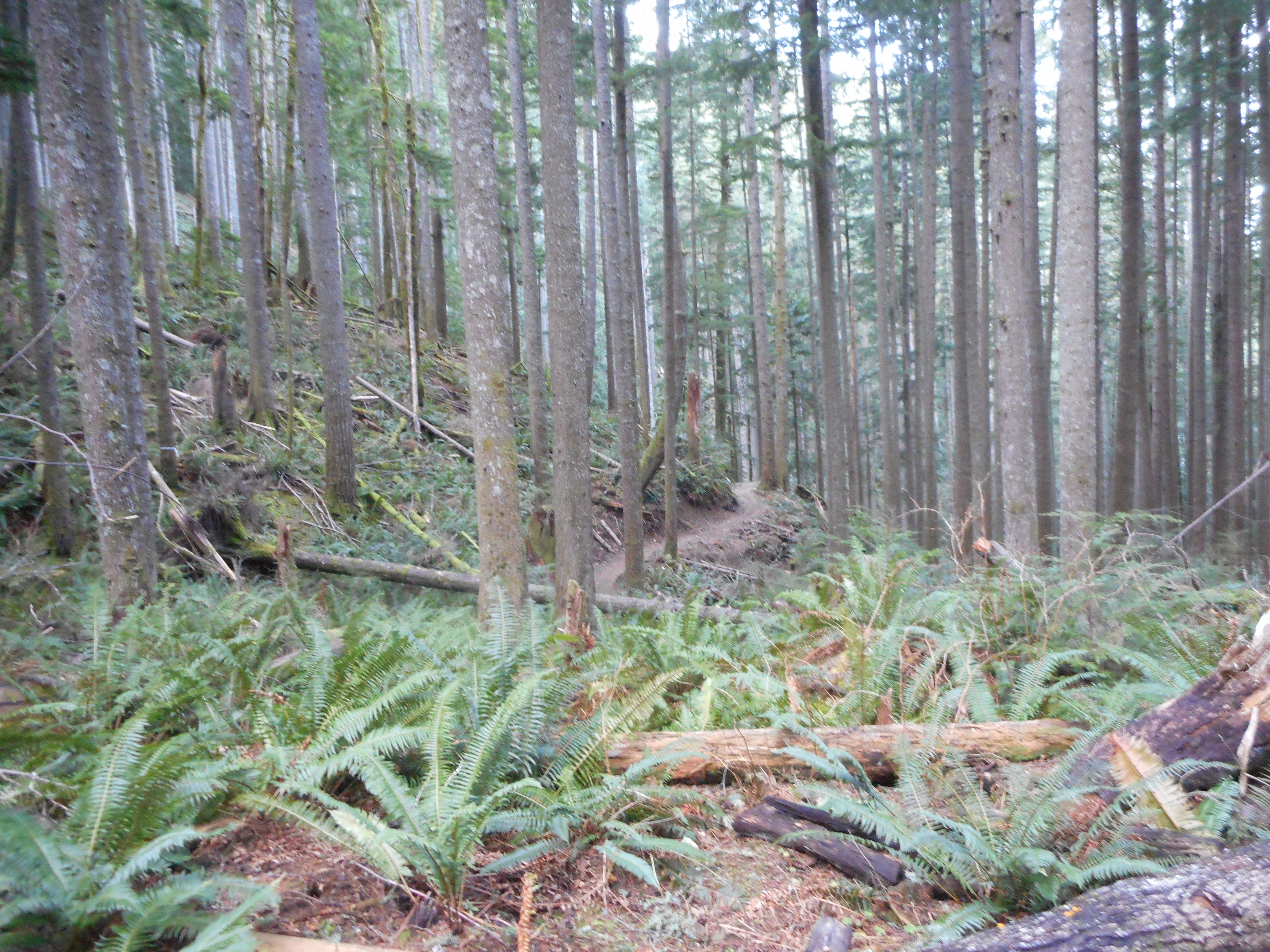
Here are a couple of typical trail views:
TrailMore Trail
I only went part-way and then turned around but a near-term goal is to hike it to near the eastern terminus, split off at the pond shortcut and go back down via Change Creek trail and IHT.
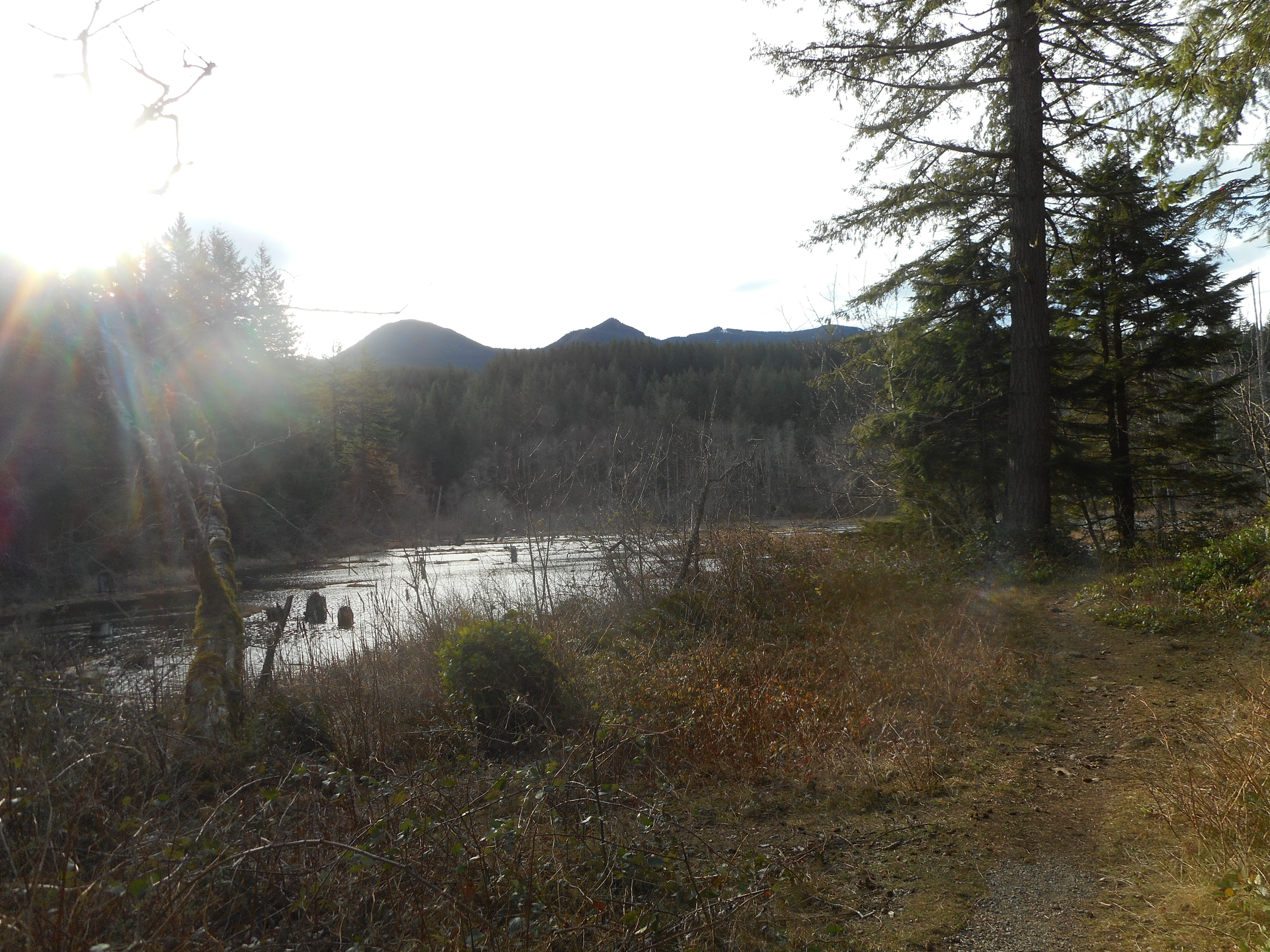
On the way back I detoured off the IHT down the Christmas Lake trail, a little-used trail and way more interesting than the IHT. It borders the northern shore of Christmas Lake most of the way, and just where you leave that section of the trail to head west, there is a nice view of this obscure little lake:
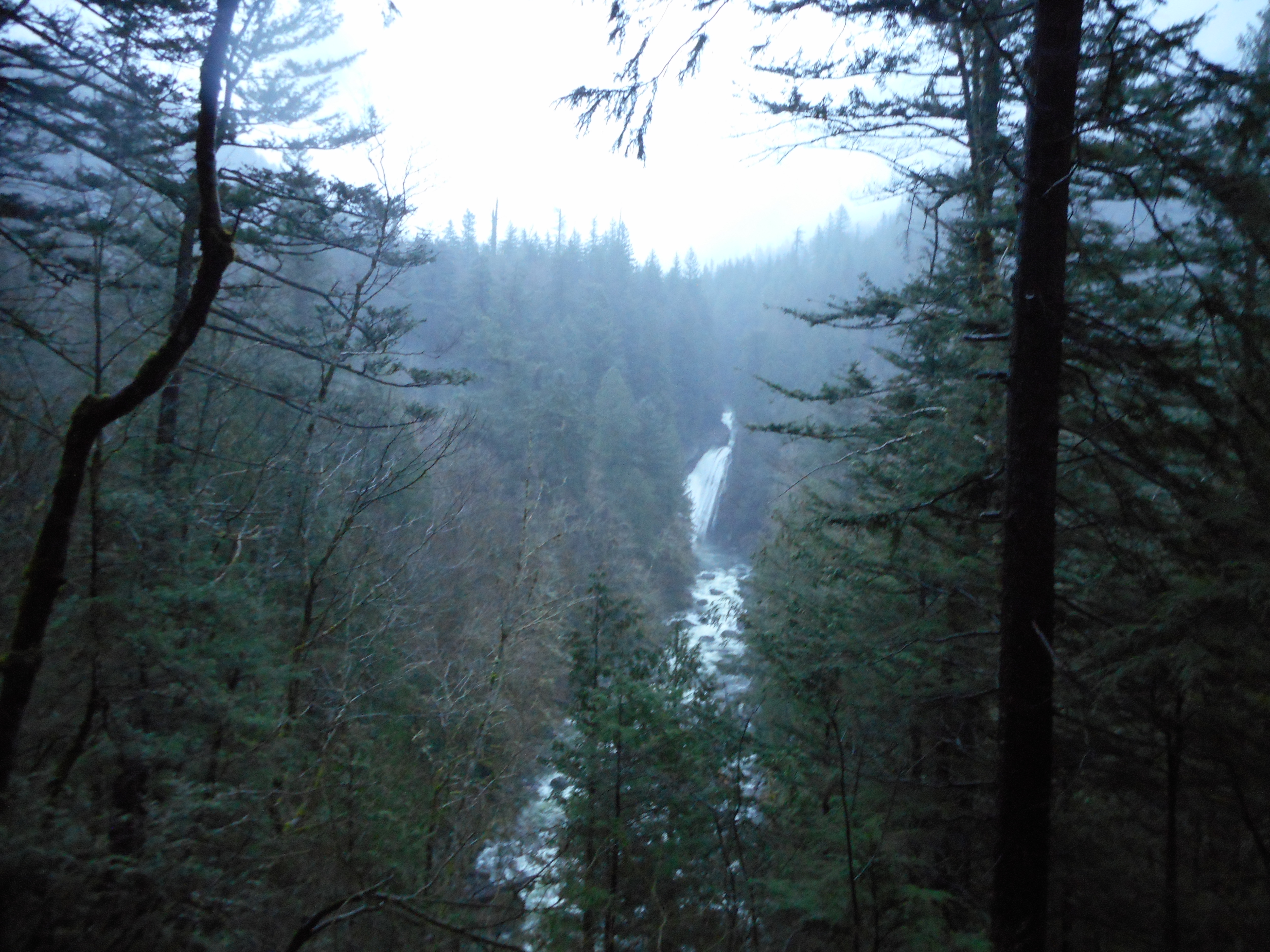
Ken, Mark, Greg and I hiked Twin Falls today. We went from the Exit 34 trail head to the IHT, then east to the Mount Washington trail head, and up that trail to the first waterfall.
Nice hike, kind of wet today but not too bad.
The falls are pretty intense lately:
Busy Waterfall
My first hike as a retired geezer, as my last day working was Thursday the 11th.
I am predicting a busy hiking 2018 and, I hope, a road trip east.
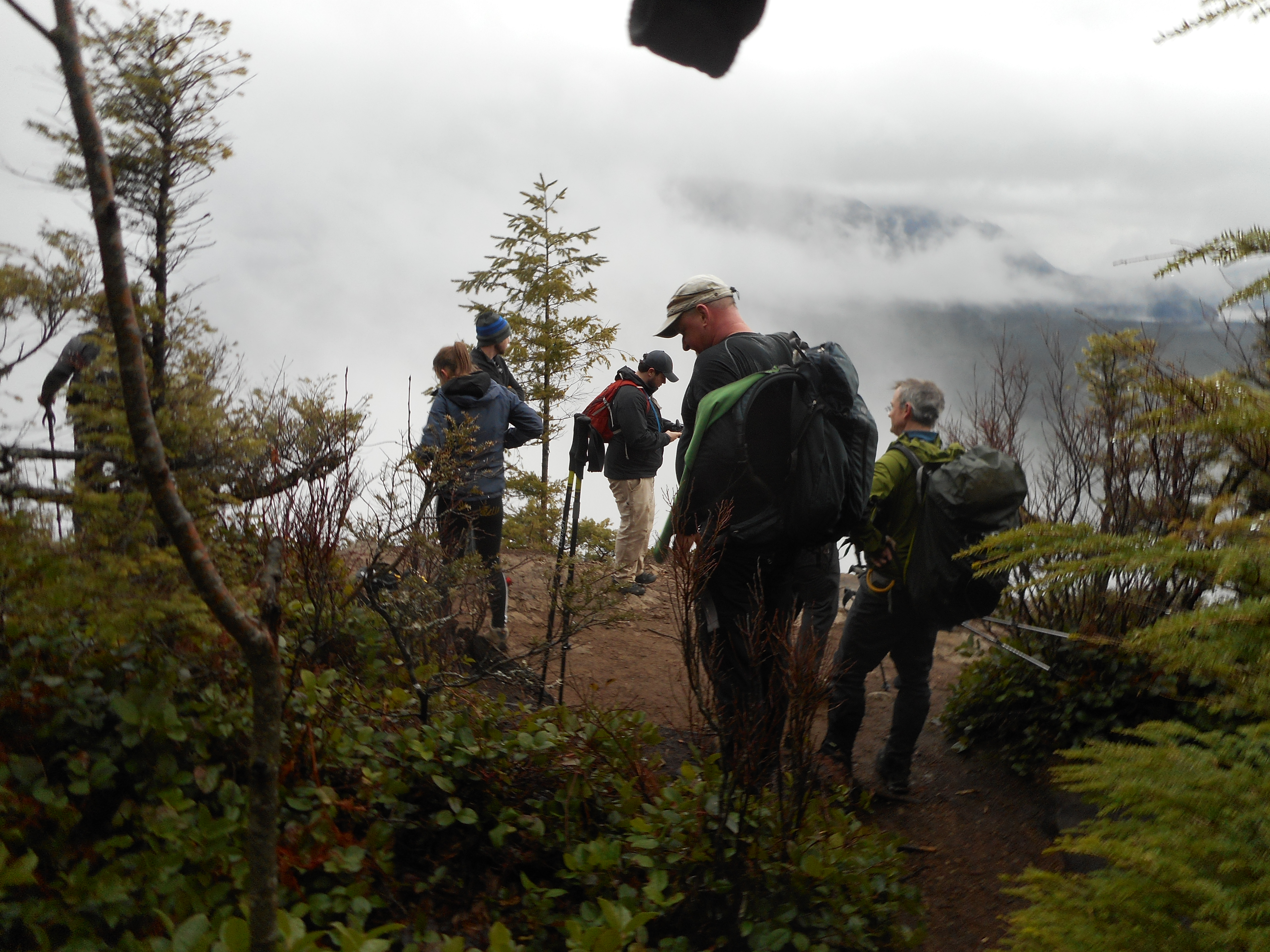
First hike of the new year with Ken, Mark, Mike and Greg. We took a version of the old trail from the Rattlesnake Lake side of the mountain to the upper ledge and found some folks making tea. The upper ledge is not capacious:
Crowd on the Ledge
I hiked solo on New Year’s Eve, did Margaret’s Way but when I got home just a few minutes before Jill and Derek and the kids arrived so I never got around to recording it.
Next week is my last week as a working stiff. I will be retired as of next Friday. So – more hiking in 2018!