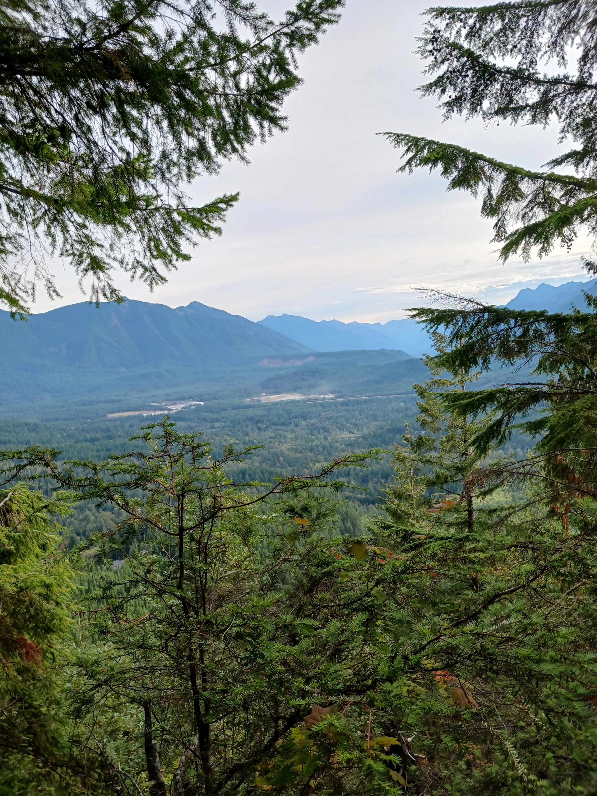
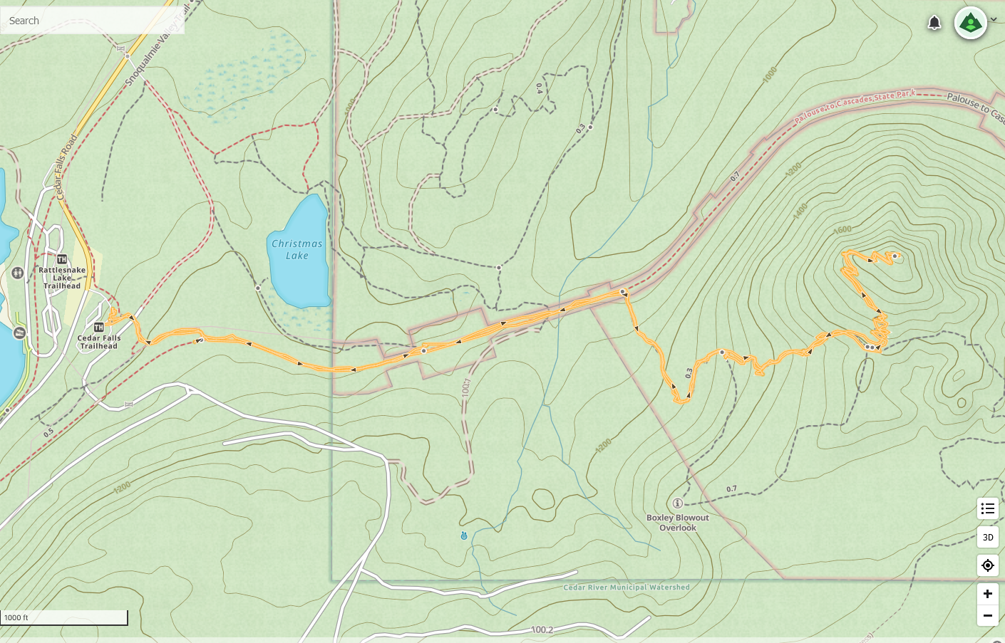
I got out today to Cedar Butte. Not the longest or most strenuous hike in the world but it was great getting into the mountains again. About 4 miles, no big deal but I do love the forest and the mountains.
Last Sunday I did a WTA Trail Ambassador tabling event at the Evergreen State Fair in Monroe, WA. My table partner was Richard Mellon. Richard is a great guy. He lives north and west of us in Anacortes, WA. Anacortes is in the NW corner of the state, on the water, served by various ferries.
Richard’s descriptions of the town and a park near the town called Sharpe Park caught my interest and today Jan and I headed there to check it out. We loved it.
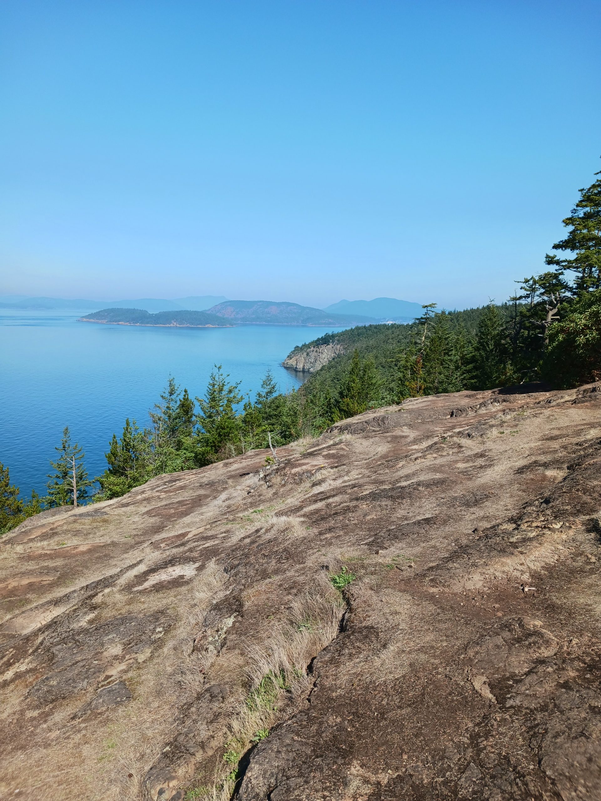
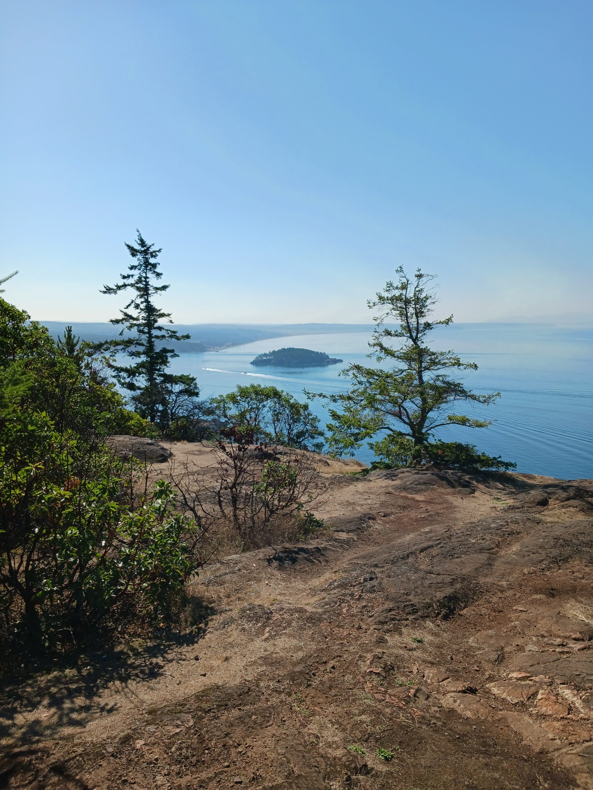
Sharpe Park has a nice network of trails. I am sure you could stitch together a longish route but Jan is not a big hiker so we just took the Sares Head Trail to the Overlook, about 1.8 miles round-trip. The trail goes through very beautiful second growth forest with quite a number of sights along the way – a pond, huge boulders, etc.
The view from the overlook is spectacular, if you like views from high cliffs overlooking islands and a large body of water. It didn’t hurt that the weather today was perfect, about 75 degrees and quite sunny.
The city of Anacortes is much bigger than we thought it would be. We walked around, had lunch, browsed in some shops. There is a Saturday Farmer’s Market but it closes at two, and that’s about the time we finished lunch. We will be back and will make sure we have more time to explore this great waterfront city.
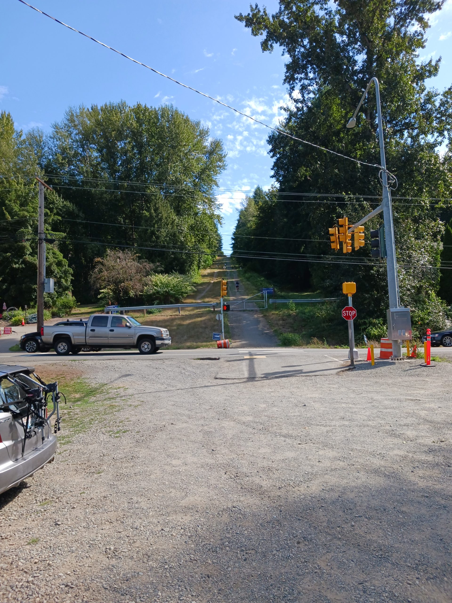
I hiked today on the Tolt Pipeline Trail. I have done this one a number of times but I stopped last year because of heavy road construction nearby that made access annoying. I tried again today and the road was all clear.
This is a nice one. From a workout standpoint, it is a bit more vigorous than my standard Section Line hike. On that one, when I count right foot steps (about 1,200 to a mile for me) there are 1,450 uphill steps. I counted today on the Pipeline Trail and there were a total of 1,750. The Pipeline Trail is very different in a lot of ways, and with respect to the uphill this trail is very hilly, lots of ups and downs. The downs on the way out are ups on the way back and so on.
As much as I love the mountains, every time I put gas in the car I am unhappy about ten gallons costing about 50 bucks. So I keep hiking locally. Perhaps tomorrow I will get out to a mountain.
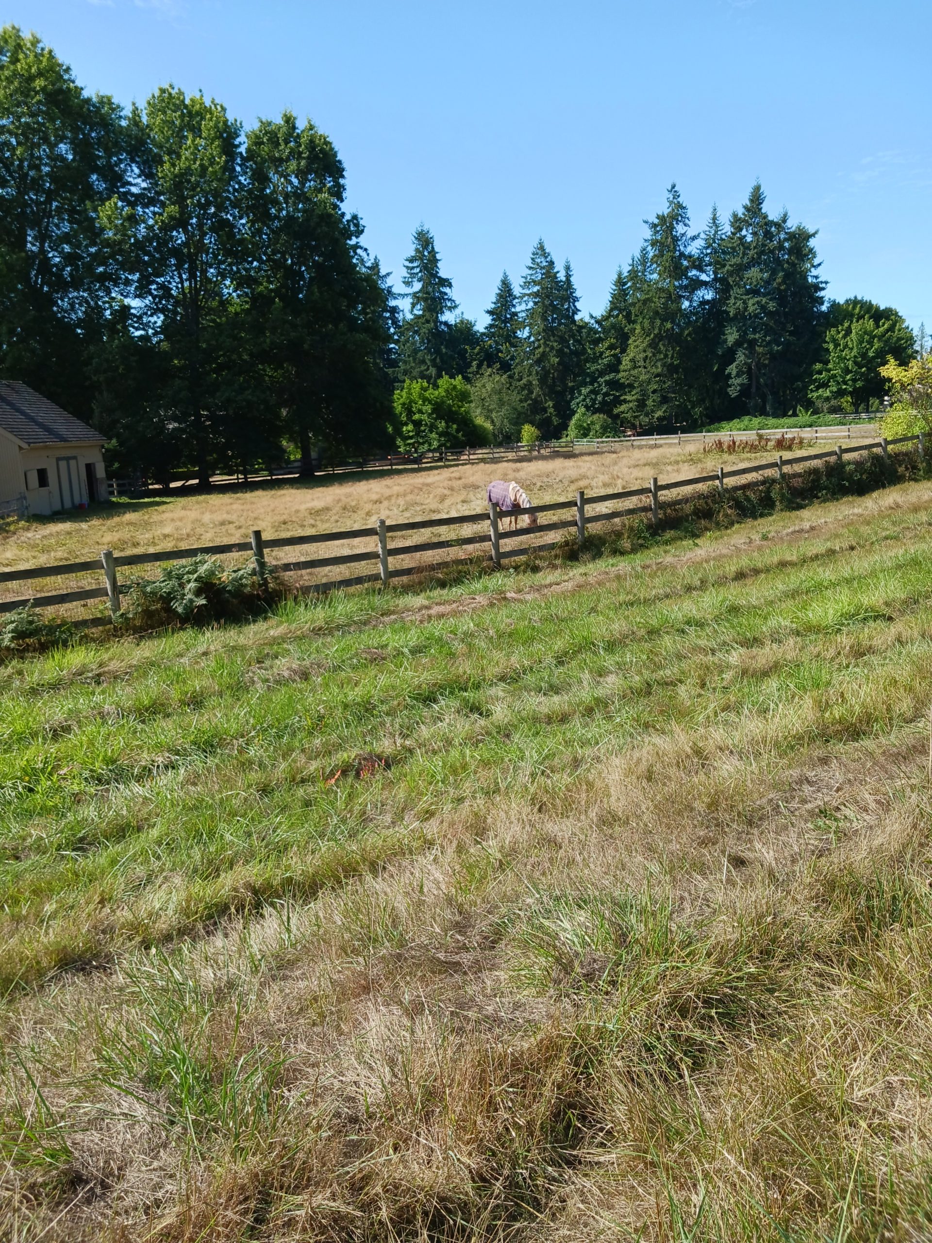
The Pipeline Trail – at least, the portion I hike – goes through a horsey neighborhood of quite prosperous looking houses with plenty of horses:
Mister Ed?
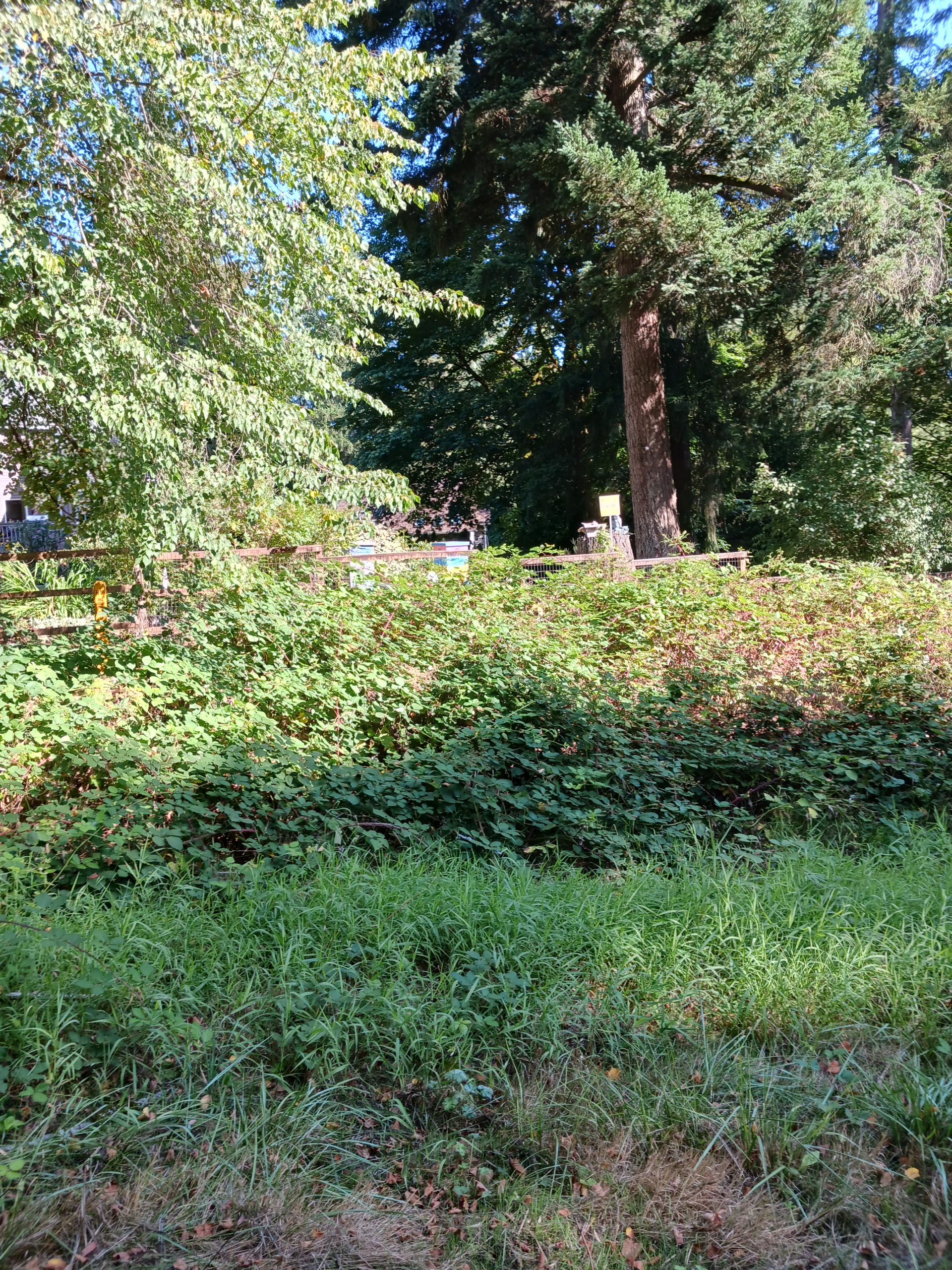
One house has bee hives in the backyard:
Bee-Loud Glade
Anyway, it was about 7 miles and a good workout on a beautiful almost-fall day.
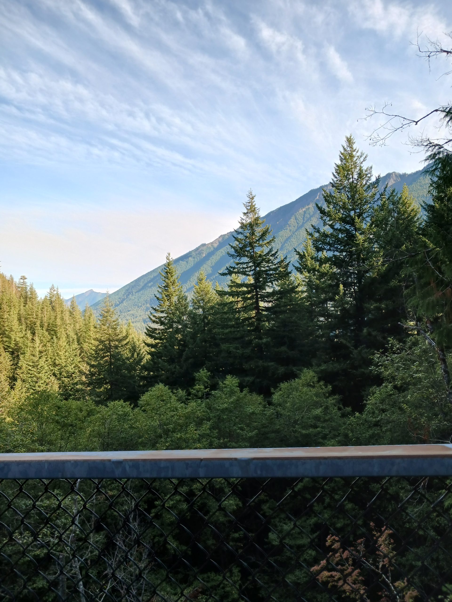
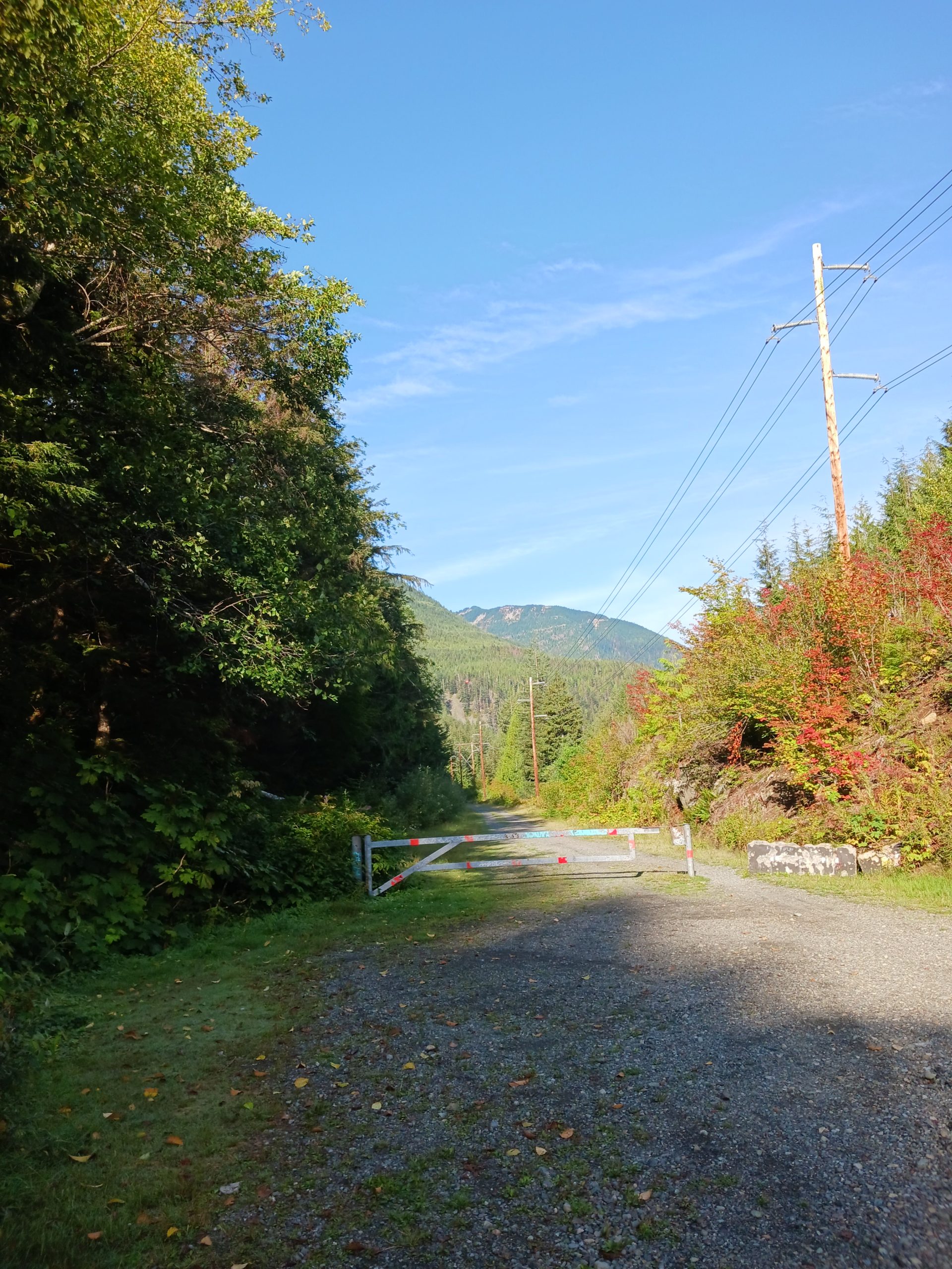
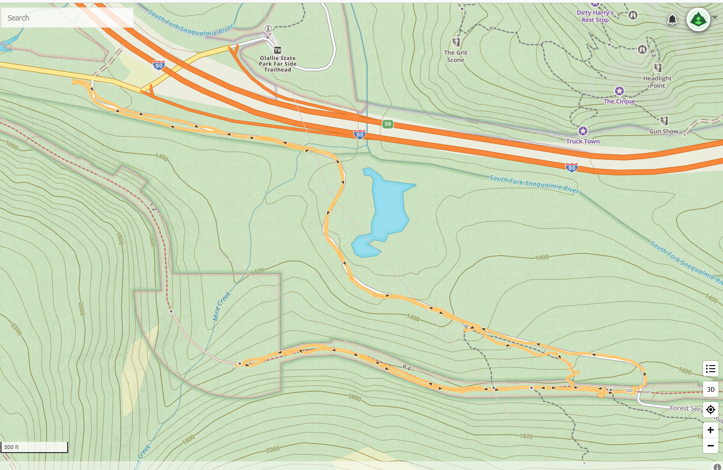
I finally got out to the mountains. I parked along the side of Homestead Valley Road and hiked up the service road to an unofficial trail that took me up to the PTC. From there I went to the Mine Creek Trestle, turned around and went back to the car via the service road.
A bit less than 4 miles, not all that strenuous but it is a start. I absolutely have to get back to doing difficult hikes and today was a decent starting point.
Here is the view, looking west at Change Peak, from the Garcia/PTC intersection: