Zig Zag Trail 3/30/3021

Turnaround at 2100 Feet

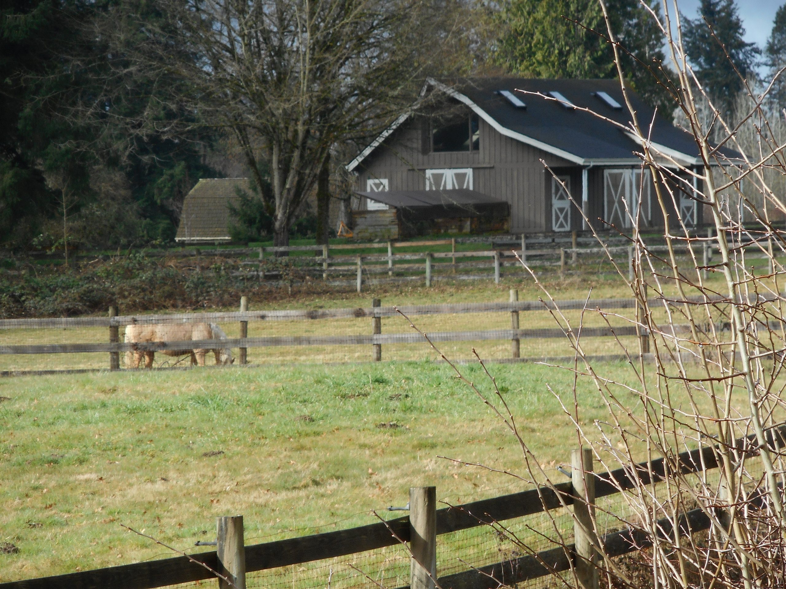
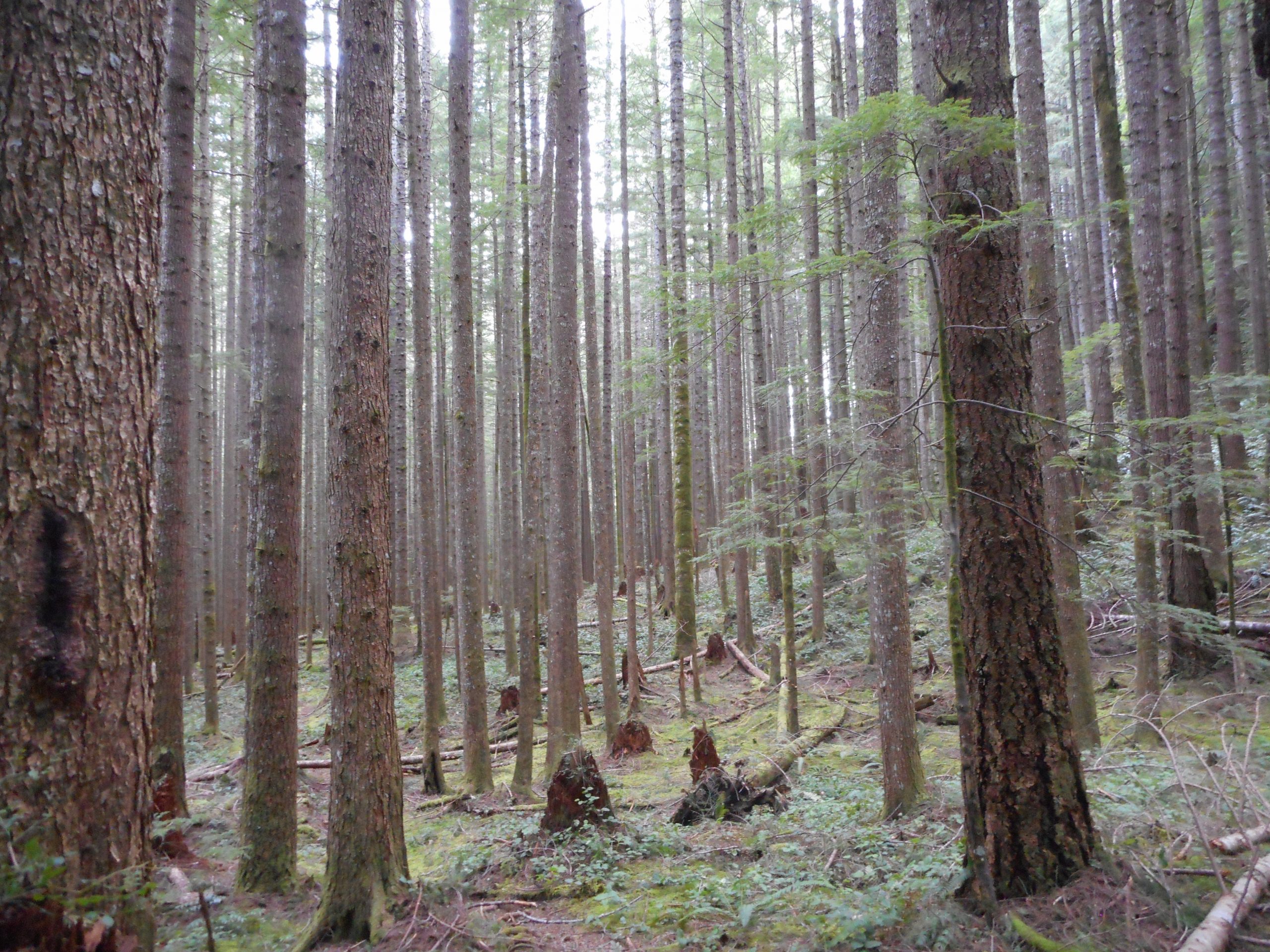
I have no objective reason to be disappointed. True, my hike today was really short (2.2 miles) but there was enough elevation gain that I had a decent workout. And I did get out on a trail, the day is beautiful, the views were awesome so I am trying to work myself into a better mood.

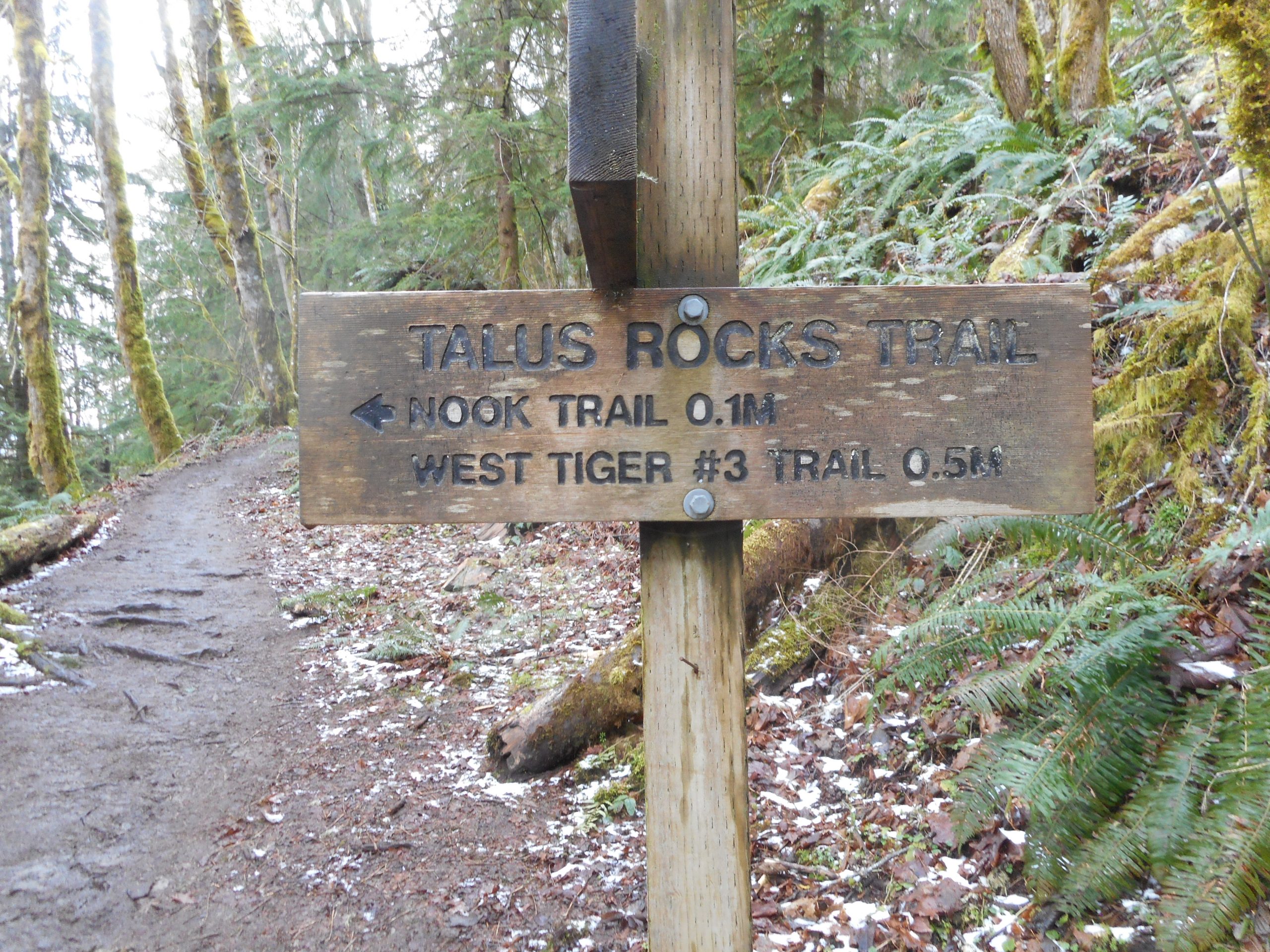
The problem is that I suggested to Derek that we go up to Truck Summit via Zig Zag Trail on Saturday and today I thought I would reconnoiter the route. I figured I would eventually hit snow, but I hoped it would be high enough that I would be able to push on to at least the top of Zig Zag, 2750 feet up.

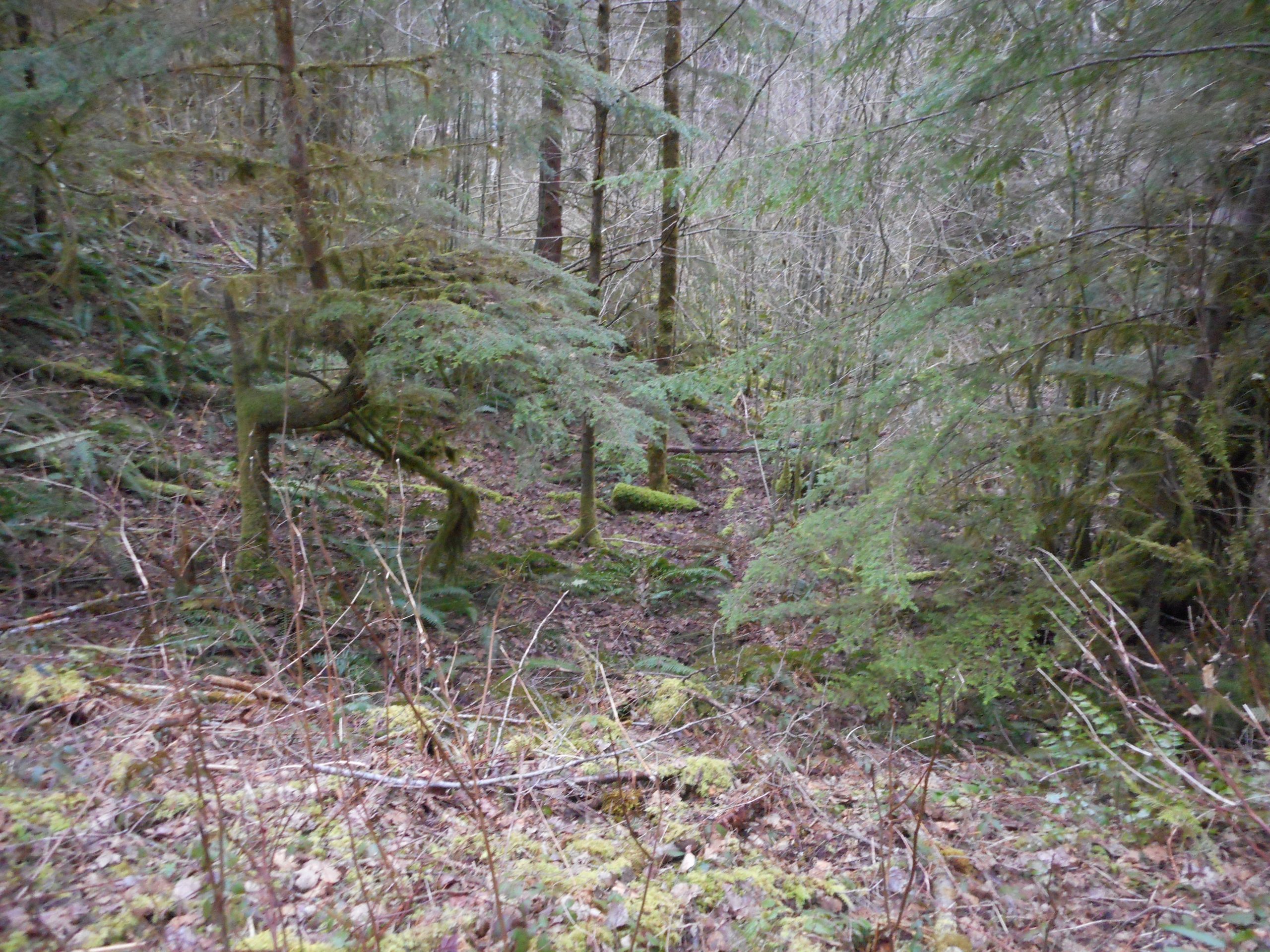
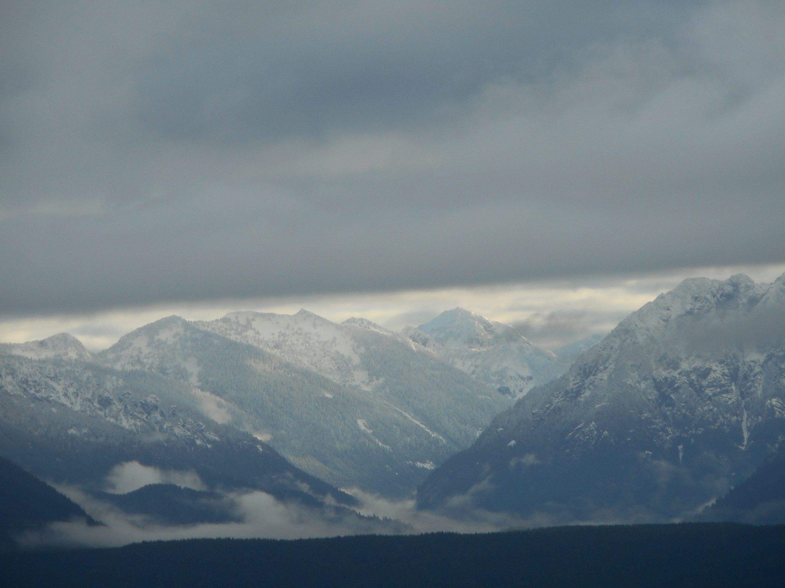
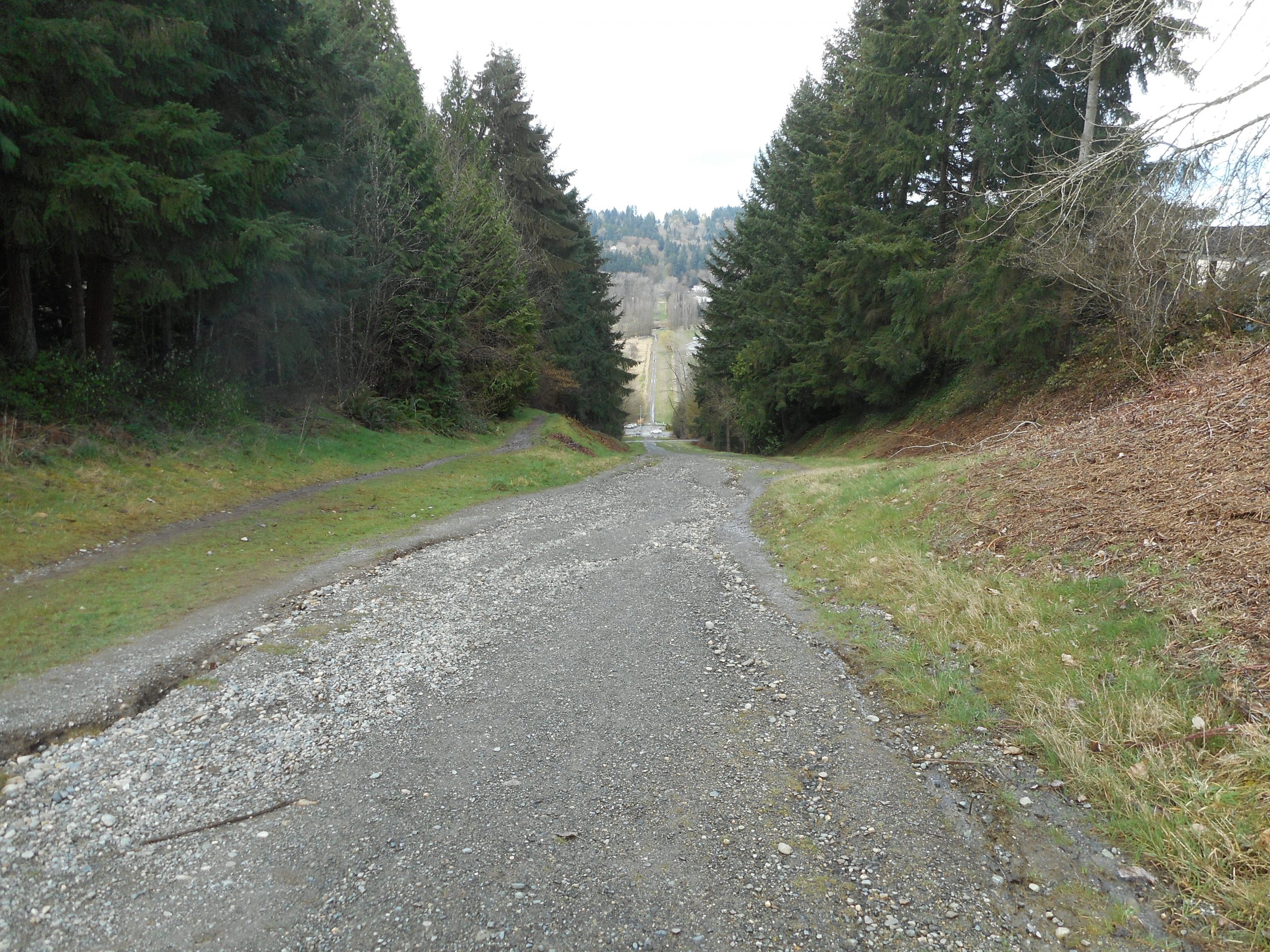
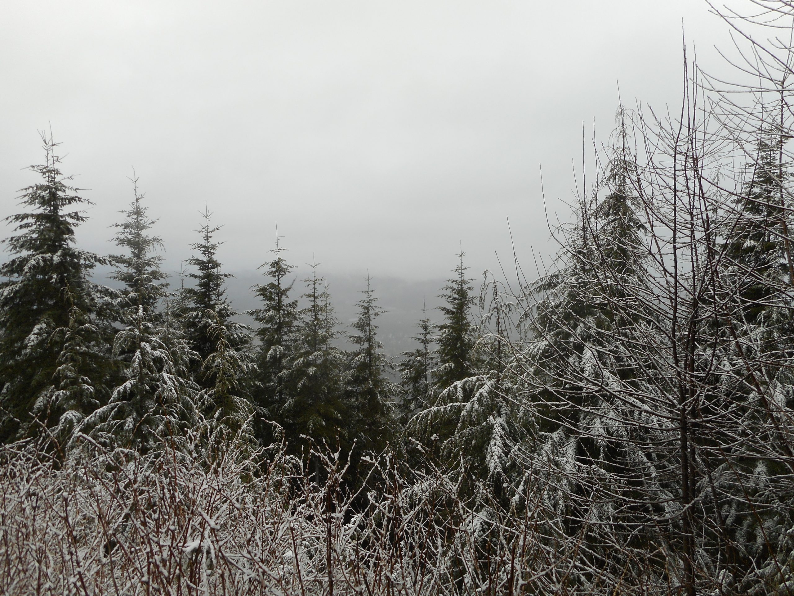
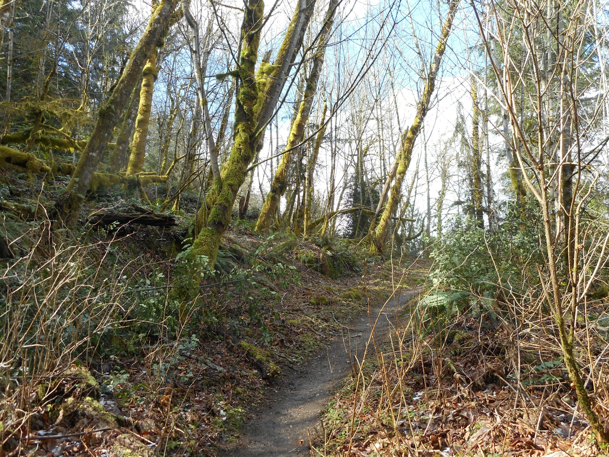
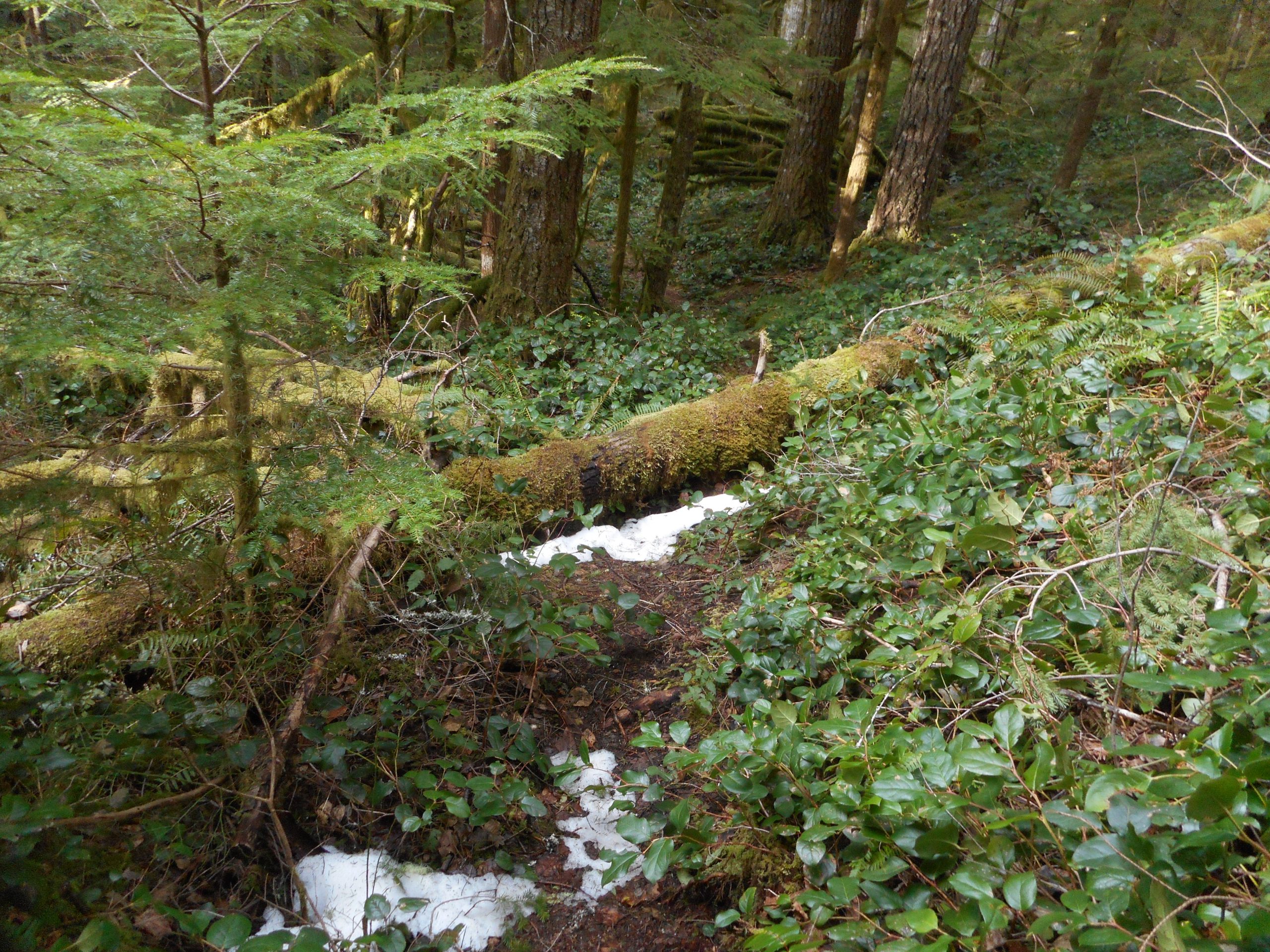
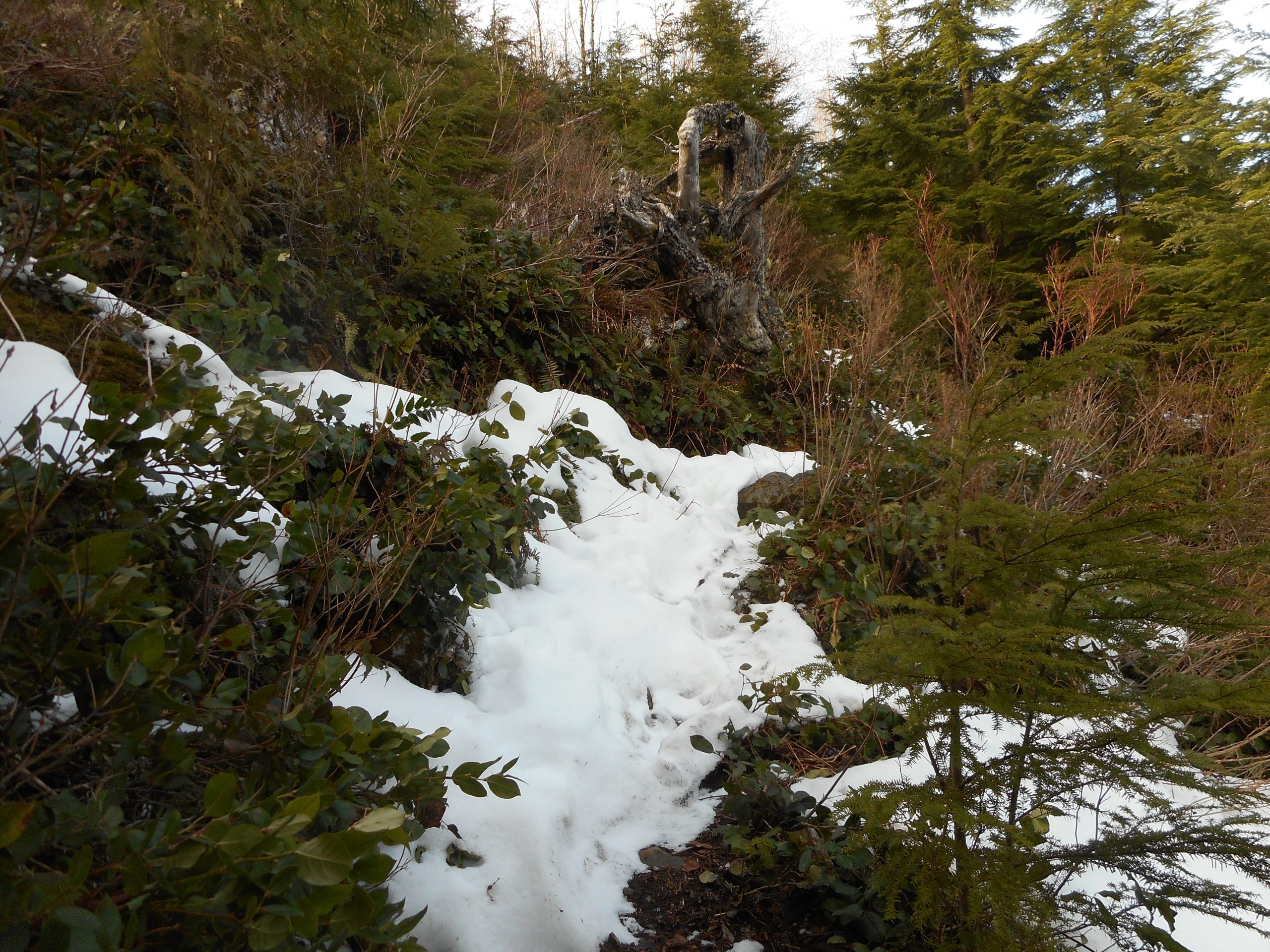
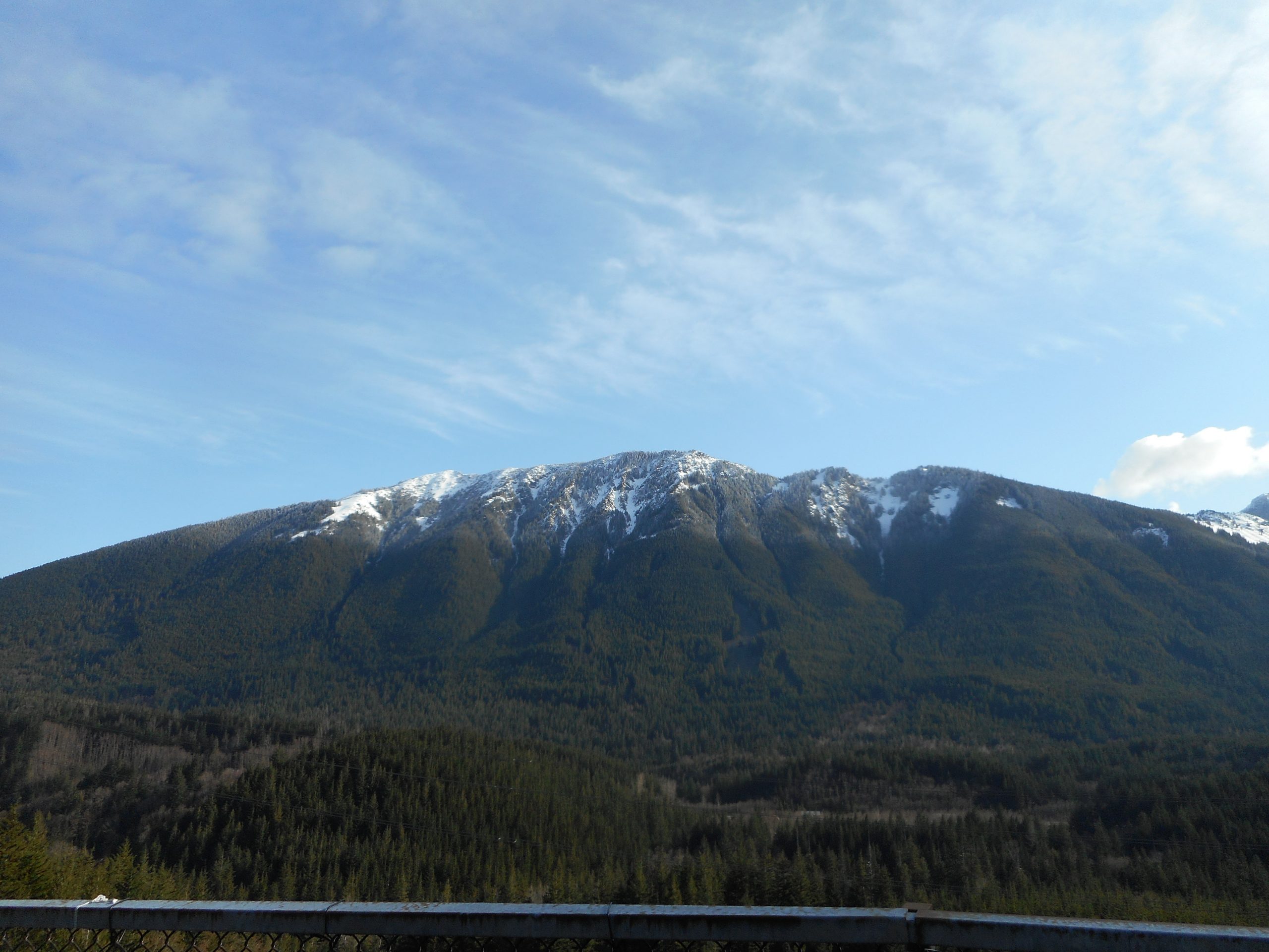
But (see photo above) I hit total snow cover at 2100 feet and I turned around. I am sure I could have gone at least a bit farther, but I figured I would have to go back down this very steep, very narrow trail in the snow and that it might be a bit dangerous.

My hope was that I could make it up to the top of Zig Zag and then go back down via the service road, which is longer and safer. I even brought garbage bags for my shoes if Mine Creek was high. I was ready to do a long hike but, solo, I was not comfortable going up and down so steeply on a snow-covered trail. And I also know from experience that this trail gets lost in the snow and navigation is an issue.

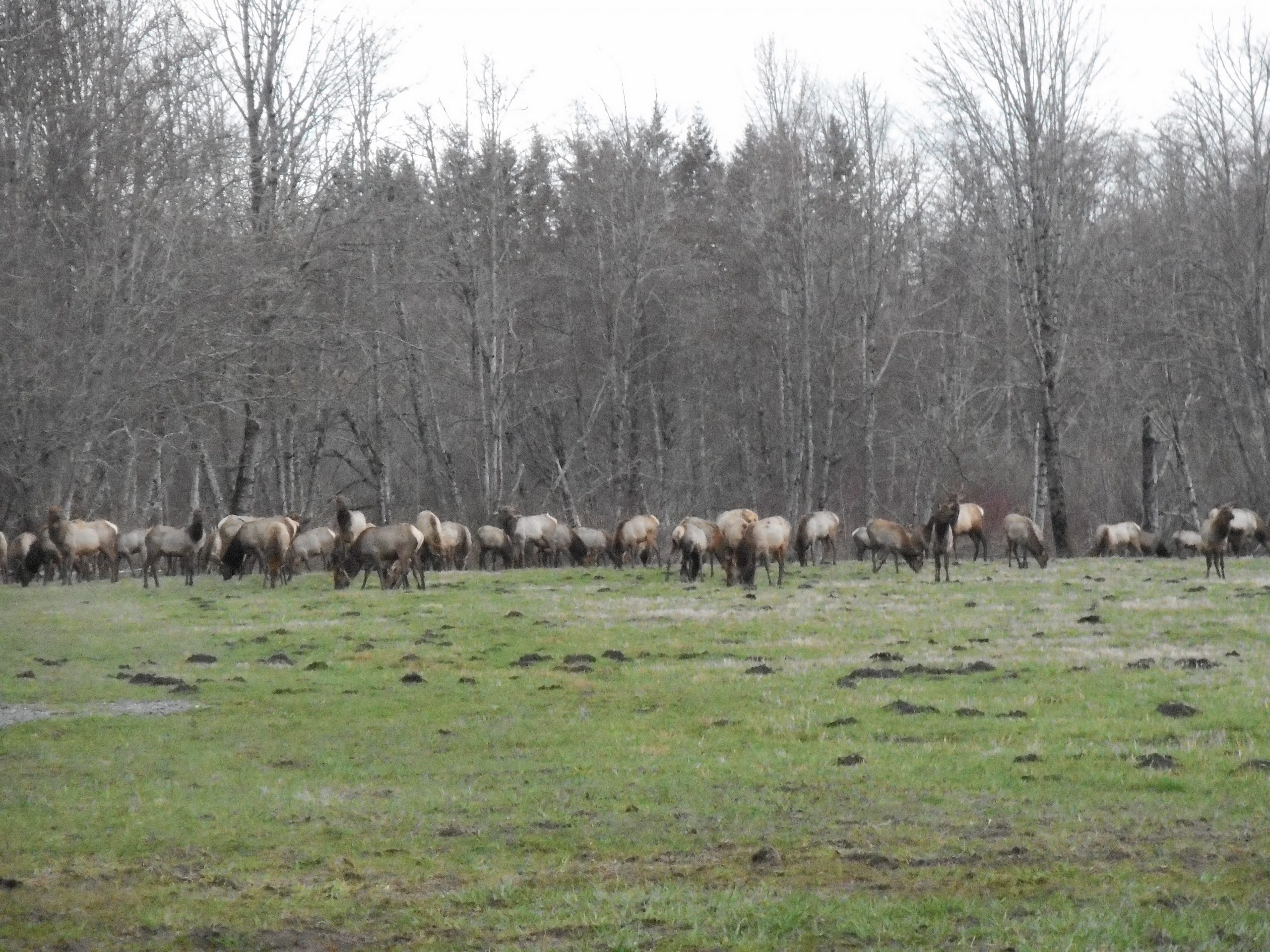
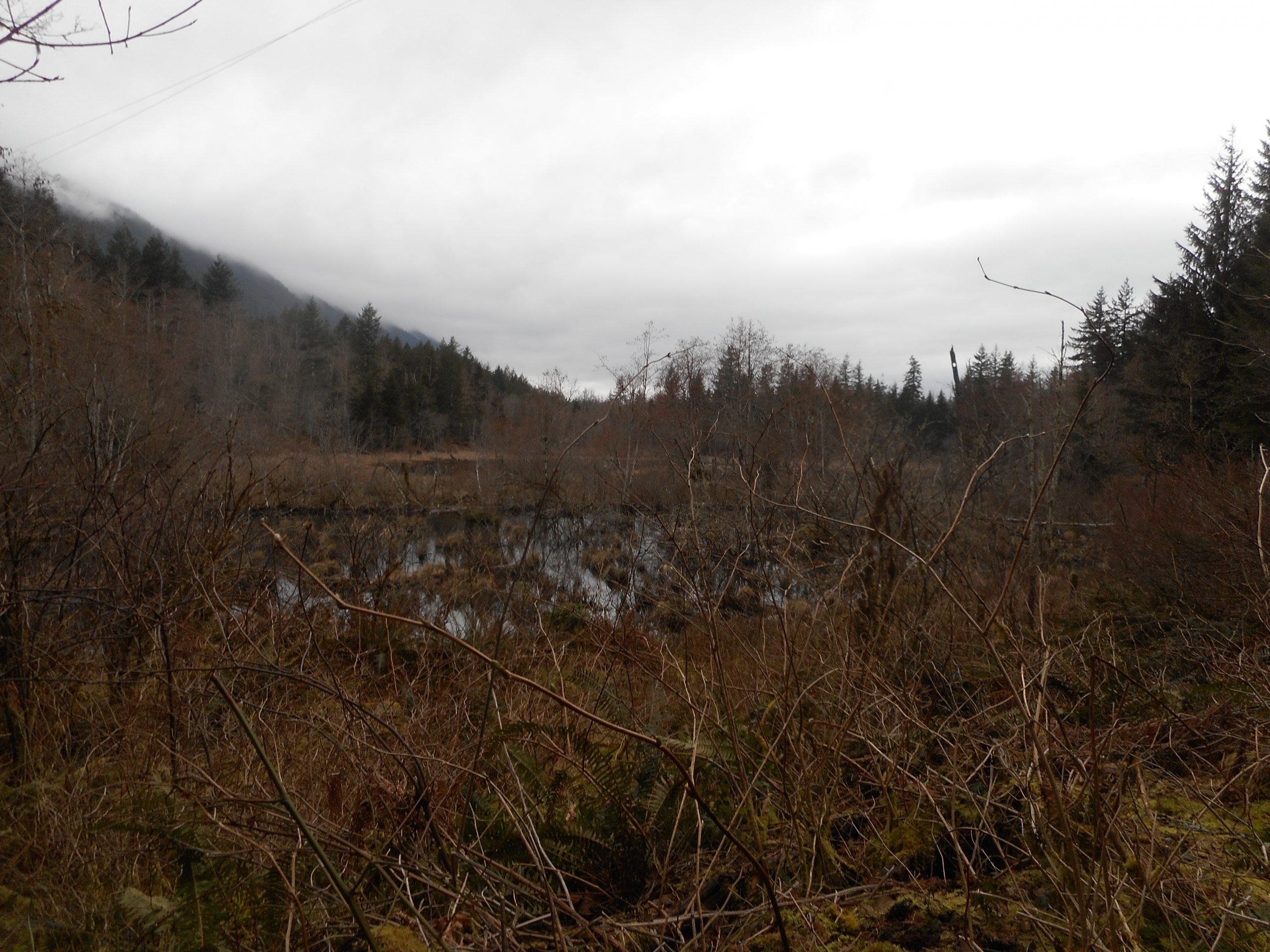
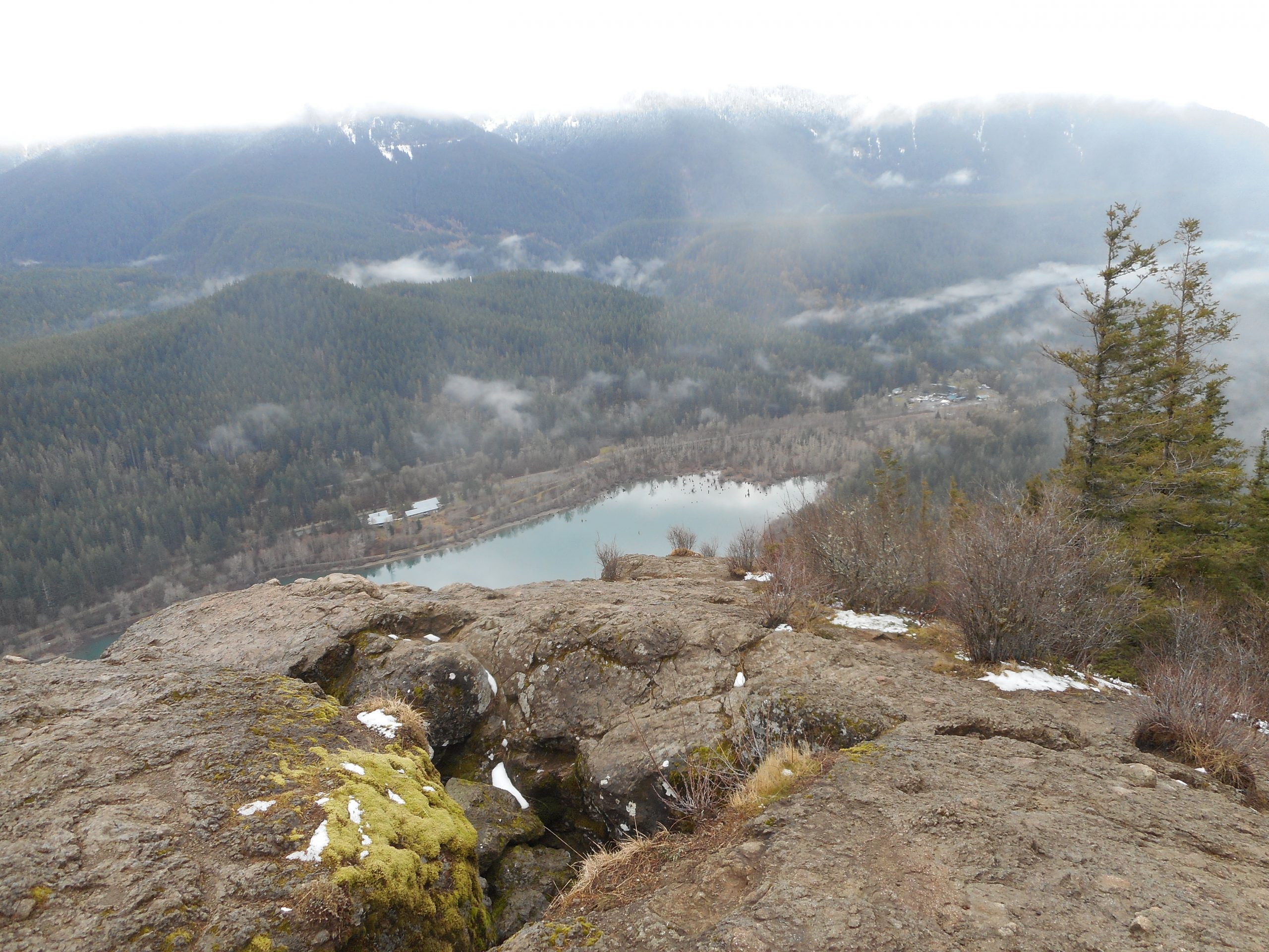
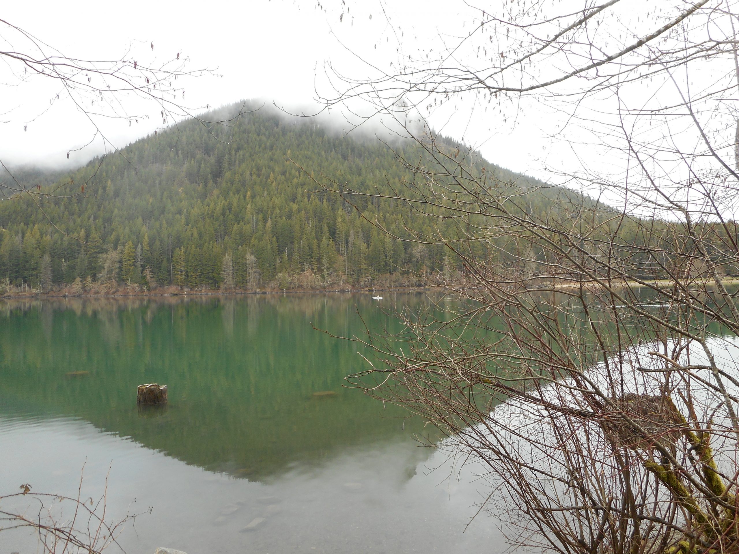
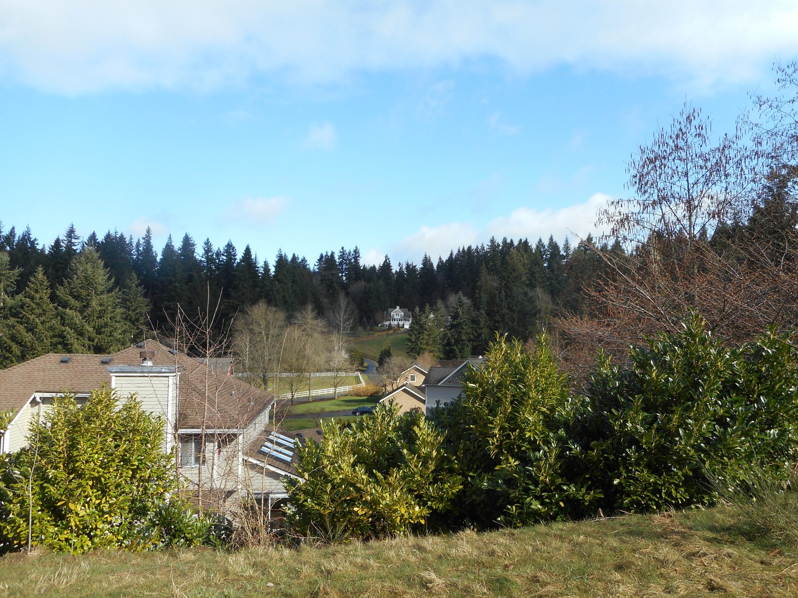
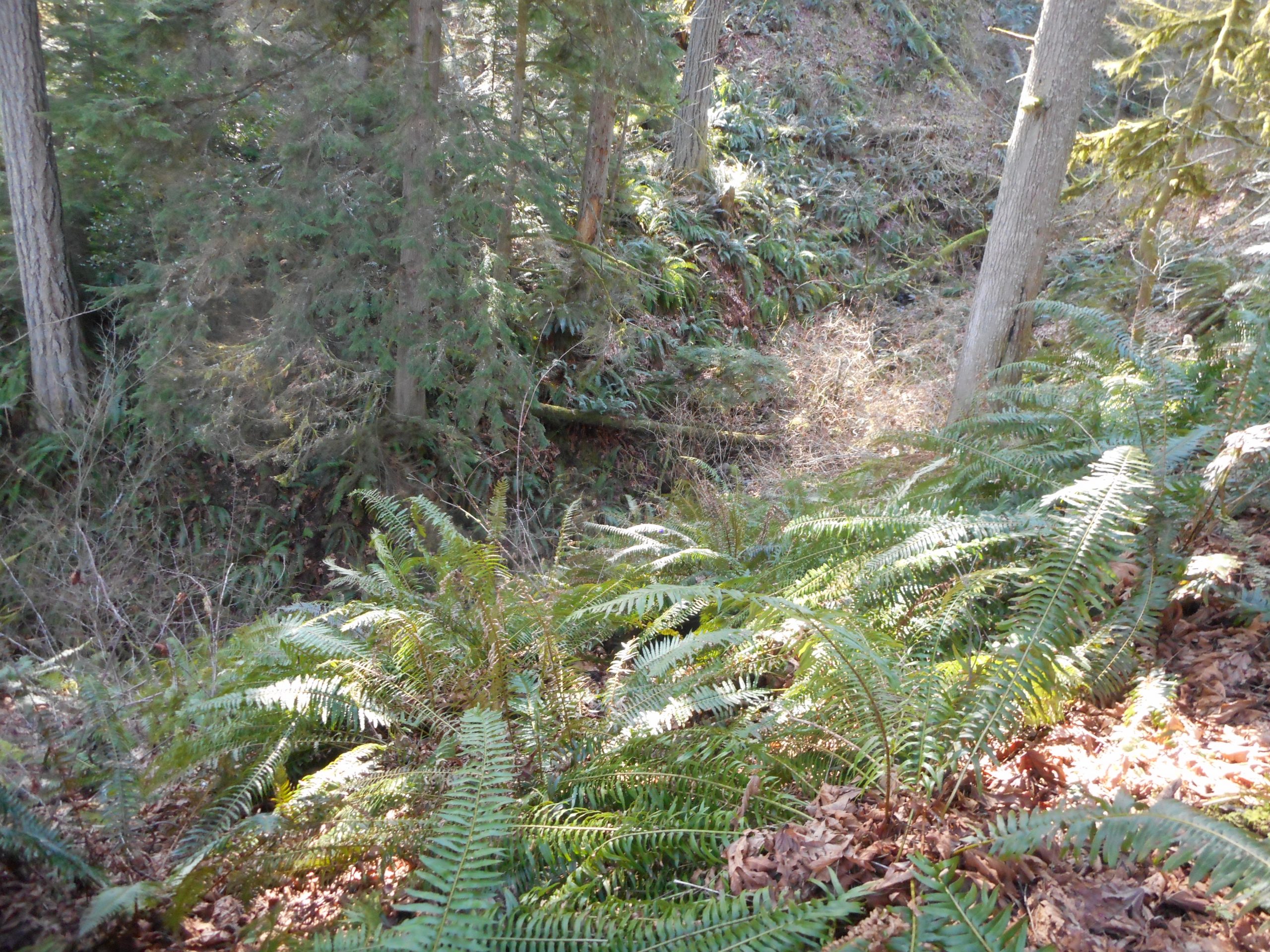
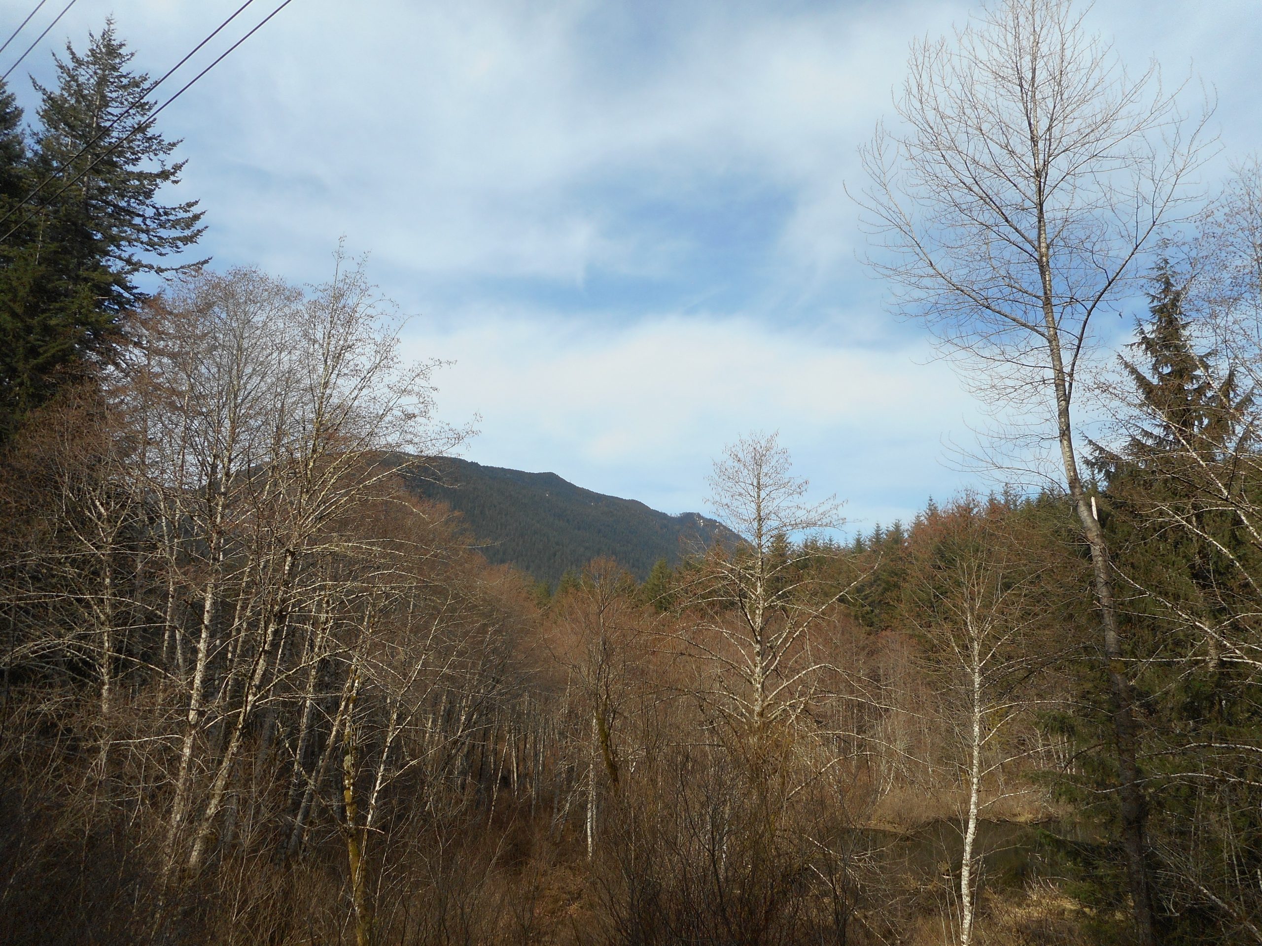
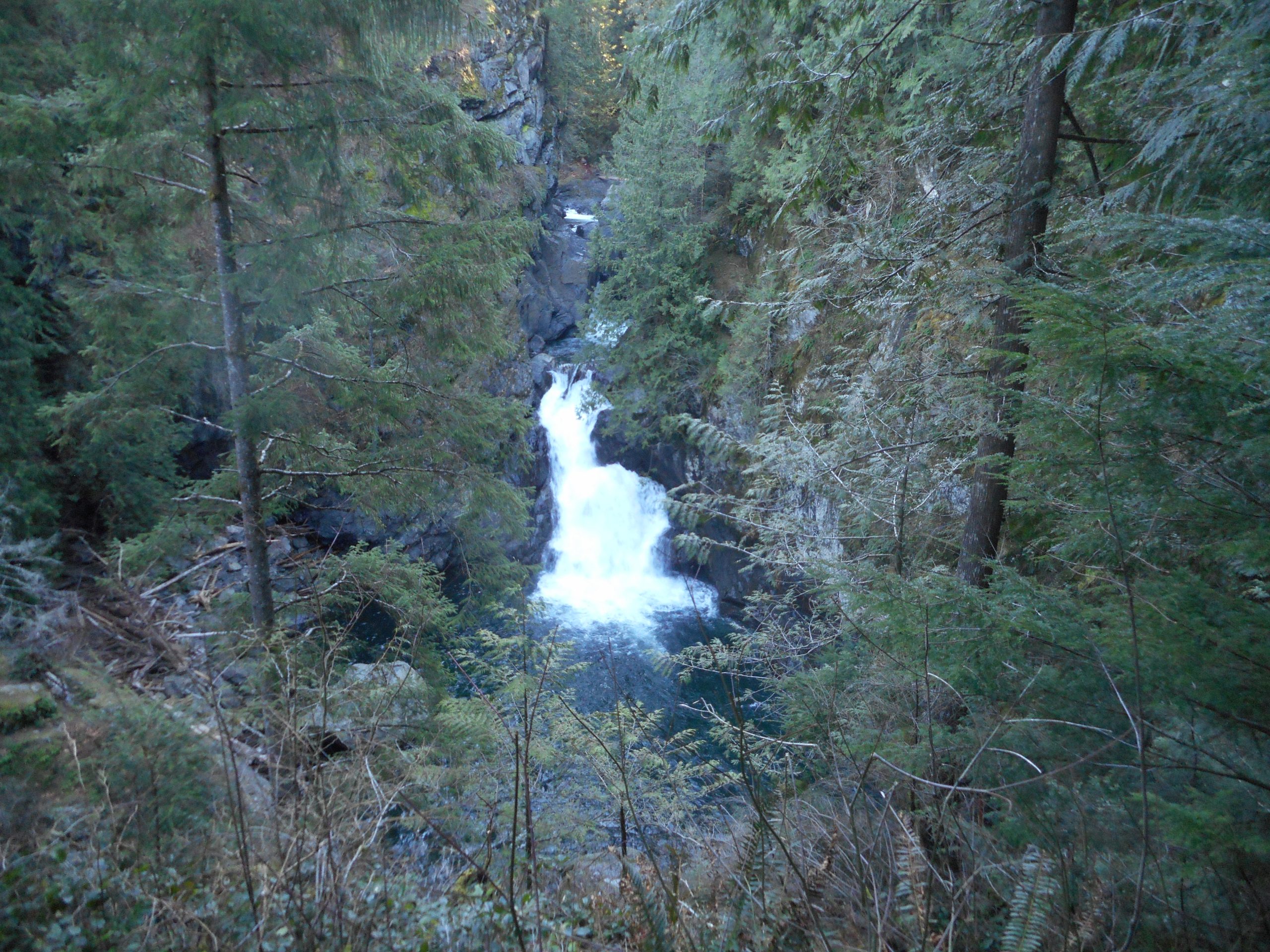
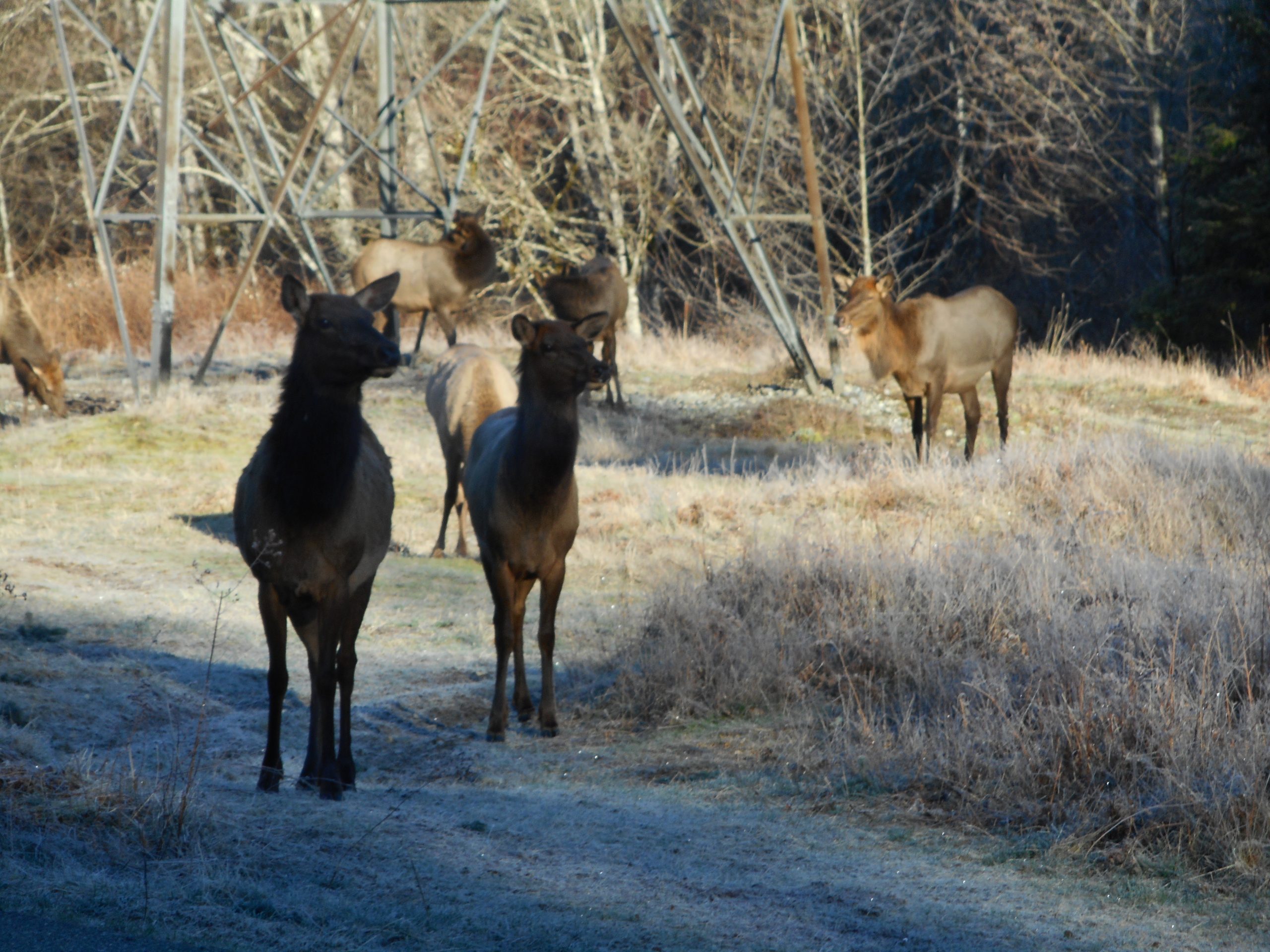
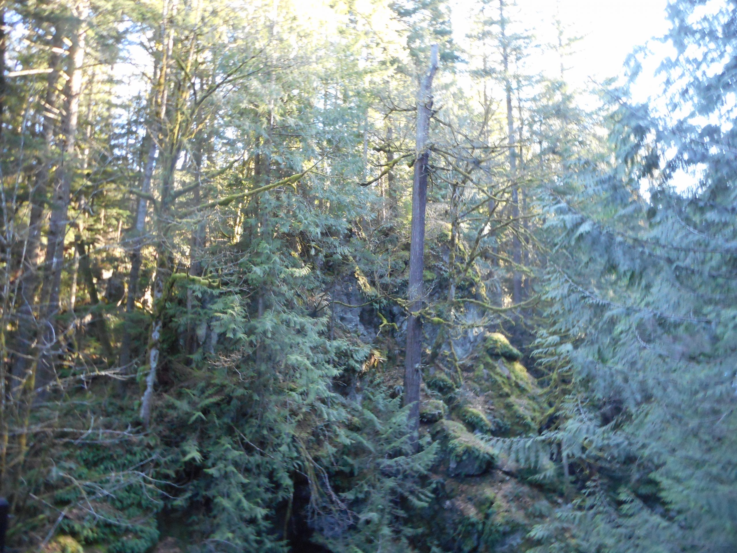
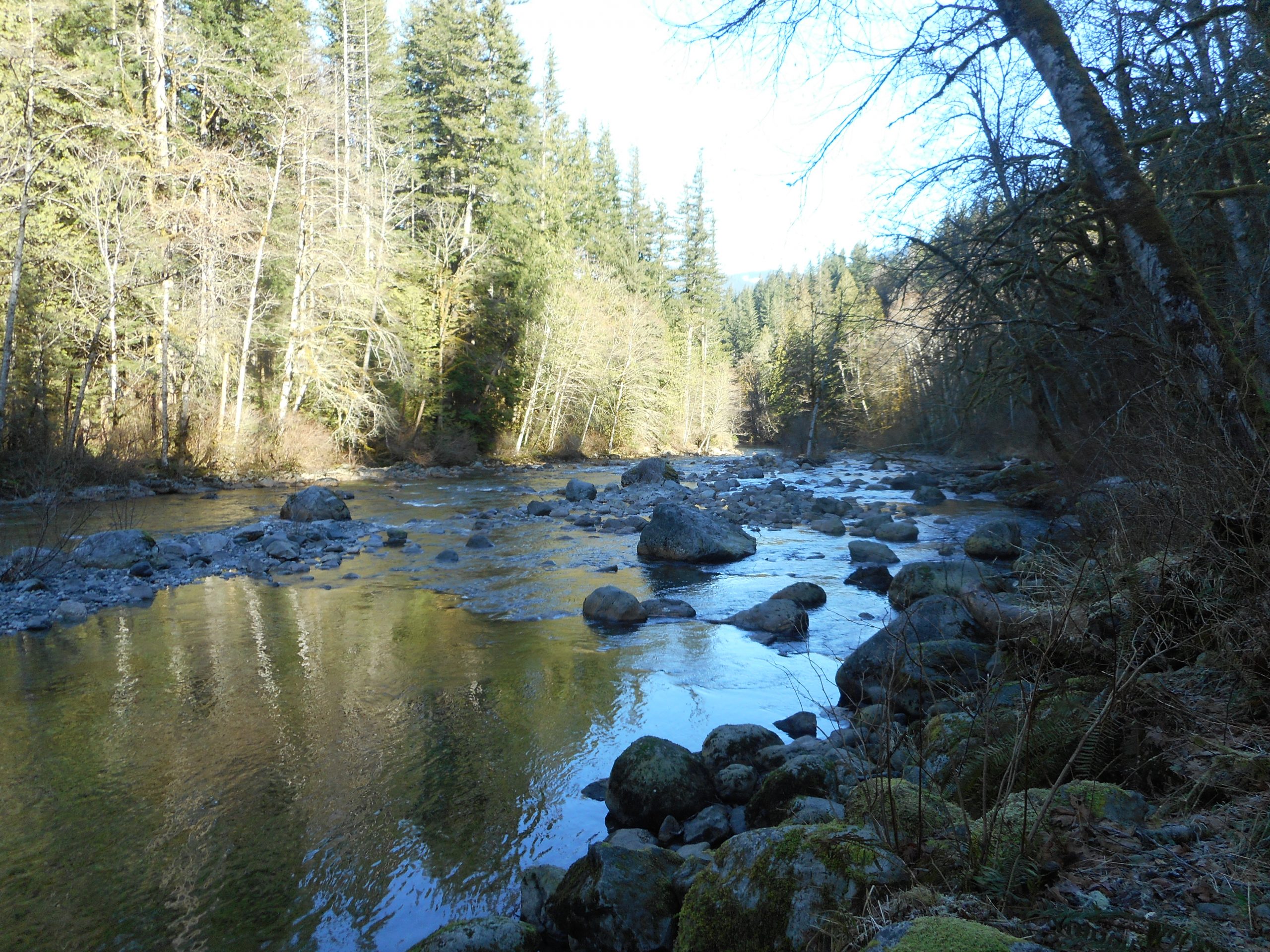
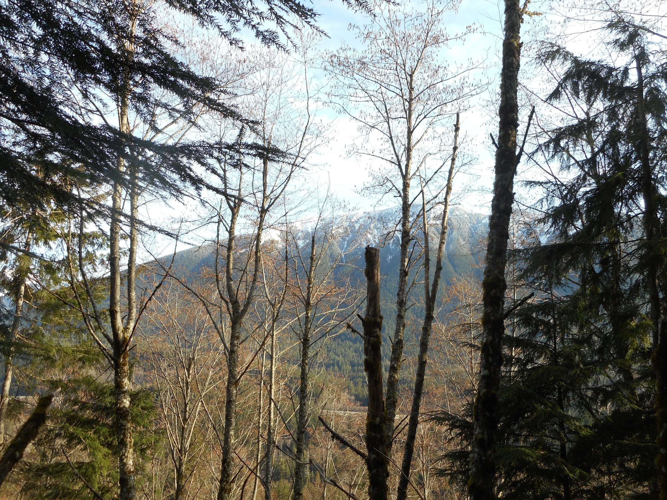
But, as I say, the views were great:

View from the Trail
Looking North

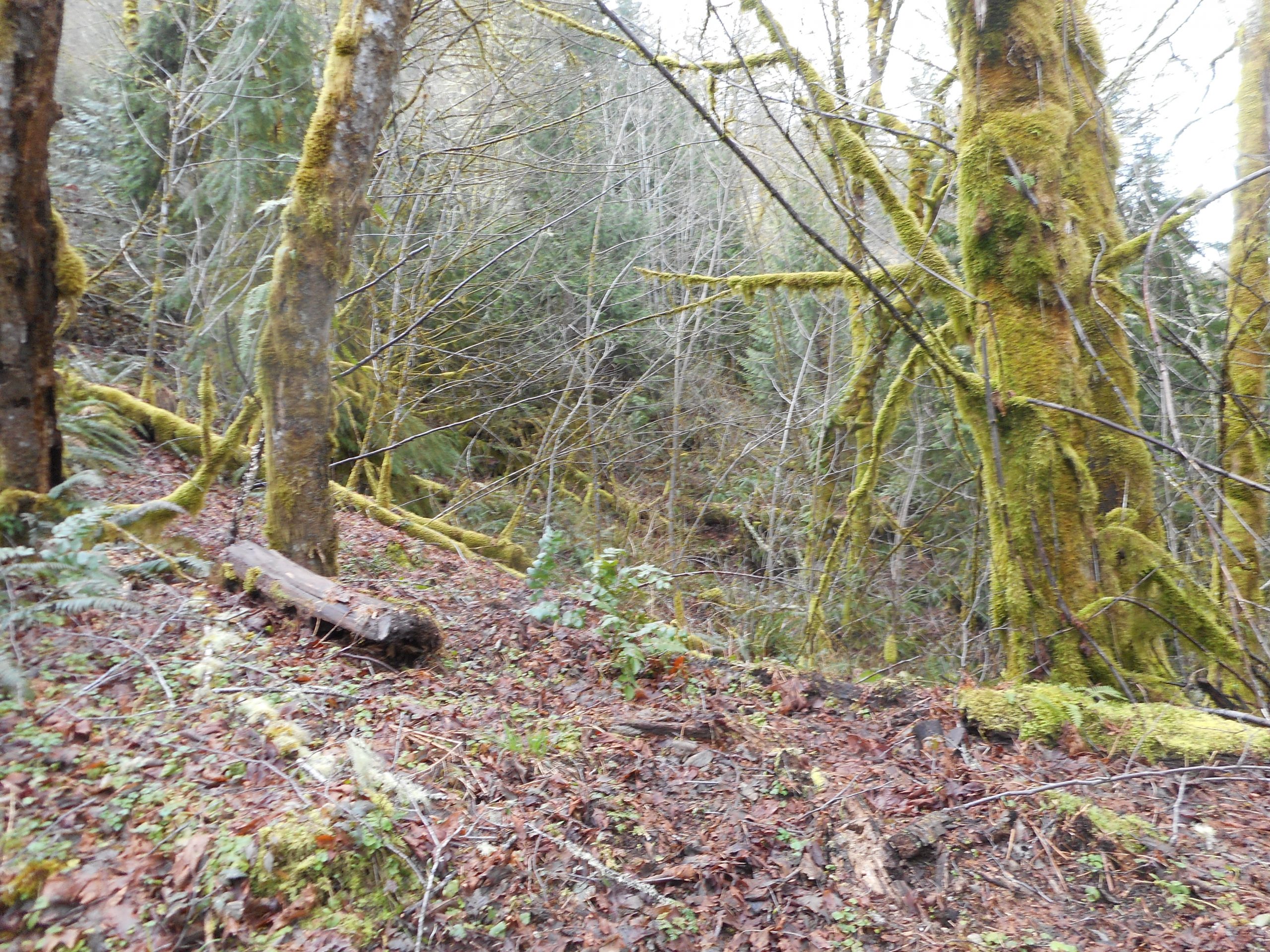
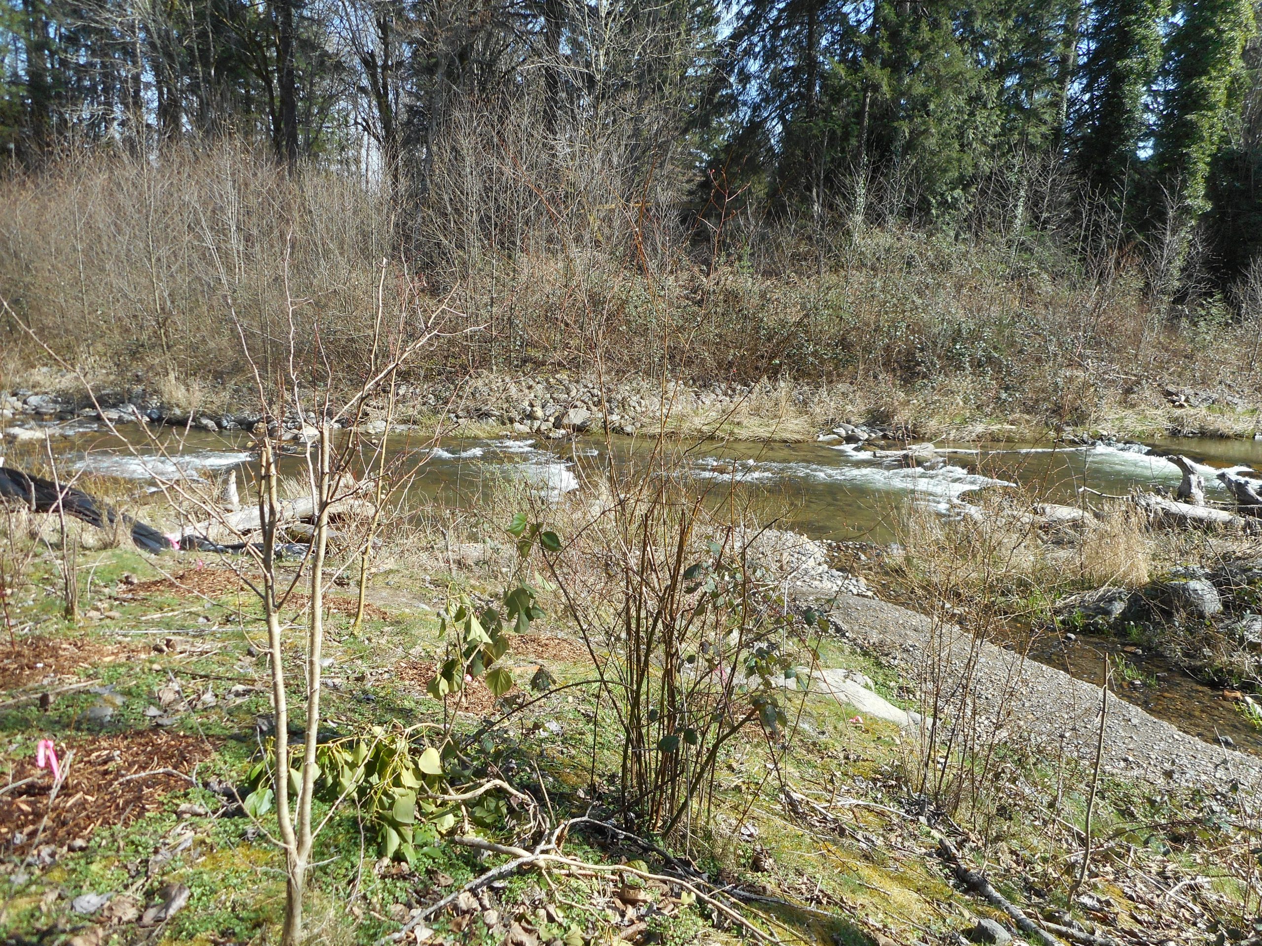
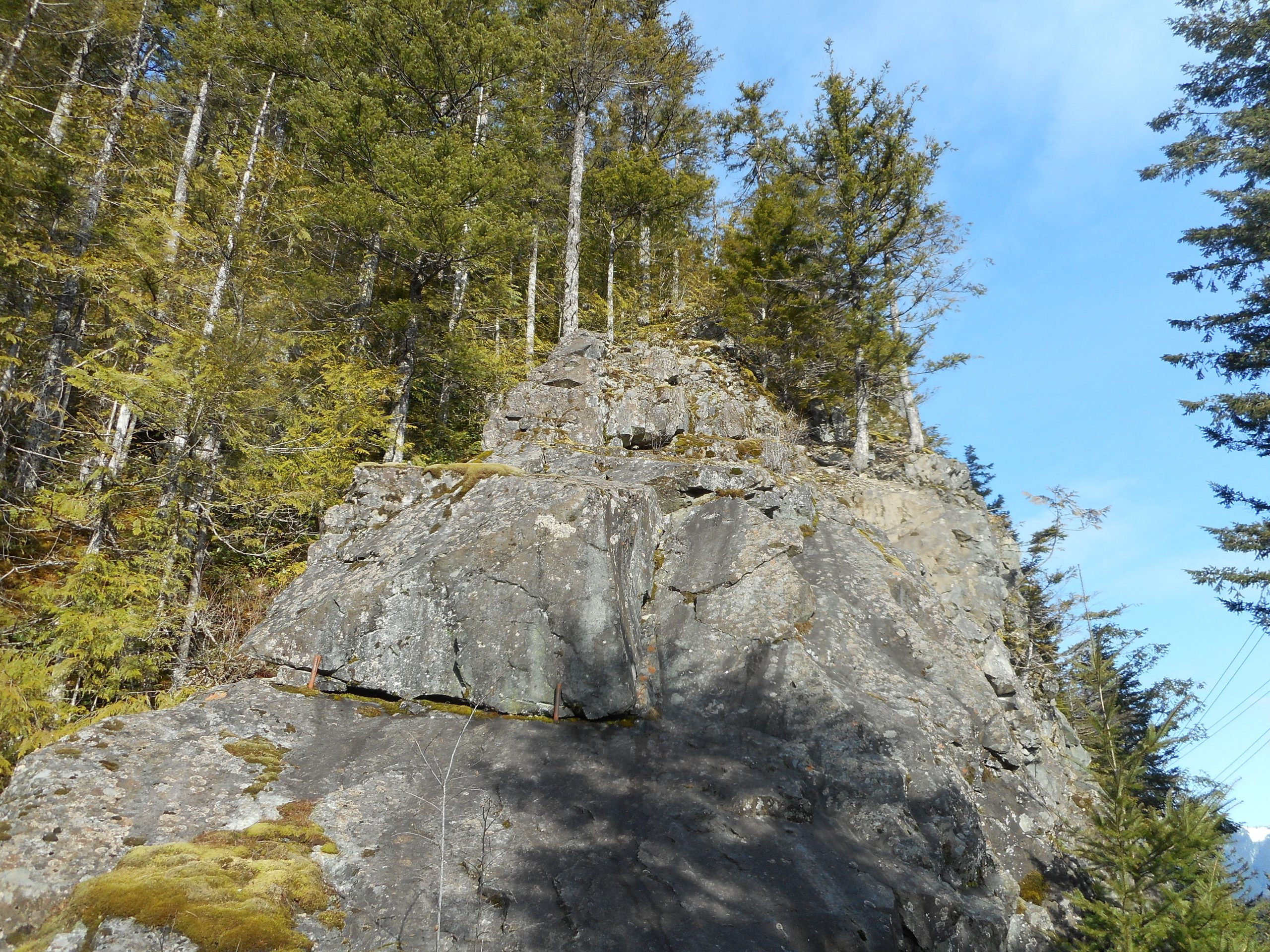
Also, at the western end of the Hall Creek Bridge I found a huge rock that looks like something Derek might want to climb:

A Rock to Climb?

I will go somewhere on Thursday, maybe on Squak Mountain, and Derek and I will discuss what to do on Saturday. It might even be possible to get at least to the top of Zig Zag, if not all the way to Truck Summit, but there are other options and we will discuss.

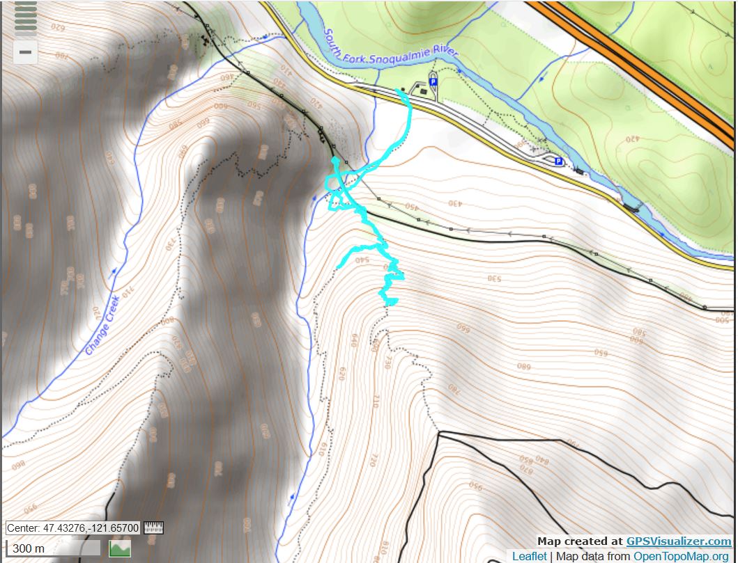
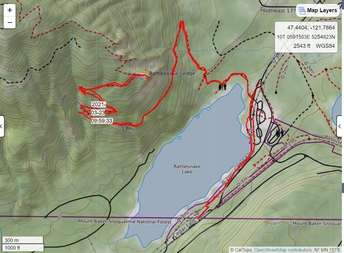
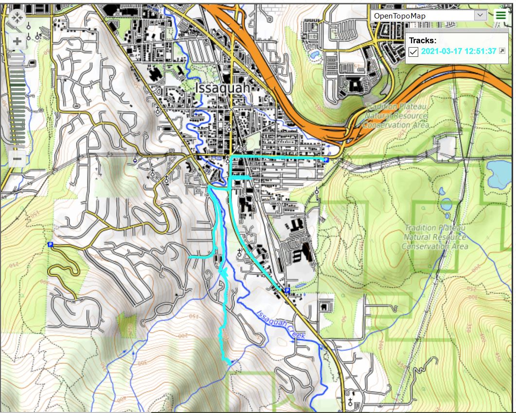
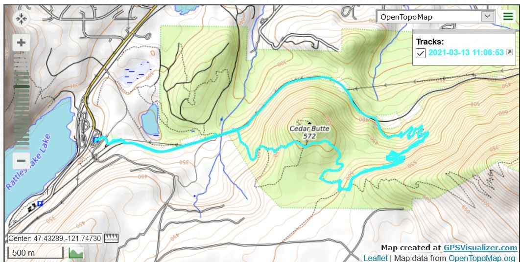
Here is the track. I did spend a good 20 minutes or so on the Hall Creek bridge, just soaking in the beautiful views. I was completely alone, I saw not a single person the entire time. I had nature, a really really huge nature, to myself.

Track

Cedar Butte 3/28/2021

Elk Club

I am planning three hikes next week, two of them fairly strenuous (up Zig Zag Trail) so I figured I would do something moderate today and save my legs for my solo attempt at Zig Zag on Tuesday.

And on the way to the trailhead, on SR202 between Snoqualmie and North Bend (North Bend is the town with the restaurant that was featured in the TV series ‘Twin Peaks’ – the restaurant is named Tweeds – and it is still there, still has pie and coffee) – anyway, there is a huge field where, periodically, a herd of elk gather. I have often seen them but pulling over to take a photo is not easy. The spot to park is very small and until today, there have been cars parked so I had to drive past.

But today it was empty and I pulled over and snapped some photos.

Cedar Butte trail was fine, no view at the top today. Nice forest along the way.

Forest

I took a different route back, via a side trail Derek and I spotted a couple of months ago. This trail runs along the south edge of Christmas Lake:

Christmas Lake from the South

Looking forward to Zig Zag next week. I hope I can get all the way to the top. It could be covered in deep snow and, if so, I will go back down. The trail is very steep and narrow and not easy to navigate in the snow as Derek and I found out a few years ago.

Section Line 3/25/2021

Looking Up

Banner day today. I was up north in Arlington to get my 2nd Pfizer vaccine and from there I drove to the E Sunset Way lot in Issaquah to get in my 3rd hike of the week. Nice! That means if I can sneak out on Sunday I will get to four for the week.

Nothing special, just the standard Section Line to Nook to Bus Trail to Wetlands, but it was a good workout and for sure, a great day.

Rattlesnake Ledge 3/23/2021

Snowy Peaks

A post on the WTA web site yesterday led me to believe that the Rattlesnake Ledge Trail, closed due to the plague since last March, had re-opened. So this morning I drove there and sure enough, the trail is now open. It is a great hike physically but I generally avoid it due to the massive crowds that are typically on this trail.

I figured today would be different, and it was, but I did see more than a dozen people on the way down so I will continue to avoid it. Still, it was nice to do this one again.

As always, the views are terrific.

Familiar View from the Ledge

When I got back down I strolled up to the (also closed) Cedar River Watershed Education Center just to see what it looked like. Duh! It looked the same but there was no one around. Sad. On the way back I saw a lone fisherman floating in the lake and I was able to look up to the ledges, which were floating in the clouds.

Tiny Speck of a Fisherman

Cloudy Ledges

I have to be creative this week to get in my 3 hikes because I am scheduled for my 2nd Covid vaccine on Thursday, and I am told to possibly expect a bad reaction the next day. And on Saturday Jan and I are doing a bird watching tour in Duvall. So Sunday looks like the likeliest candidate for this week’s hike #3.

The track, which was just under 6 miles:

Track

Tolt Pipeline Trail 3/22/2021

Heart Attack Hill

I didn’t have much time today but where there’s a hill there’s a way so I popped over to Woodinville to spend some time on the hilly Tolt Pipeline Trail.

The people who live along this stretch of trail are not paupers:

Nice Neighborhood

It is horse and goat country as well:

Giles
Horse Country

Nice way to start the weekly rambles. Derek and I are planning a 4/3 outing to Truck Summit – should be fun.

Stan’s Overlook 3/20/2021

Not Much View

It was rainy the entire way except for the last .25 mile or so when it was snowing. And when I finished I drove to Maple Valley and picked up my grandson Camden. He is here right now – we had a fun day! – but I am off to bed.

I got in my three hikes this week and I will be looking to duplicate that next week.

A Little Squak 3/17/2021

Turnaround Spot

Frustrating day but a learning experience.

I wanted to do the SE Squak Mountain trail. The trail head is near a residential neighborhood with limited parking, so the WTA web site recommends that you park near the Issaquah Alps Trail Association’s office, which is just off Issaquah’s main drag. I was fine with that – in fact, I parked at my usual E Sunset Way parking lot, because it seemed to be fairly close to the place they want you to park.

I made my way towards my first goal, looking for a street called Bush. I stupidly passed it by, and wound up going about a mile in the wrong direction. I doubled back and found the office but I had printed the directions from there via the WTA web site.

The directions pointed in the wrong direction and, when I finally got oriented correctly, they became irritatingly vague. I did finally find the trail but boy! What a long strange trip to get there. And since I had planned to go back via Carnation and Duvall, by the time I got no more than perhaps .75 mile up the Squak trail, I turned around.

Here is the track – it is bizarre:

Track

As you can see from the track, some of it runs along Issaquah Creek:

Issaquah Creek

The learning experience was this: now I know how to get to the trail. And it looks like it is very steep and therefore a good workout. Today it was just under 7 miles with a few hills, but nothing real challenging. We’ll see how it goes this weekend with the weather. But I do plan to get out, even if I might get wet.

Section Line 3/15/2021

Along the Trail

First hike this week was my standard Section Line workout. This time, I turned around at this sign:

High Point

Usually at this point I go on. Sometimes, straight, which is ultra-steep and leads to the summit of Tiger 3. More often, I go left and come back either via the Nook Trail or, via the Talus Rocks Trail, the West Tiger #3 trail. But today I just turned around, as I had started late (left the car at 12:04 PM).

I have done this before, and my time was about 2 hours and 5 minutes. Total hike about 4.1 miles. Today, without trying to rush, I was down to 1:51. I like the trend.

Olallie Trail 3/13/2021

Rattlesnake Mountain

I expected to do about a 6 miler today – up Cedar Butte, down Southside, down Olallie but I screwed up and added a mile.

When I got to the junction with the Olallie Trail I noticed the pink flagging tape I had hung to show the intersection, which is far from obvious when you are on Olallie, was gone. So I took off my pack, put down my walking stick, dug out the tape, and put up another strip.

Then, about .5 mile down the trail – doh! – I realized I had left my stick. So I turned around and flew up the trail and there it was. Probably my best uphill time for quite a while.

As always, I love the forest:

Forest

There was hardly enough snow to mention. One tiny little patch is all that is left:

Last of the Snow
Track

If you look closely at the track above, the extra thick blue line on the right (east) is where I had to back-track. Oh well, adding a mile to a hike is rarely a bad thing.

Once I got back onto the PTC trail it was like downtown Seattle – but it is a wide trail, so no one feels too crowded.

I made my goal: three hikes this week. I hope to do it again next week, but I am trying to ramp them up slowly enough to not injure myself or otherwise wear down too much.

Twin Falls 3/11/2021

Upper Fall

I did the Twin Falls hike today. A nice 4.2 miler, nothing too extreme but enough elevation gain, particularly in the section just after the falls, to qualify as a decent workout.

Near the trail head as I was driving in I noticed a few friendly friends:

Friends

Plenty of interesting landscape and forest on this trail:

Sunny Day

And a good portion of the trail is in sight and in hearing of the South Fork of the Snoqualmie River:

The River

Hike #2 this week, I am thinking of doing something on Saturday for #3.