Heybrook Lookout 6/28/2022

View from Heybrook Lookout

I wanted to check out this hike for two reasons:

  1. Based on the WTA description and on trip reports it seemed like a hike I could do with Derek and Camden, and
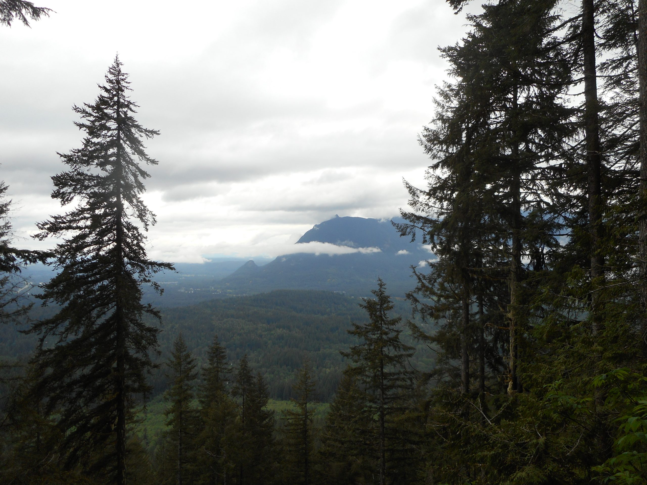
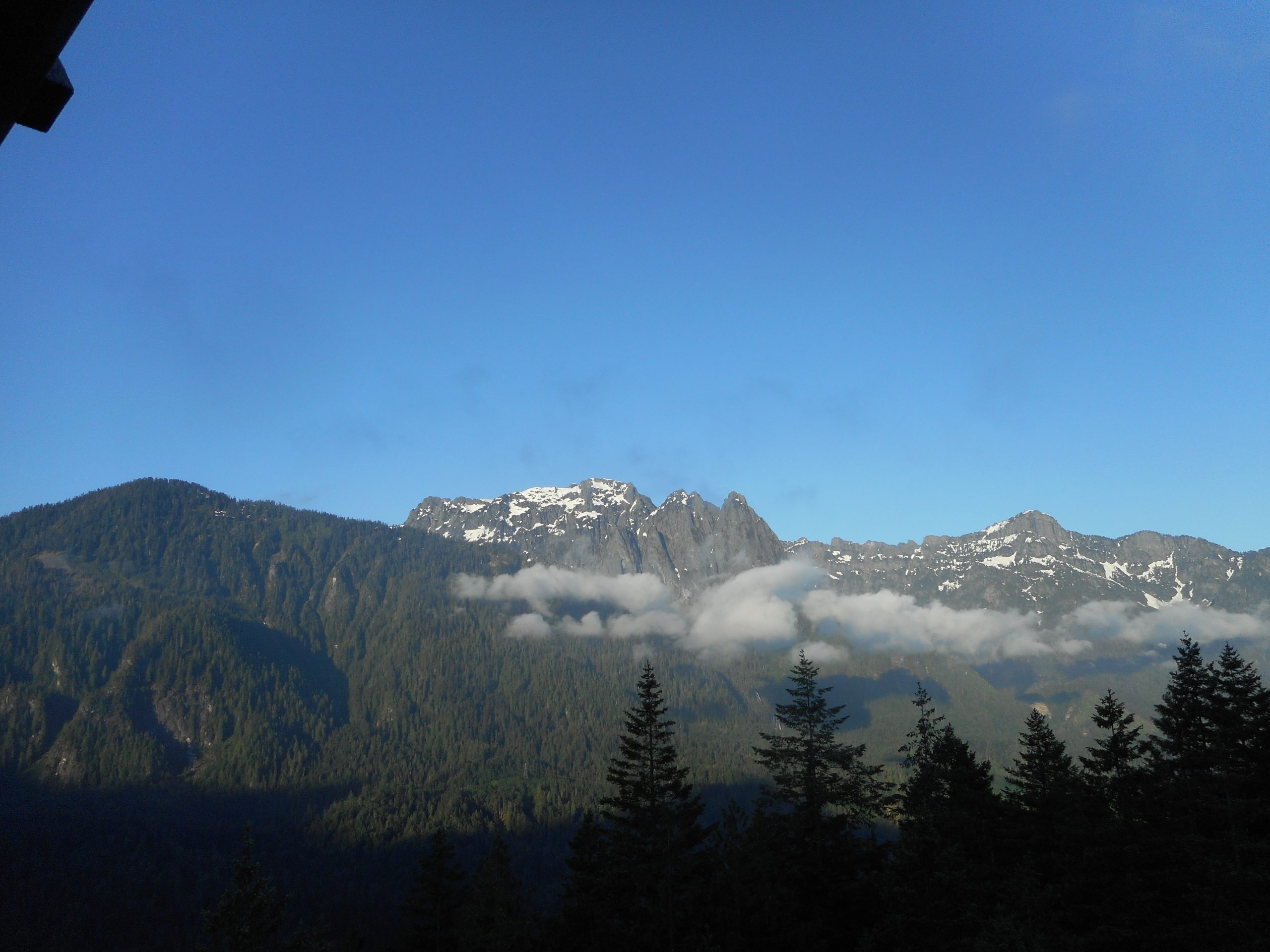
  2. I expected the views from the top to be spectacular.

Correct on both counts.

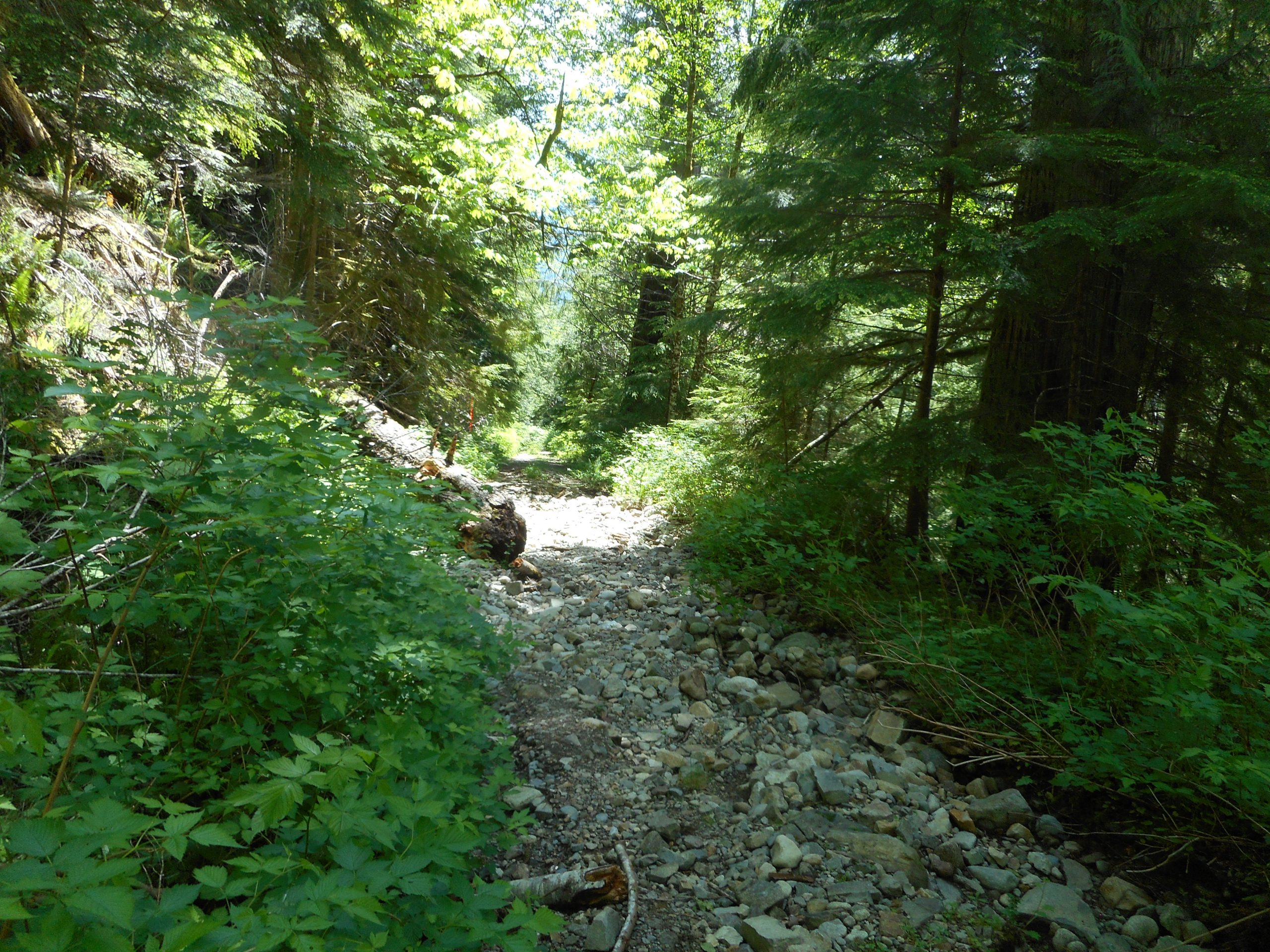
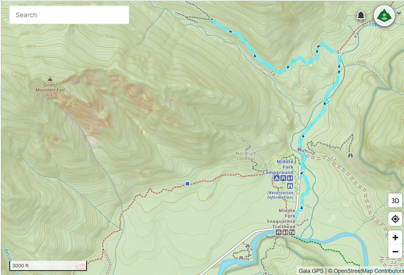
This hike is only about 2.5 miles up and down, with 850 feet of elevation gain. Sounds mild but most of the gain is packed into the first .65 miles so it is steep enough to get your heart beating.

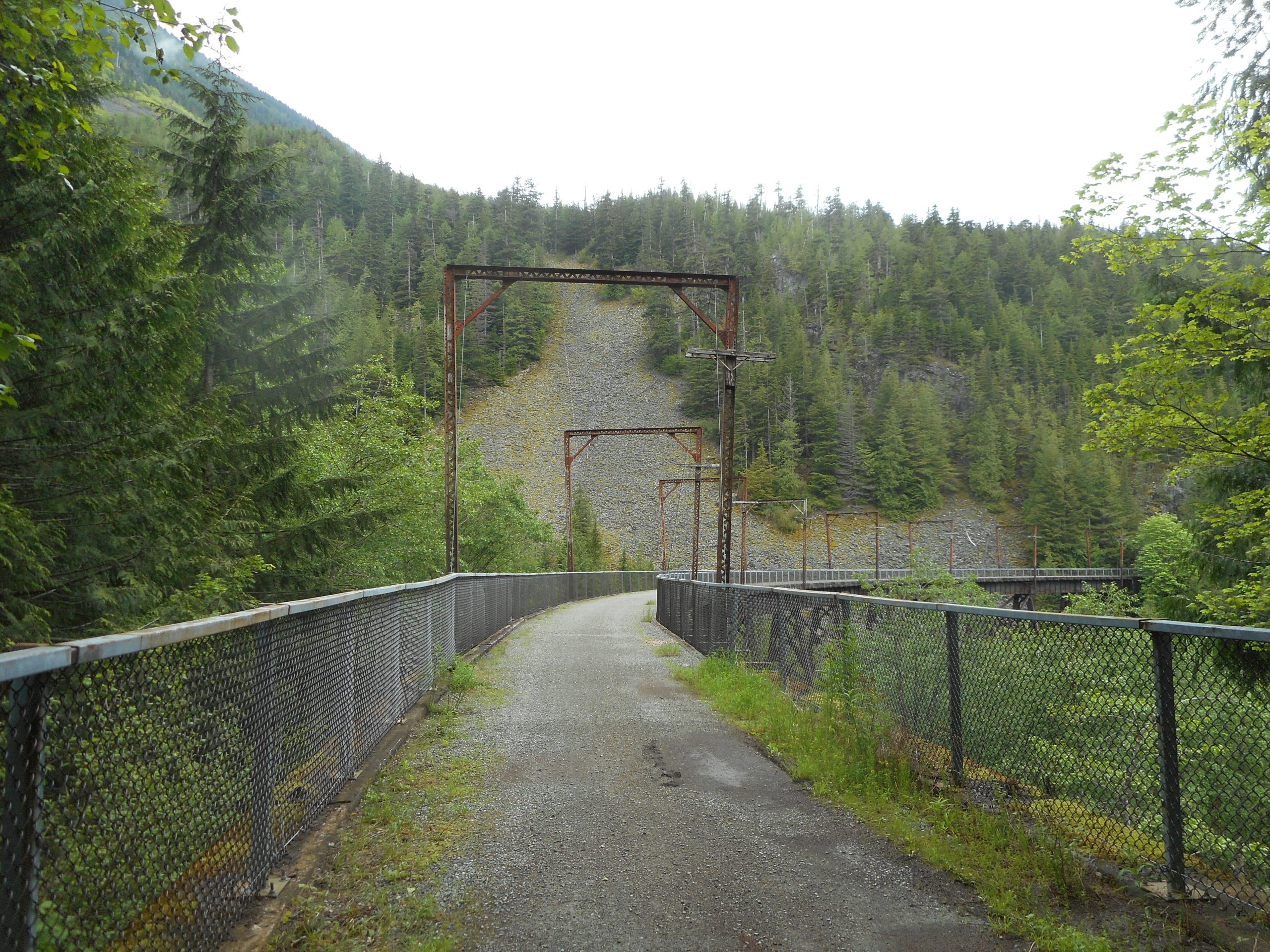
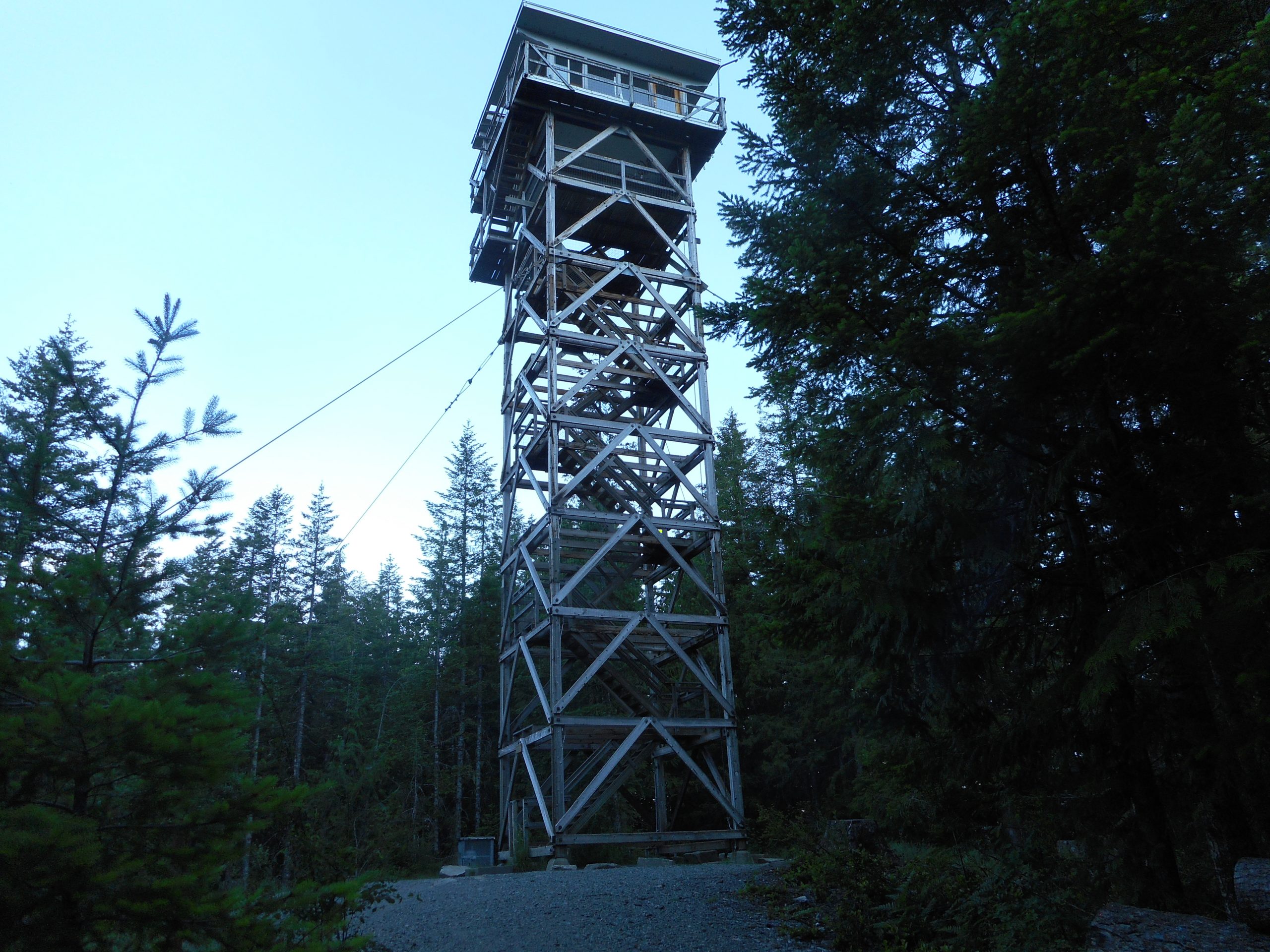
The lookout itself is a minor workout:

Heybrook Lookout

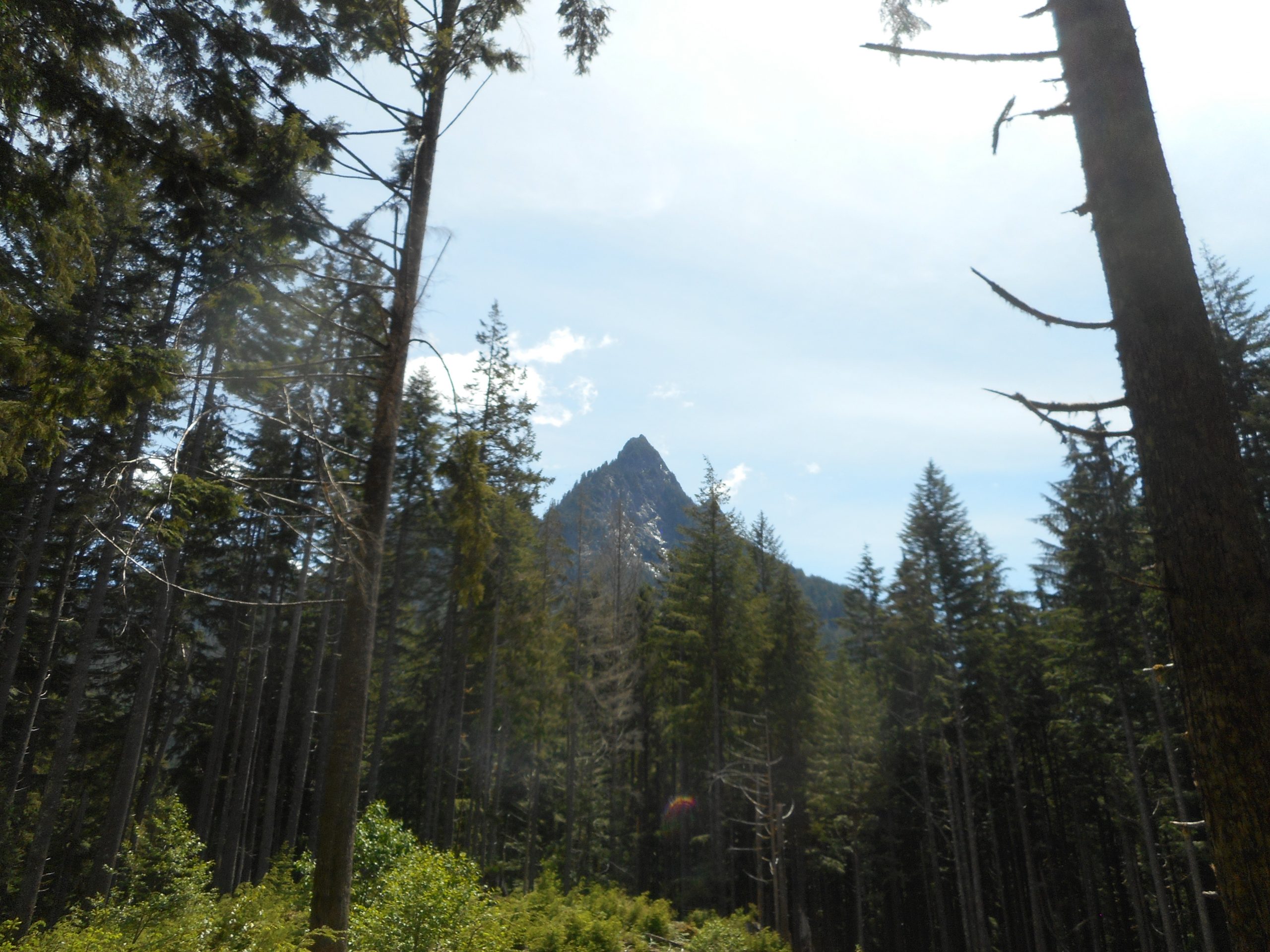
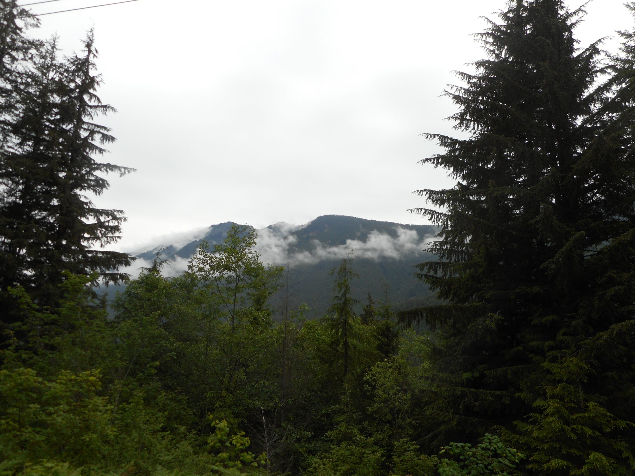
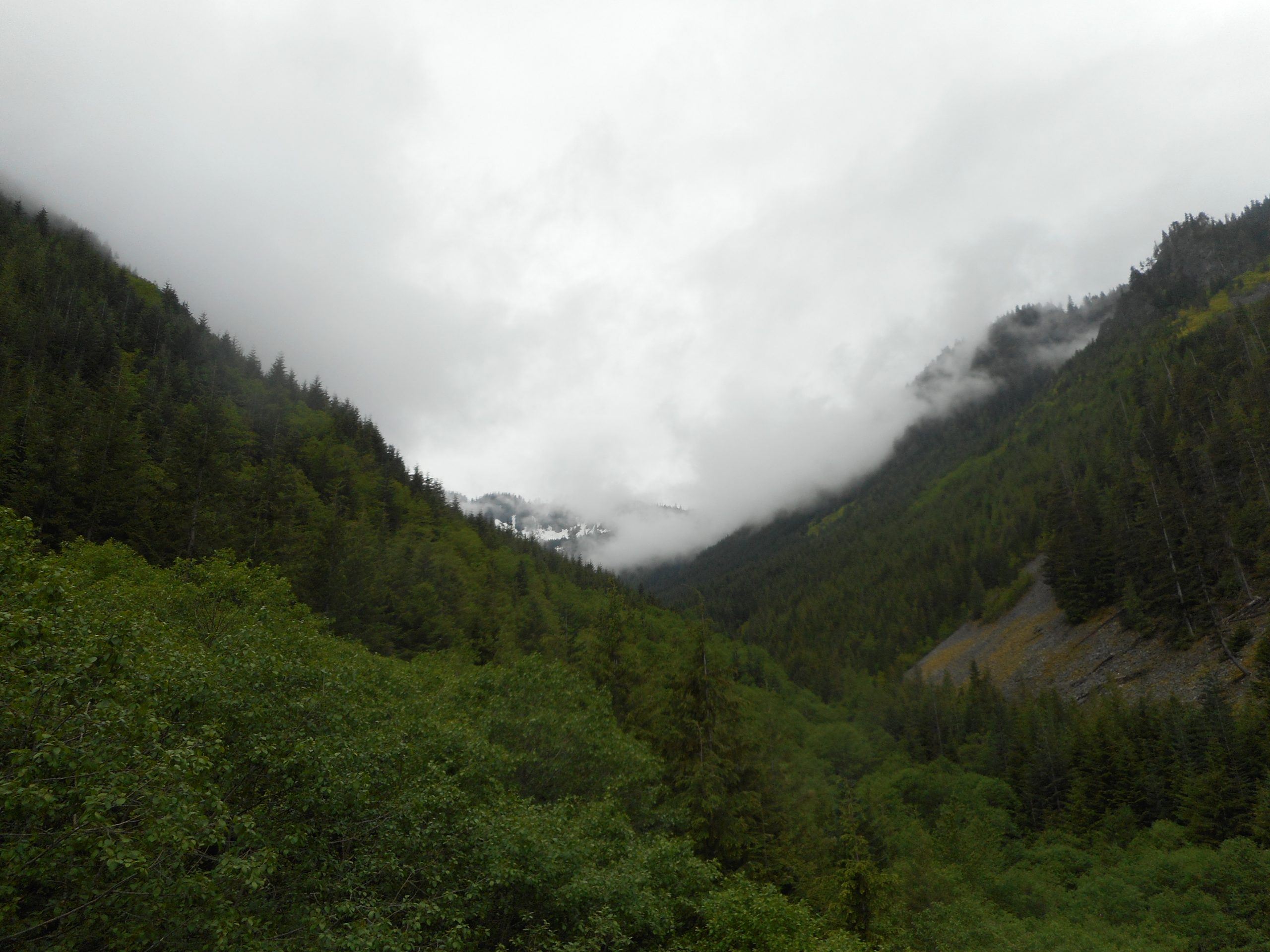
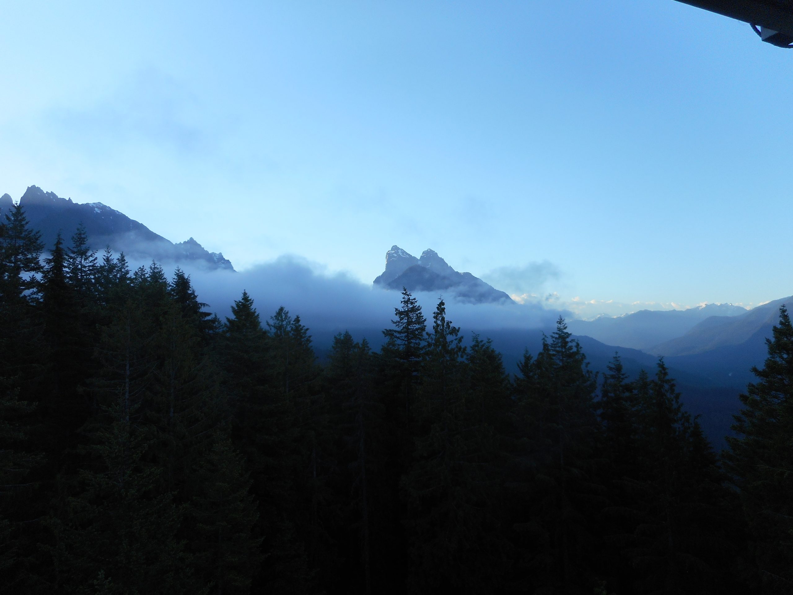
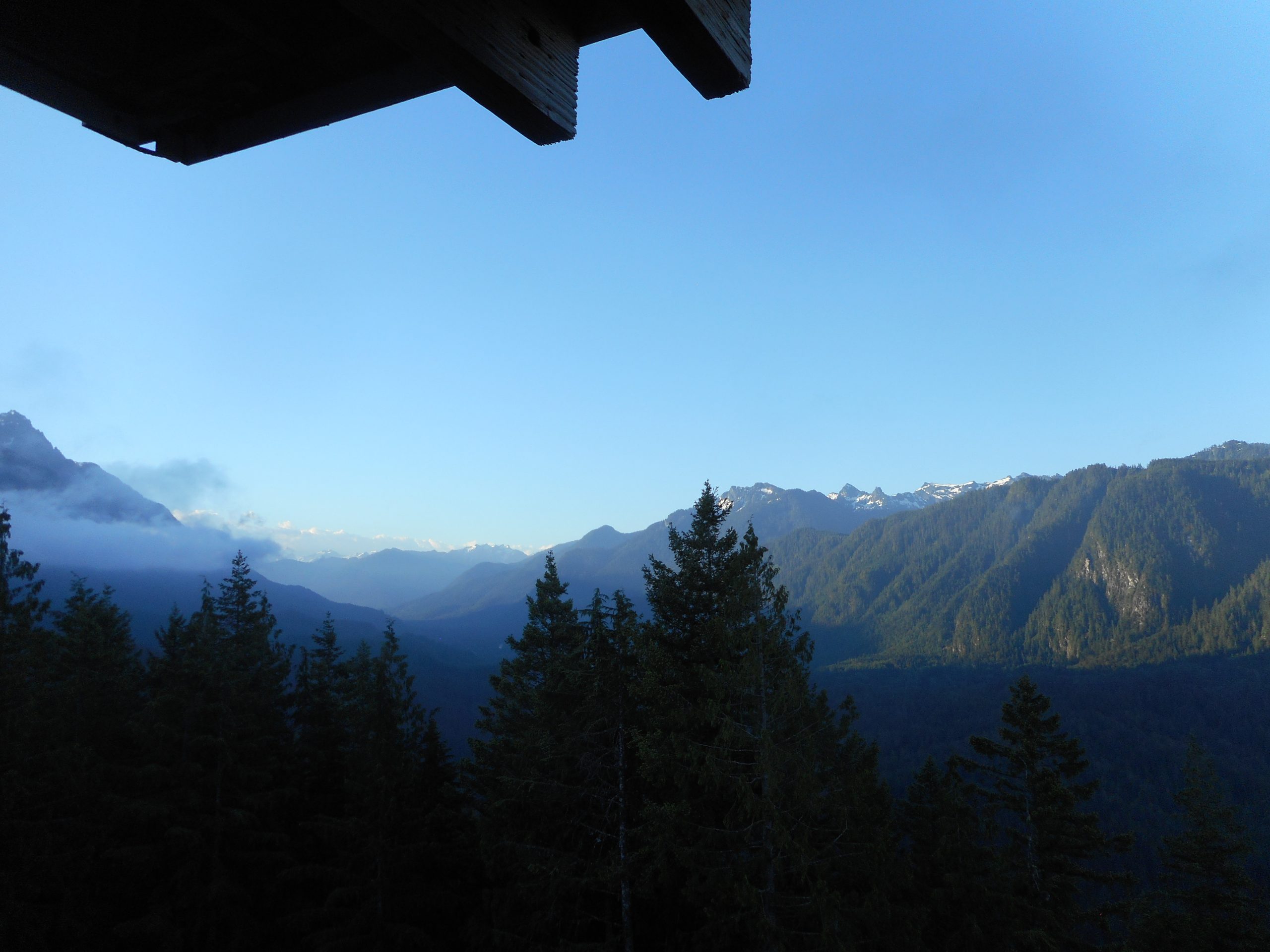
From the lookout the views are terrific:

It’s All Good
Another One

It has been hot for the past few days so I started early, leaving the car at just after 5:30 am. I enjoyed the lack of traffic on the way out. This hike is farther north than most of the hikes I do, it is up on Highway 2 just past Sultan. A very scenic drive and a great morning.

I am hoping that my relative lack of mountainous hikes lately, saving on gas money, have given me enough credit to be more active in the next few weeks.
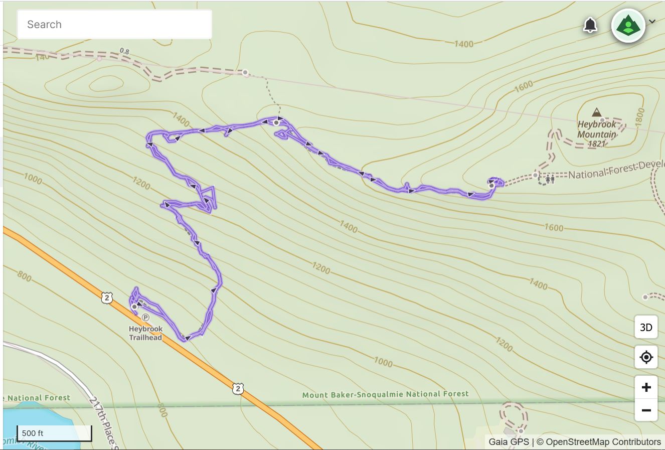
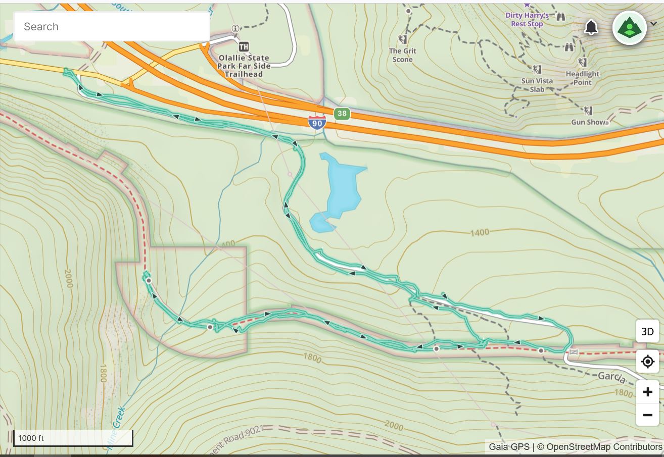
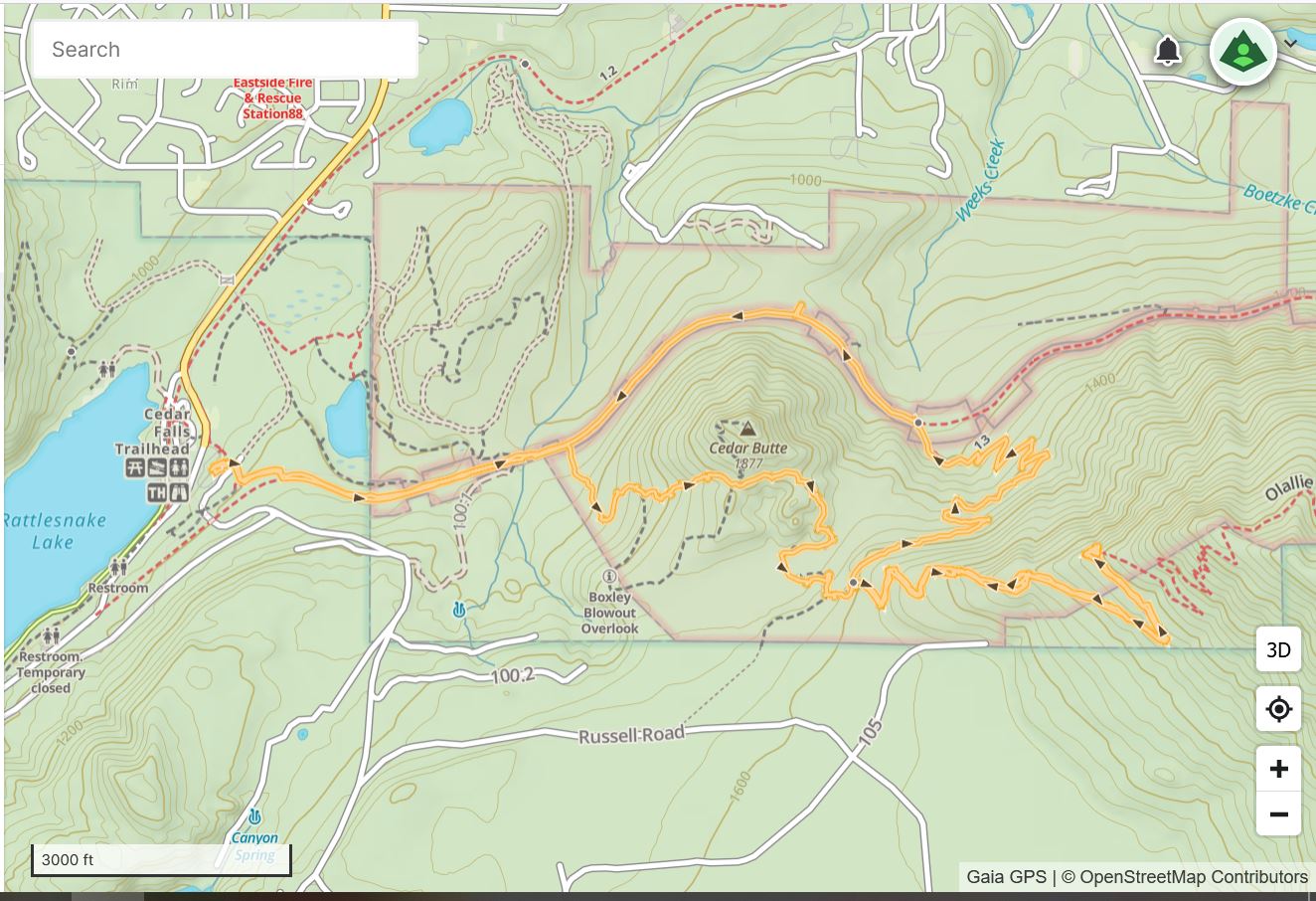
Track below:

Track

Quartz Creek Trail 6/21/2022

Garfield Mountain

My plan – or hope, at least – was to check out the approach to Rooster Mountain. However, we have contractors at the house today and I waited for them to arrive. I didn’t leave the car to go up the trail until almost 10:30 and, mindful of the traffic coming home, I headed back at what turned out to be the junction of a long-abandoned mining trail called the Rainy Mine Trail. If you look at the track, below, you can see the turnaround point is right next to a little duo of trails heading off to the west (left). I would like to come back and explore. Based on very old trip reports, there may still be some old mining detritus in the area.

This trail, which used to be a road (and, I noticed today, had some truck tracks on it for awhile) goes to Blethen Lake, Cockerel Point, and Rooster Mountain. Other places as well, for those who are fearless explorers. In fact, I have reason to believe that making it up to Rooster Peak is a considerable undertaking. Interesting.

Just under 6 miles (I parked at the Middle Fork parking lot). On the way back I started hearing loud ‘bangs’! As I got close to the bridge over Taylor River, the Snoqualmie Lake Trail parking lot and trail head, I could see a guy just off the trail shooting a target affixed to a tree. I waited for him to stop (what if he misses?) and hurried by.

Needless to say, it is totally illegal to discharge firearms in National Forests, and there we were in the Mount Baker-Snoqualmie National Forest. I hope I do not have to deal with that ever again.

Next time I am on this trail I will wear my heavy leather boots, because after a certain point, the trail becomes super-rocky:

Rocky Trail

The Quartz Creek Trail intersects the Snoqualmie Lake Trail and whenever you are on that trail, there is the pleasant sound of the Taylor River:

Taylor River

A fun hike. This area is worth some exploring.

Track below.

Track

Mine Creek Trestle 6/15/2022

Looking North

I had to improvise today. My plan was to check out the McClellan Butte trail and file a trip report on the Washington Trails Association website (wta.org). This trail is mostly off-limits in the winter, up to early summer in fact. In the winter the avalanche danger is super high. By the time the avalanche danger is gone the deep, deep snow on the east side of the mountain piles up in the five avalanche chutes, forming snow bridges. At some point the bridges become unstable, so good luck making progress, unless you can drop down below the snow and try to make it up the other side.

Anyway, I was going to check out the conditions. But when I pulled into the McClellan Butte parking lot there were two very suspicious-looking vehicles parked there, clearly having stayed the night, and so I turned around and left. There have been numerous trashed cars at trailheads in the area (a scandal amongst the local hiking community) so I headed back west to exit 38.

I parked by the NF9021 service road, hiked up to the PTC and then back down to the car, via an unofficial boot path.

Only about 3.5 miles, I was a bit disappointed. I have been cutting back on my mountain hikes due to the cost of gas and this seemed almost like a waste.

The view south to Chester Peak was looking good, due to all the beautiful clouds:

Chester Peak

I do love the Mine Creek Trestle:

Mine Creek Trestle

Track below.

Track

Olallie Trail 6/8/2022

Little Si and Mount Si

I have been itching to get back into the mountains but the price of gas has kept me doing local walks/hikes. Yesterday I took a longer, hillier route to the mall. It was a decent (7 mile) workout but, let’s face it. Walking on sidewalks along busy streets is not exactly peaceful. It is not what Beethoven had in mind with his Pastoral Symphony.

Today I did an Olallie Trail hike: PTC to Cedar Butte, to Southside Trail, to Olallie. I took a right and, 1.5 miles later, was at the first view point. Just to prolong the pleasure I took Olallie all the way down to the PTC. Total mileage today was 8.3.

I saw one trail runner as I was leaving the lot at 6:35 am and not another person until I was almost back at the car. I heard excited voices ahead and ran into a group of close to (I estimate) forty people, mostly little kids with a few adults trying to keep the kids under control. I am glad they were going out while I was coming back, but I do like to see kids out hiking. Get ’em started early.

Track below.

Track