Low Mountain 7/24/2016

Mark on the true Low Mountain summit

Mark Garrett, Christopher Gronbeck (check out his beer, wine and whiskey bar in Seattle The Barrel Thief) and Jamil Haque and I hiked to Low Mountain on Sunday, the 24th.

This is not a hike I will do again.

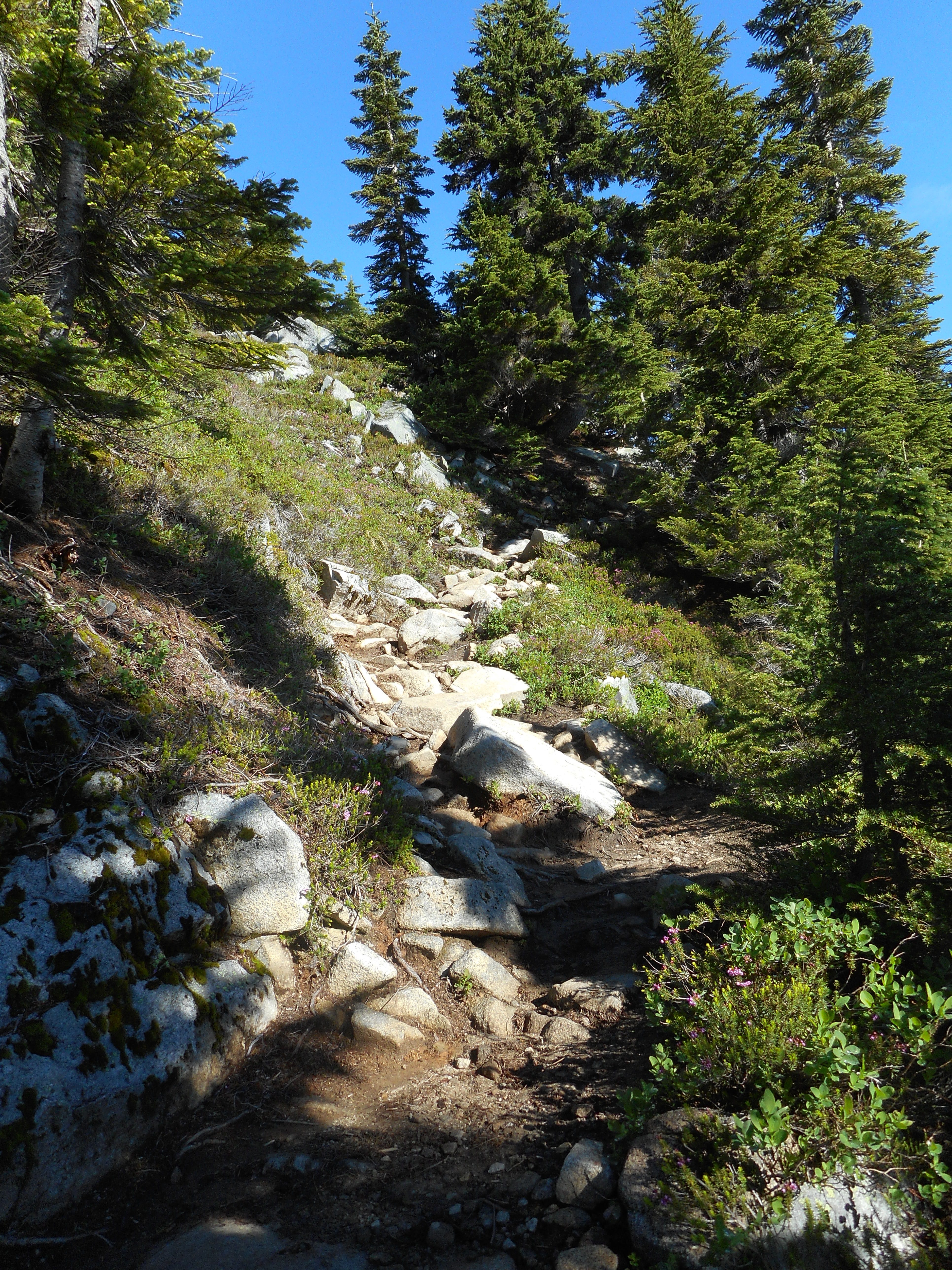
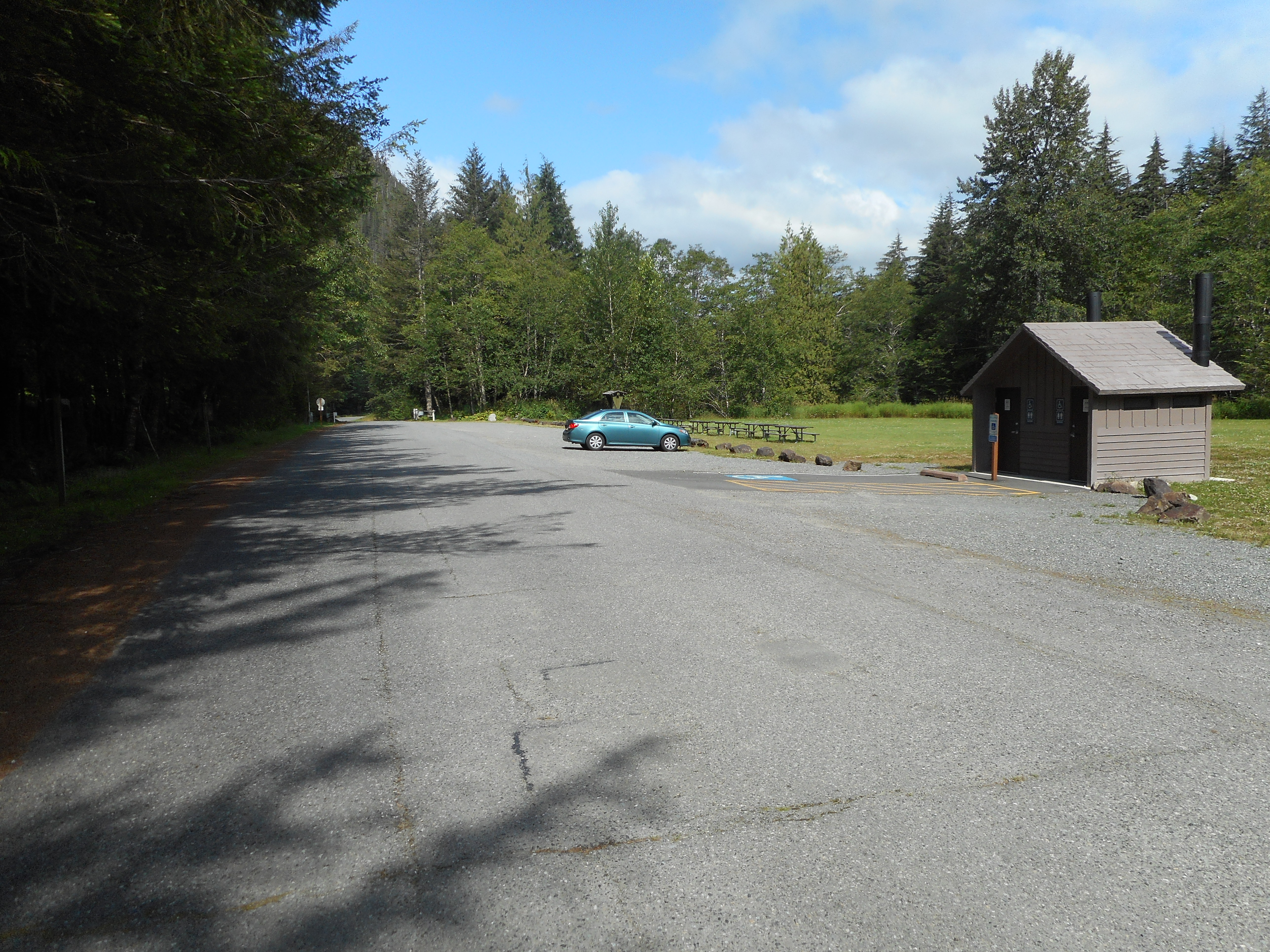
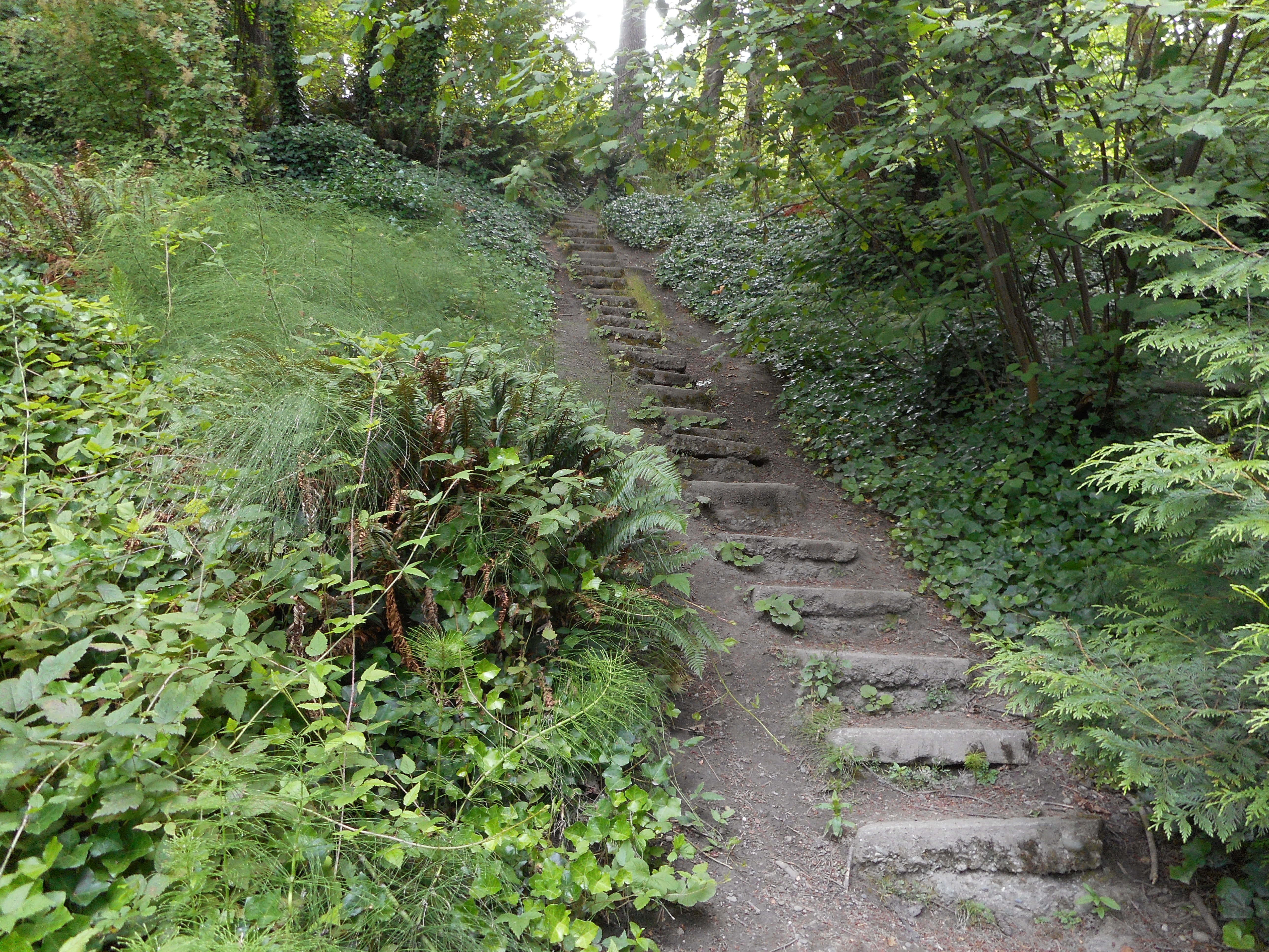
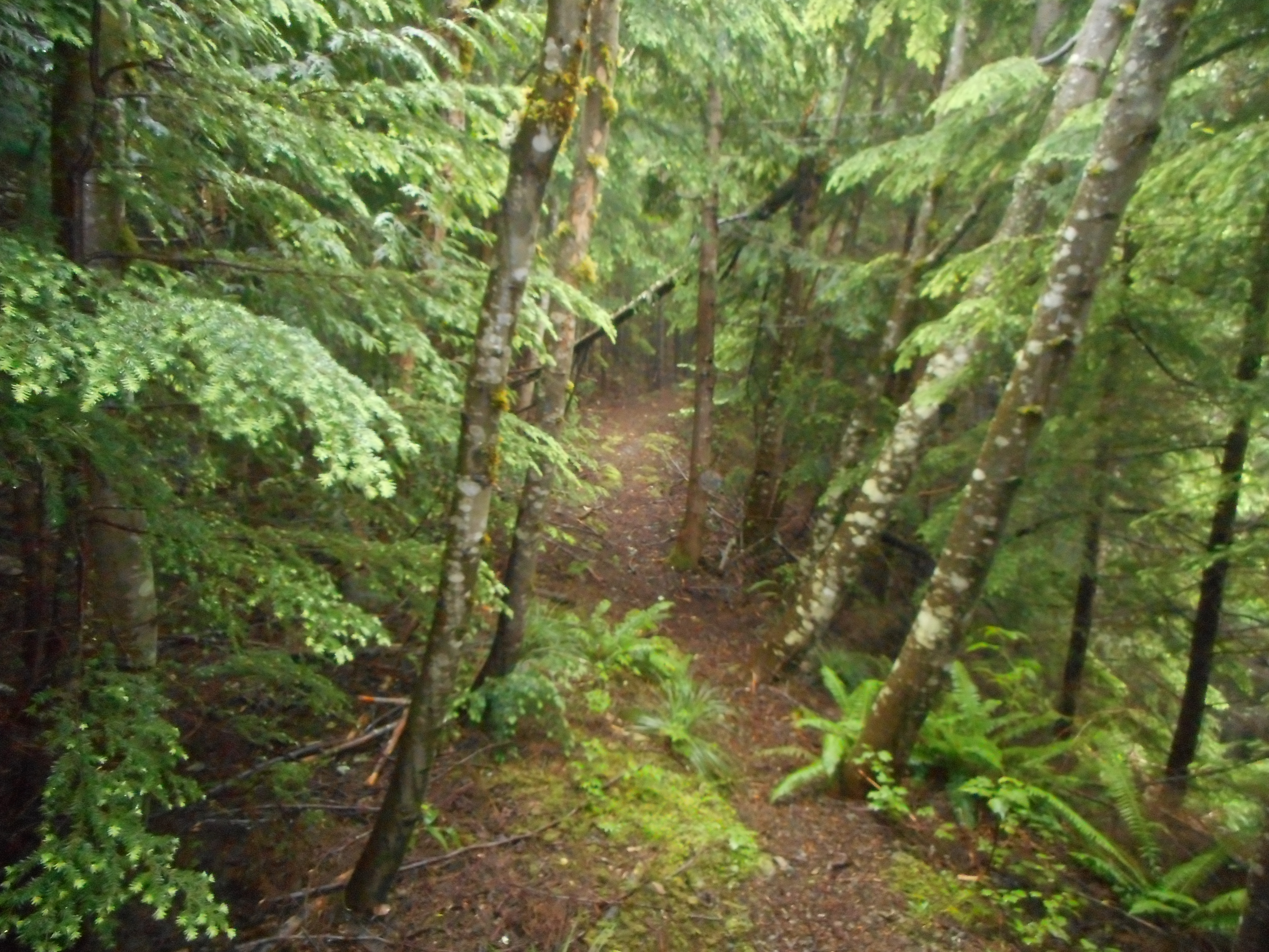
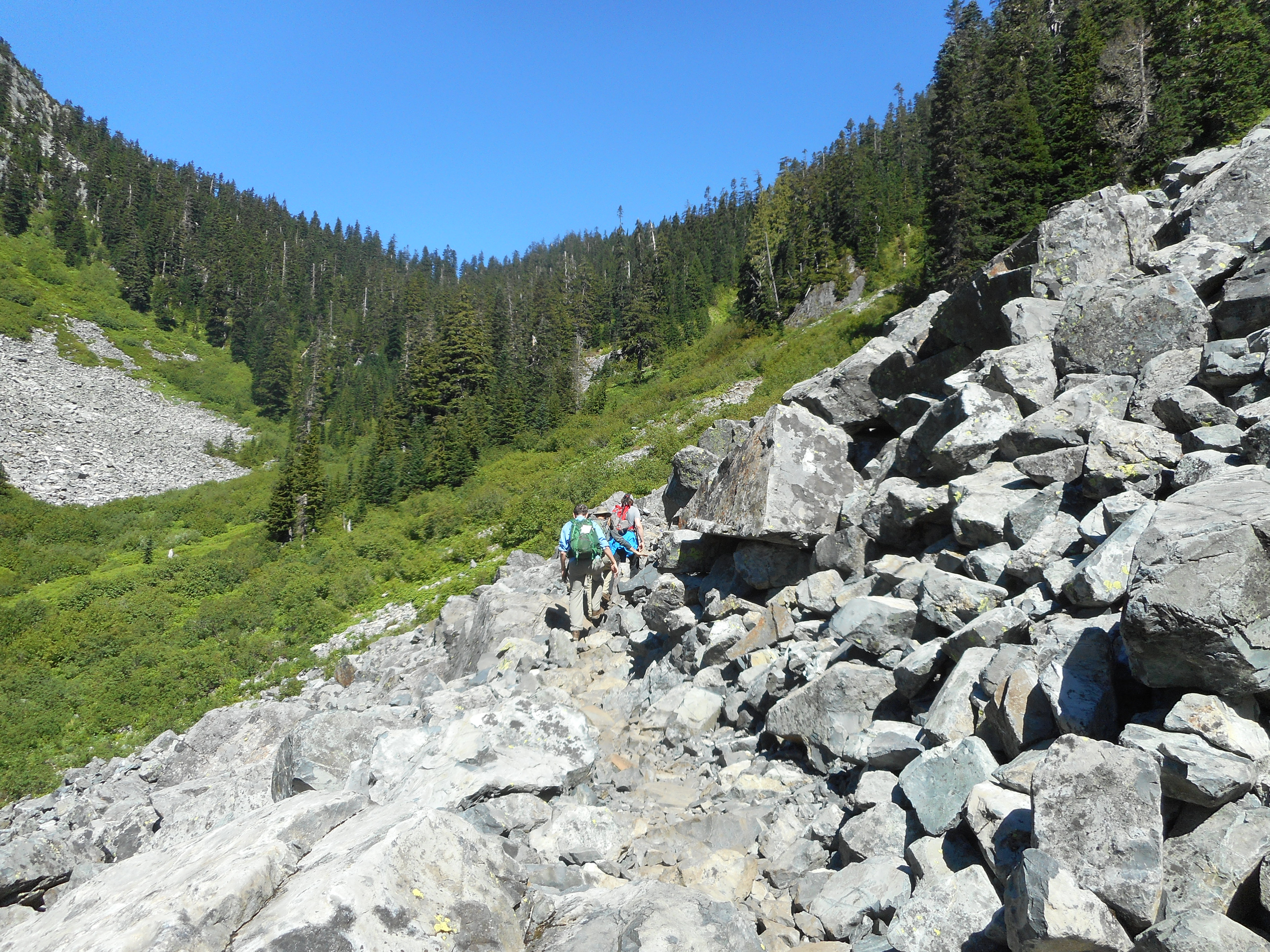
The route is up the Denny Creek Trail.  This trail is fine but a bit on the rocky side:

The trail is rocky
The trail is rocky

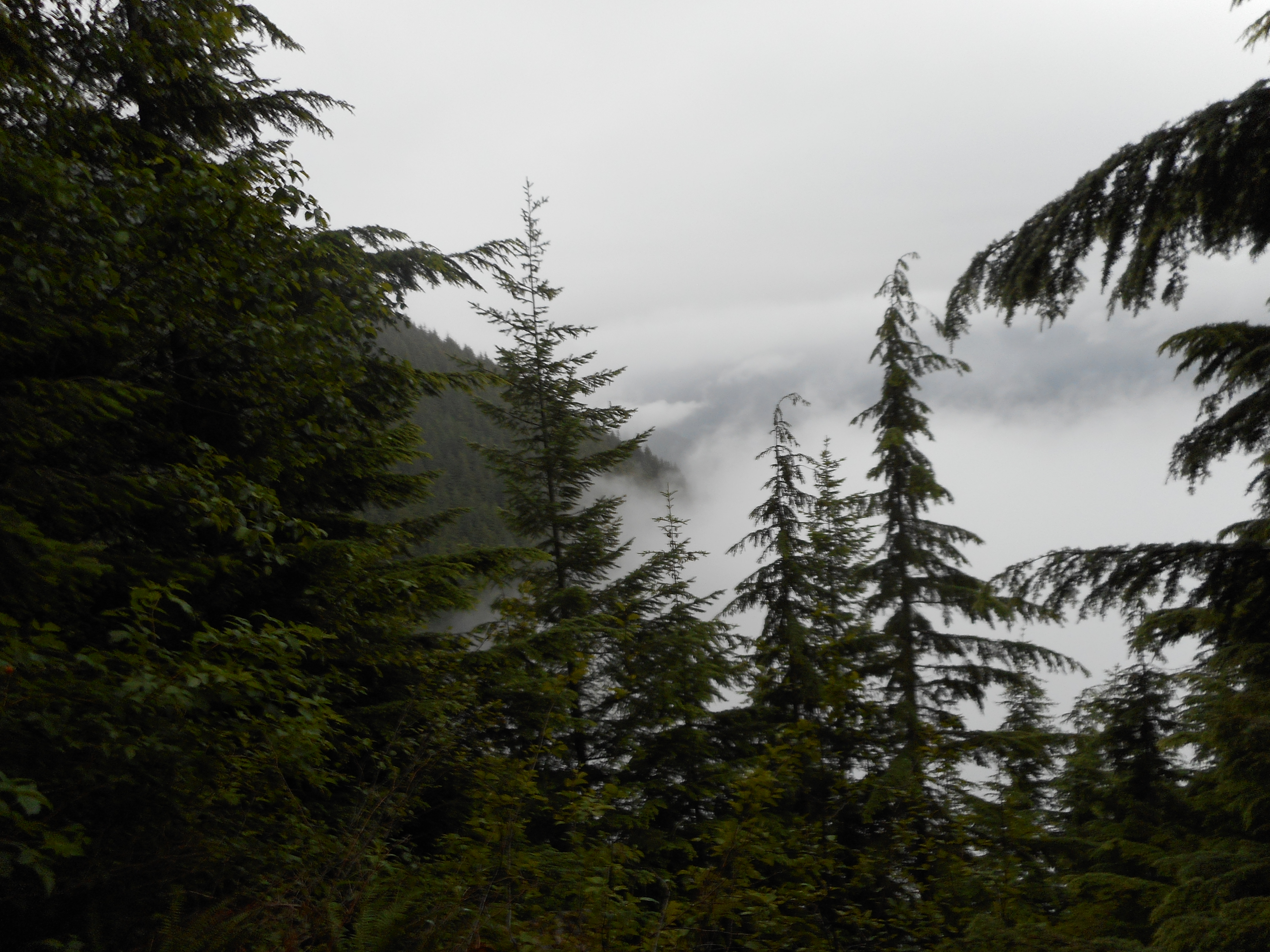
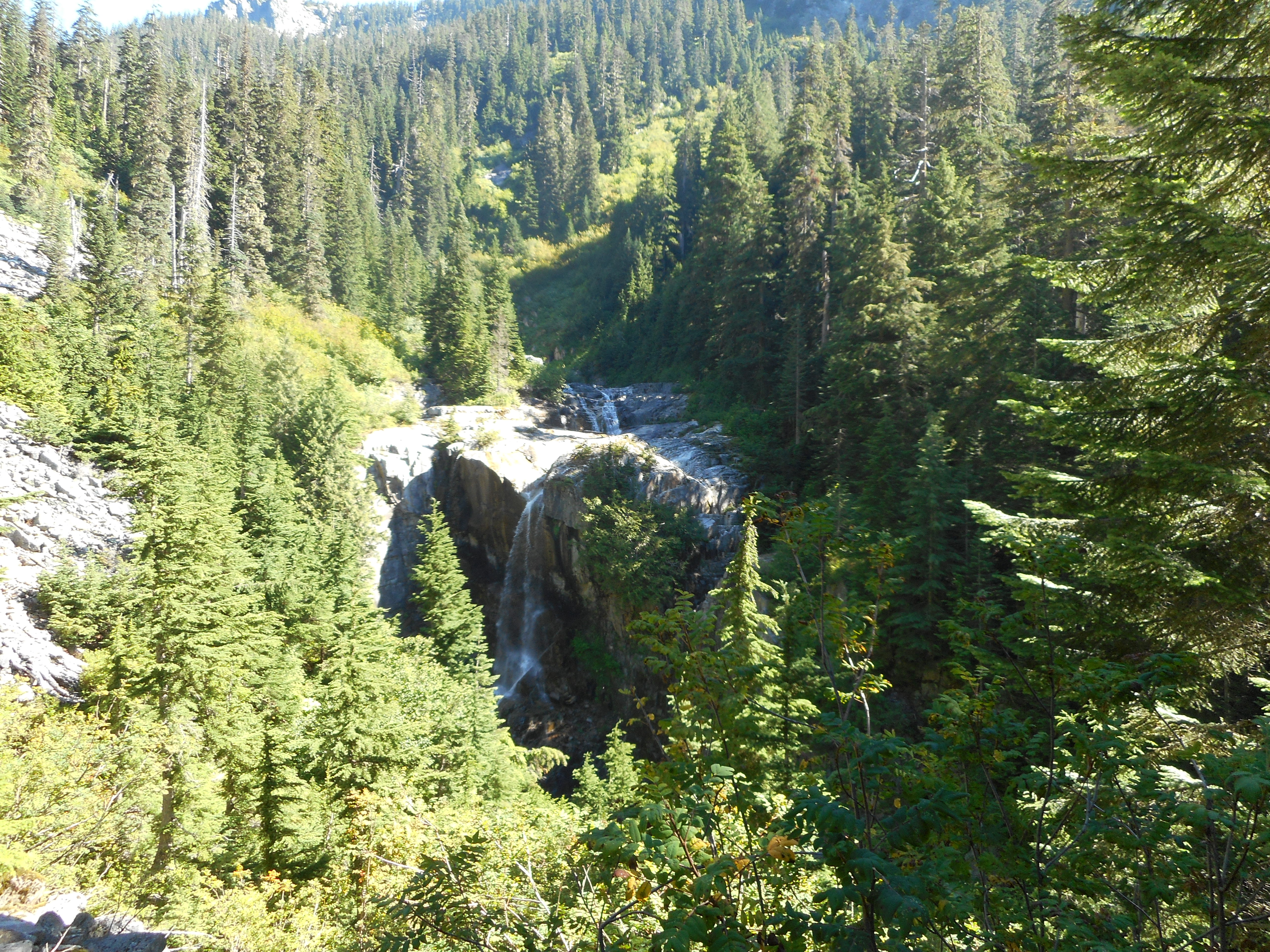
We left the trail at Hemlock Pass, 4600 feet after passing a couple of gorgeous waterfalls:

Keekwulee Falls
Keekwulee Falls

The problems began when we left the trail to head towards the Low Mountain summit.

By the way, this mountain is low in the same way that 6’6″ Michael Jordan is short compared to 7 footers like Luc Longley.

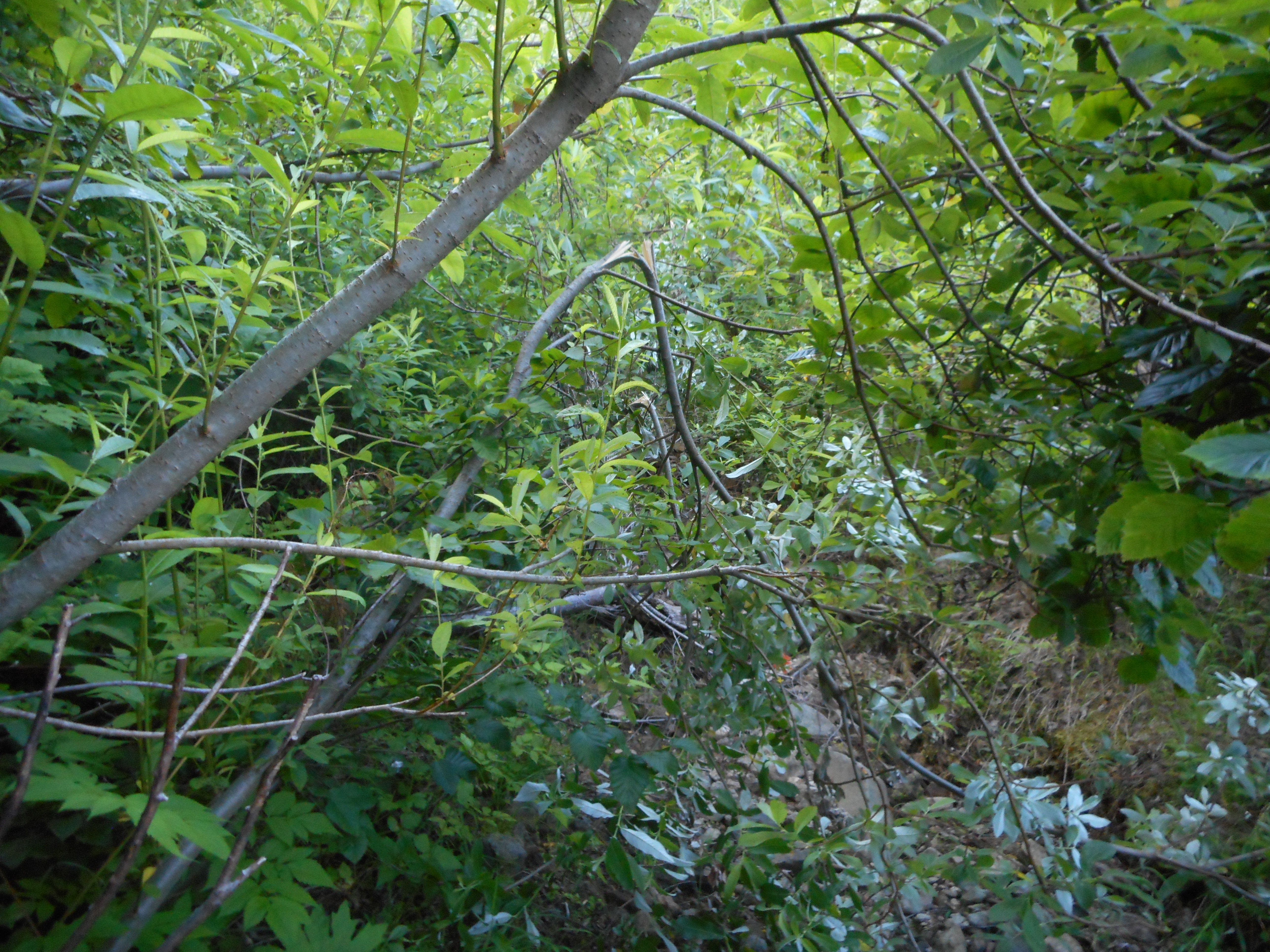
Anyway, the mile from Hemlock Pass to Low Mountain (false) summit took more than two hours.  This is very tough bushwhacking.  It was so tough I couldn’t get my camera out to snap a shot.  I was afraid that if I tried that maneuver I might lose my footing.  Suffice it to say that much of it was very narrow, choked with vicious trees (I think they were not happy we were there), boulder fields to traverse, rocks to climb – it was a hard slog.

The last .25 or so miles were almost straight uphill, grabbing onto tree limbs and roots to pull yourself up.  I, an old man, was worn out.  Christopher, Jamil and Mark were already sitting on what looked like the summit before I got there, legs like putty, panting like a Golden Retriever looking for a tennis ball to chase.

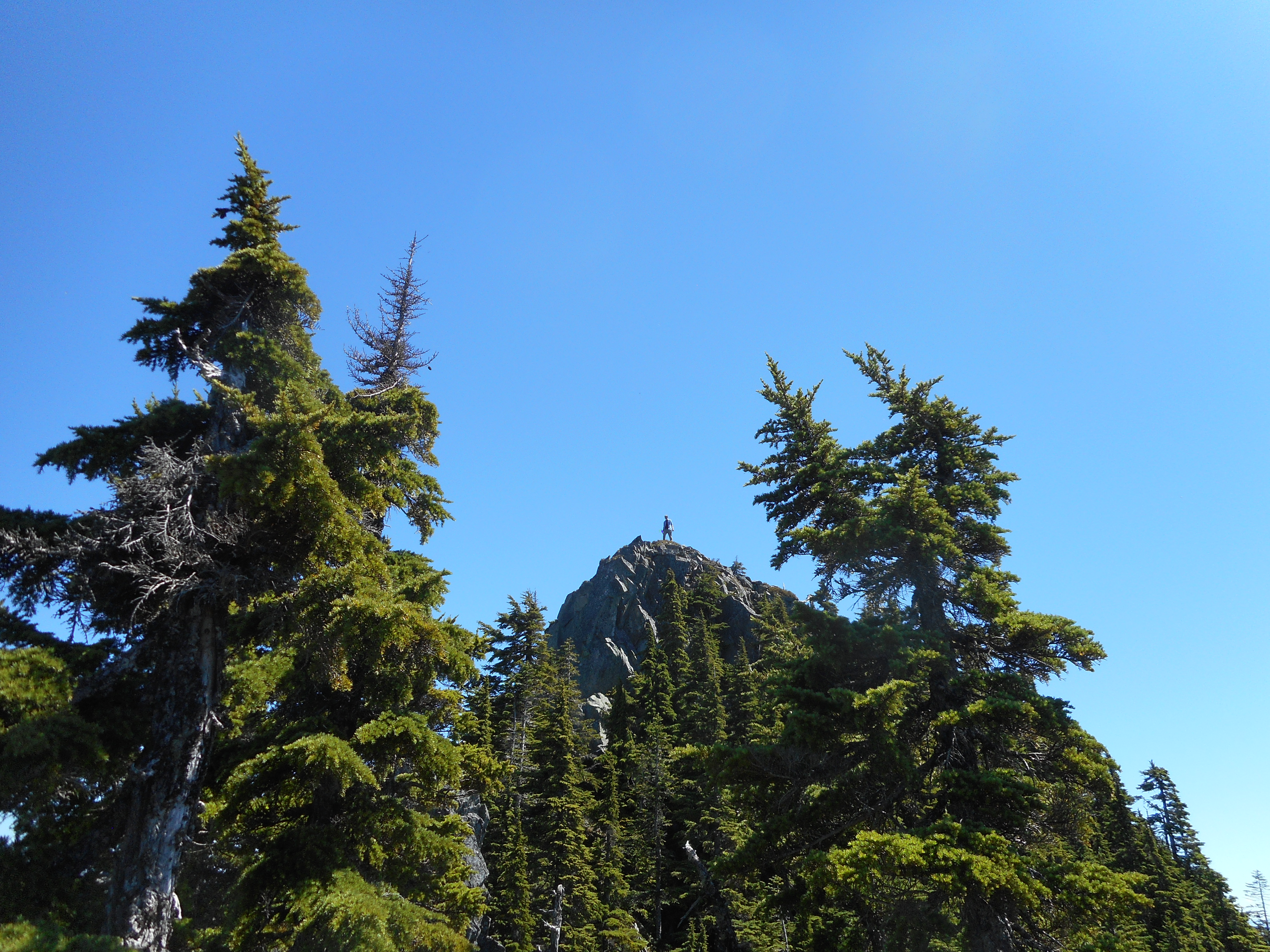
Mark wandered off to examine a tower of rocks nearby and announced he was going to climb it.  And he did – see the photo above.  Great job!

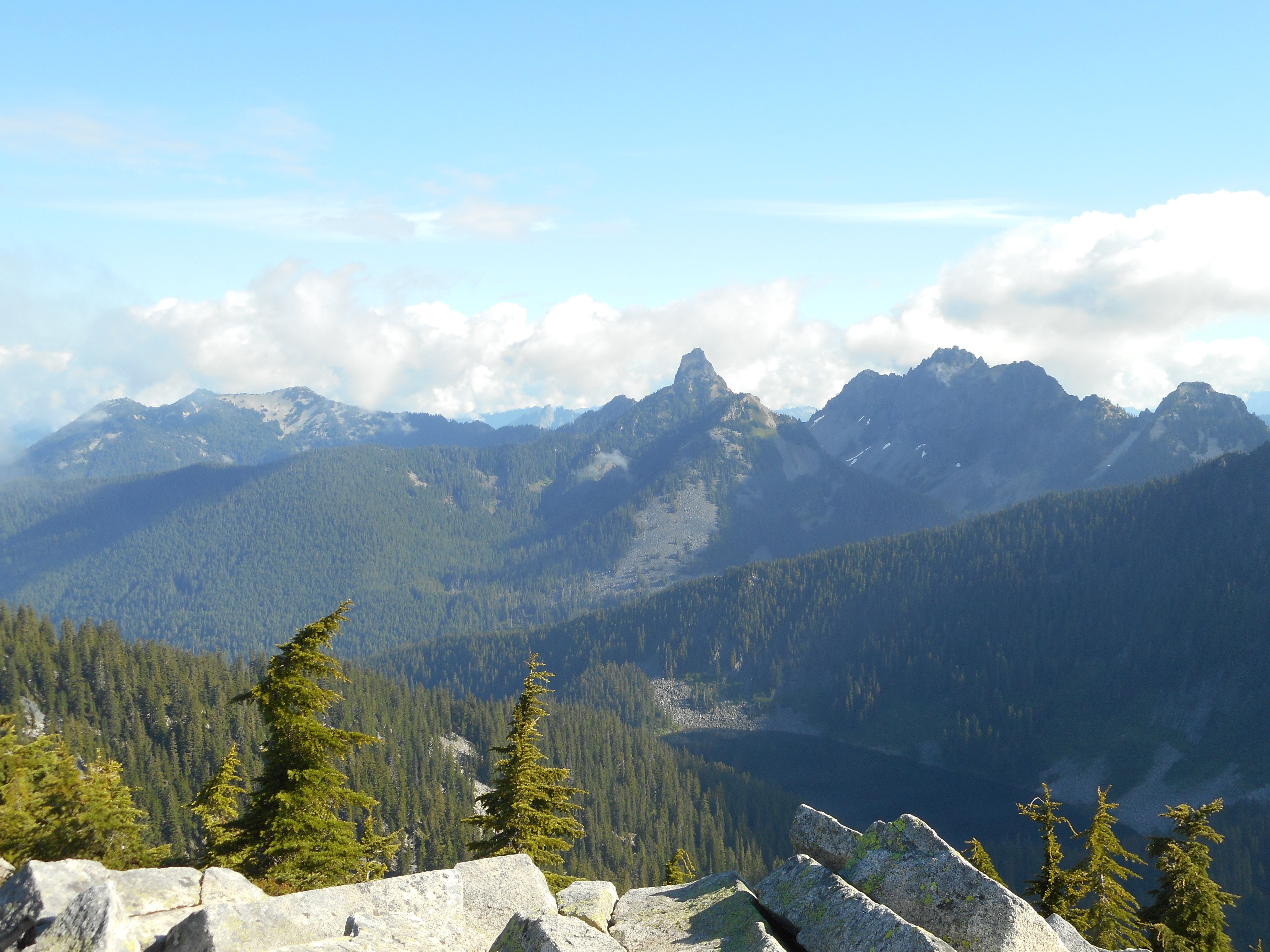
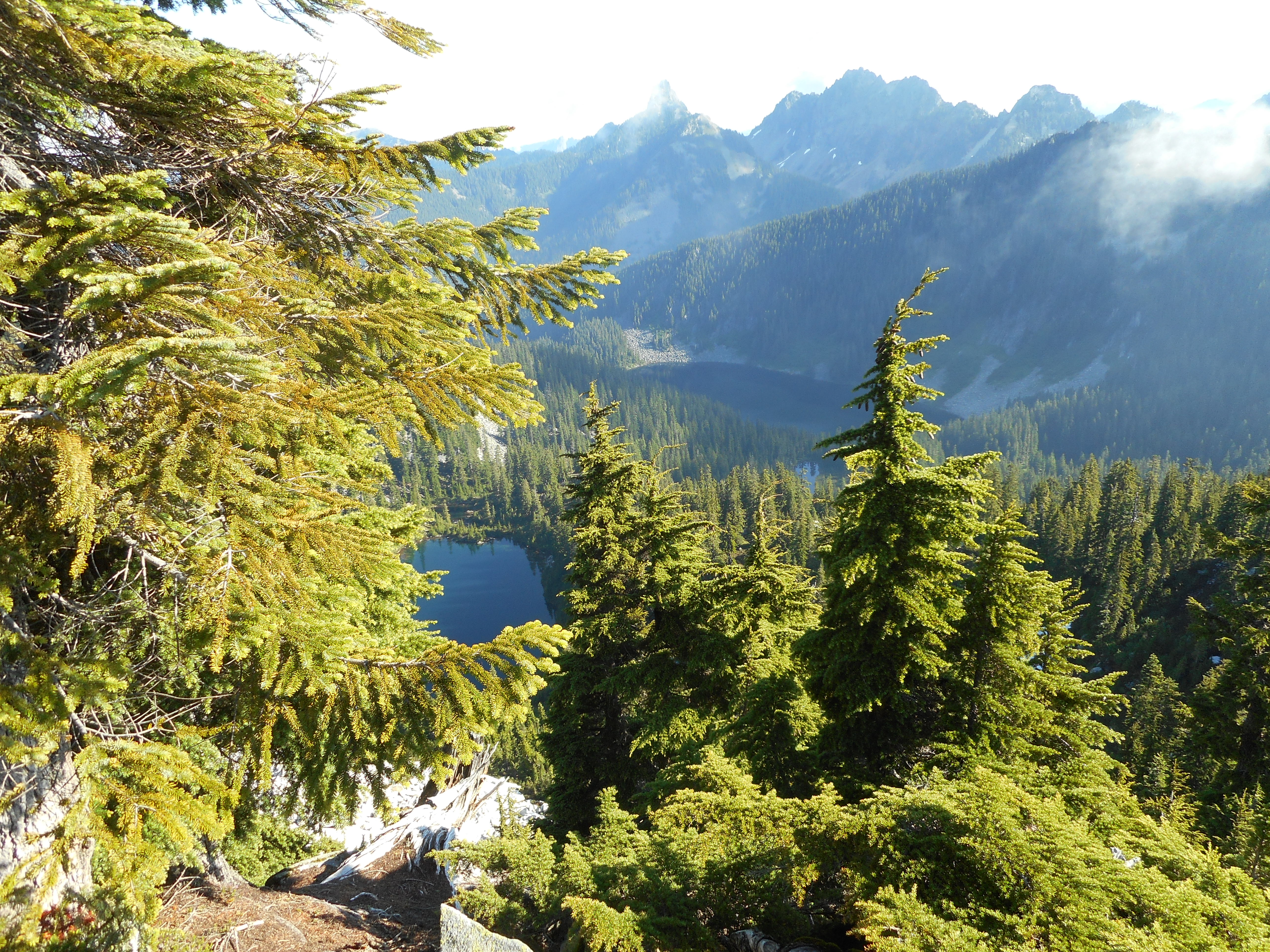
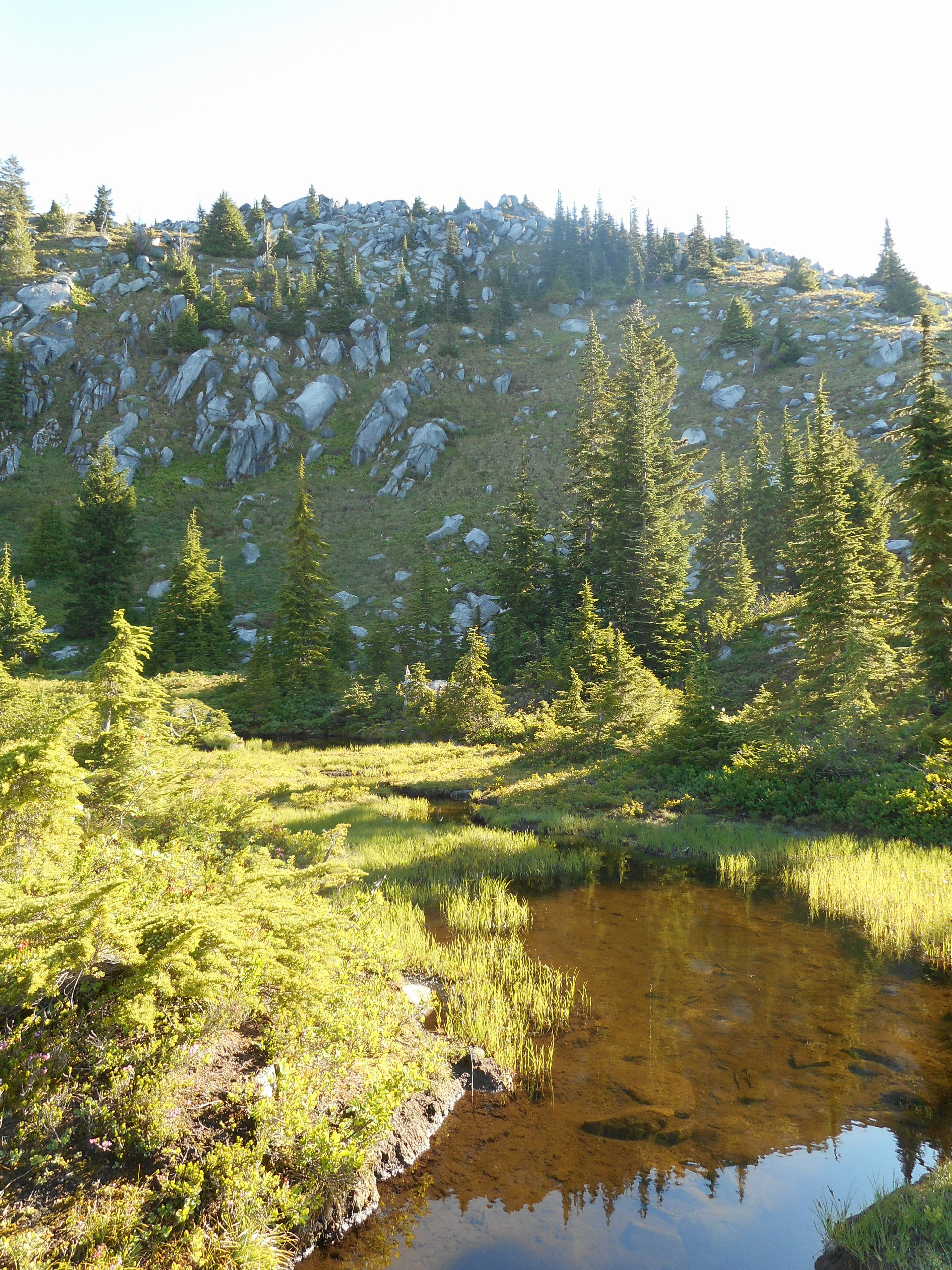
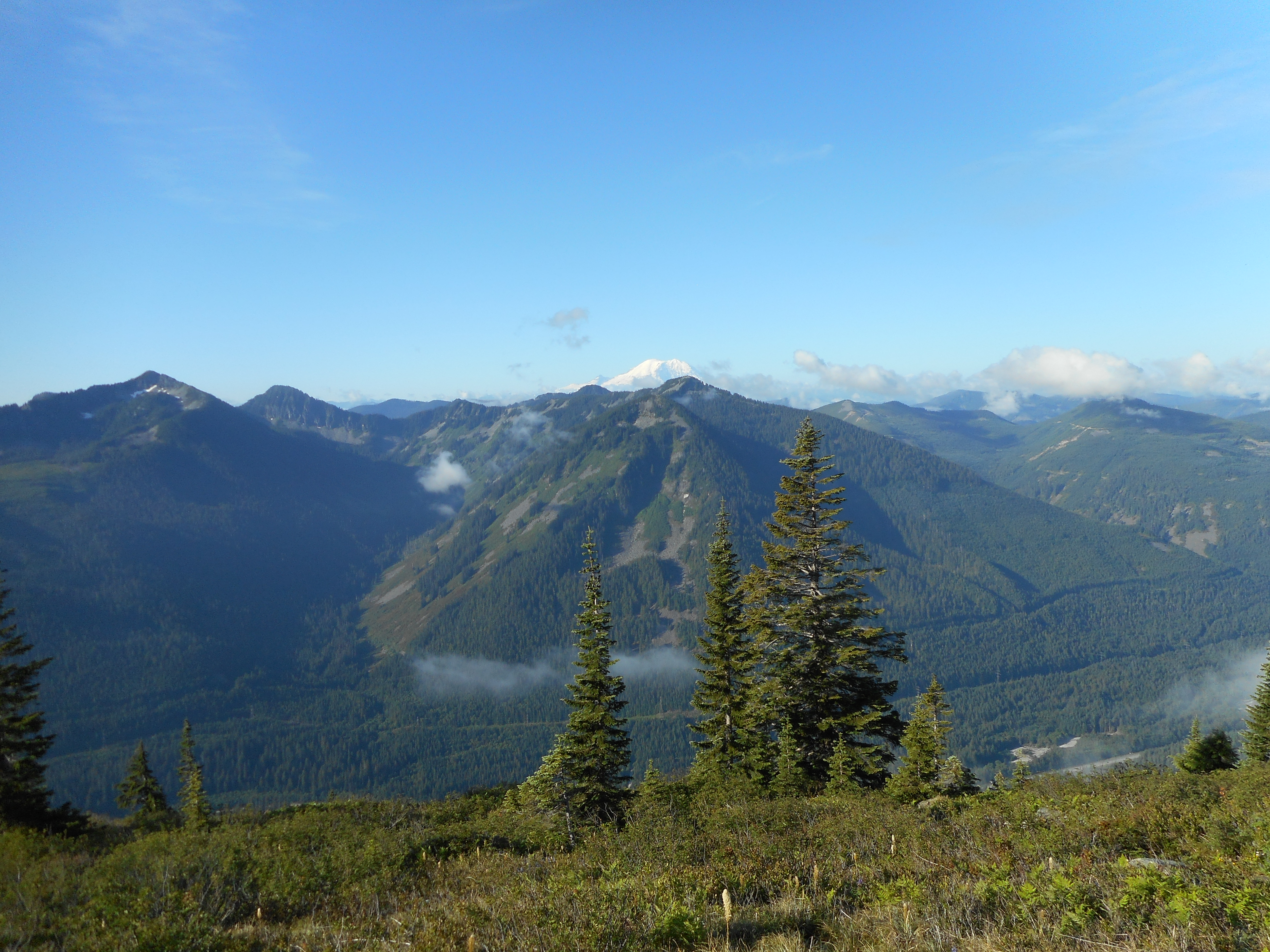
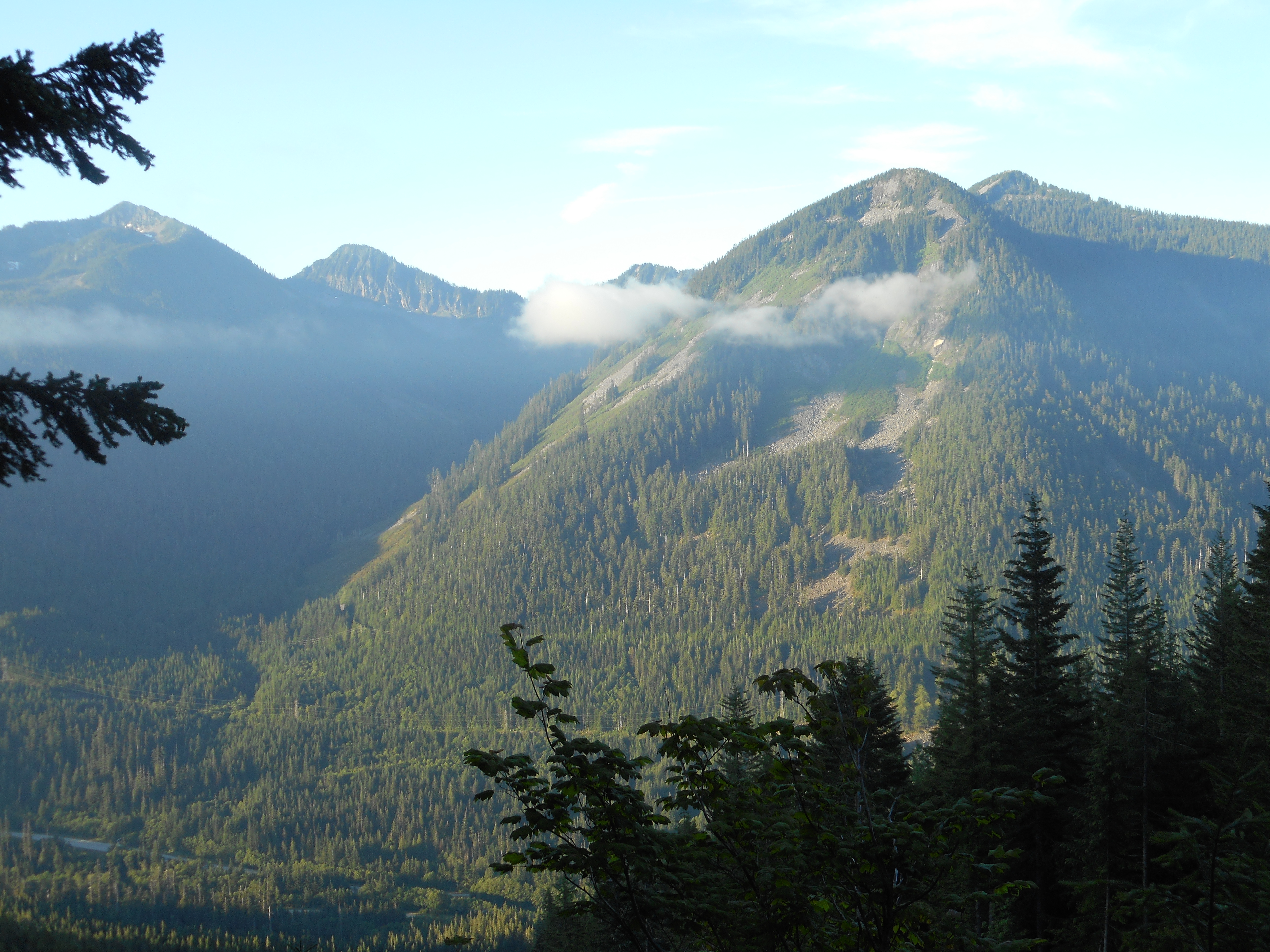
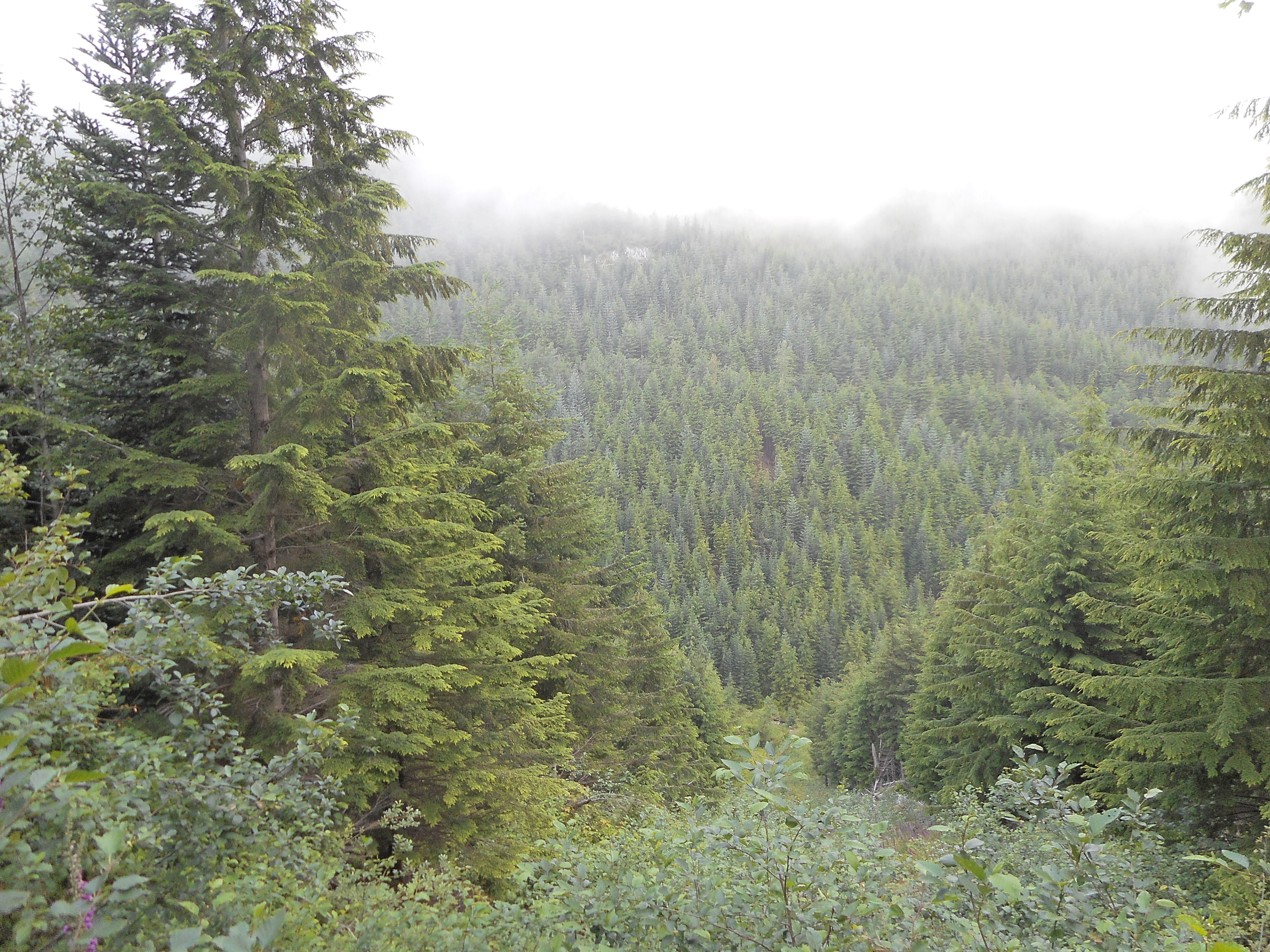
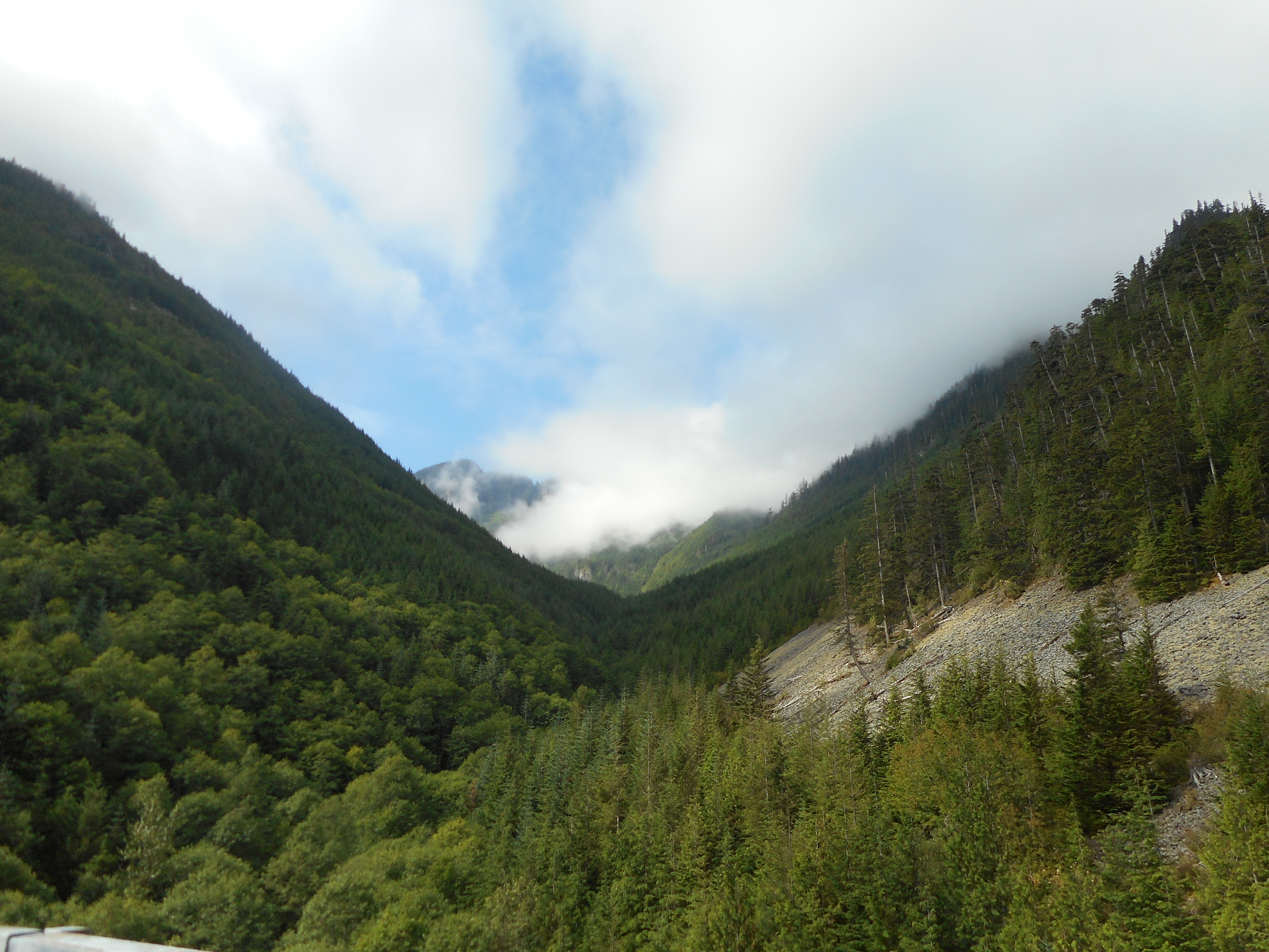
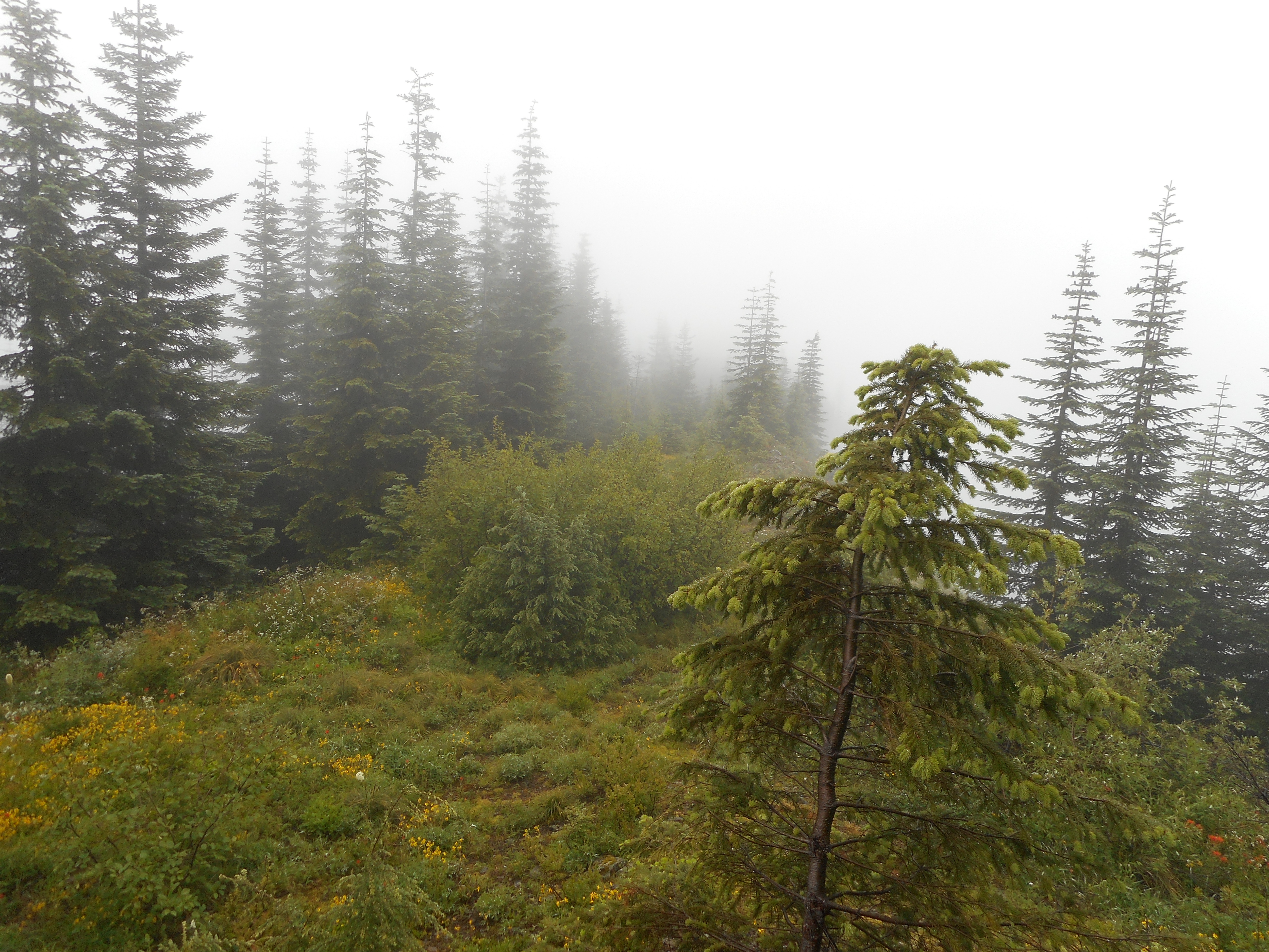
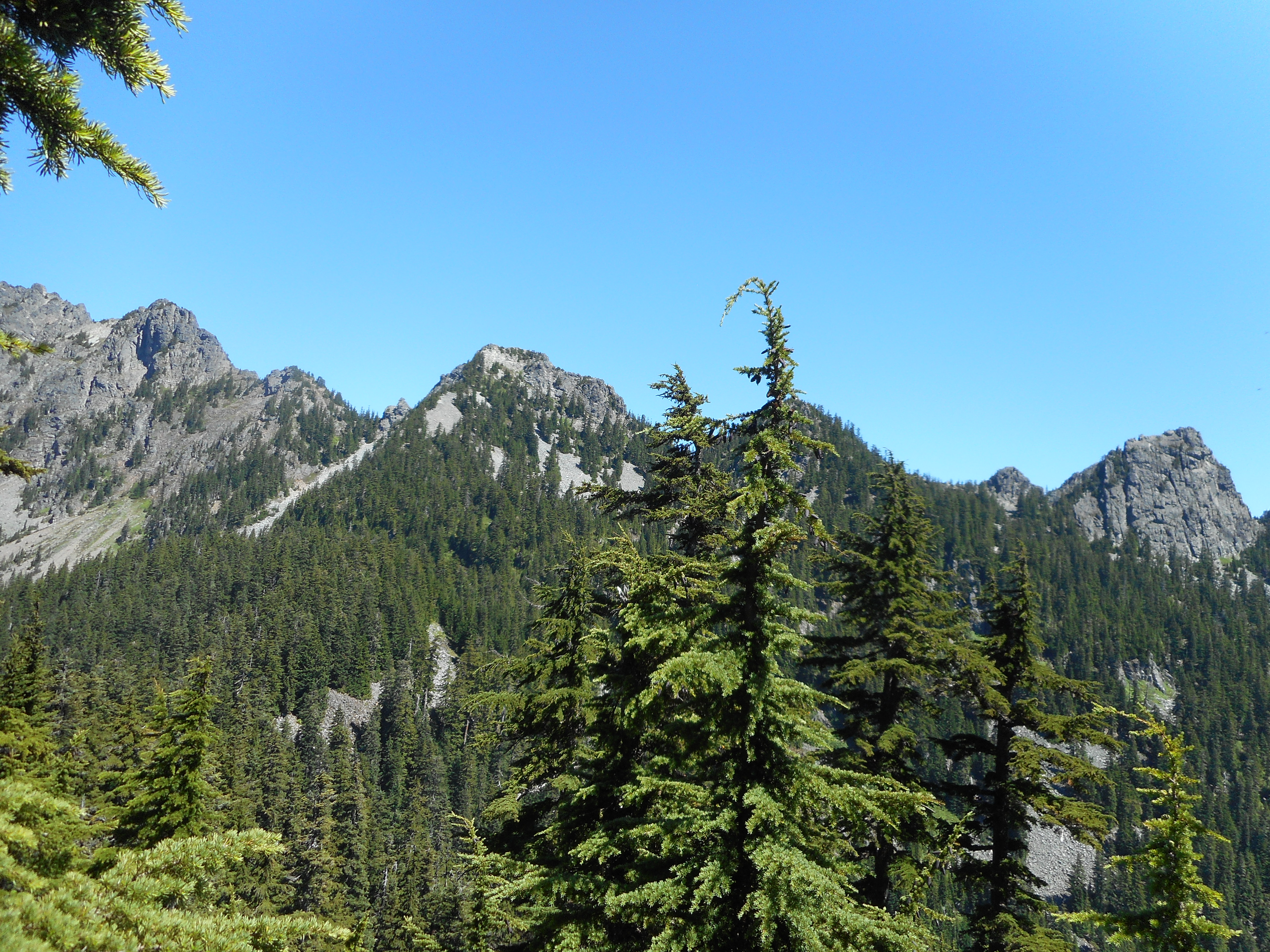
Plenty of views around there.  During the bushwhack on Low we did find a small spot to sit down and check out the mountains in the neighborhood:

The neighbors from 4900 feet

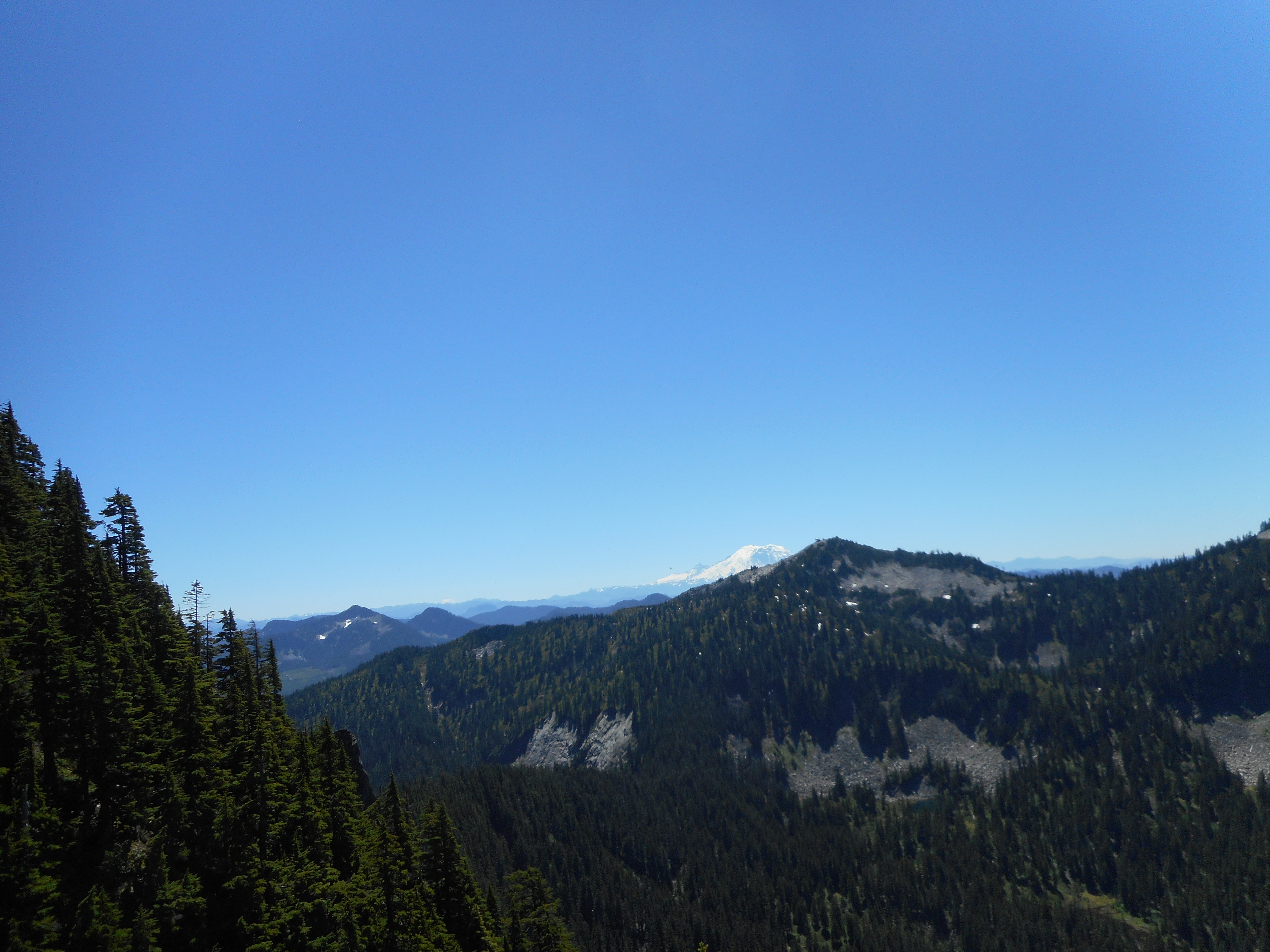
The bushwhacking was too intense for an old fart like me, but I cannot complain about the views:

Looking south
Looking south

Visualization:

http://adventures.garmin.com/en-US/by/djhiker/low-mountain-7-24-2016/#.V5Yag5Xlupp

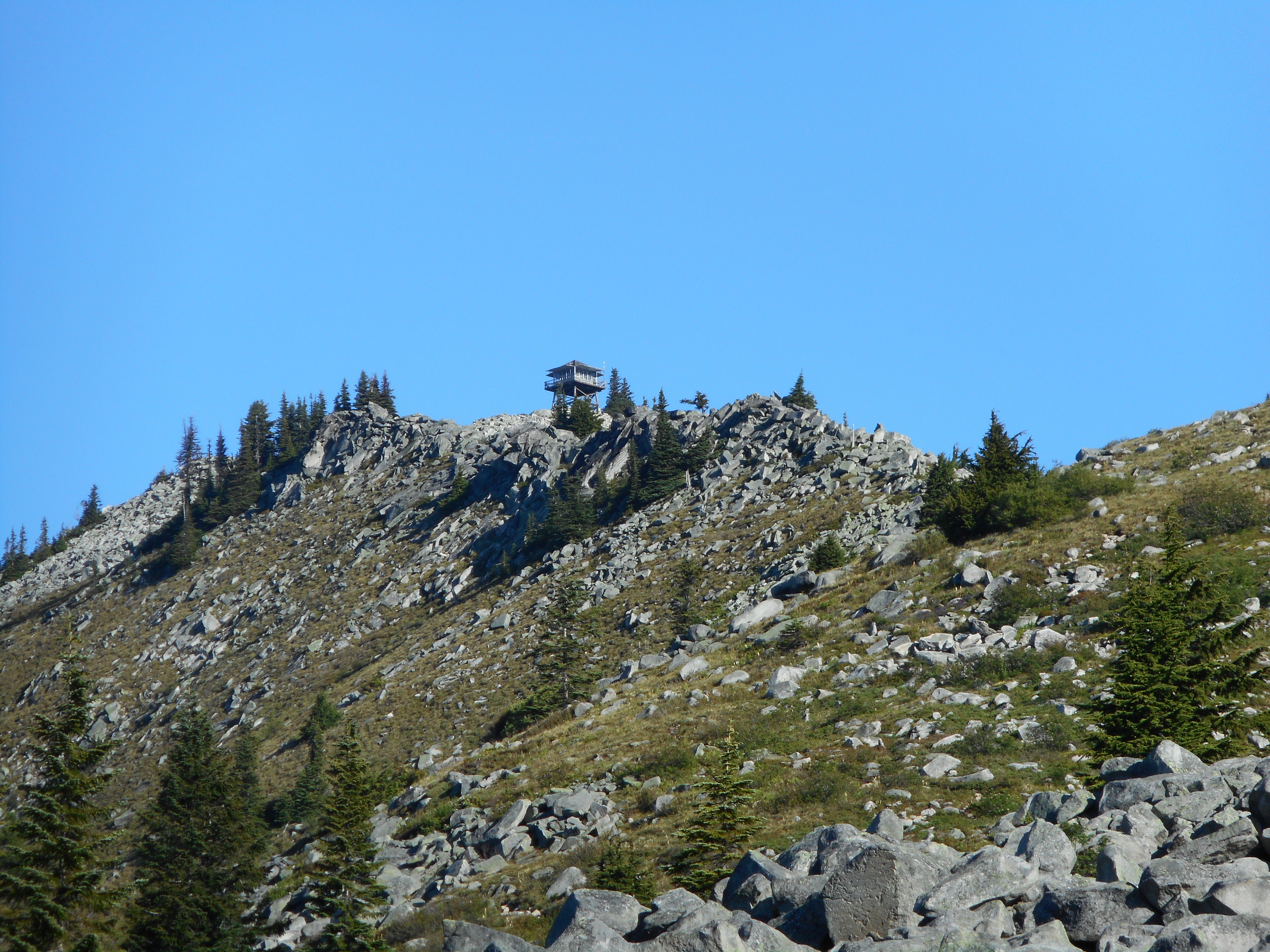
10 miles, 9 and a half hours (!), 3,593 feet of elevation gain.  We were not slacking yesterday and I can check this summit off my list.  I will next check it out from the summit of nearby Granite Mountain (we could see the lookout from Low Mountain summit) and bid it a fond farewell.

Granite Mountain w/Derek 7/20/2016

Looking north from Granite summit

What a great hike today!  We were first out of the trail head and first to the summit today – left the lot about 5:45 am and got to the summit about 8:30.

This is one of those hikes where you can see the goal from a long way off:

The goal is in sight

That lookout is the goal.  The official trail apparently goes straight up that rocky ridge but we hiked up to the base of the ridge and found a trail that went down and then up around the less-drastic northern end of the summit area.  No way up that isn’t tough, but there are degrees and we took the milder route.

Last section of the trail

And then, all of a sudden, Derek got to a switchback and saw that we were really close.  A few minutes later, and Derek was up there:

Derek on summit, right below lookout

The views up there, at just over 5,600 feet, are 360 with lakes and mountains dominating the view.

Looking down on (l) Crystal Lake, (r) Denny Lake

You won’t die of thirst, there were plenty of water sources today, periodically throughout the entire hike.

Water source near the summit

We shared the space with a family of Marmots.  Here is the Grampy:

Marmot
Marmot

And beautiful flowers along most of the trail.

Flowers along the trail

Views aplenty:

Looking south from about 5,000 feet
Another southern view - looks hikeable
Another southern view – looks hikeable

I do think, looking at the map, that that peak is Silver Peak – if so, we can get up there and in fact that hike has been discussed lately.

Here is the visualization:

http://adventures.garmin.com/en-US/by/djhiker/granite-mountain-7-20-2016/#.V4_fkJXlupo

According to my brand new Garmin Montana (might not have worked perfectly the first time) the hike was only 8 miles.  I don’t believe it.  Officially it is about 8.6 miles, and Derek’s Garmin was about 8.5.  I think mine needs a little shakedown.

Anyway, totally fun hike today, I will definitely be going back to this one.

Zig Zag to Hall Creek Road 7/17/2016

End of the Trail
End of the Trail

Once again I was aiming for Greenway, once again I came up short.  This time, way short.

My route today was going to be up Zig Zag trail to Hall Creek Road, south and then west to hook up with the road/trail that snakes up and south to Greenway.

My plan required that the blow downs that annoyed the [heck] out of me and Mark Garrett a few months ago be gone.  And for awhile, they were.  The first batch of blow downs was gone.

But about 1.4 miles south on Hall Creek Road the blow downs began and the situation was even worse than before.  Now, later in the year, all of the undergrowth was taller and thicker.  I bushwhacked about 1/4 mile through six or seven distinct trail disasters when I gave up.

I went back the long way, down FR9021 to Garcia and then west on IHT to Hall Creek and the junction with the Hall Creek Connector trail and back to the car.  Which was alone in the lot at 10:15 am on a nice July Sunday!

Every hiker's favorite view
Every hiker’s favorite view

It is clear that dirt bikes have been using this trail.  I am glad I did not encounter any of them:

Dirt bike tracks
Dirt bike tracks

There was a nice western view along Hall Creek Road:

Another misty mountain

And the view on IHT along the Mine Creek Bridge (a very impressive structure) is nice:

North view from Mine Creek

I did note a trail going west from Hall Creek Road – marked by pink ribbons at the junction and down the trail a ways.  Might be the end of the Hall Creek Trail – it is worth investigating.

You can see the intersection spot on the visualization:

http://adventures.garmin.com/en-US/by/djhiker/zig-zag-to-hall-creek-road/#.V4vbs5Xlupp

10 miles, 2,400 ft elevation gain, just over 5 hours.  Another 5am start.  A good workout but I am still looking for Greenway’s summit.

Urban Hike (Shilshole Bay) w/Derek 7/10/2016

Shilshole Bay
Shilshole Bay

All things considered today, our best logistical bet was for Derek to come by our house, with Camden, who was happy to hang out with Granny for a few hours (the feeling was very mutual) and drive into Seattle for an urban hike.

I parked near Green Lake.  We went west on 80th to the end, then north to 85th, and then into Golden Gardens Park, which is a nice little wooded area with plenty of steep trails and steps leading down to a nice beach and bay.

Steps in Golden Gardens Park
Golden Gardens trail
Swimmers
Swimmers

We kept a sharp eye out, going and coming, for interesting homes and yards such as this one, along 80th:

Particularly nice yard along the way

Based on my Boeing On The Move pedometer I figured about 9.5 miles, but looking at Google maps it was surely closer to 12.  Fun urban ramble and Shilshole Bay looks like a place where we can drive in with the inflatable kayak and paddle around the bay.

This part of the world sure is fun!

This close to Greenway summit Fourth of July 2016

Greenway summit (almost)

OK, I got closer than ever to the Greenway summit but just a bit short.  Now that I have looked at the map (see the  visualization linked below) I see I should have gone a bit farther on the logging road, just past where it turns north, and scrambled up to the summit from there.

On the other hand, the summit of Greenway seems to be pretty well protected from non-hooved intruders.  We shall see.

I started up the Mt. Washington trail at 5:20 am.  I took it to the Great Wall and turned east there.  I was curious to see what had happened to it, and why Derek and I, back in April coming down from Change Peak, had missed the old path.  I found the answer today.

The trail – which has one of my absolute favorite sections of trail, as it is nice and non-rocky and winds through beautiful woods:

One of my favorite sections of trail

The trail goes up to just short of the area where they have been working when, immediately following a ‘stay out/construction’ sign ends abruptly in a huge pile of stumps and trees and rocks shoveled over the trail by the guys working the excavators.  Coming back down I knew what to look for and where to look for it, but no way to see that little scramble to that section of the Great Wall trail otherwise.  So that’s why we missed it in April.

However, all I had to do was a minor scramble up a bank to hit the newly created section of the trail, which turned into the classic Great Wall.  I followed that south to the old logging road that runs along the watershed boundary and then east to the vicinity of Greenway.

I kept looking for a reasonable way up, there being no trail right below the summit and I finally found what I thought was a boot path.  Aha!  I thought.  This is it.  So I followed it up.

And soon realized I was following hoof prints rather than foot prints.  So I got near the summit but I did not quite make it.  Next time for sure.

It was cool and rainy today, pretty good hiking weather, but not much for the views.

Best view of the day

12.5 miles in 6 hours, 3,450 feet of elevation gain, not a bad workout.  But not exactly the summit I wanted to bag.  Nice Fourth – we are going to Jill and Derek’s tonight for dinner and the local fireworks show.

Looking forward to going back to totally bag that peak….

Visualization:

http://adventures.garmin.com/en-US/by/djhiker/greenway-mountain-7-4-2016/#.V3rGhpXls5s