McClellan Butte/Salmon Lake 9/28/2016

Mount Si floating above the clouds

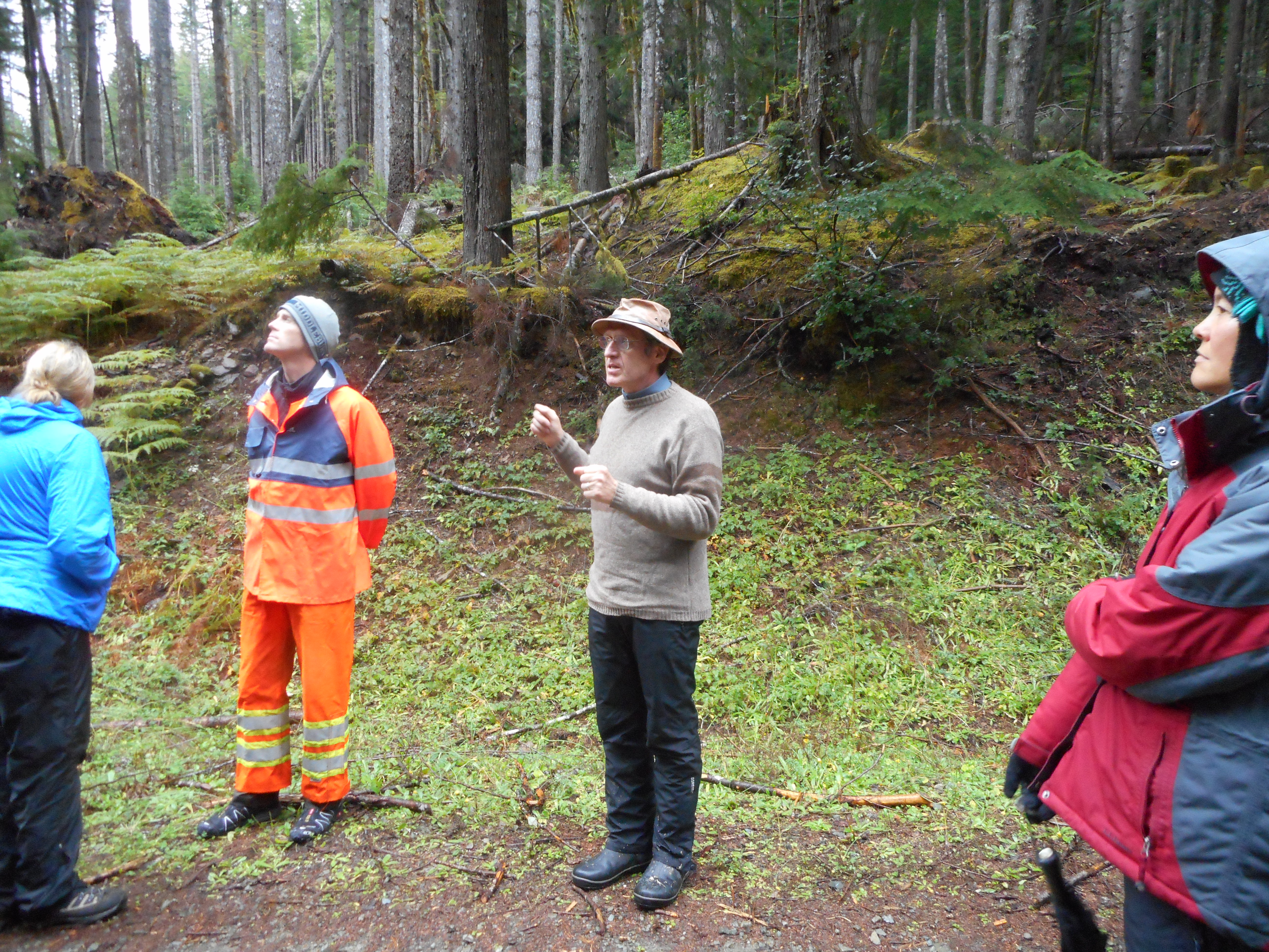
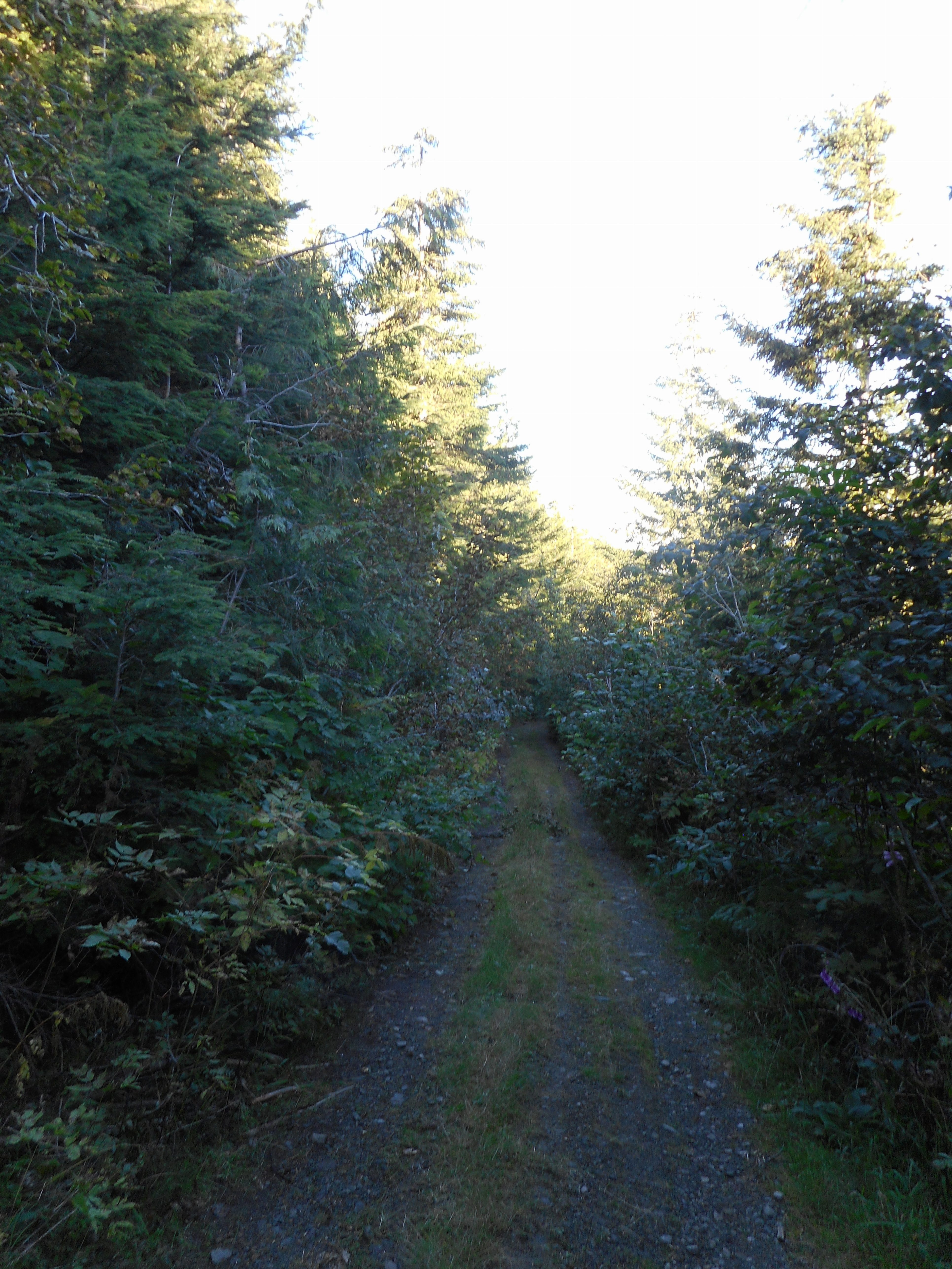
Derek and I had planned to go up McClellan Butte and then investigate what we thought was a trail heading west from what we call Salmon Lake (a small tarn, in fact).  But Derek’s work schedule was changed and he couldn’t make it and I wound up doing a solo hike today.

The past week has been one for me to (almost) run into animals.  This time, as I turned north for the final stretch to the summit I came up to the top of the rise and startled a group (collective noun?) of mountain goats.

They took off down the trail and a few went west (down) and a few went east (up) and there they were.  I was not moving, waiting to see what they were going to do.  I did not want to walk the gauntlet between them, in case they were feeling territorial.  I also wanted a photo.

So I took out my camera and that was enough movement to send them all down the trail at high speed.  I slowly went that way (the alternative was to turn around and I was too close to my goals to do that, short of a trail blocked by a cougar or a bear) but never saw them again.  I did take a couple of pictures of their tracks but the photos are both very poor – I need to learn how to switch between the landscape mode and close-up mode – so that’s that.  It slowed me down but did not terrify me.

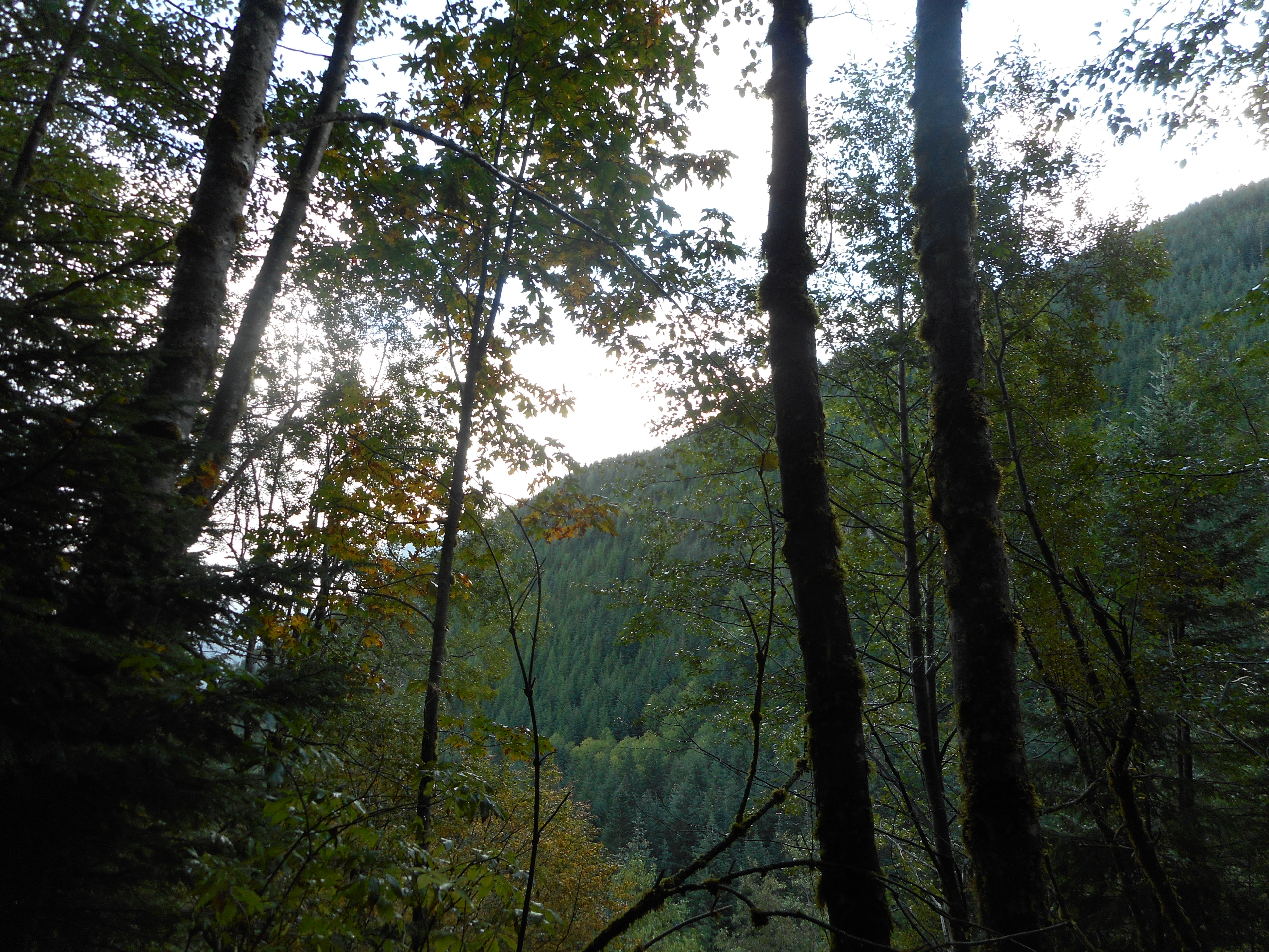
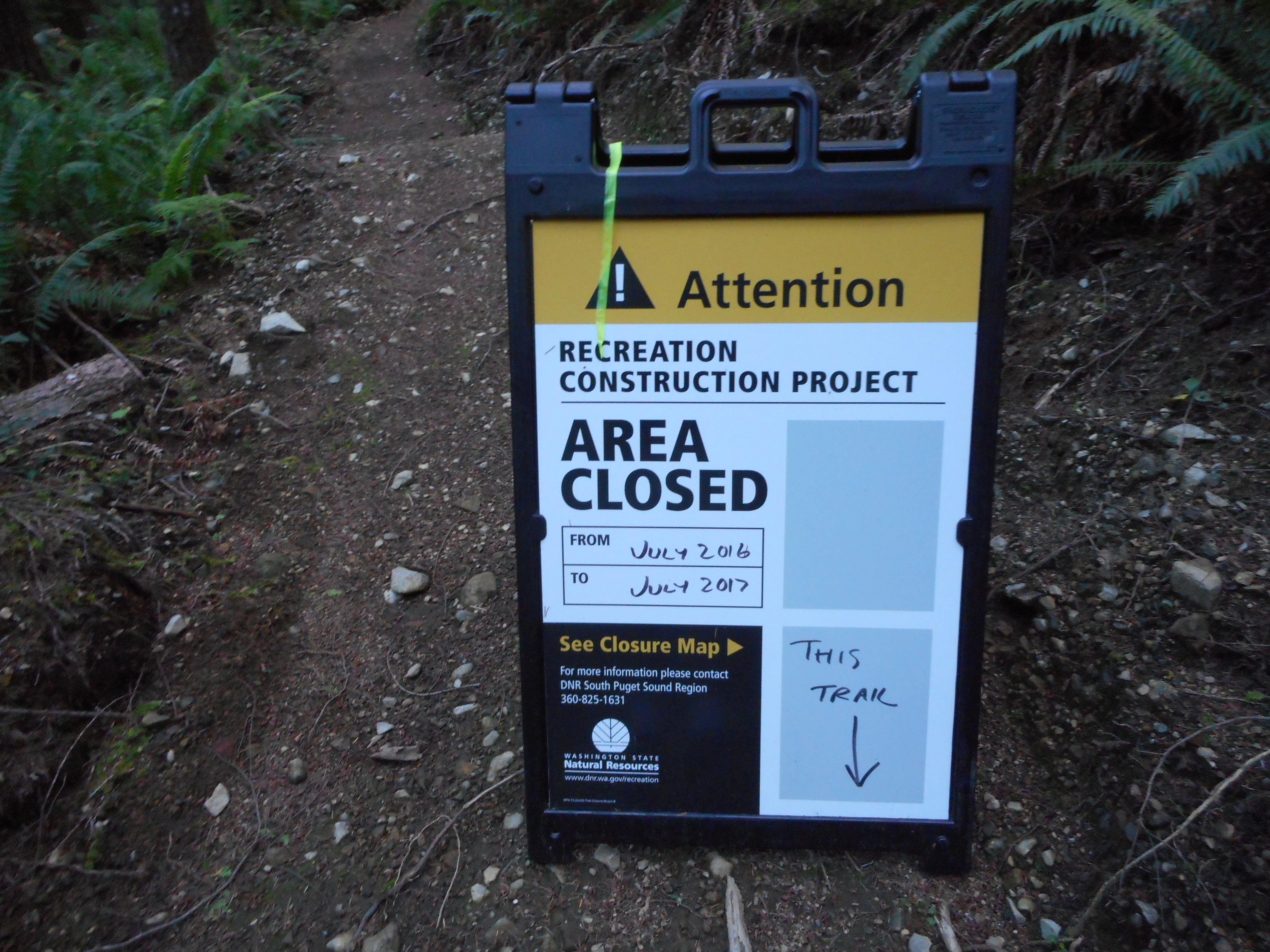
As for Salmon Lake, shortly after the goats I found the trail down and headed there.  It appears to me (Derek and I can check it out more thoroughly some time) that the trail we thought went west just circles back to the main Salmon Lake trail.  I was unable to find a route west and furthermore, it looks like a very steep and difficult bushwhack.

Probably doable, but not with a time limit.

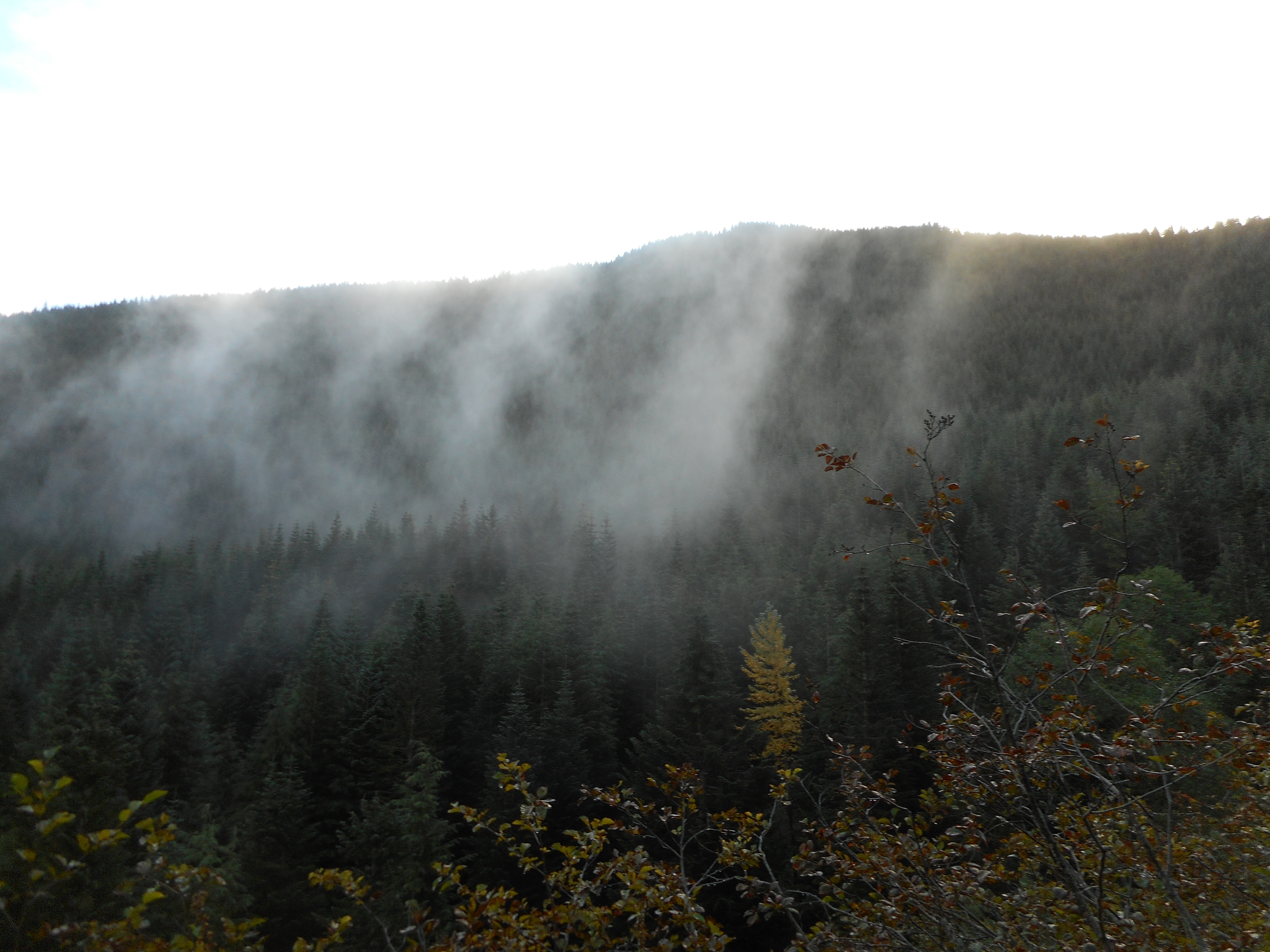
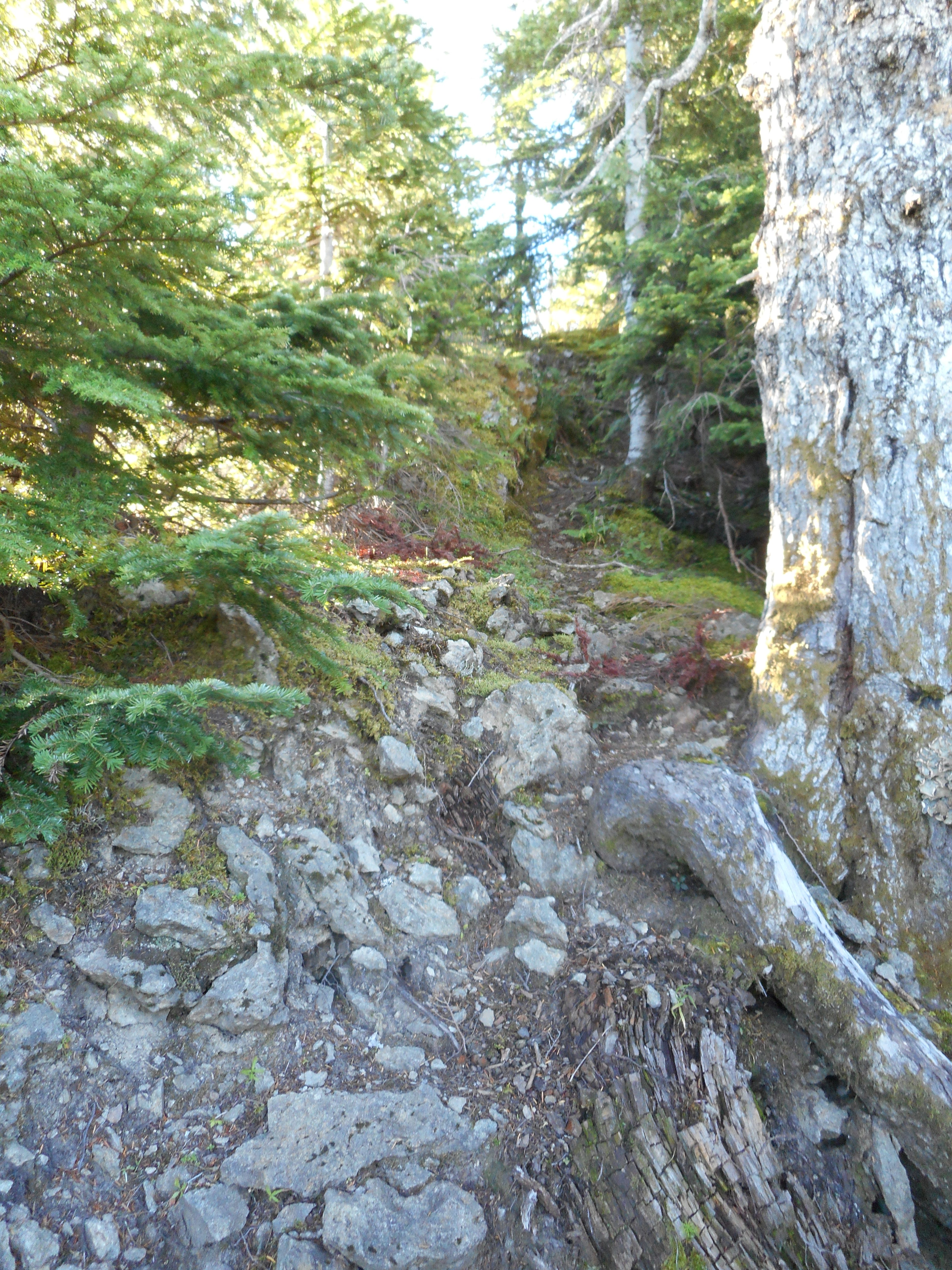
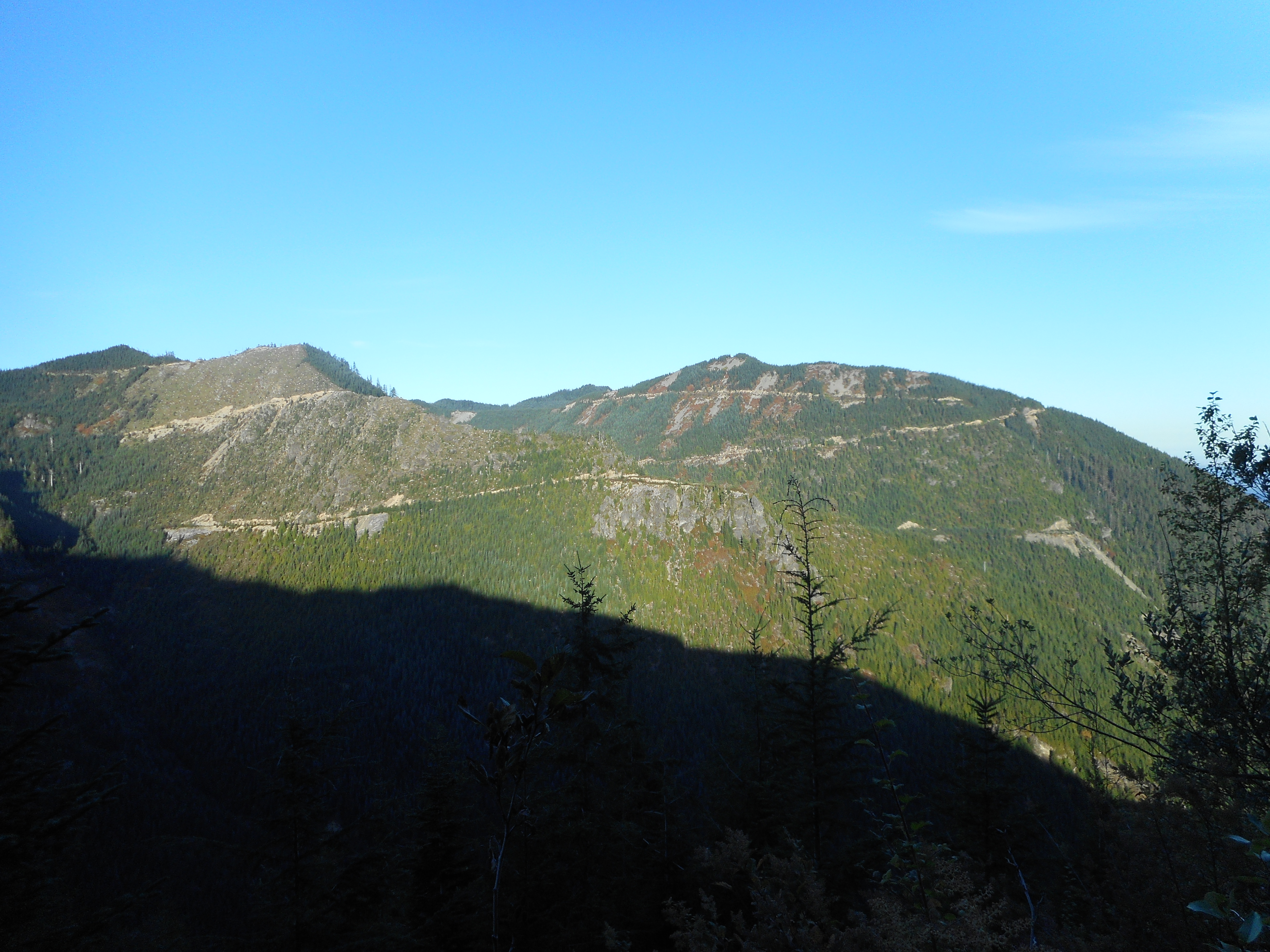
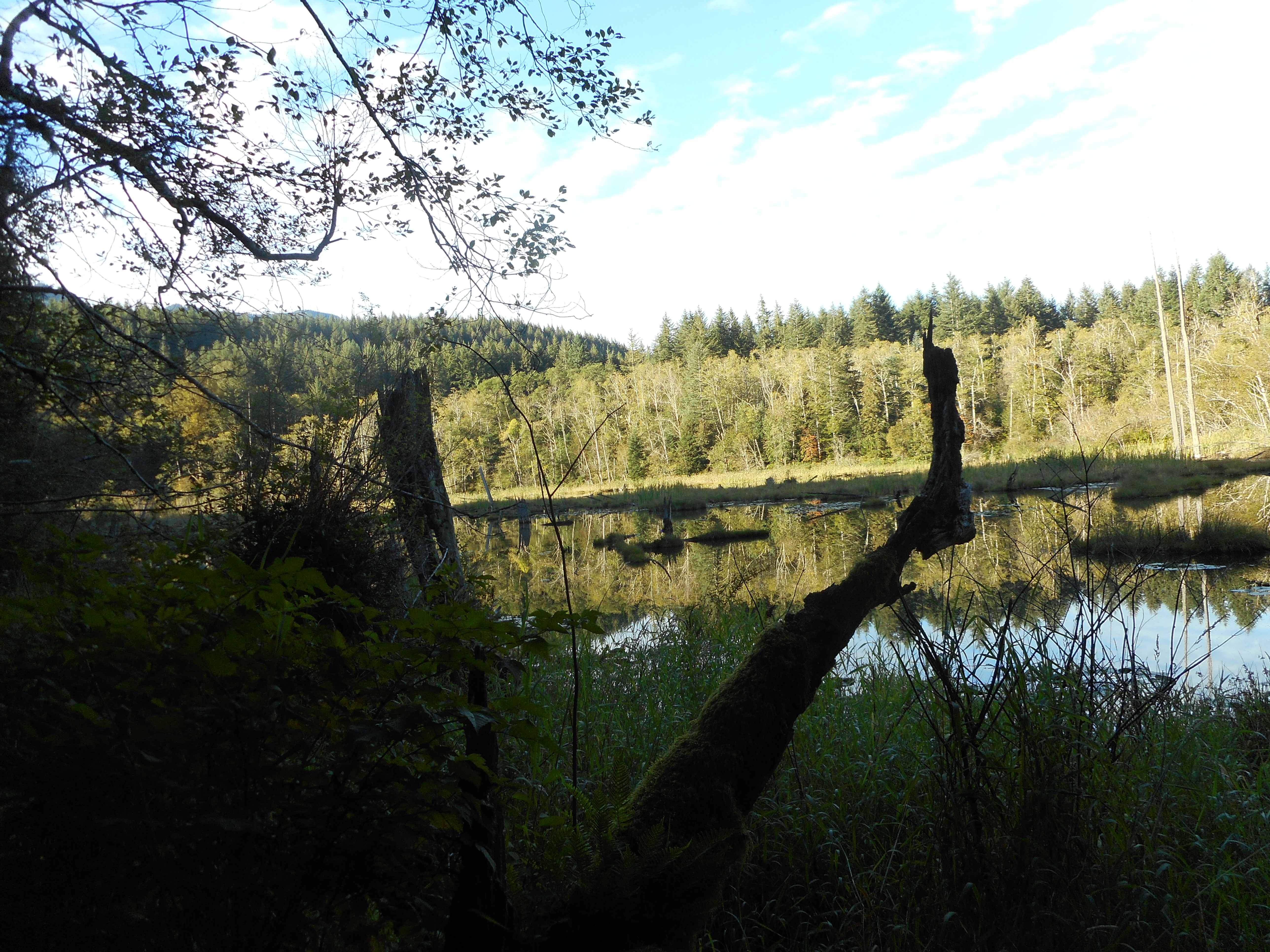
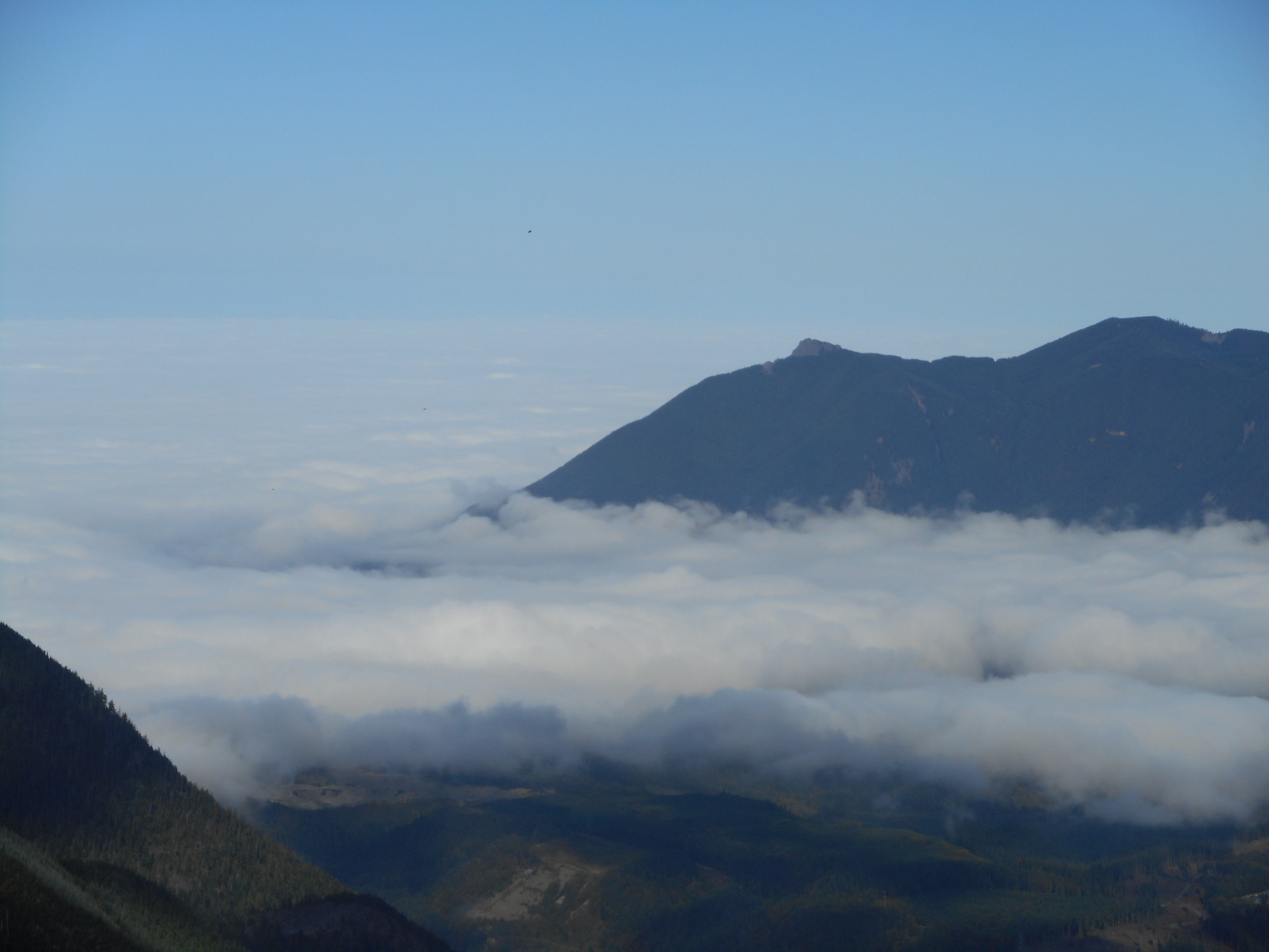
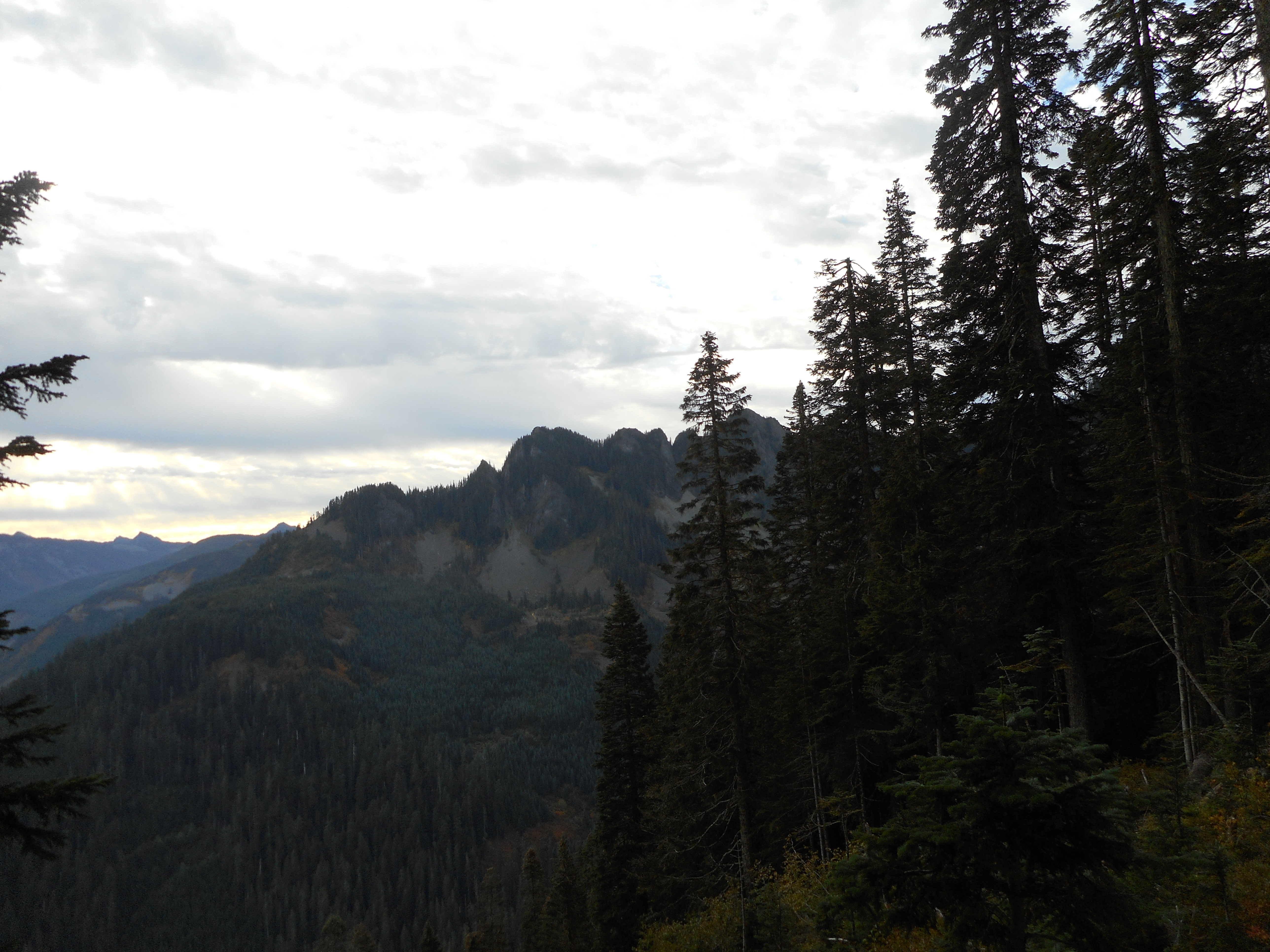
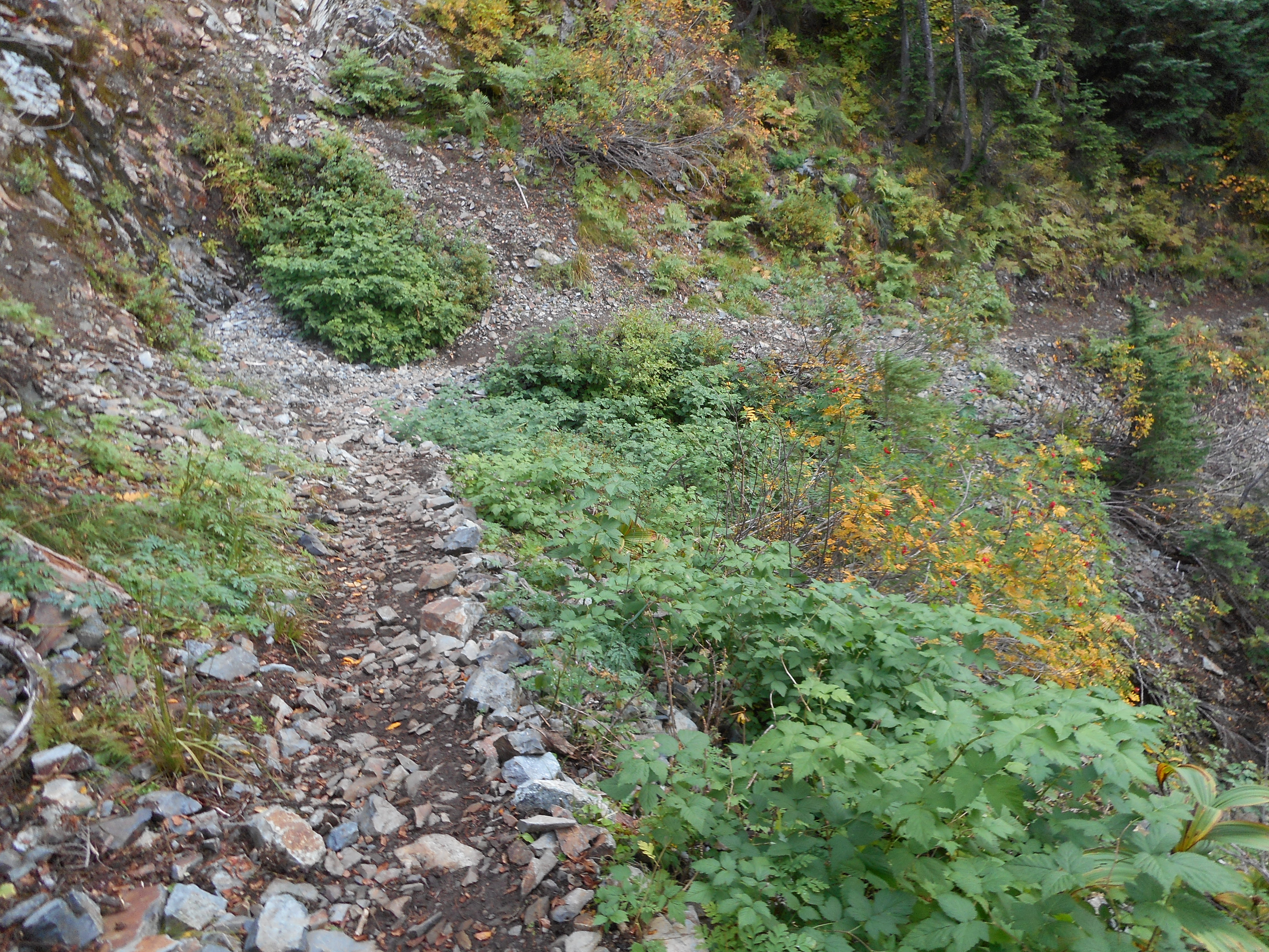
Nice sunny day up there with plenty of views:

Rainier
Rainier
Duke and Duchess of Kent
Looking west - about where we were last week
Looking west – about where we were last week
Mount Kent
Mount Kent

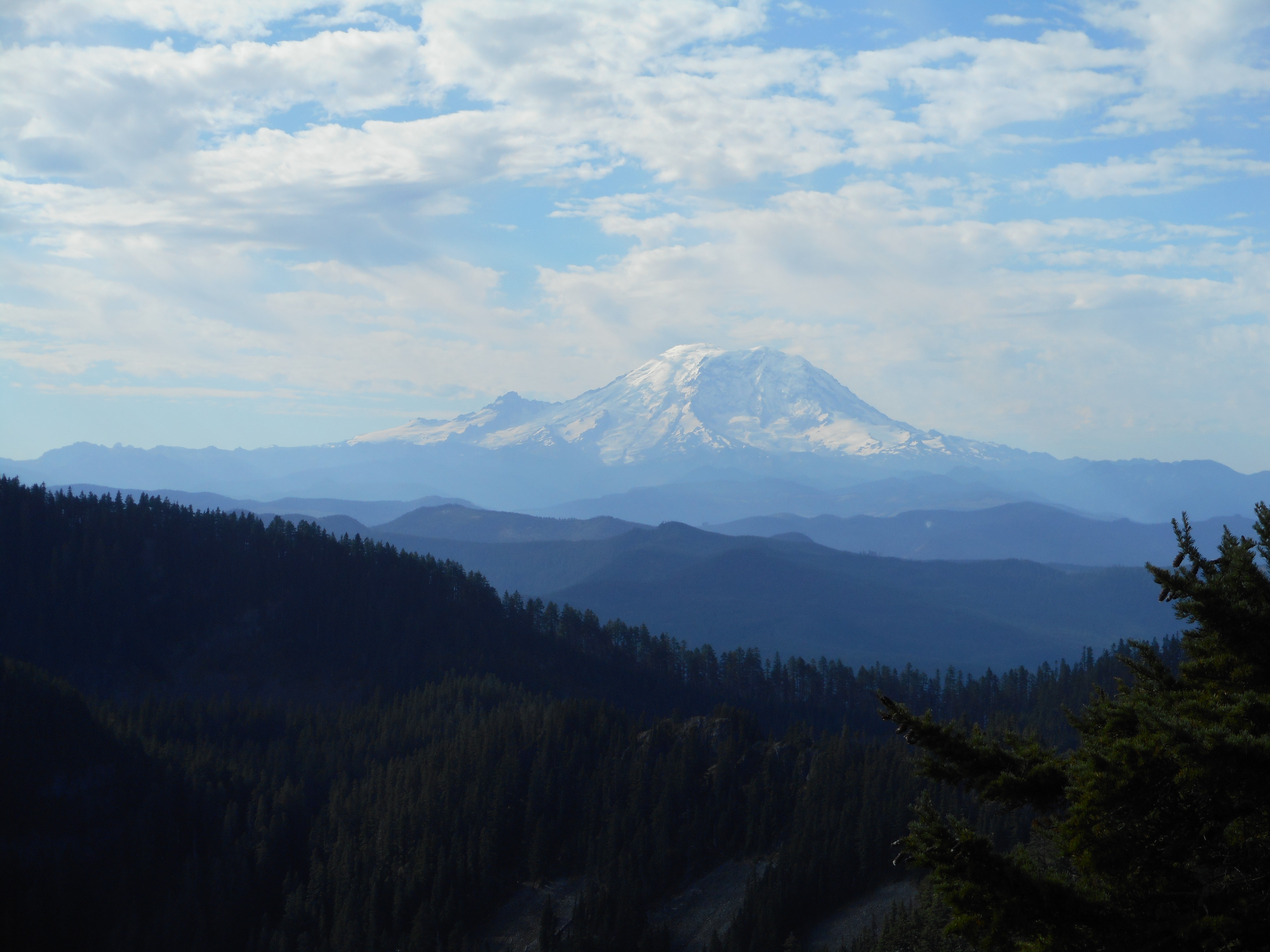
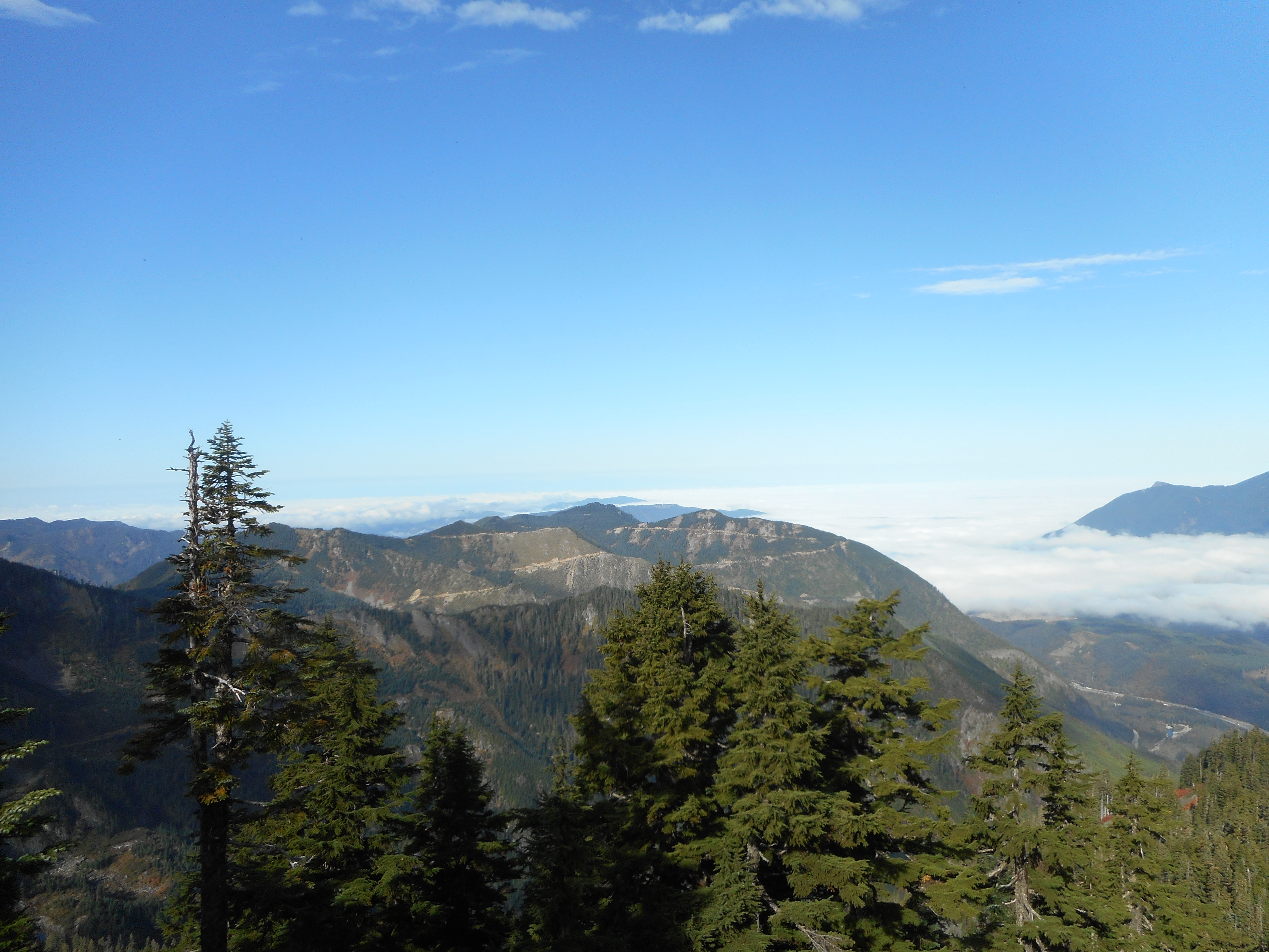
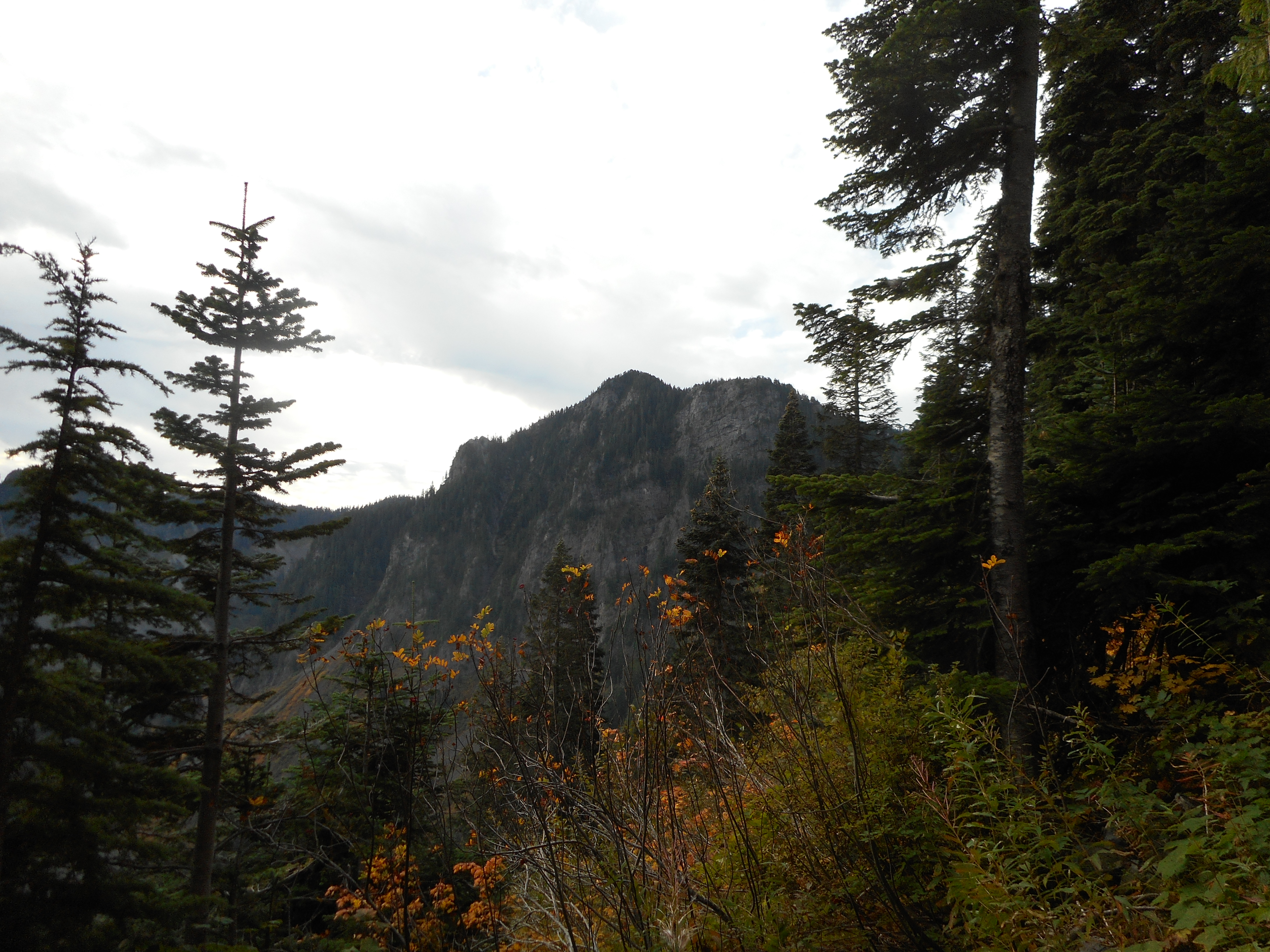
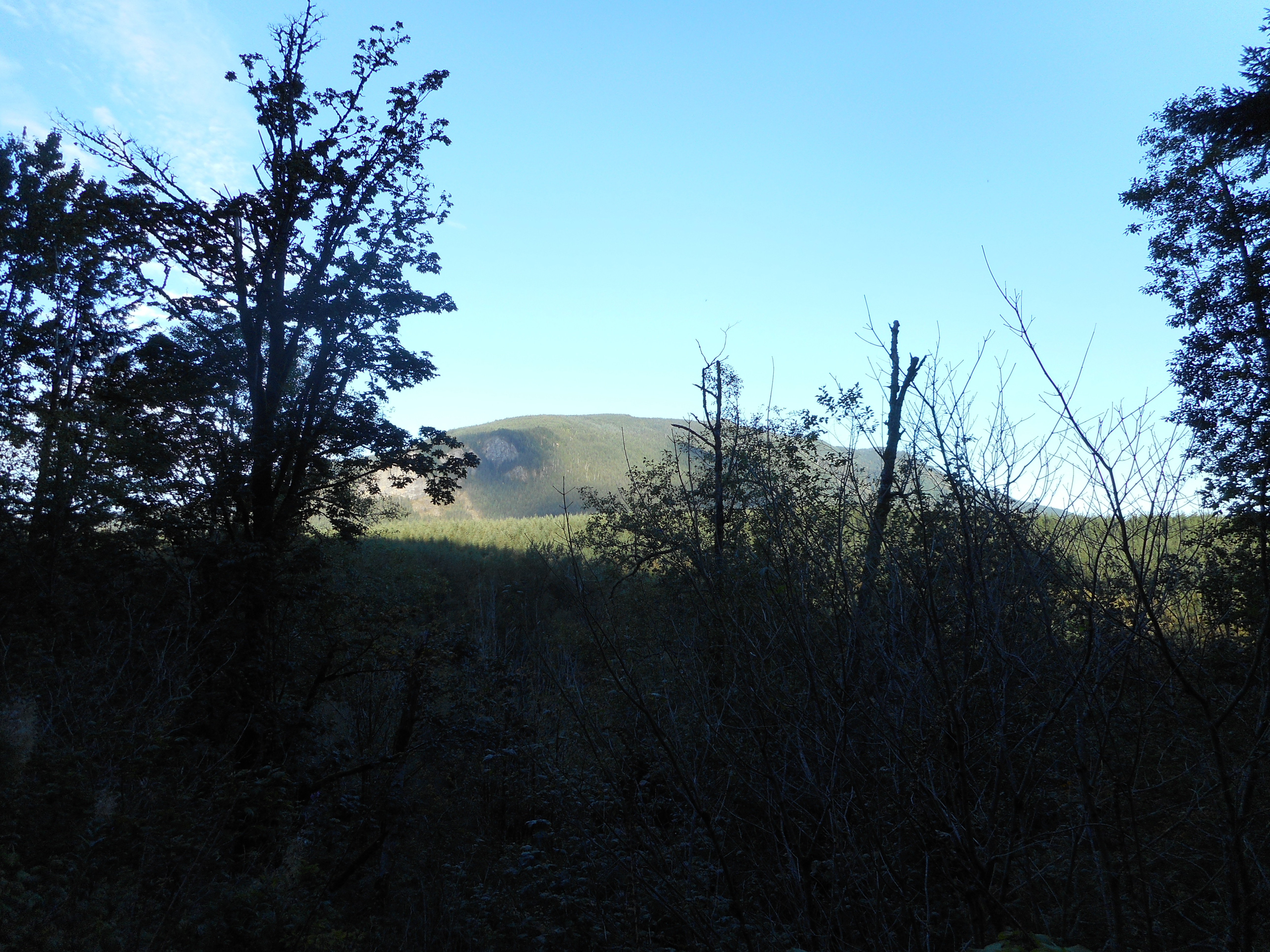
And, for Derek, there’s Mount Kent.  We are definitely going to hit that one when we can get it into our schedule.

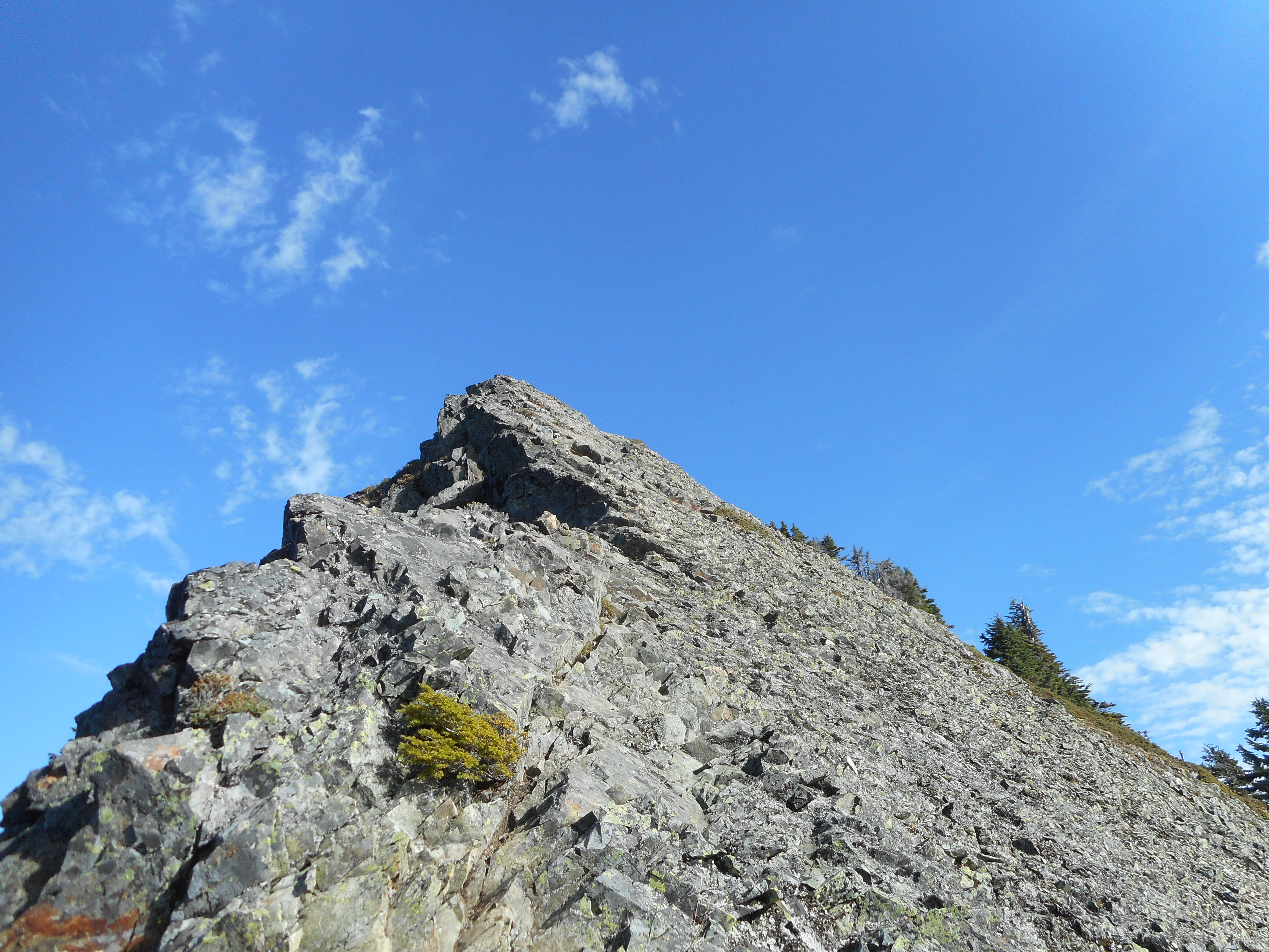
As always, I did not attempt the way-too-exposed climb up to the ultimate summit of McClellan Butte.  Getting to its base is enough of a goal for me.

The McClellan Butte scramble

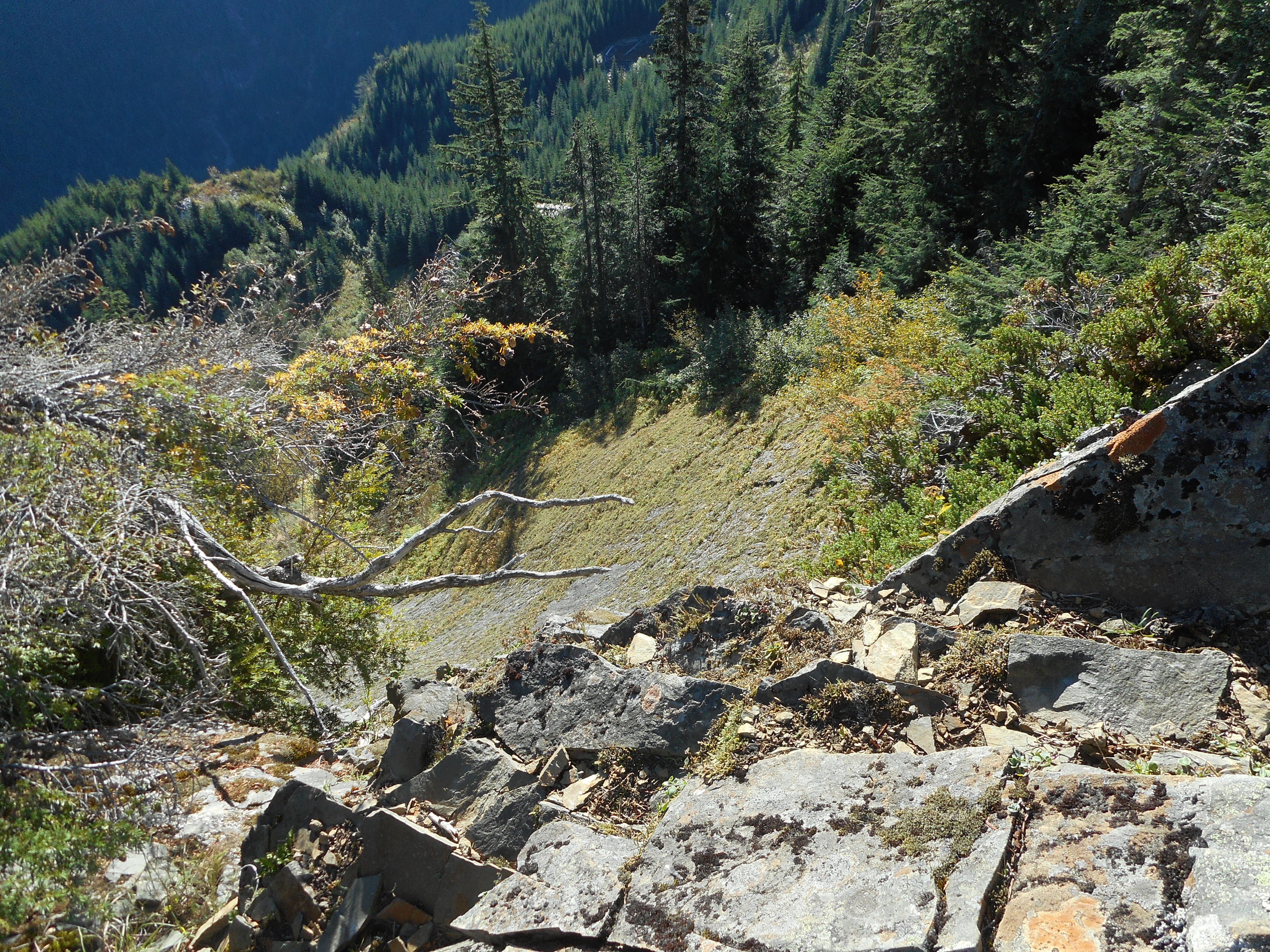
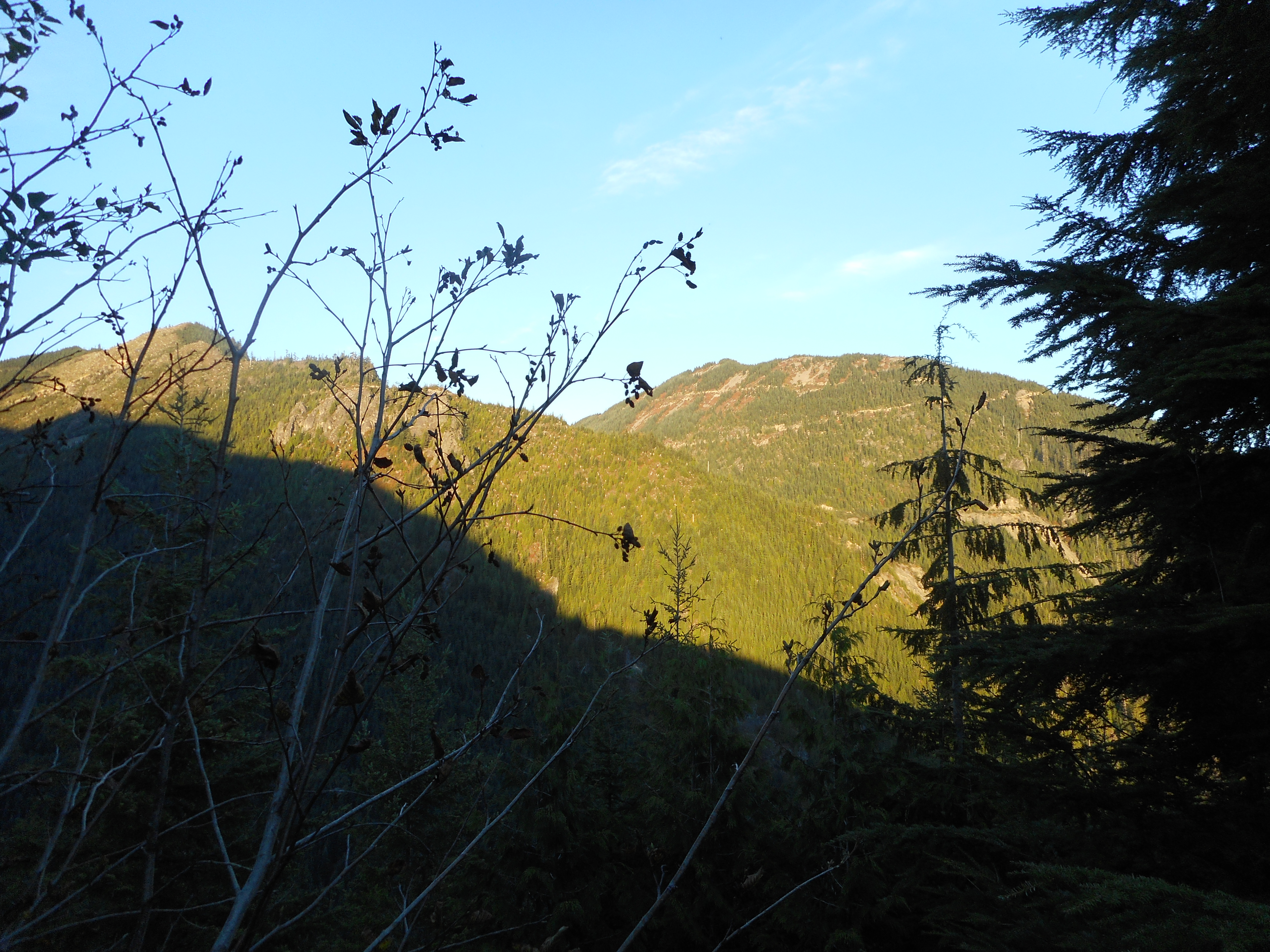
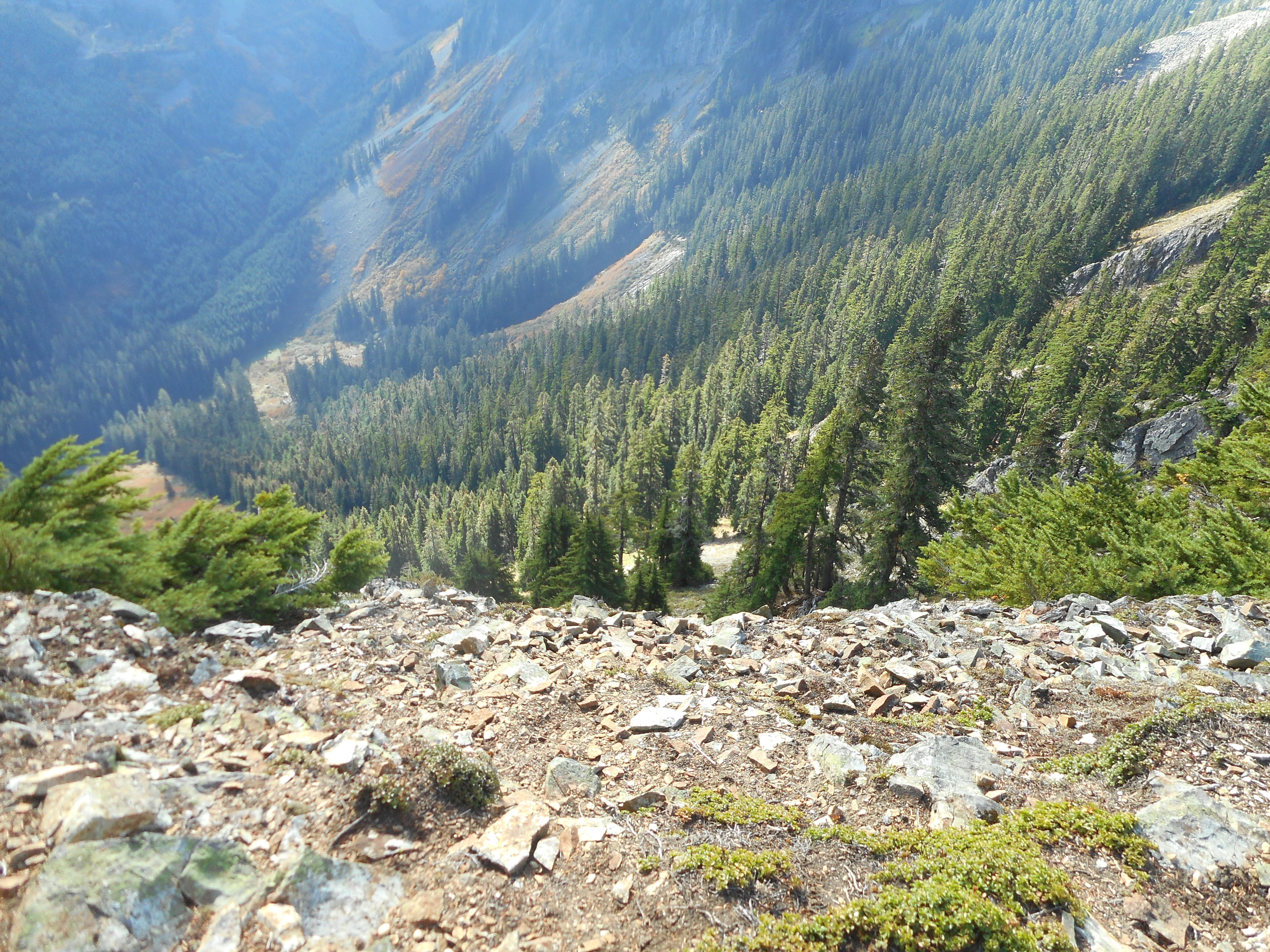
If you turn around after taking this photo and walk a few yards, you come to the  of edge of a sheer cliff.  But the photo does not show the reality, which is you are effectively standing on a ledge of a huge skyscraper:

Doesn't look as steep in a photo
Doesn’t look as steep in a photo

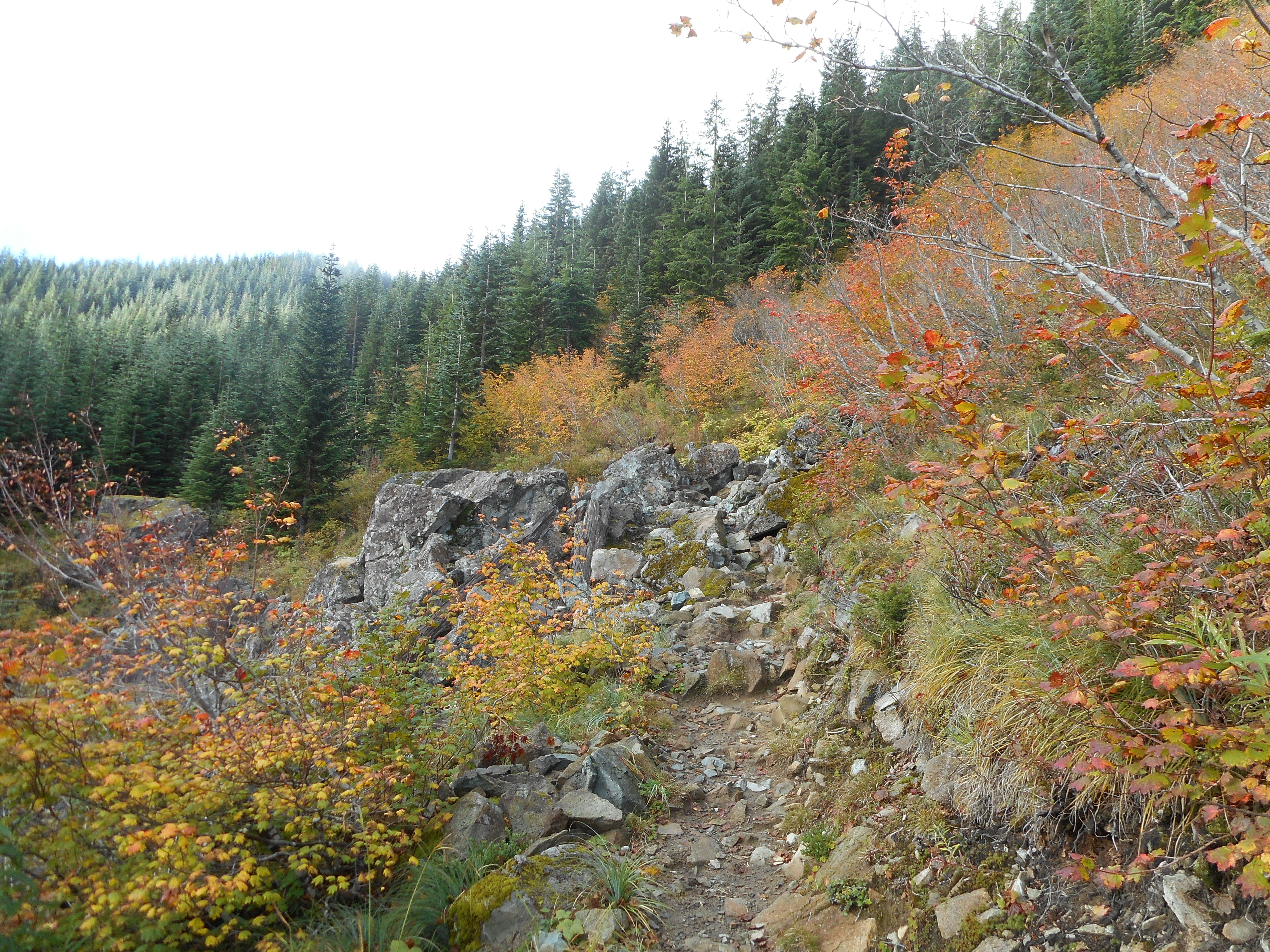
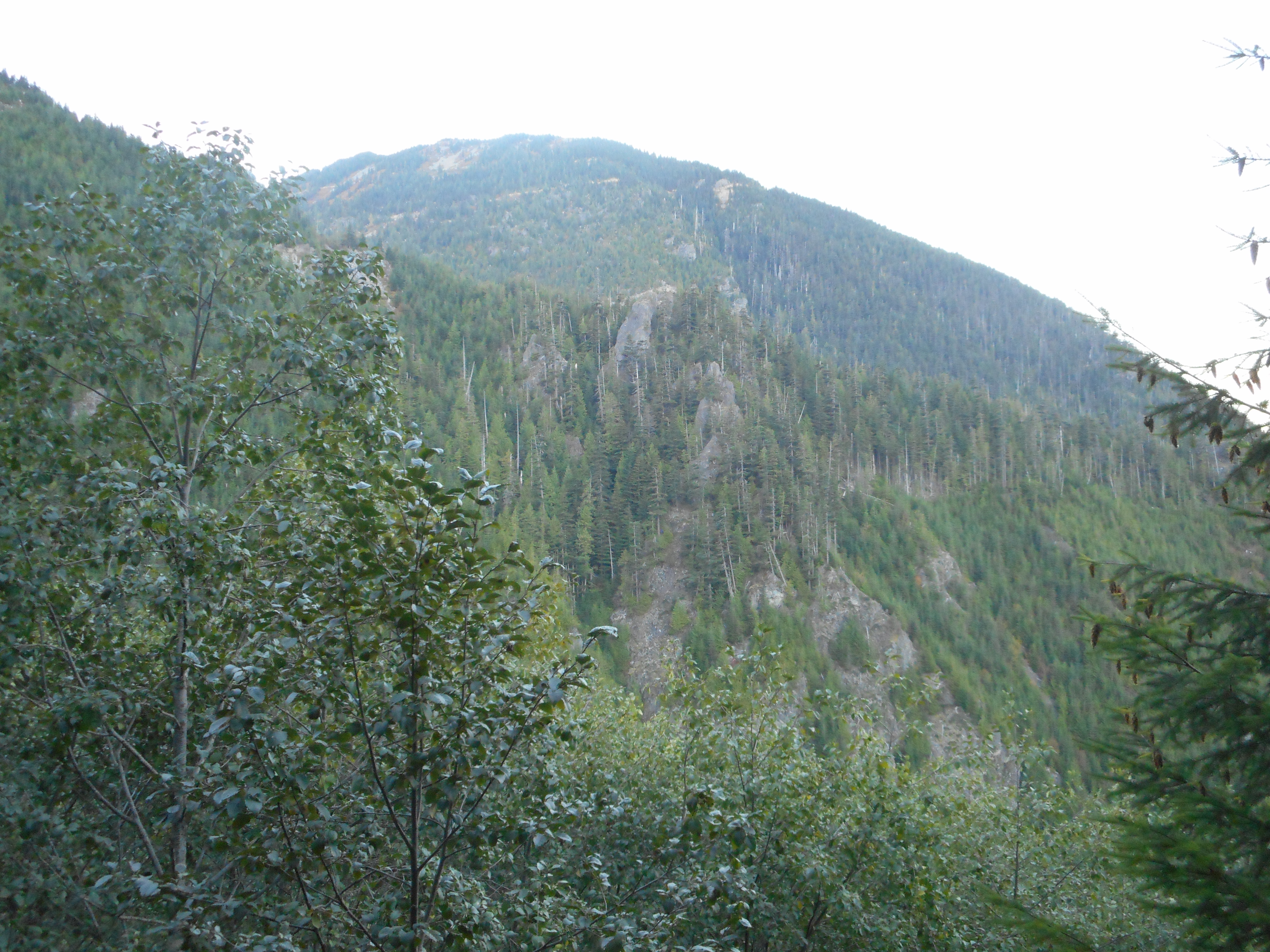
A feature in the area I have noticed but not snapped before is the road on the mountains just east of the Butte – this definitely looks like it can be accessed and hiked.  Another goal to accomplish!

There is a road to the east

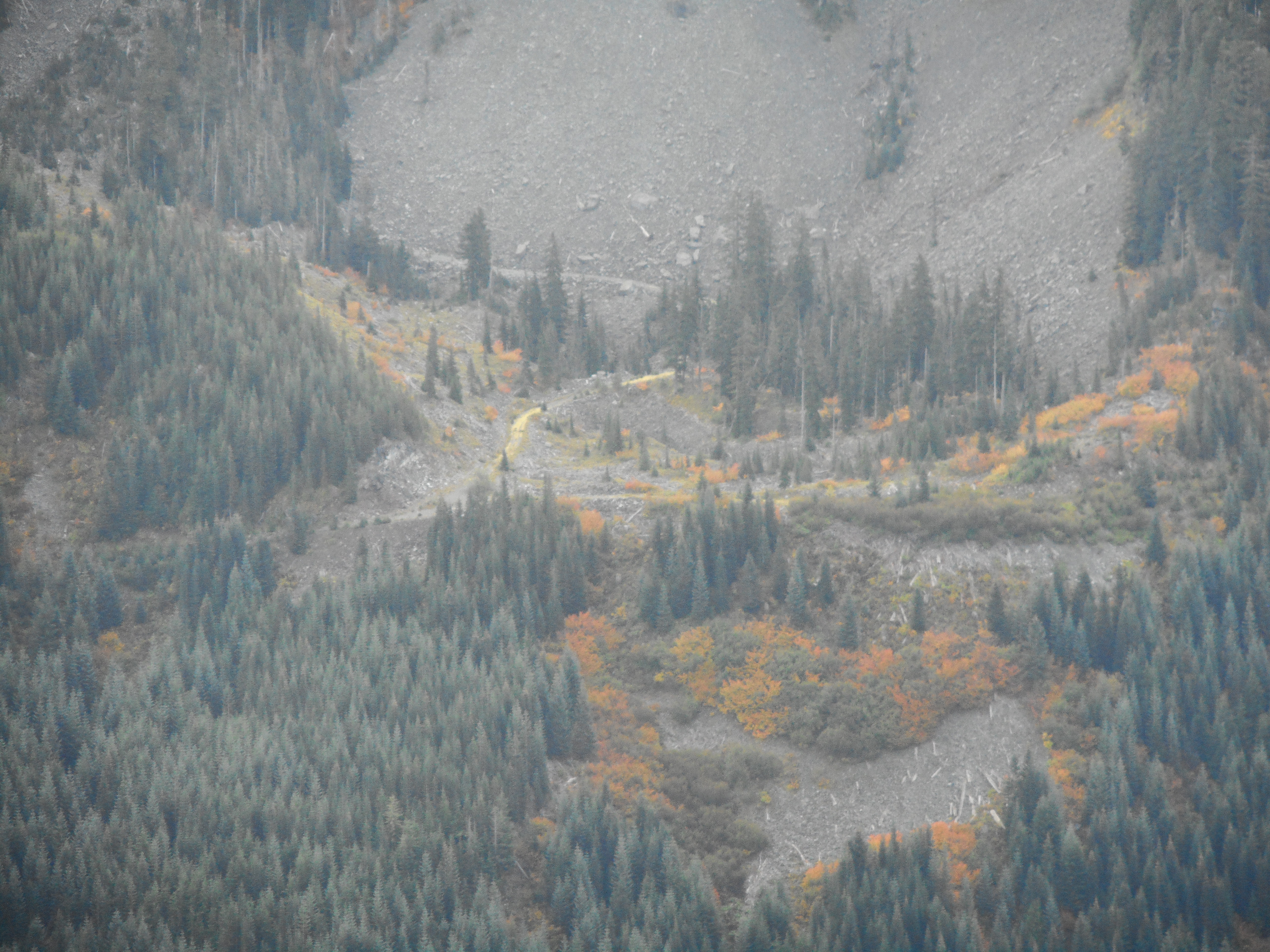
I also kind of chuckled when I came to the second (of six!) avalanche chutes on this mountain.  This is the one that caused us so much trouble when there was a deep cover of snow.  We had to drop down into a little canyon and climb up the other side.   Although the first time I crossed this in the deep snow, on the way down, I was with Mark Garrett and I chose the wrong route and almost wound up sliding off the mountain.

But with no snow it is a nothing-burger:

2nd avy chute is tame without any snow

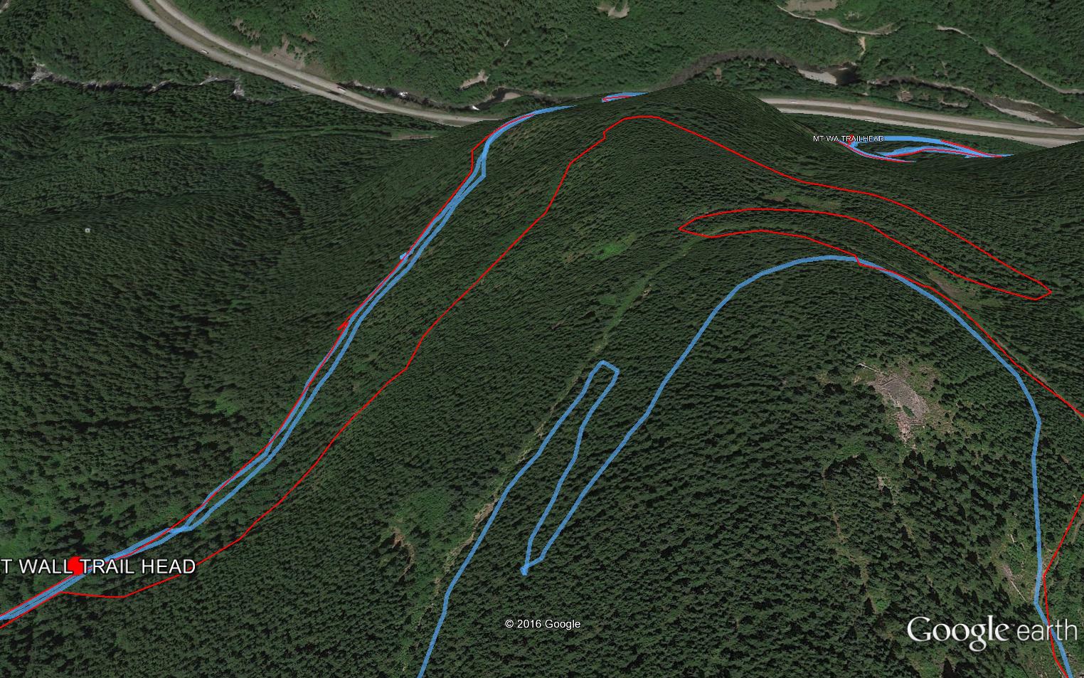
10.7 miles, 3,871 feet of elevation gain, six and a half hours.  Derek and I were going to start on NF9021 to save time, and we were going to start hiking about 5:30.  Well, based on my experience today, skipping the lower two sections (from parking lot to IHT, and IHT to the service road) would have saved us about 80 minutes, which is totally worthwhile.  Without the mountain goat delay, the hike I did today could be done in about five hours starting from the service road.

Piece of cake.

Here is a visualization of the hike:

http://adventures.garmin.com/en-US/by/djhiker/mcclellan-butte-and-salmon-lake-9-28-2016/#.V-xDj5WV8bw

Mt Washington/Great Wall 9/24/2016

Morning Mist
Morning Mist

Not many great views today, it was a bit misty/foggy.  But a great hike nevertheless.

I had planned to show up at the trail head about 6:30 but I had some chores and some Boeing work to do and did not head up the trail until 7:20.  But it worked out well as I met three intrepid hikers en route and we wound up going down together.

They had never done the Great Wall to the summit – there is a little trick someone showed me – so we met up at the summit and decided to go down the Great Wall together.

There is a section of the trail that is signed from the main trail and connects to the Great Wall proper.  This section ends abruptly thanks to the new trail construction, but you can bushwhack a few yards to intersect the new trail.

Coming down I was looking for where to bushwhack but the new trail construction has changed the view so much I didn’t find it so we wound up intersecting the main trail way up at the pond.  This added an additional half-mile to the trek.  No big deal, but I am going to go back and find the right way and hang flagging tape.

Below is a Google Earth view of our track today in this area (in blue) and the former track (in red).  You can see how close we were.  Frustrating:

Red is old track, nearest blue is new

There were some views today:

View through the trees

And, as always on this hike, there is the fun of navigating a big pile of rocks about 2/3 of the way up:

Mt. Washington rock pile

In the parking lot my Garmin said the hike was just less than 10 miles, but the downloaded stats give the distance at 10.3 miles and the elevation gain as 3,300 ft.  It took about 5 hours and was a great way to spend Saturday morning.

A link to the visualization:

http://adventures.garmin.com/en-US/by/djhiker/mt-washington-great-wall-9-24-2016/#.V-b3lZWV8bw


Bears! on Puget Power Trail 9/21/2016

This was a short conditioning hike using a workday-snatched couple of hours.

I only had one meeting today in Renton and it ended at 10.  I figured I could do a little Tiger Mountain hike starting at E Sunset Way trail head (it is off I-90/exit 18, so not far from the north/south freeway I take home).  I was planning to just edit my post from April or May that I have been using for these little hikes.  But events took an unexpected turn.

I took the steep little connector trail up to Puget Power, to Adventure Trail, to High School Trail, to Section Line, to Nook, etc. etc. back down to Puget Power.

I was walking west on Puget Power trail – a wide and busy trail, not very far from I-90 – and I was just coming to the end of a short section with overhanging trees when, just around a little curve, I thought I saw a really big dog with a couple of little pals.  They were looking at me intently.

So I stopped, figuring I would wait until the dogs’ owners came along.  But it quickly dawned on me that this was a mother bear and two cubs.  Whoa!

At that point my heart rate about doubled.  My instinct was to turn tail and run but there is no way to outrun a bear and why act like prey?

So I stood there silently.  We stared at each other for a few seconds and then I slowly started backing away.  She kept looking at me but did not follow.

I backtracked about 1/4 mile and briefly thought about going back the way I came.  But that would take a lot of time, and I thought maybe the bears had split, so I turned around and slowly – carefully – walked back.

No bears, I am happy to say, but after I passed the point where I had encountered them I confess I set a record pace back to the car.

Just goes to show how ignorant I am of bear behavior.  In a hundred years I would never have guessed that bears would be hanging out in such a busy place.  But winter is coming, the bears are fattening up, and there must have been some berries (and/or senior citizen hikers) around.

Bottom line, I need to be totally vigilant not just some of the time, but everywhere I hike, all the time.

Adventures in Forest Ecology 9/17/2016

In the old growth stand

I took this excellent Cedar River Watershed Education Center (CRWEC) tour last year and I am going to take it again next year.  And just like last year we visited the oldest stand of trees in the area, 700 year-old giants.  It is a signal joy to be able to have that experience.

And we got to do some bushwhacking along the way.  It was raining pretty hard most of the day (the tour was seven hours, 9A to 4P) and the forest creeks were running a little high.  We had fun crossing the creek in the old growth stand:

We got our feet a little wet

The rain did not dampen anyone’s spirits that I could see.  Almost everyone who was registered showed up and I heard zero complaints in spite of the inclement conditions.  We all dressed for the weather.

Sometimes it rains around here....
Sometimes it rains around here….

Our guides, Rolf Gersonde and Bill Richards, who are both scientists and passionately devoted to the watershed and their restoration mission, made the day both fun and educational.

Bill Richards
Bill Richards
Rolf Gersonde
Rolf Gersonde

Towards the end we had a fascinating discussion about what we all saw for the future of watershed restoration.  Climate change is already a reality.  The watershed is already changing.  More and more trees are unhealthy because of drought – not so bad this year but what if we have trouble every other year?

Should we start introducing species that we think would thrive in the climate of the future, say fifty years out?  Should we even try?

The CRWEC staff and facilities are, if not exactly hidden around here, not nearly as prominent as they should be.  I hope everyone who lives around here, and our visitors from the east, take the time to travel a few miles east on I-90 and check out the CRWEC and its beautiful environs (like Rattlesnake Lake and mountain).

Truck Summit and a little beyond w/Derek 11/15/2016

The Truck!
The Truck!

We hit the trail at about 6:05 am – Derek has to get back in time to not be rushed getting ready for work – and our plan was to go up the Zig Zag Trail to Truck Summit and go down via NF9021 to Garcia and then west on Iron Horse Trail.

But we did something more fun.

Derek discovered a bushwhacking opportunity traveling south from truck summit along a narrow (reminiscent of Low Mountain) ridge.  We were following some kind of trail but looking at the GPS on the map we were a bit east of the former logging road.  I think we were following a mountain goat and coyote trail, given how much of their scat, and fur, we found along the way.  In either case we definitely want to go back and explore it more thoroughly.

Here is what the “trail” looks like:

Mountain Goat trail
Mountain Goat trail

There are quite a few very interesting little spots that let you look straight down the side of a cliff:

Looking down from the spine of the ridge

We went a little ways (see visualization below) and turned around.  There are plenty of nice views along the trail to Truck Summit – the trail is actually a former logging road (presumably, how the truck got there in the first place) and is very easy to deal with:

Typical Truck Summit trail view

This part of the trail is like the Great Wall trail, except you are looking west (at the Great Wall Trail) instead of east:

Looking west
Looking west
West, from a little farther south

On the way up Zig Zag we looked west towards where we were to see the Perseids in August:

Looking at our meteor viewing platform

6.5 miles, 3K elevation, 5 hours, Derek was home by 11:30. Sweet!

Visualization right here; note how we were slightly east of the former logging road.  Interesting.

http://adventures.garmin.com/en-US/by/djhiker/truck-summit-via-zig-zag-with-derek-9-15-2016/#.V9sCJJWV8bw


Random Wanderings 9/10/2016

Drat!
Drat!

My plan today was to check out the not-quite-opened Olallie Trail to see if they had extended it any farther east than when I checked it out this spring.

Well, they have extended the no-go zone at least.  This sign was posted right at the point where you hit the trail.

I went west to see how they were doing in that direction and they had a sign back there as well.

I wasn’t in the mood to hang out with a mother bear and her cubs (Cedar Butte trip report from a couple of weeks ago) so I just wandered back via the Christmas Lake trail:

Christmas Lake
Christmas Lake

I hate to use such a cliche but I don’t know how to describe walking through the woods on a sunny day other than to say I love the sun-dappled look:

Woods and sun
Woods and sun

Nice view of Rattlesnake Mountain as well:

Rattlesnake Mountain

I did detour around Rattlesnake Lake as far as I could.  The water is low and I was able to almost circumnavigate the lake but I was finally stymied and had to turn around.

This hike (if it shouldn’t be called just a walk) was only about 7.5 miles and 1K feet elevation.  Better than sitting on the couch but not exactly a vigorous workout.

I will keep trying to get some little Tiger Mountain weekday hikes into my schedule for conditioning.

Poo Poo Point 9/5/2016

Poo Poo Point is on Tiger Mountain and is a well-known spot for hang gliders to launch and land.  I didn’t even bring my camera because the only photo-worthy place is Poo Poo itself and it was foggy today anyway.

I chose this relatively moderate hike because I hadn’t hiked in several weeks and I had lost some conditioning.  I am an old man and that’s just the way it is.  I have to work harder just to stay in place.

Here is a visualization of the hike:

http://adventures.garmin.com/en-US/by/djhiker/poo-poo-point/#.V83h2JXluTM

4 hours, 8 miles, about 2400 feet of elevation gain so not completely easy but, let’s face it,  no big deal.  But it was a decent workout and I had fun on a Labor Day so I can’t complain.

We had a little visitor Saturday night, our grandson Camden (15 months old) stayed with us and it was totally fun.  We love both of our grandkids and Camden is getting bigger by the week.

I figure in a few years I will be hiking Poo Poo with him.

Update 9/6/2016:

A hug from Camden
A hug from Camden

Beauty and the beast for sure.  I put this here so I could see it from anywhere.  Saturday Camden (15 months old) stayed with us.  Granny and I were sitting on the couch and Camden was standing on my legs while I held onto his hands.

He decided he wanted a hug instead and Granny snapped the picture.