As of today we were able to download all of our Garmin gps data to my laptop and I am learning how to work with the data.
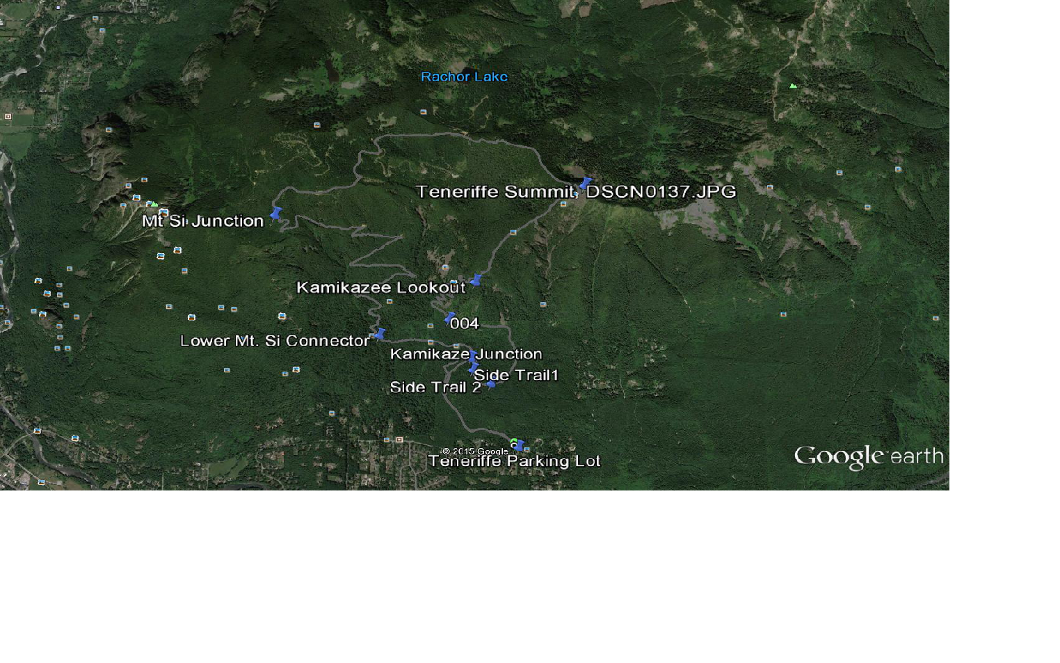
This will help us put our hikes into context for our future reference. Above is Google Earth with our route overlaid on the map, and our real-time labels for various points along the hike.
What distinguishes this hike for us is the extreme steepness of the section we call the Kamikaze Trail. We think this trail actually starts earlier than our own start, which is labeled Kamikaze Lookout on the map on top, but that’s OK.
The point is that the Kamikaze Trail, as mapped by us yesterday, is only the section from Kamikaze Lookout to Teneriffe Summit. Here is a close-up of that route:
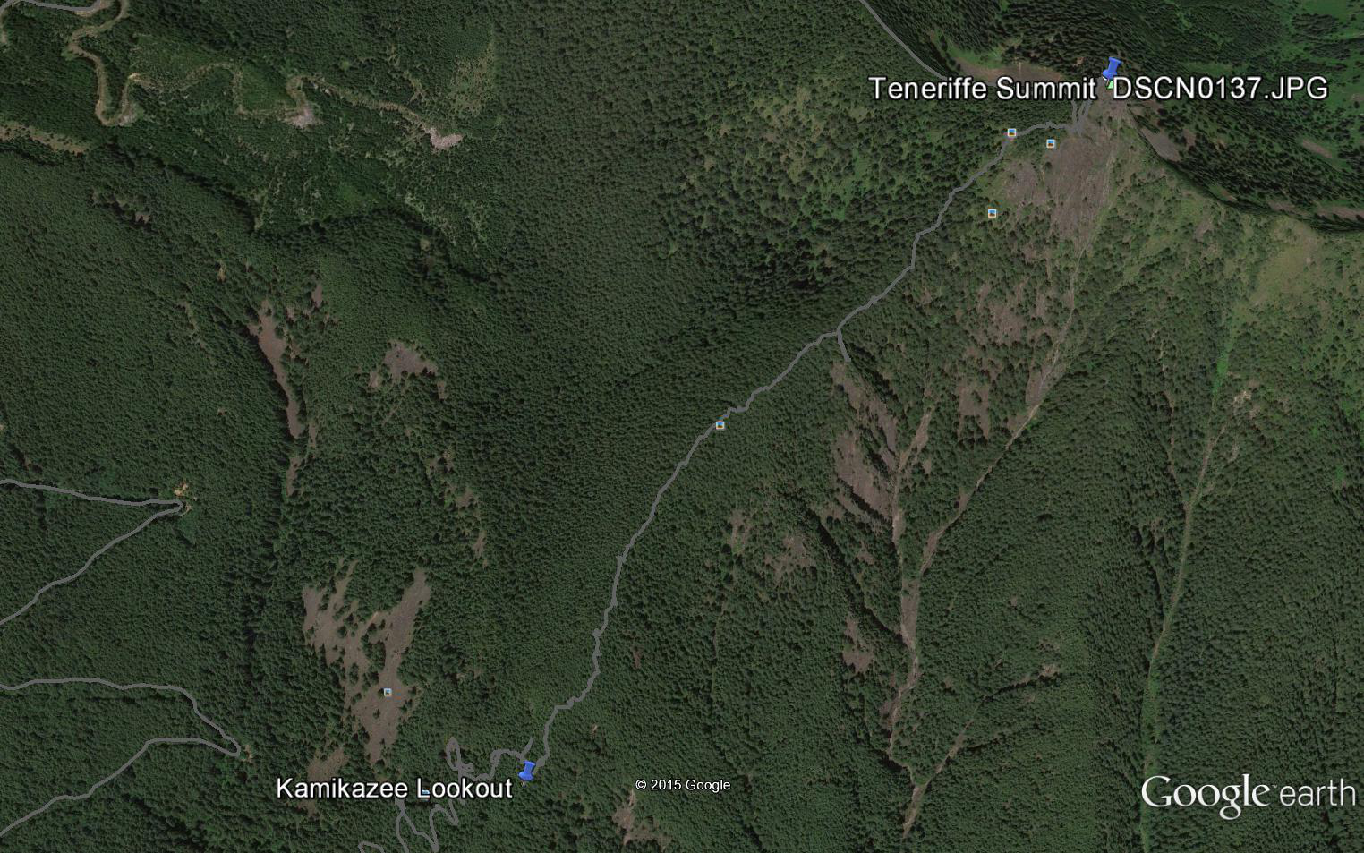
You can sort of tell from the photo, but compare the relative straight line to the summit on this route vs. the much longer official trail and note that the Kamikaze Trail is essentially a trail along one of the mountain’s spines. The official trail is the grey line that represents our route down, it goes west (to the left) from the summit.
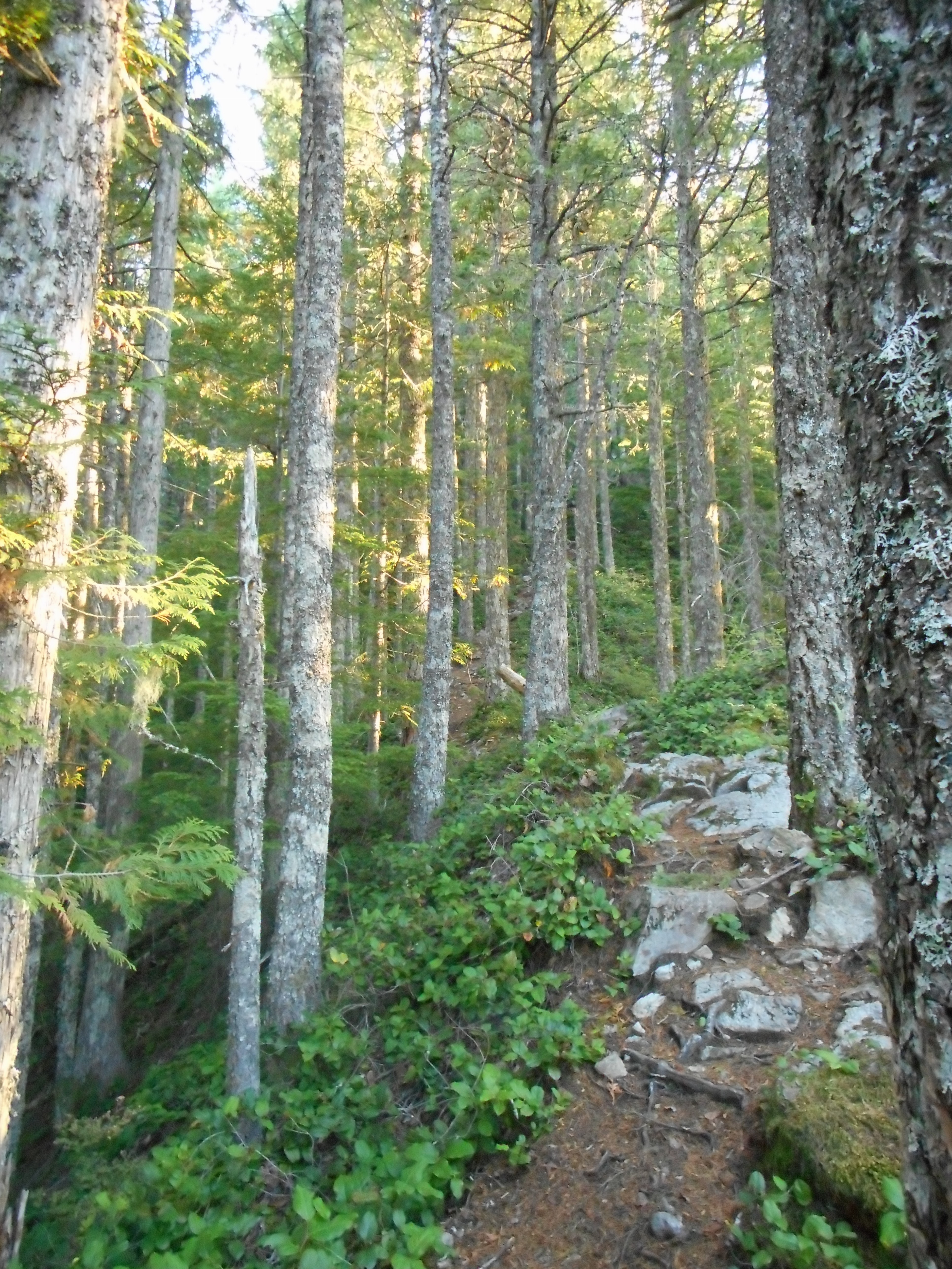
Derek and I stopped quite a few times on the Kamikaze trail because our legs – particularly mine, the old man – were burning up from the steepness. But at one point it was level enough to catch our breath and Derek documented what this spiny trail looks like when you are on it:
Now that we know how to download the data from the device to the laptop we are all set to be able to create the detailed maps we have been working on. We have done so many hikes in the vicinity of Mt. Washington, Change Peak, the Great Wall that we are going to focus some energy on getting that all organized.
Already we noticed that our eternal question at one point on the Great Wall – where does ‘left’ go at this junction? – is answered via Google Earth. And the answer is: a long way down a tangled network of logging roads.
Cool! We will be exploring and mapping those and sooner or later we will have the most detailed hiking maps of the mountains around here that you have ever seen. But you won’t see the complete versions as we plan to keep some of our discoveries private.