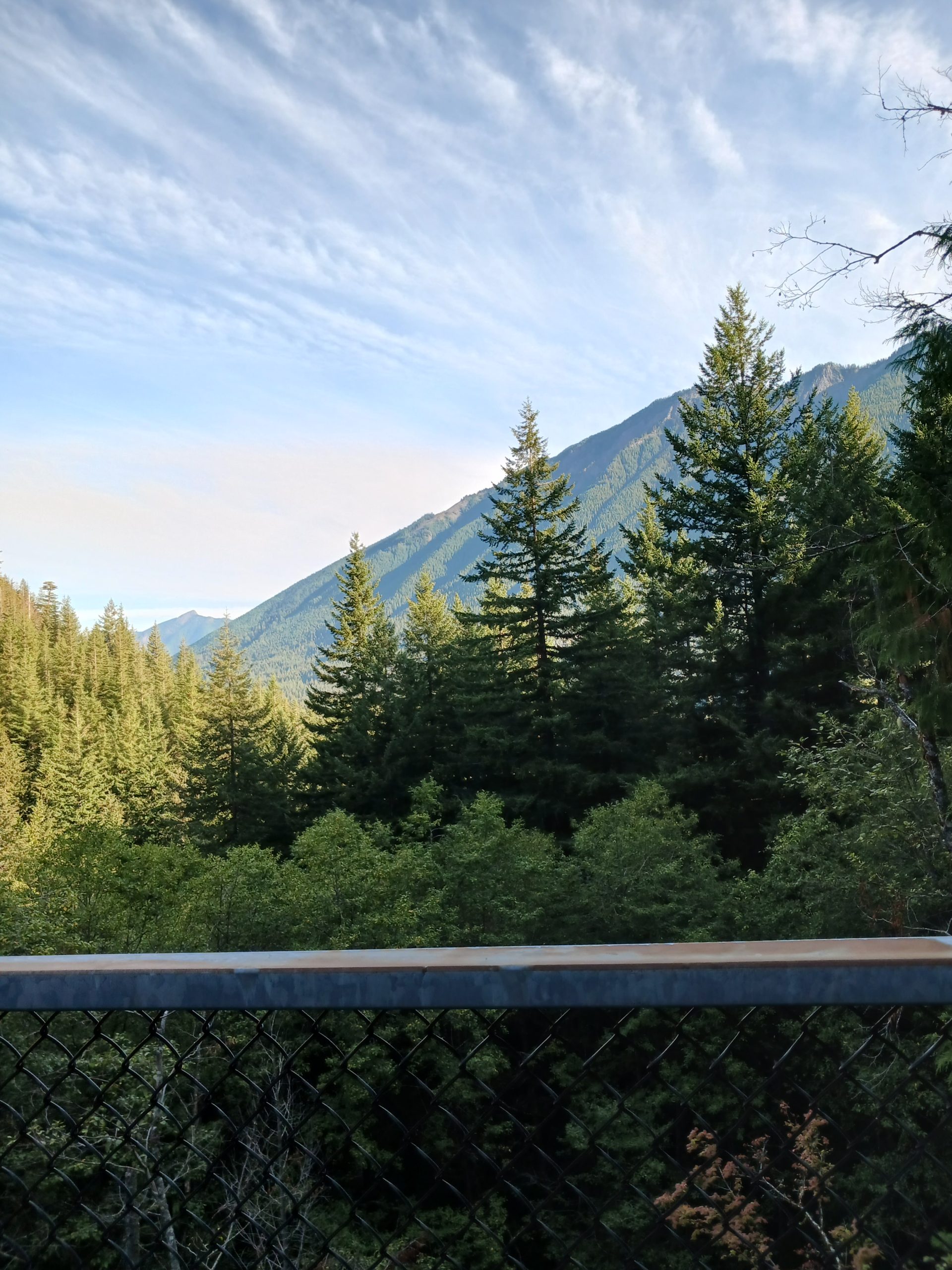
Sares Head Trail 9/9/2023

Looking North

Last Sunday I did a WTA Trail Ambassador tabling event at the Evergreen State Fair in Monroe, WA. My table partner was Richard Mellon. Richard is a great guy. He lives north and west of us in Anacortes, WA. Anacortes is in the NW corner of the state, on the water, served by various ferries.

Richard’s descriptions of the town and a park near the town called Sharpe Park caught my interest and today Jan and I headed there to check it out. We loved it.

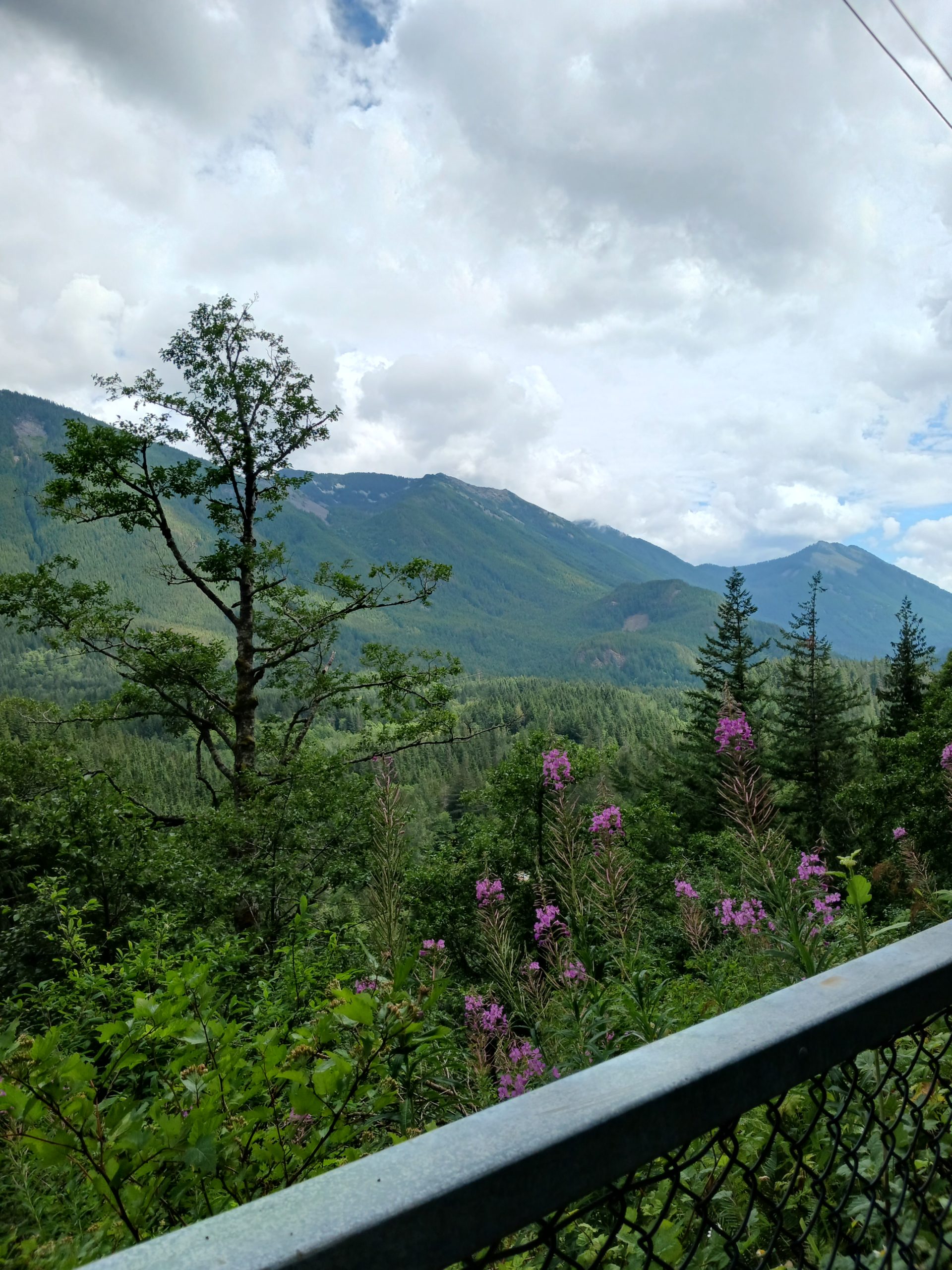
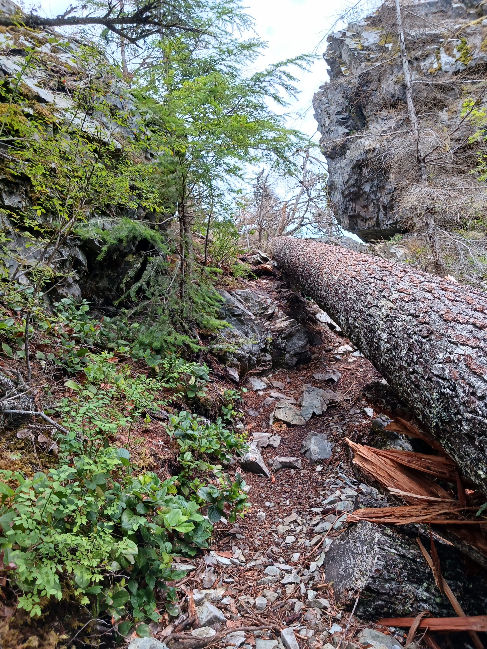
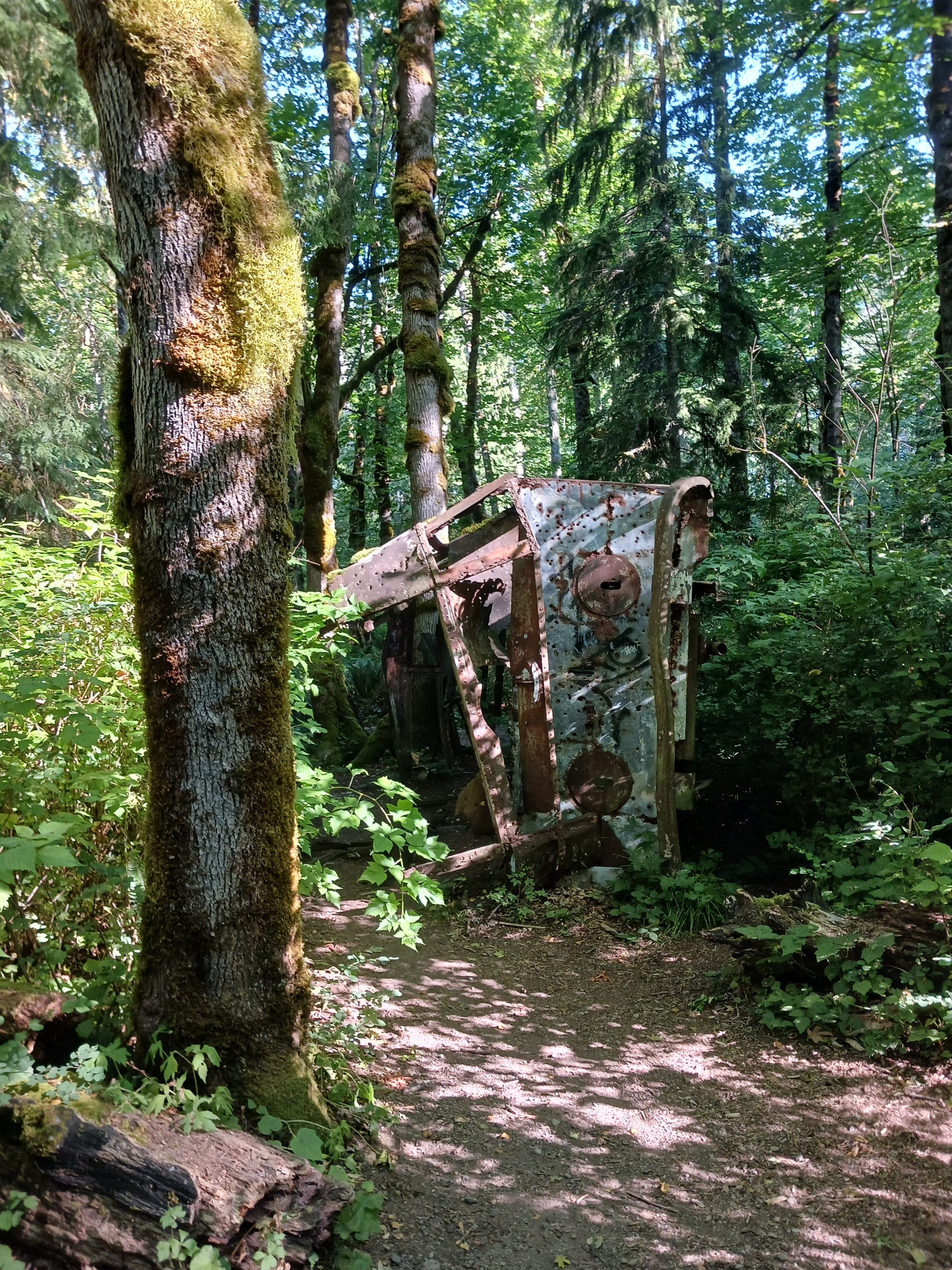
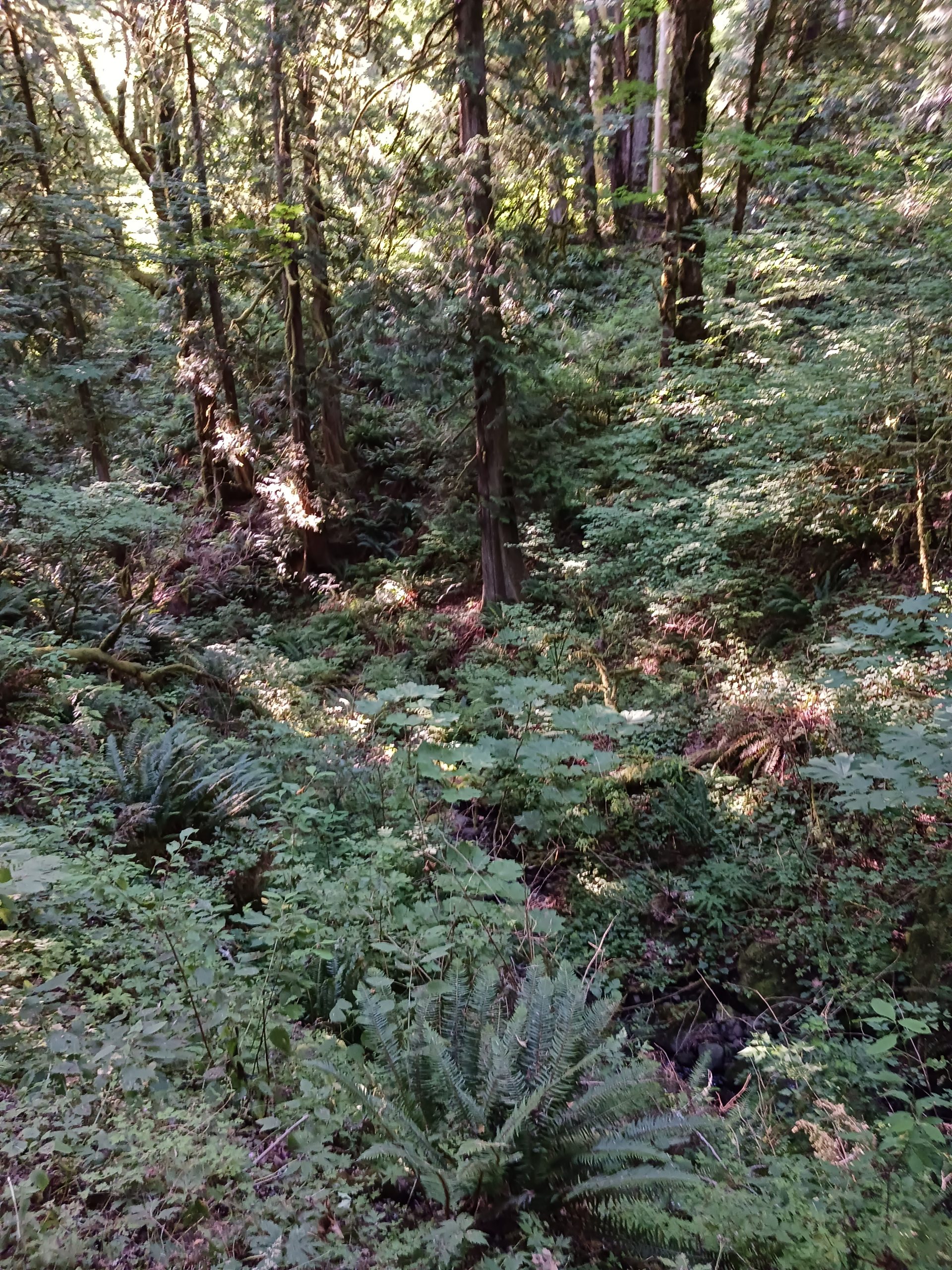
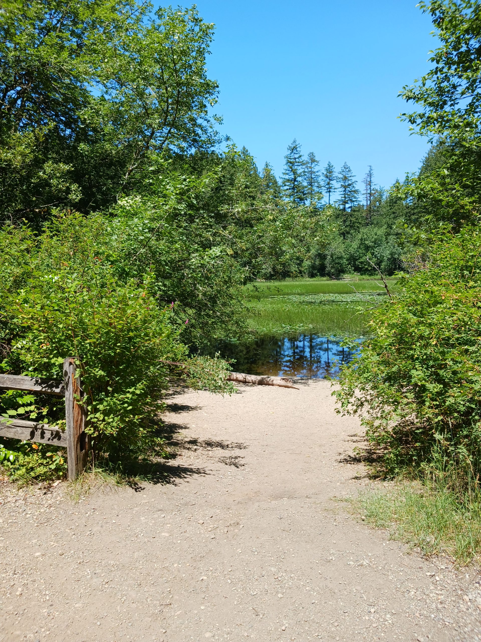
Sharpe Park has a nice network of trails. I am sure you could stitch together a longish route but Jan is not a big hiker so we just took the Sares Head Trail to the Overlook, about 1.8 miles round-trip. The trail goes through very beautiful second growth forest with quite a number of sights along the way – a pond, huge boulders, etc.

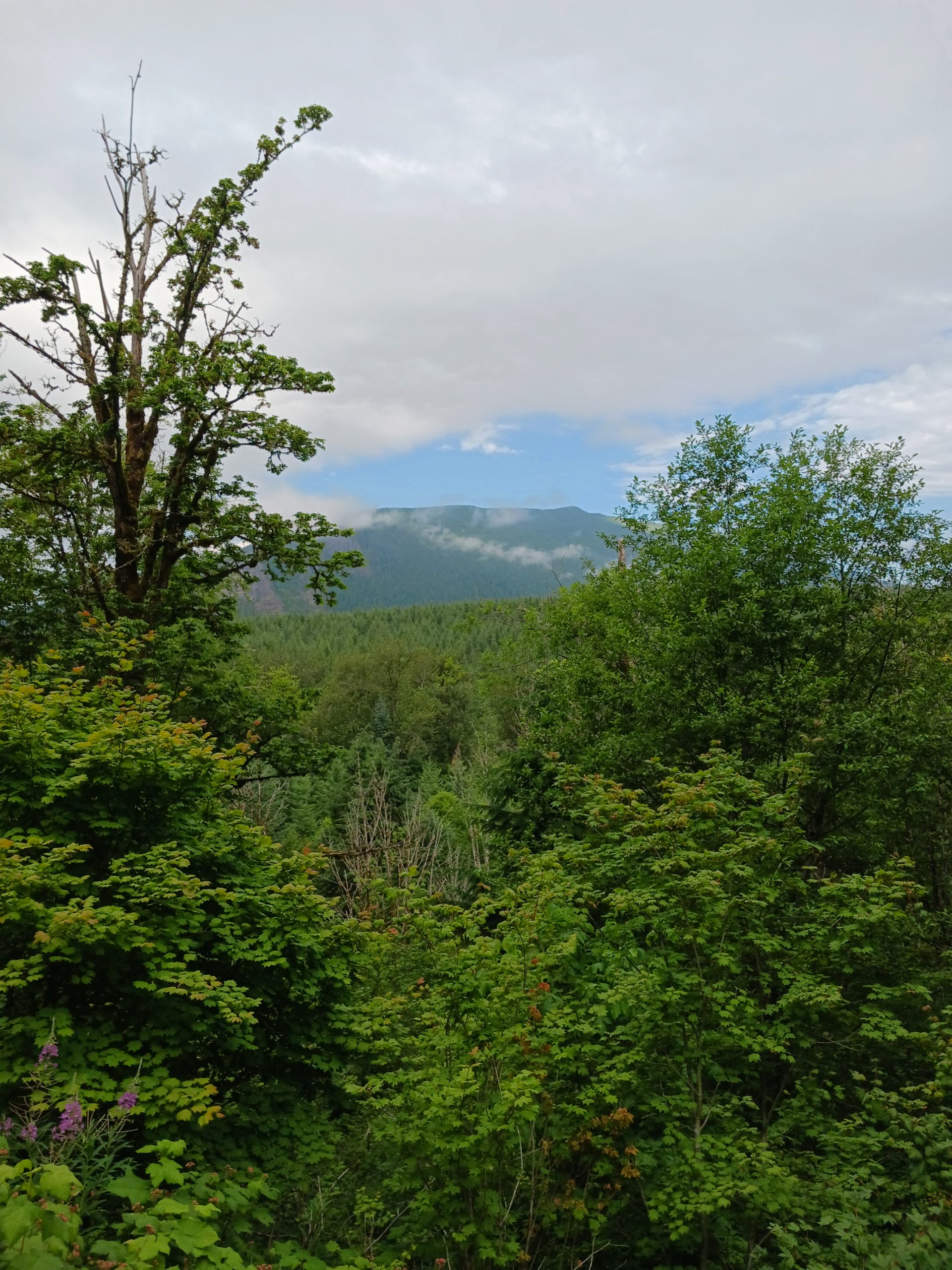
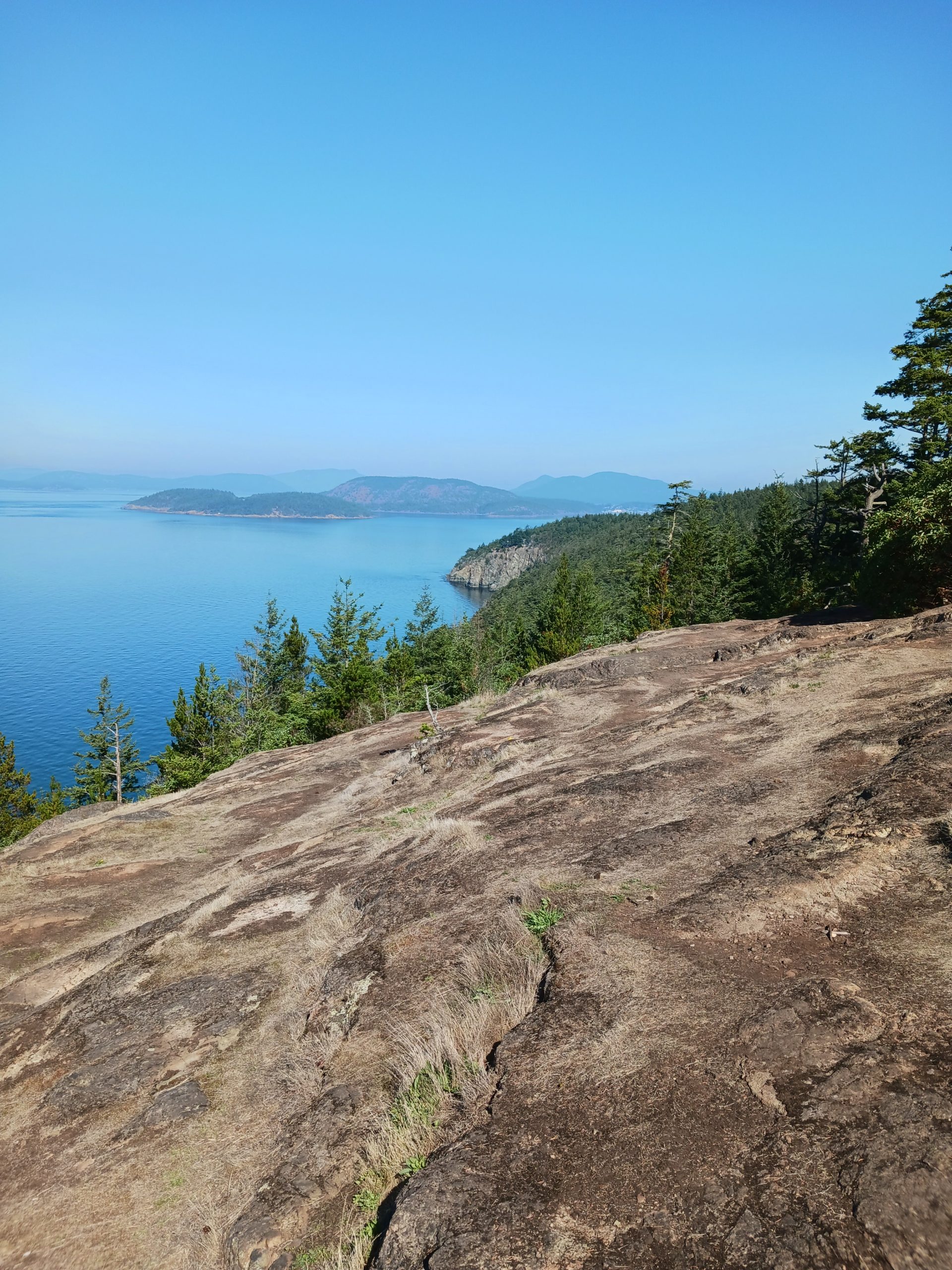
The view from the overlook is spectacular, if you like views from high cliffs overlooking islands and a large body of water. It didn’t hurt that the weather today was perfect, about 75 degrees and quite sunny.

The city of Anacortes is much bigger than we thought it would be. We walked around, had lunch, browsed in some shops. There is a Saturday Farmer’s Market but it closes at two, and that’s about the time we finished lunch. We will be back and will make sure we have more time to explore this great waterfront city.

Here is the view looking south:
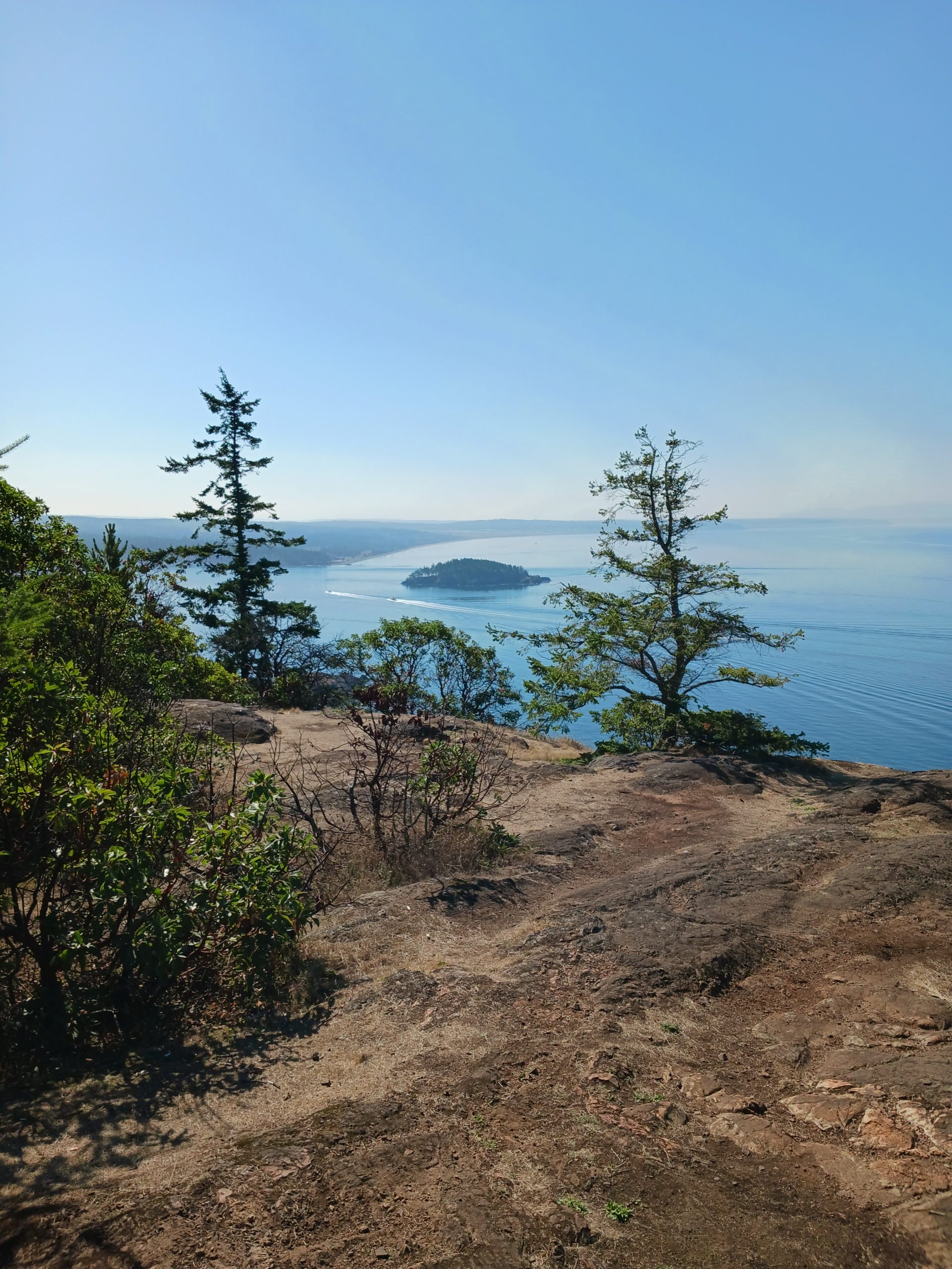
South

Tolt Pipeline Trail 9/6/2023

Heart Attack Hill

I hiked today on the Tolt Pipeline Trail. I have done this one a number of times but I stopped last year because of heavy road construction nearby that made access annoying. I tried again today and the road was all clear.

This is a nice one. From a workout standpoint, it is a bit more vigorous than my standard Section Line hike. On that one, when I count right foot steps (about 1,200 to a mile for me) there are 1,450 uphill steps. I counted today on the Pipeline Trail and there were a total of 1,750. The Pipeline Trail is very different in a lot of ways, and with respect to the uphill this trail is very hilly, lots of ups and downs. The downs on the way out are ups on the way back and so on.

As much as I love the mountains, every time I put gas in the car I am unhappy about ten gallons costing about 50 bucks. So I keep hiking locally. Perhaps tomorrow I will get out to a mountain.

The Pipeline Trail – at least, the portion I hike – goes through a horsey neighborhood of quite prosperous looking houses with plenty of horses:

Mister Ed?

One house has bee hives in the backyard:

Bee-Loud Glade

Anyway, it was about 7 miles and a good workout on a beautiful almost-fall day.

Mine Creek Trestle 9/2/2023

Looking North

I finally got out to the mountains. I parked along the side of Homestead Valley Road and hiked up the service road to an unofficial trail that took me up to the PTC. From there I went to the Mine Creek Trestle, turned around and went back to the car via the service road.

A bit less than 4 miles, not all that strenuous but it is a start. I absolutely have to get back to doing difficult hikes and today was a decent starting point.

Here is the view, looking west at Change Peak, from the Garcia/PTC intersection:

Change Peak

Track

PTC Bike Ride 8/11/2023

Rattlesnake Mountain

I have been hiking locally at places like Norway Hill and St. Edward State Park and not blogging about it. But today I took the bike out to the Palouse-to-Cascades Trail for a bike ride. I went east (slightly uphill) and then back west a total of about 8.5 miles. It was fun and longer than my last ride.

Here is a photo of where I turned around:

Turnaround Point

And here is the track:

Track

Change Creek Trail 7/25/2023

Looking North

I got a decent hike in today but it was a strange day for traveling.

My plan was to drive to Carnation and explore the Tolt-McDonald Park. Jan and I were there once, and I was there alone one time, but there are a lot of trails, including some steep ones, and I wanted to check it out in more detail. En route to Carnation, via the Woodinville-Duvall Road, I encountered a totally closed down stretch of the road.

I backtracked and took what I thought would be a decent detour. Alas, this road was also blocked a few miles down. I went farther north, to Avondale, and took that to SR202 and took that to Fall City, and then headed toward the freeway. I stopped for coffee at the coffee shop just off Exit 22 and the barista asked me if I was going west and, if so, good luck, construction. Freeway backed up for miles.

I decided to head east, to Exit 38, to check out the route from the Homestead Valley Parking lot to Deception Crags, a popular rock climbing area with a Porto-San and a picnic table, where I am planning to travel with Jan at midnight on 8/13 to view the Perseids meteor shower.

I went past the picnic table to the Change Creek Trail, just past the large blowdown at about 6 mile up the trail:

Blowdown

I got past if but due to the amazing road adventures I heaeded back down. Too bad; the blowdown can be skirted and it would be nice to travel farther.

On the way back I exited at Exit 22, just as the freeway clogging began. The freeway is down to one lane from Exit 20 to about Exit 11 (roughly) and was backed up two miles east of that. Yikes!

I went back on SR202, to 520, to the 405 freeway and back home. I will not be traveling in that direction again any time soon. Too bad, as that is where most of my hikes are.

Bummer! I will have to head north, I guess, In fact, I might go back to Cascade Pass on Thursday.

Diablo Lake Boat Tour 7/21/2023

View from the Boat

On Friday Jan and I drove all the way up to Diablo Lake to do the boat tour and lunch I booked for us a few months ago. It was a great outing. It is a 2.5 hour drive but a nice drive, with much of it through forest and in view of towering, snow-capped peaks.

Diablo Lake is almost teal colored thanks (we learned) to various minerals carried into the water as glaciers on the surrounding peaks melt and run down into the lake. The entire area is stunning.

The Boat

On the way back we stopped at the North Cascades National Park Visitor Center and I got a mug, a couple of postcards, and a T-shirt. This place is so outstanding.

Jan had a great time and the lunch afterward was tasty – salad, soup, and bread, all from local ingredients, expertly prepared. I give this boat tour 5 stars out of 5.

Ross Dam

Squak Mountain 7/16/2023

View from the Trail

I did a little jaunt today on Squak Mountain, heading up the East Side Trail about a mile and then went down through the Sycamore neighborhood. I love some of the houses there. One of them had a nice collection of Morning Glories:

Morning Glories

Just under 4 miles, I plan to do Poo Poo Point tomorrow. Will I do it or wimp out?

Track below.

Track

Section Line 7/13/2023

Round Lake

I did my old favorite conditioning hike today, following my trip to the grocery store with Brittany and Dean. No big deal on the hike but it is nice to get out.

I need to get back in shape.

Olallie Trail 7/9/2023

Rattlesnake Mountain

I got out today, hiking from the Cedar Falls lot down the PTC to the Cedar Butte Trail, across the Southside/Westside trails, down Olallie to the PTC, and then to the Christmas Lake Trail. I parked in the pull-out before the official lots and so when I finished the Christmas Lake Trail I was almost back at the car.

There was a bit of rain but I was in the forest and only felt a few drops. It stopped by the time I got down to the relatively open PTC. It was all good.

Abut 6.2 miles altogether, a nice outing.

Track below.

Track