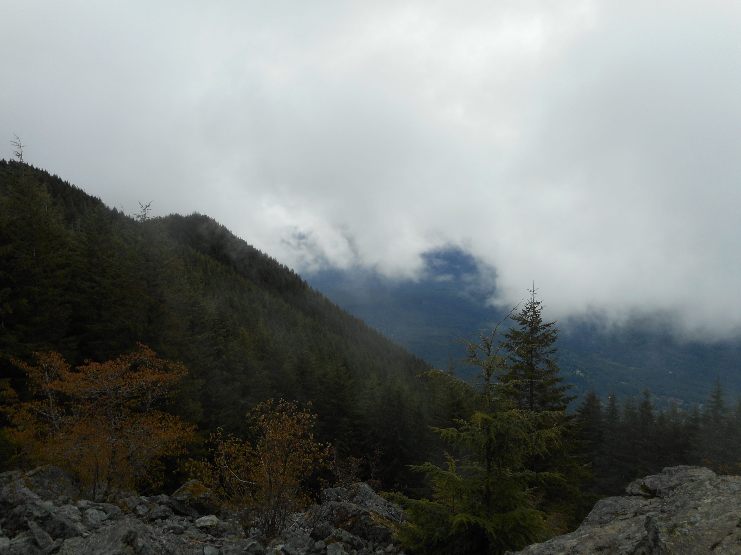
I did a proper hike today, 8 miles, 3150 feet of elevation gain. For the first time I went up the “new” Mount Si trail. I have gotten to the top of Si several times but in the past, always from the Old Trail or via Mount Teneriffe trail.
I have avoided the main trail because it has a reputation of being massively crowded. So I started early on a week day and I only encountered a few people on the way up. On the way down – over and over and over I had to step aside (the trail is mostly pretty narrow) to let the uphillers go by.
Summit Block
So I guess this will be one and done for me. I did it and that’s good enough. The other routes are fine with me.
My hike today was completely unplanned. I wanted to get out of the house because a contractor is here banging and sawing. But where to go on a very rainy day?
I first thought of the mall so I put a water bottle and a book in my Rick Steves day bag and headed out. As I drove the rain seemed to lessen and I always want to at least take a long walk and it dawned on me that I could go back to Garfield Ledges, which is totally under a forest canopy, even without my full pack and the gear it contains.
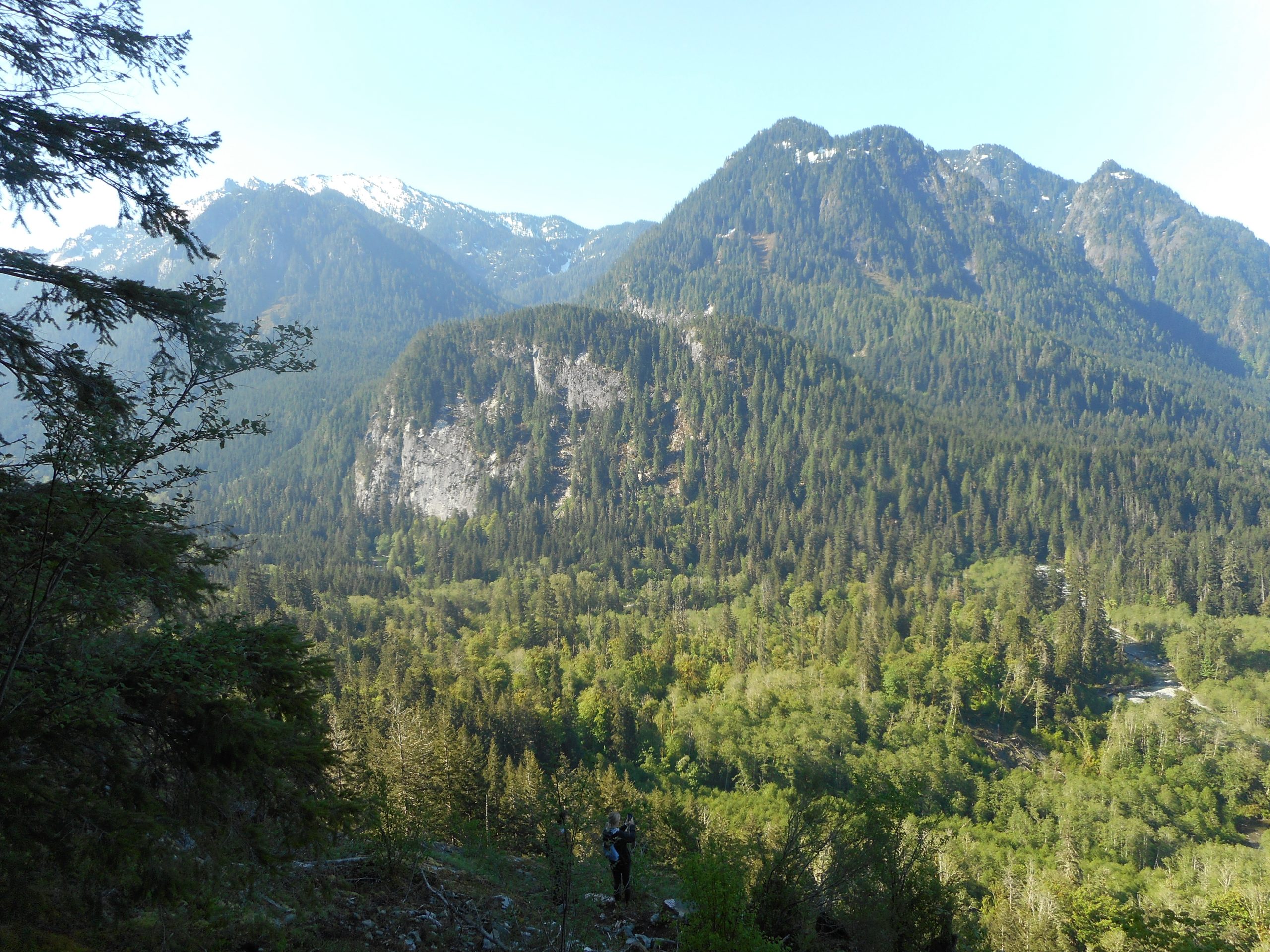
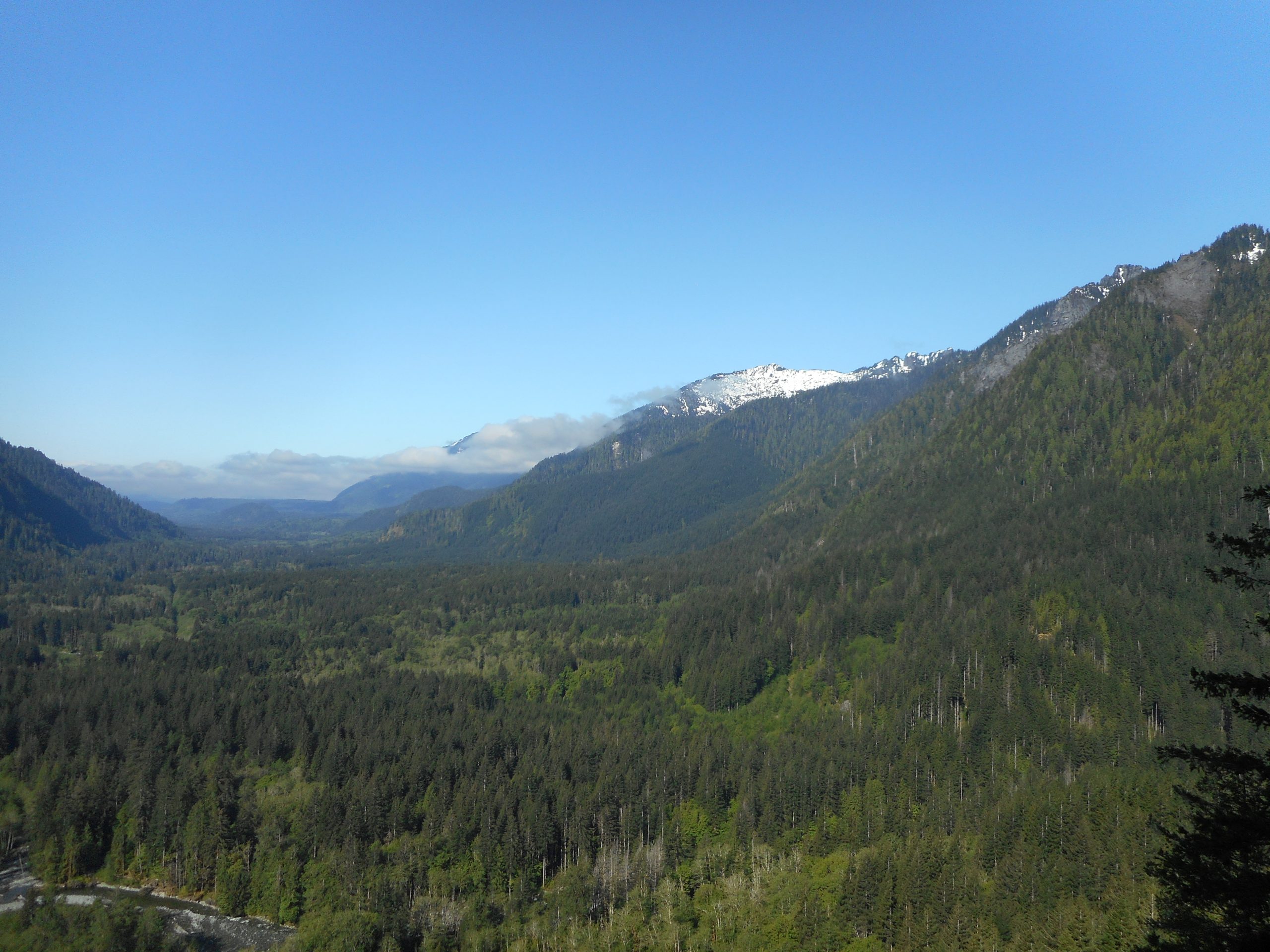
So I drove thru Duvall, Carnation, Snoqualmie and North Bend (past the little diner where agent what’s-his-name had pie and coffee on ‘Twin Peaks’) to I-90, exit 34, and then 12 miles down the Middle Fork Road to the Garfield Ledges trail head. Not much traffic today, no long line of illegally parked cars near Mailbox Peak.
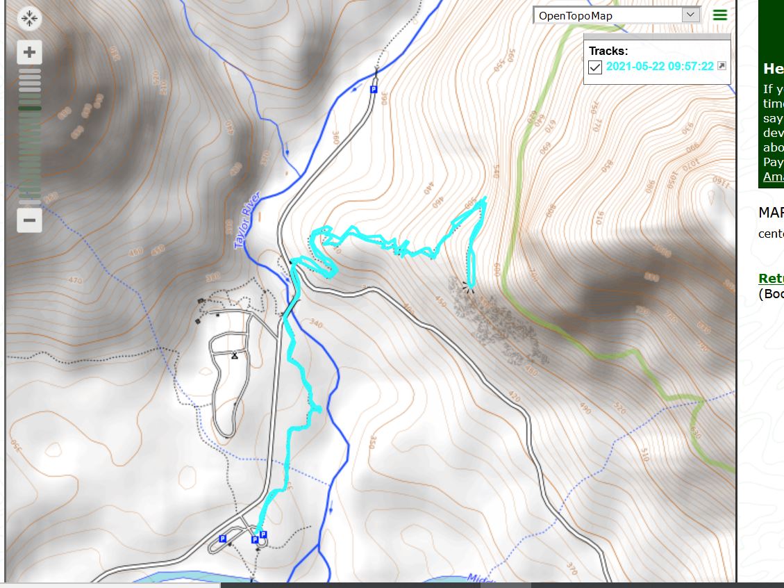
This time, instead of parking at the Middle Fork trail head and taking the connector trail I parked right at the Garfield Ledges trail head so I could gauge how long the hike takes. Jan’s sister and her daughter Jackie are coming to visit in a couple of weeks, and I thought we might do a little outing there. Jan and her sister Deb could visit (perhaps sip some wine) at one of the picnic tables near the trail head, overlooking the river, while Jackie and her dog Flynn and I could zip up the trail for a quick workout. Anyway, it took me 45 minutes car-to-car and I wasn’t trying to hurry.
So the plan just might work, if Deb and Jackie want to do something like that.
I wanted to check out the Garfield Ledges hike. I thought it might be a good one for Derek, Jill and the kids and I was right. I will recommend it to Derek.
This one is out a bit past the trailhead for Stegosaurus Butte, way down the Middle Fork road. I parked in the lot for the Pratt River Trail and did the little connector trail to get to the Ledges trail head. It added a bit to the hike, which was still, car-to-car, only 3 miles.
The main trail is about a mile up and maybe 700 feet of elevation gain. So, not exactly flat but not really steep. The trail is in great shape. I assume WTA has done work on this recently.
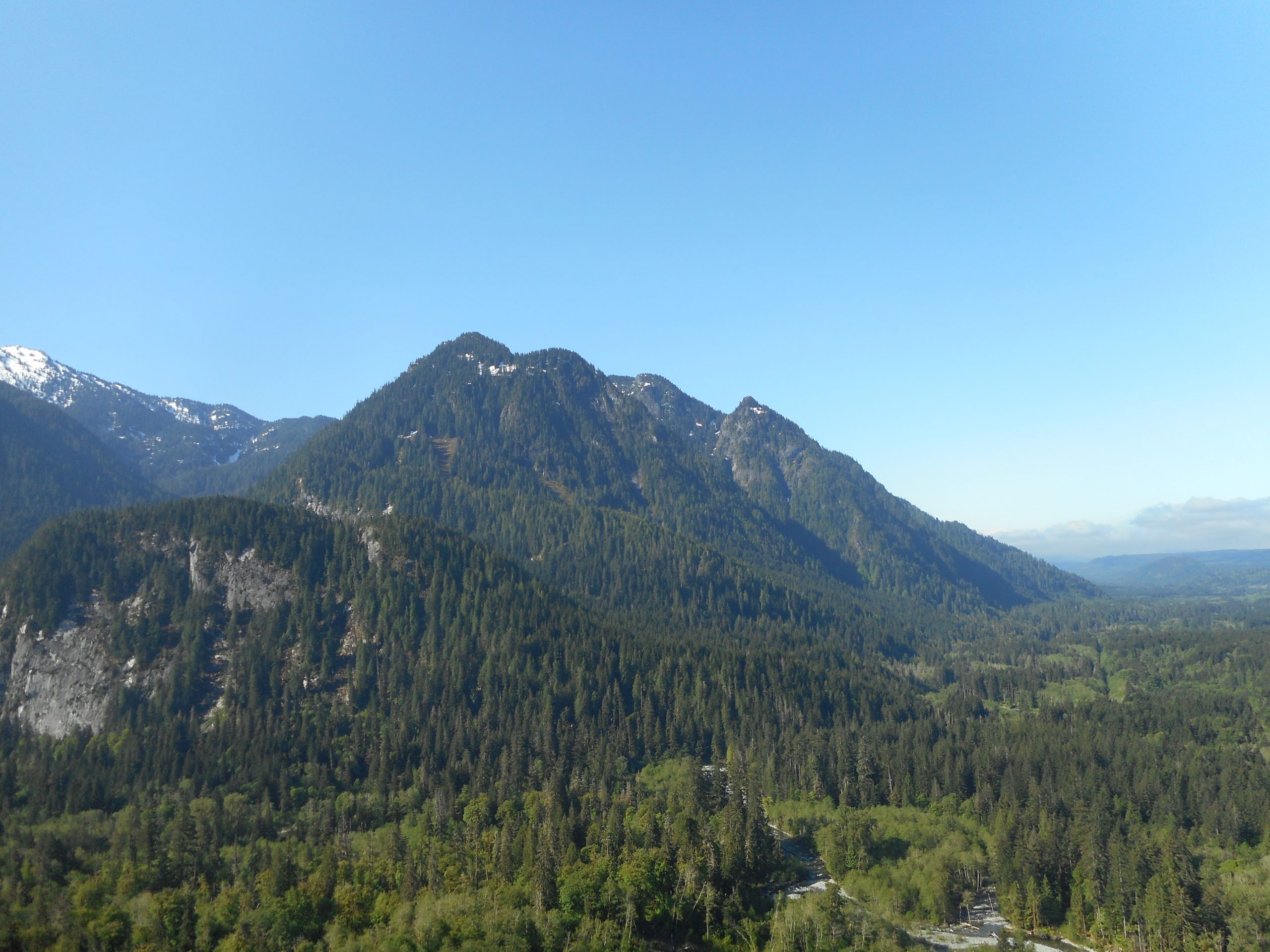
The view at the ledges is great (see below). But I will not be back in this area on a weekend if I can help it. Not only are there many cars on FR56, about half of them going way too fast around the curves, but the cars in the general vicinity of Mailbox Peak are out of control. The lots were both full so hundreds of people parked their cars along the side of the road, in plain view of the numerous ‘Park Only in Designated Areas’ signs. People: if you want to hike and the lot is full, your plan failed and go somewhere else. You don’t just park illegally, and dangerously (it is a narrow 2-lane road as it is and when people park on the side, two cars passing are a dicy proposition).
Anyway, nice hike, good discovery, won’t be back there on a weekend any time soon.
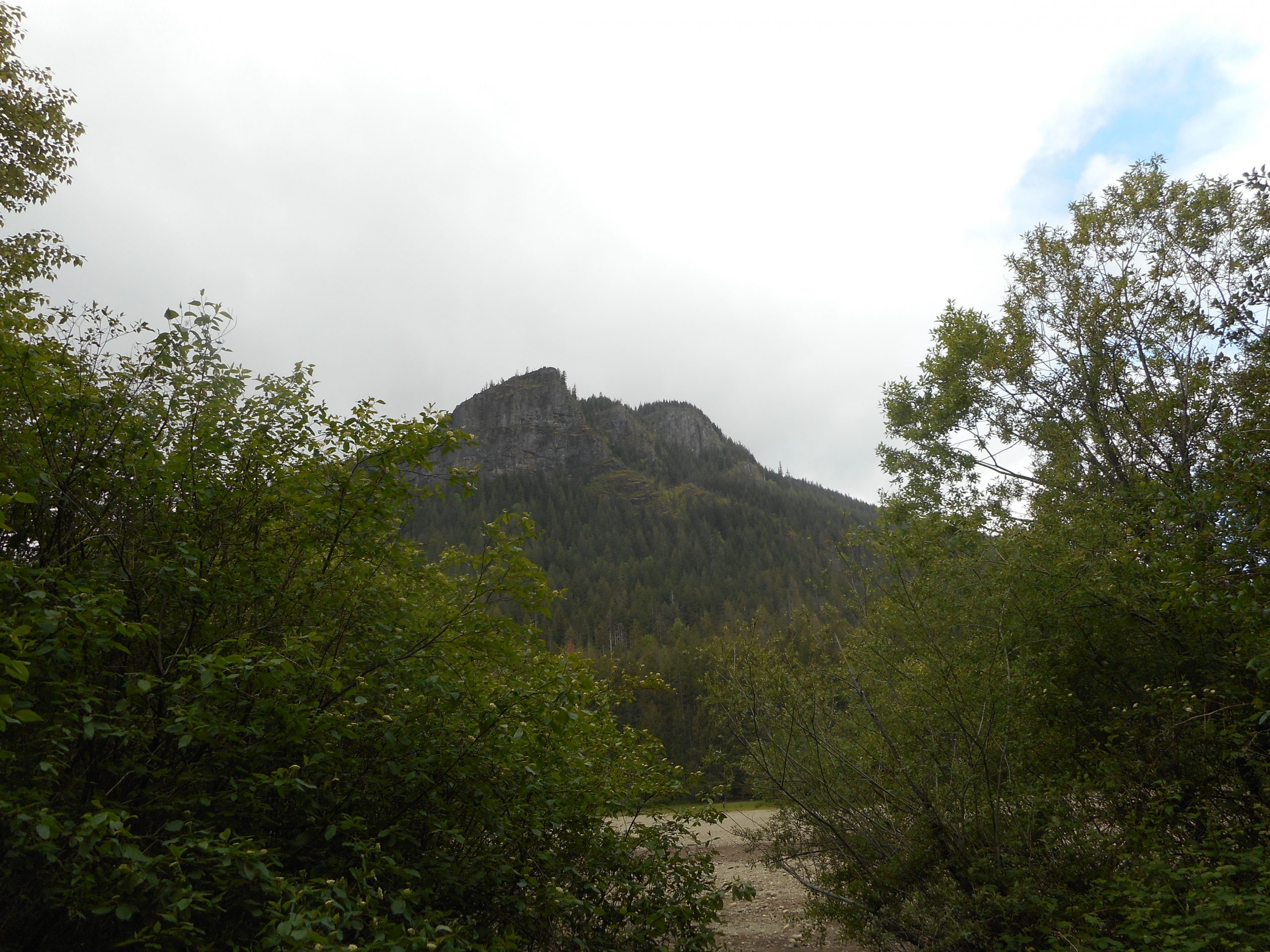
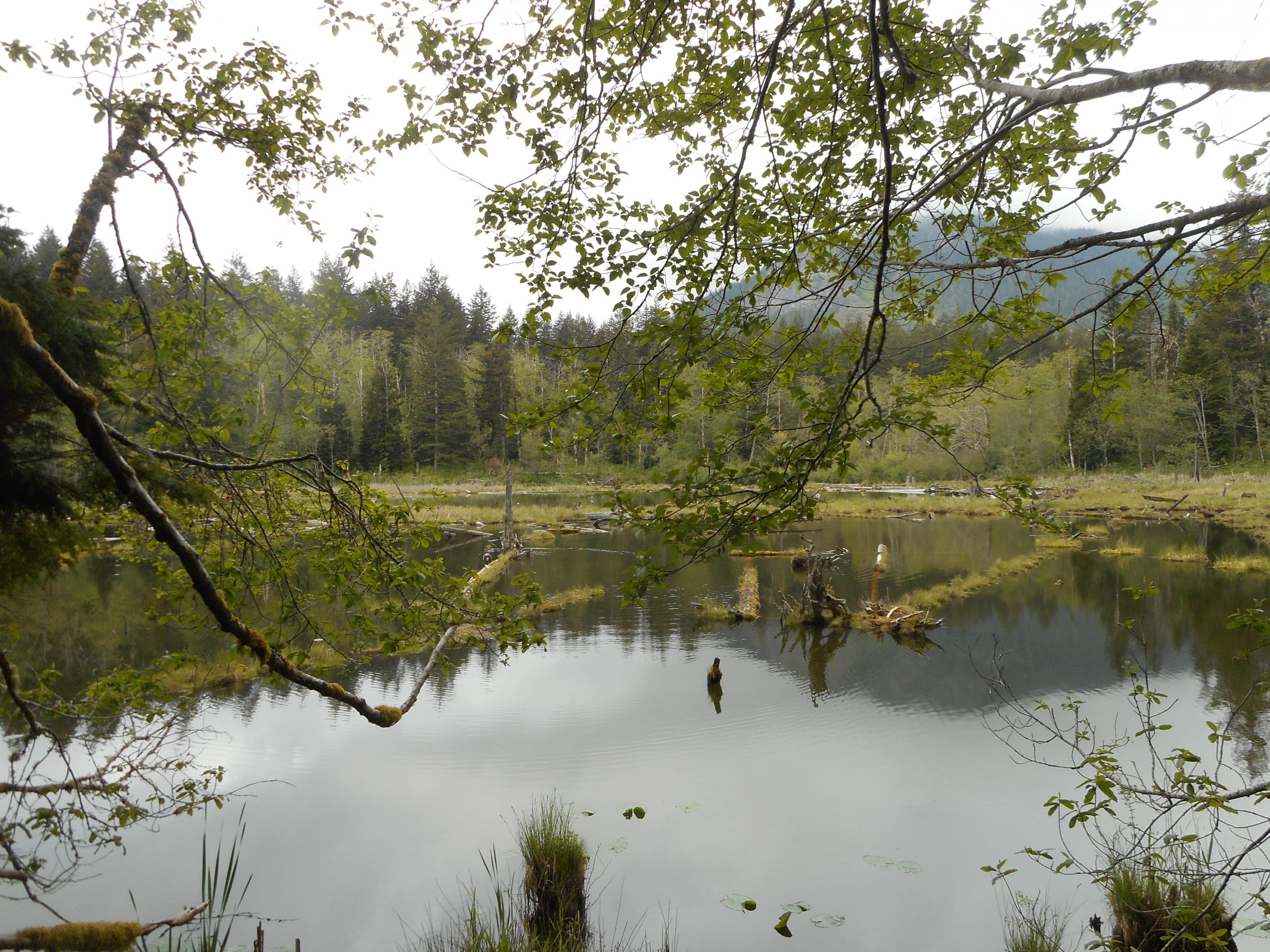
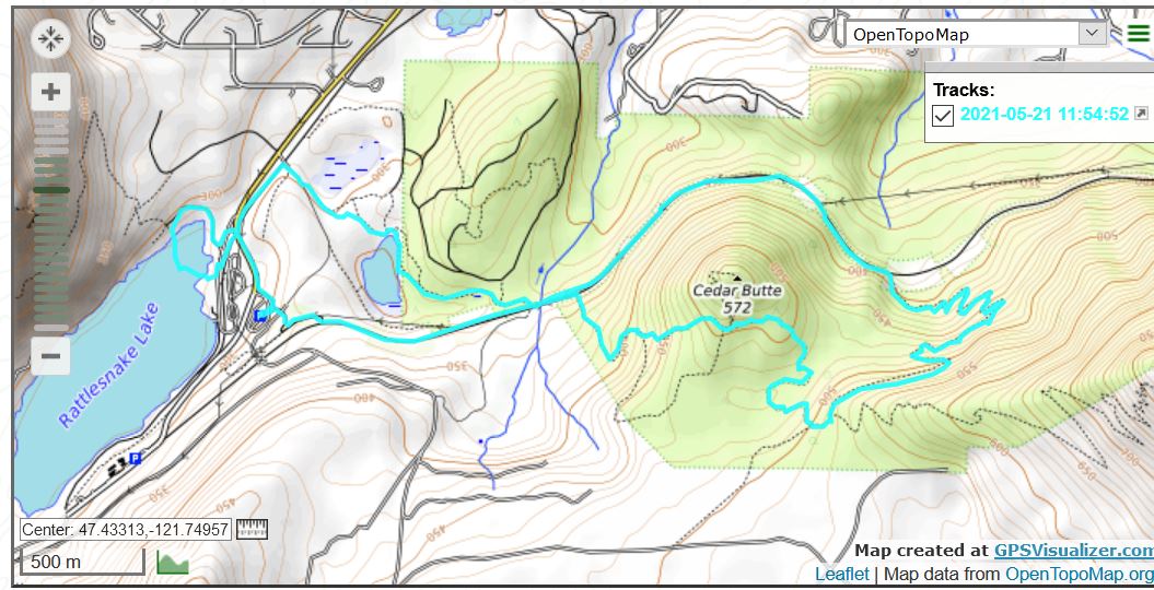
I did my typical Cedar Butte/Olallie hike. I went by Christmas Lake on the way back, as well as Rattlesnake Lake. 6.5 miles, lots of fun and a decent workout.
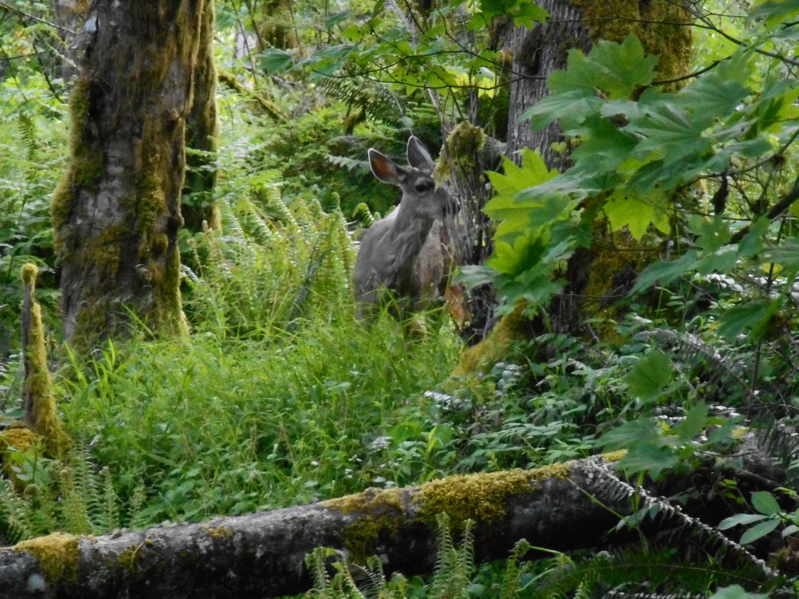
I got a relatively close look at a deer today. I startled her and her startle startled me. She ran just off the trail and stopped. I stopped. I pulled out the camera, zoomed in, and got the shot above. When I proceeded she bounded uphill a few strides and stopped again. I take it she has seen plenty of hikers, is wary of us, but has learned we aren’t pulling out guns. Bambis on Tiger Mountain are safe.
I went up Section Line as per my usual conditioning hike, but extended it a bit by taking the Talus Rocks Trail to West Tiger 3 trail, and down to the Swamp and Big Tree Trails, etc., back to the E. Sunset Lot.
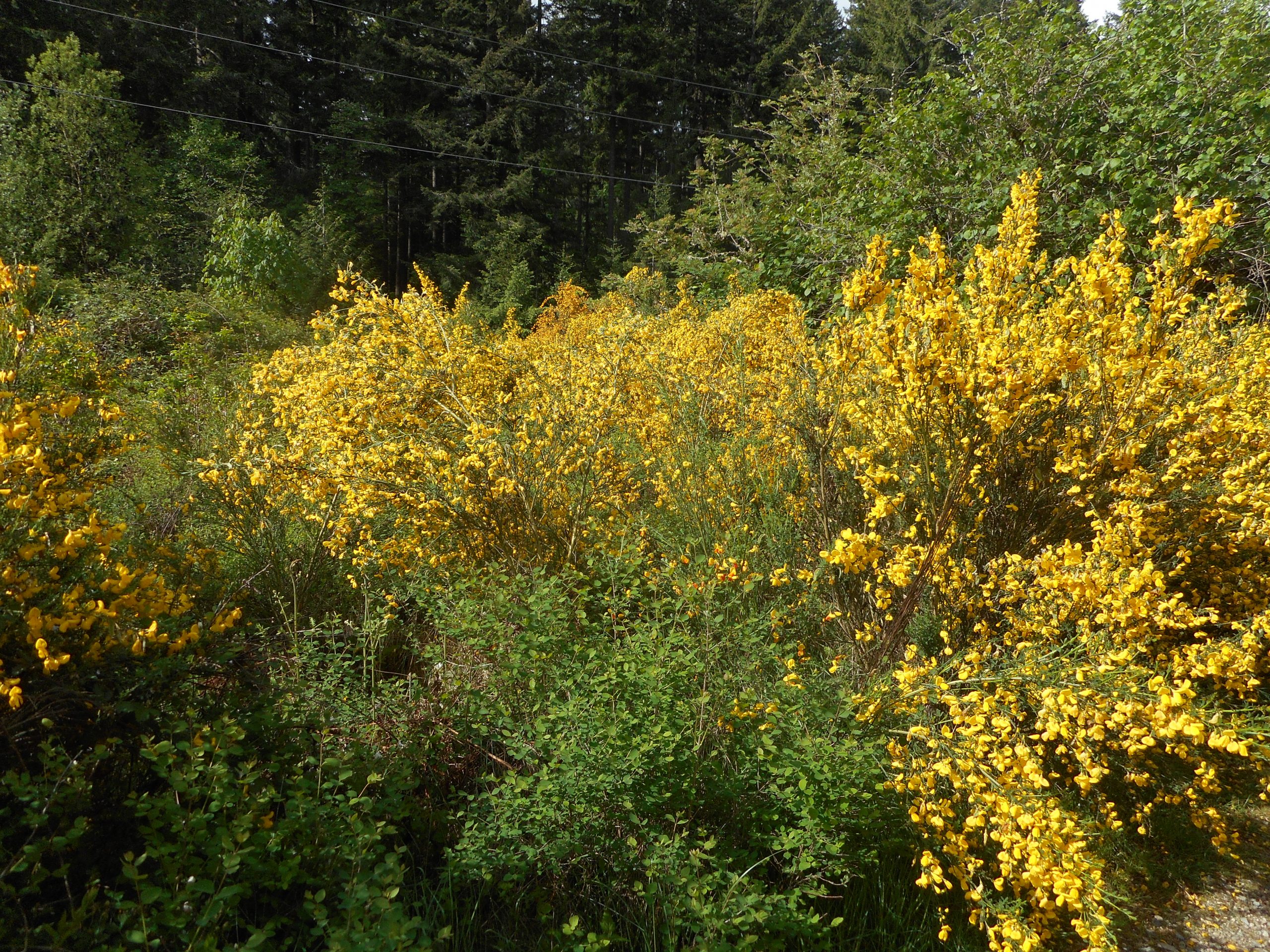
Plenty of nice flowers out right now:
Where is Van Gogh When You Need Him?
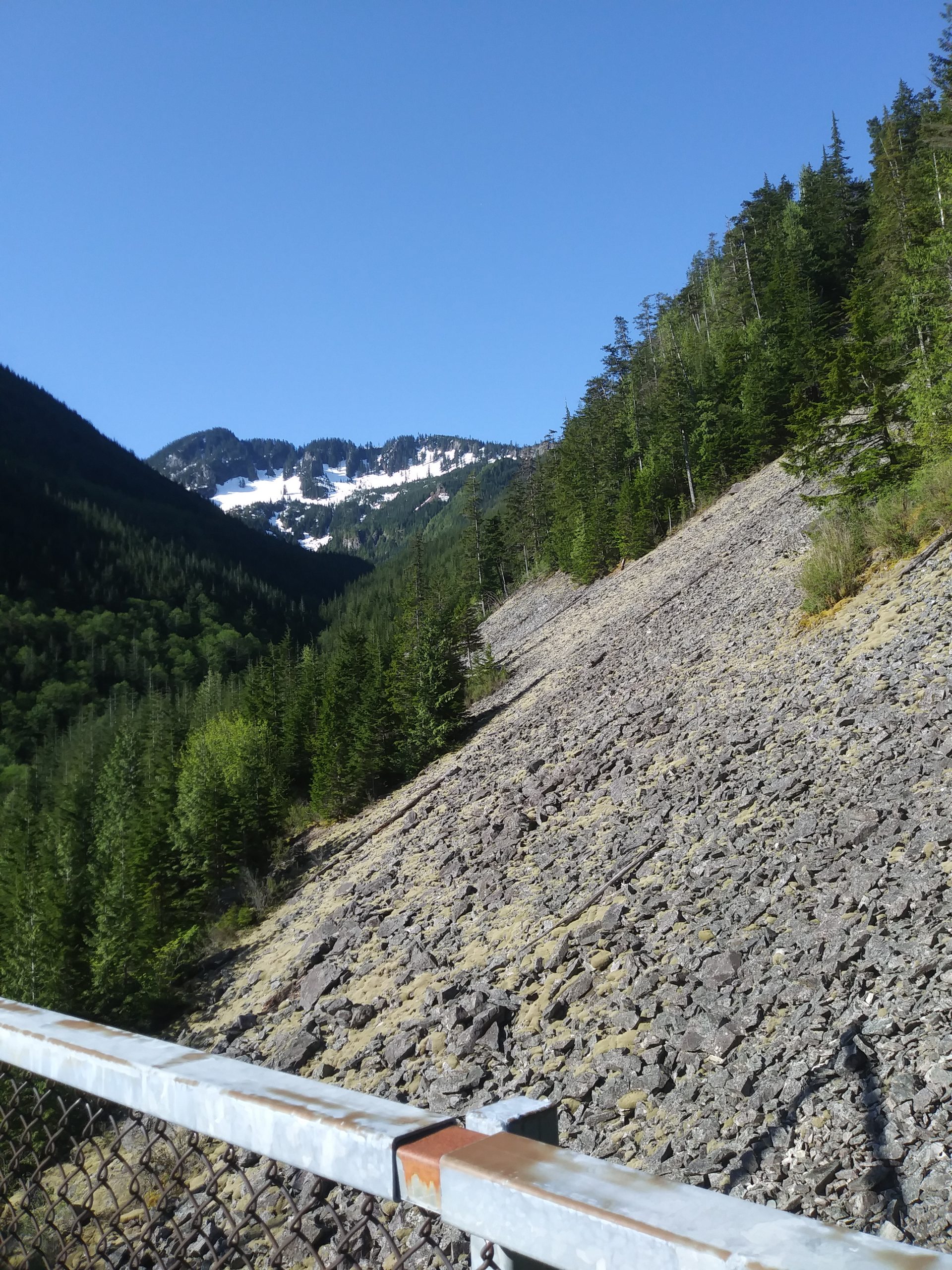
And there is the decent view of Issaquah and Lake Sammamish (look up July 14, 1974) in the distance.
A semi-bust today. My plan was to go up Zig Zag Trail but when I got to the start of the trail (after the .1 mile ultra-steep connector) my knee was sore. Since I want to keep up my pattern of three hikes a week, I headed east on the flat PTC trail to Mine Creek Bridge and turned around.
When I got back to Zig Zag my knee was feeling better but I didn’t have time by then to go up to the top. I went up about .25 mile, to the Hall Creek Trail junction and turned around. Live to fight another day and all that.
I had a date to pick up my grandson Camden (almost 6) and bring him back for a stay over. When I got there the plans changed, and not for a good reason. On the way to work this morning Jill got into an accident and her car is totaled. No one was hurt, which is good news, but I am predicting a huge problem going forward. I am pretty sure the person is going to sue and being without a car is going to be an issue. We will do what we can to help.
In the meantime, both Camden and his sister Finley (now 12) are over:
Camo and Fin
So at least we have that going for us. But what a miserable turn of events – totaling the car.
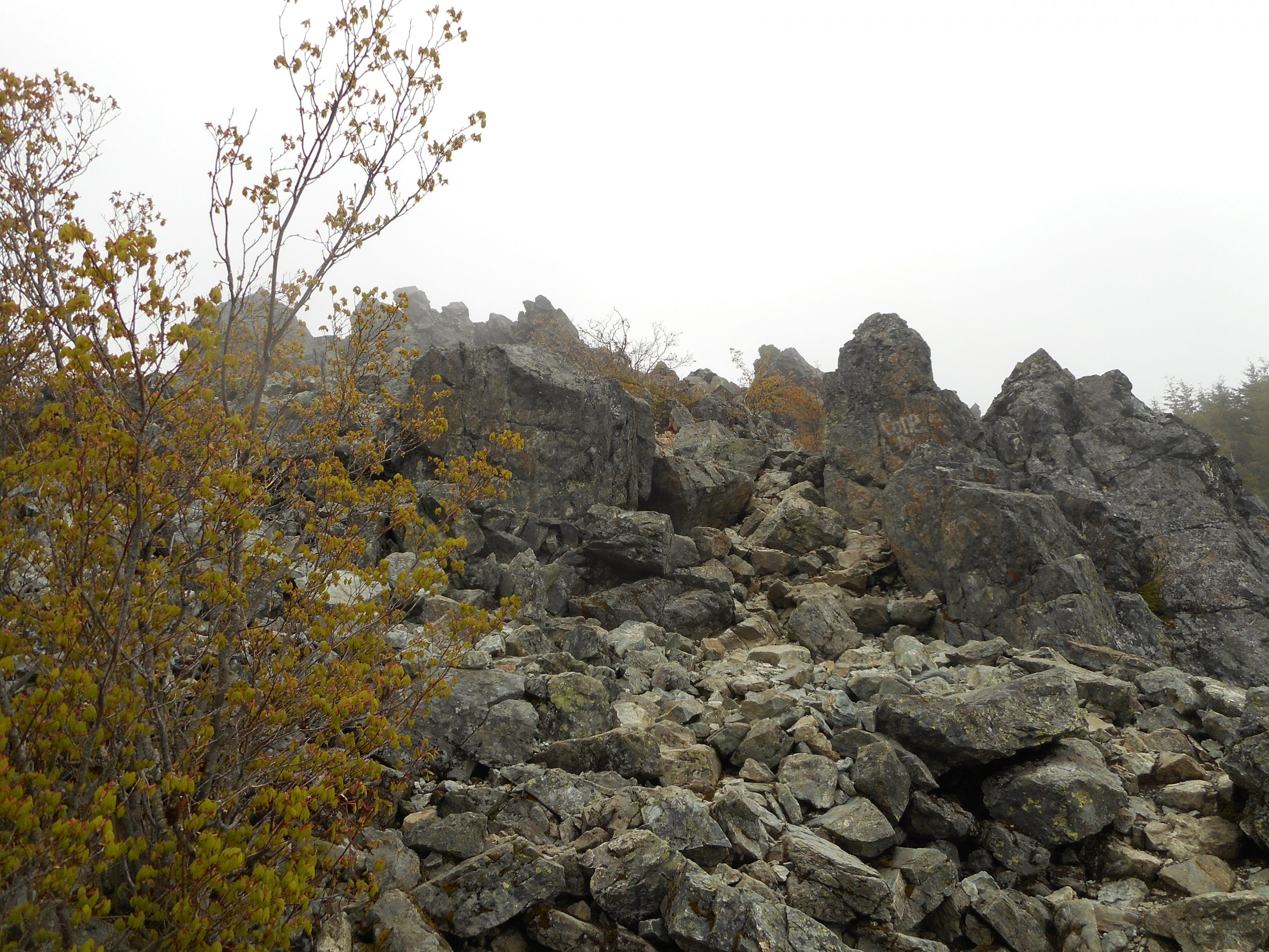
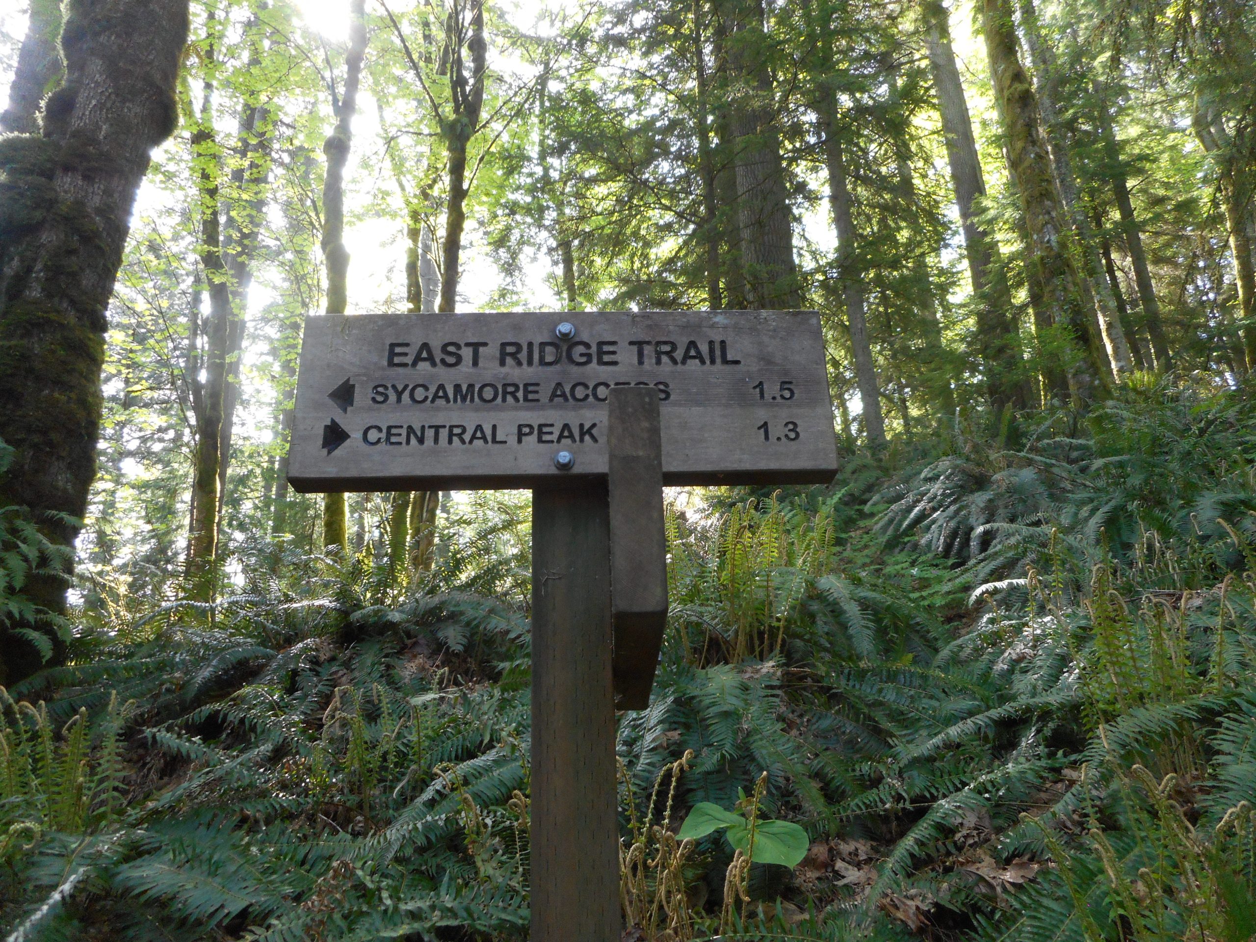
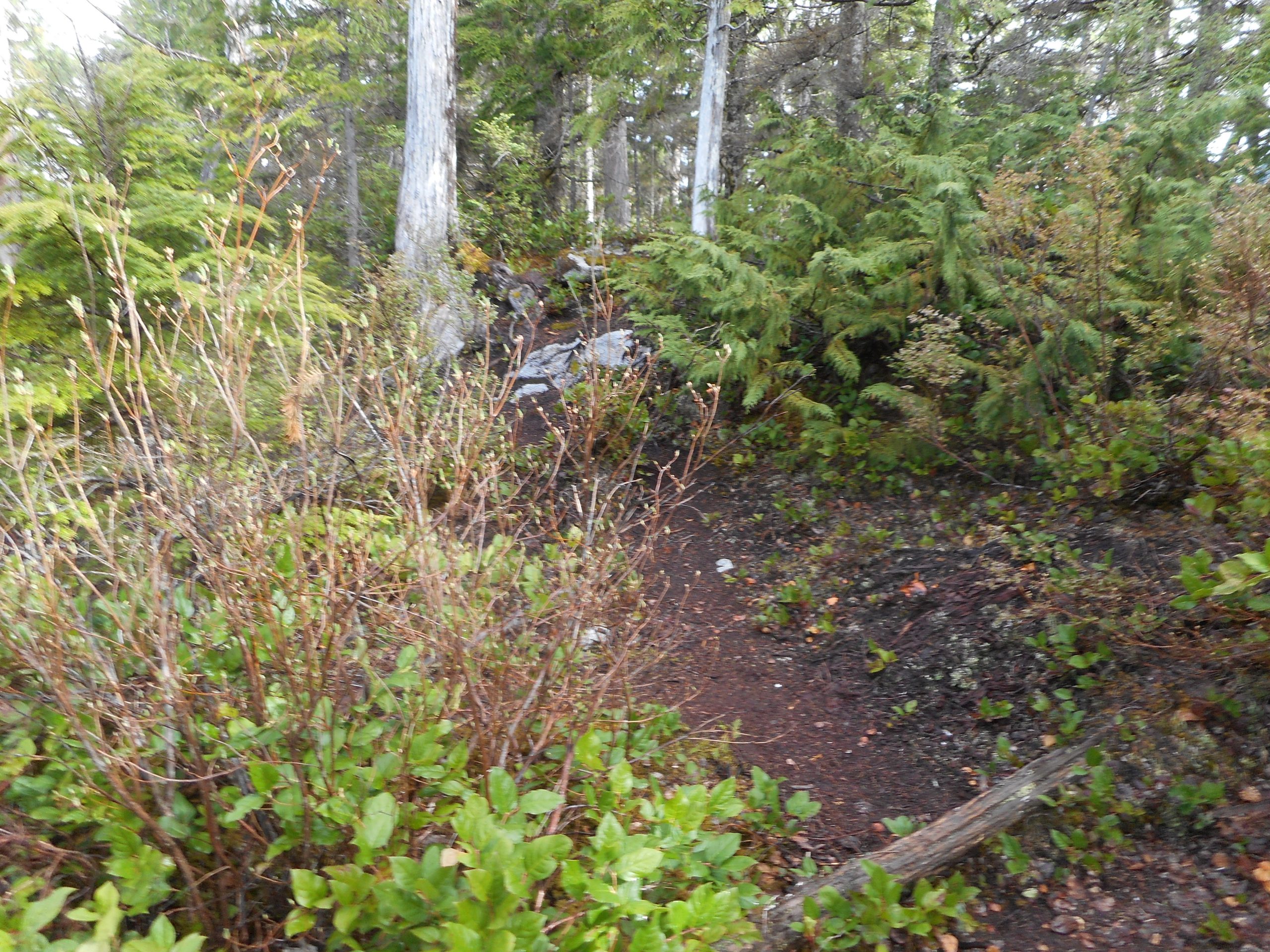
I now know exactly how I missed the spur trail to Southeast Peak.
Squak Mountain has many trails, and thus many trail junctions, and there is a sign for almost – almost – every one. Check out this junction (the left leads to SE Peak):
The Turn I MissedTypical Sign
Not that SE Peak is a big deal. It has a slightly better view (see top photo, above) than West Peak or Central Peak, but Squak Mountain peaks are just not high enough to be above the tree line (SE is 1630 feet).
Anyway, now I know.
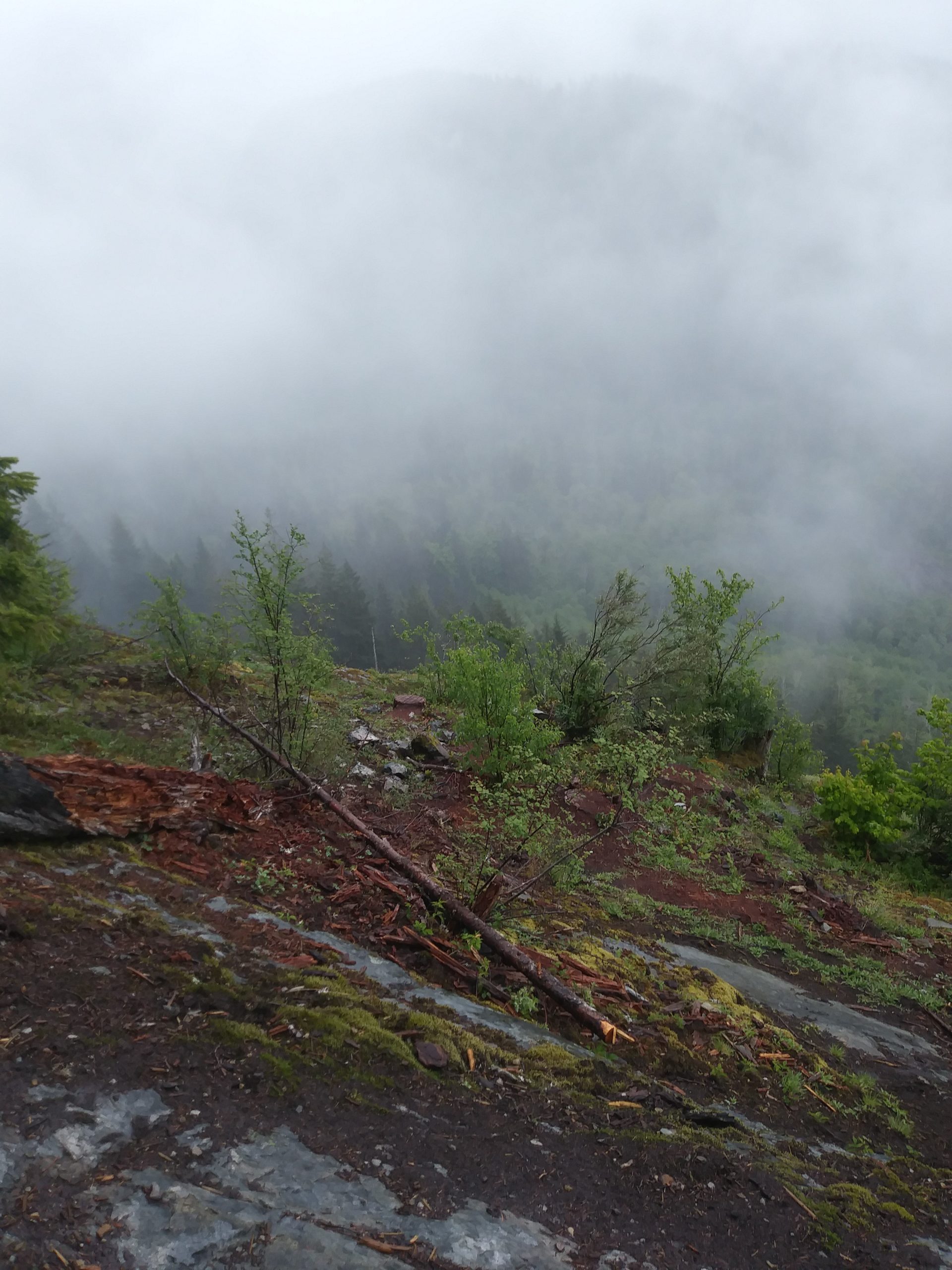
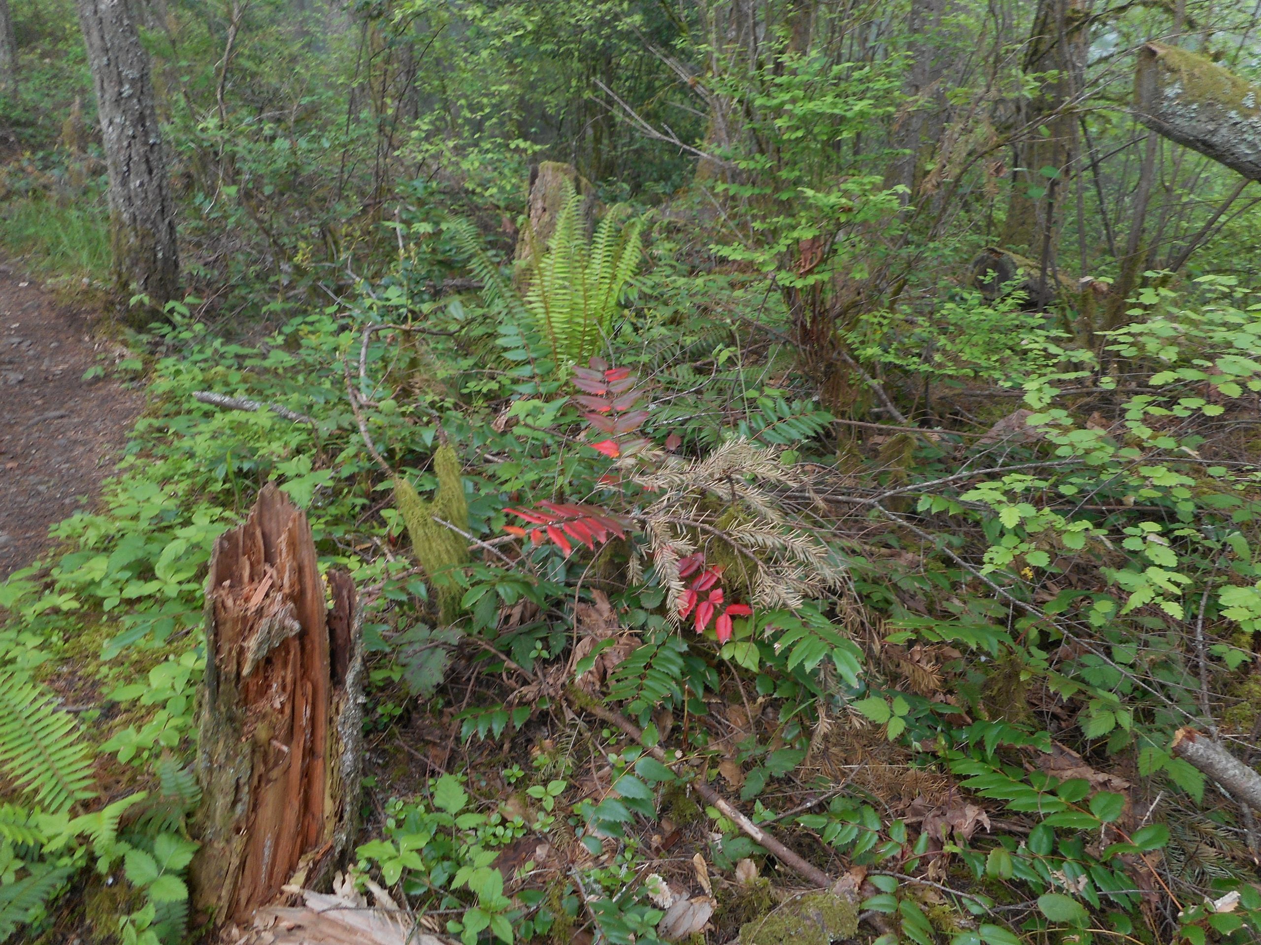
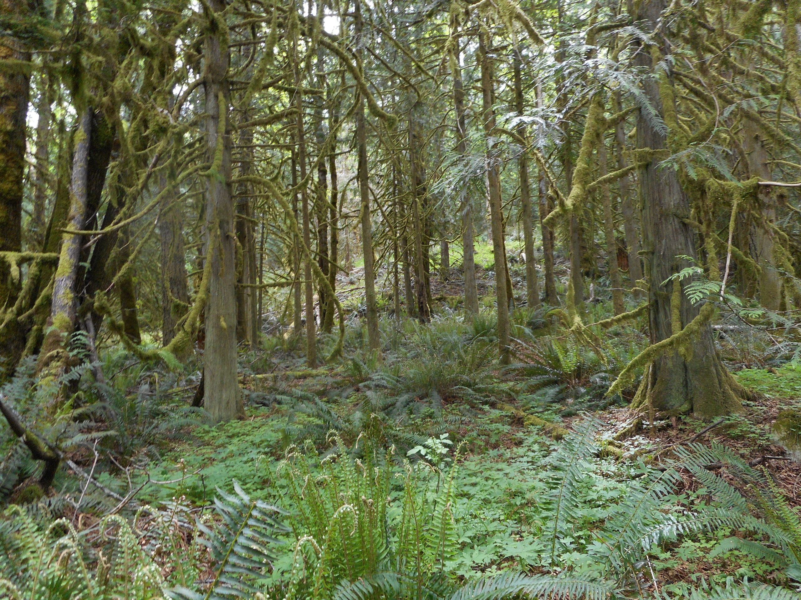
Some nice color along the trail:
Forest Color
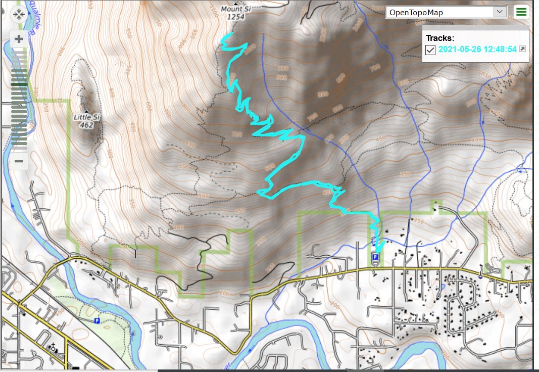
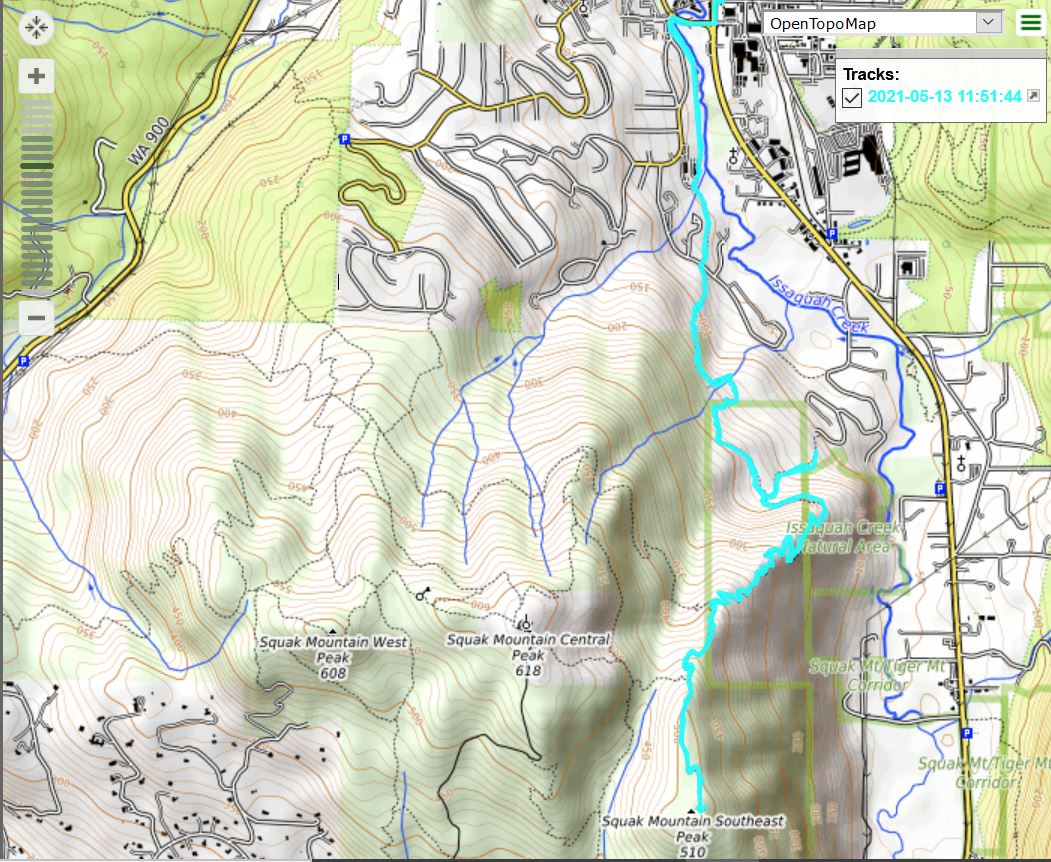
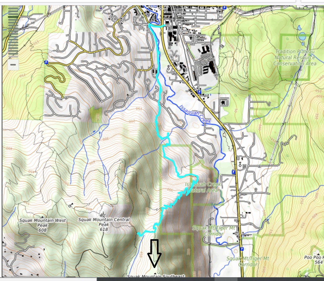
About 7.75 miles, (including a little detour when I looked for an alternate way down but, when I got to the bottom, discovered they are building condos right up to the trail itself!) a good workout. Here is the track:
My plan today was to hike up the SE side of Squak Mountain to Southeast Peak. I missed the turn for the peak – the arrow pointing downwards above shows the turn I missed. I am not sure how I missed it. There are a few signs on this mountain and I suspect the trail I needed to take had a sign that said something besides ‘Southeast Peak’ (unlike the sign for West Peak, e.g.).
Anyway, I forgot my camera but will remember it Thursday when I come back. I was going to do something else Thursday but this screw-up bugs me and I won’t be OK with it until I actually hit this peak.
I had heard this trail was very steep, but if it is, I didn’t get to the steep section. It is a fairly steady climb, but I do not regard this trail as steep. I guess I will learn more on Thursday.
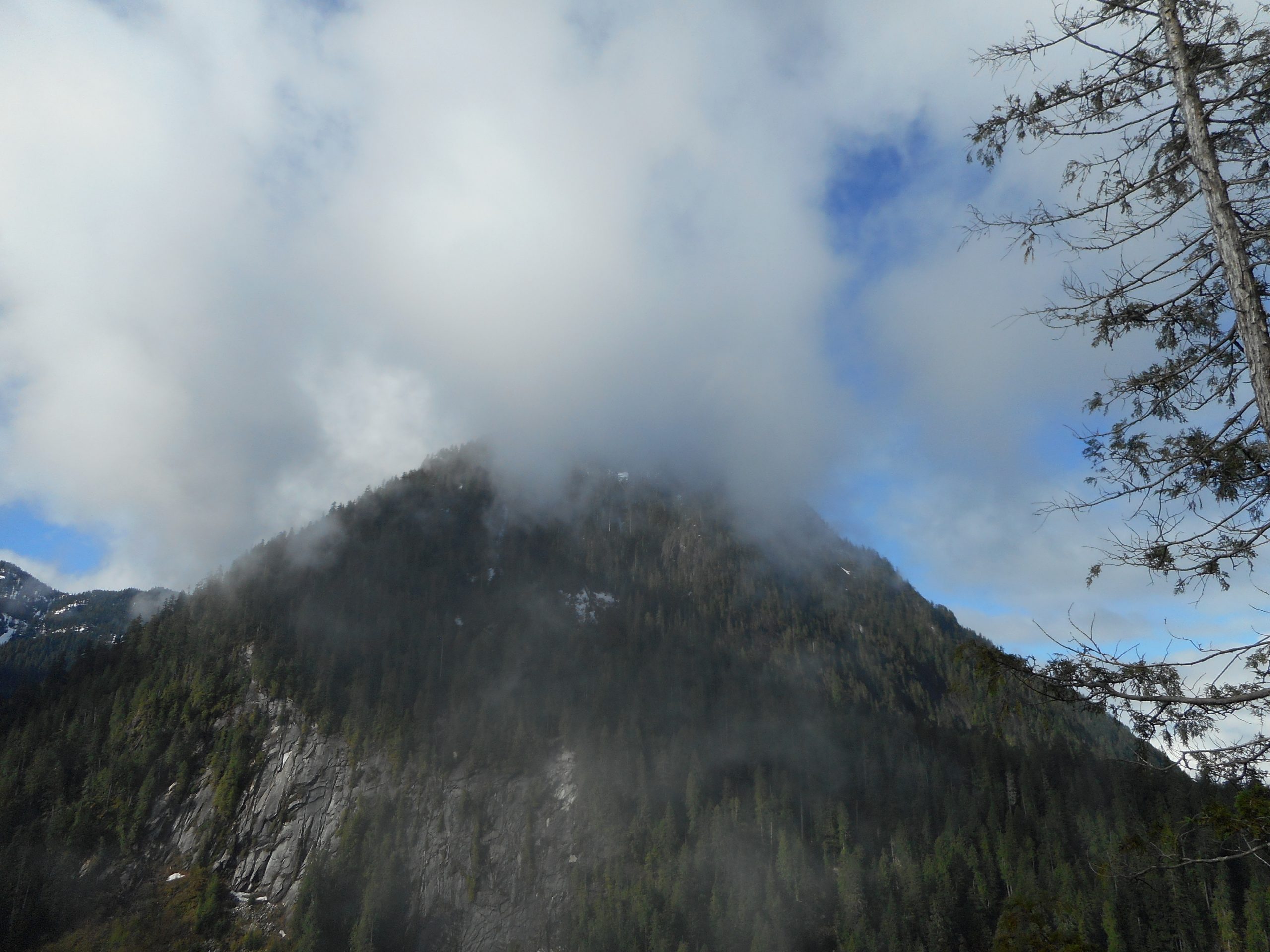
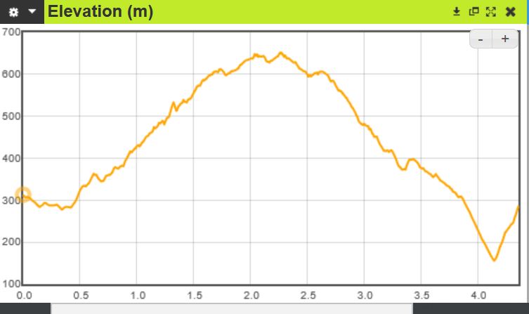
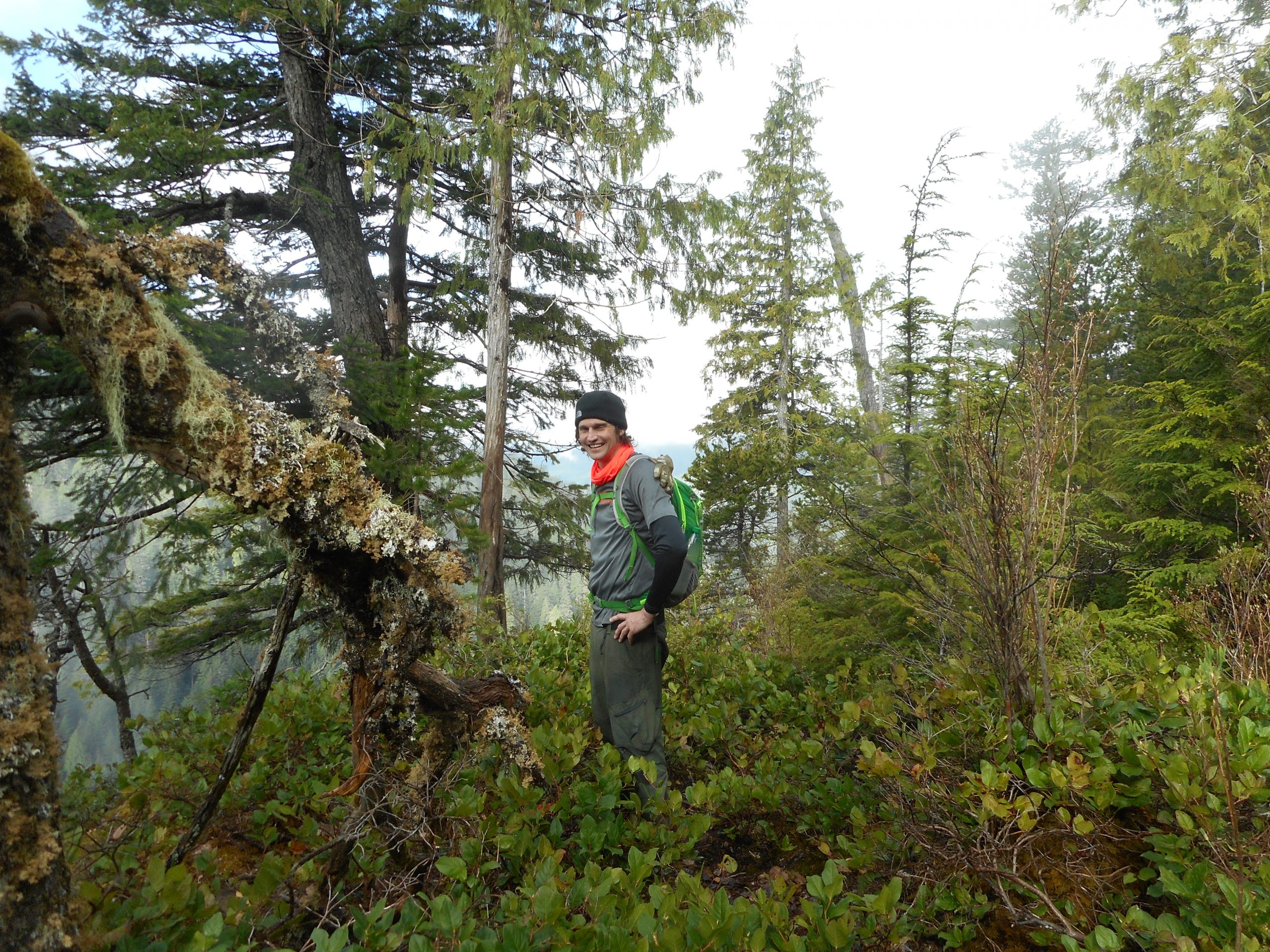
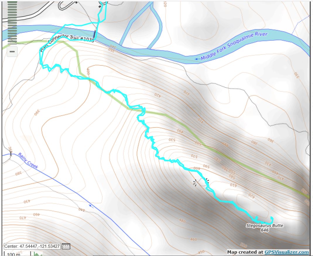
Derek and I did Stegosaurus Butte today, we went all the way up to the true summit (see track below). I was on this trail a few weeks ago and, I now see, wisely decided to turn around mid-way, as the hike ahead of me looked so steep that it might be dangerous going down, and being injured and alone on an out-of-the-way trail like this sounds like death.
And, in fact, it was incredibly steep and, today, muddy and slick. Here is the elevation profile:
Elevation Profile
The views at the top are amazing:
Those Mountains Block The View!
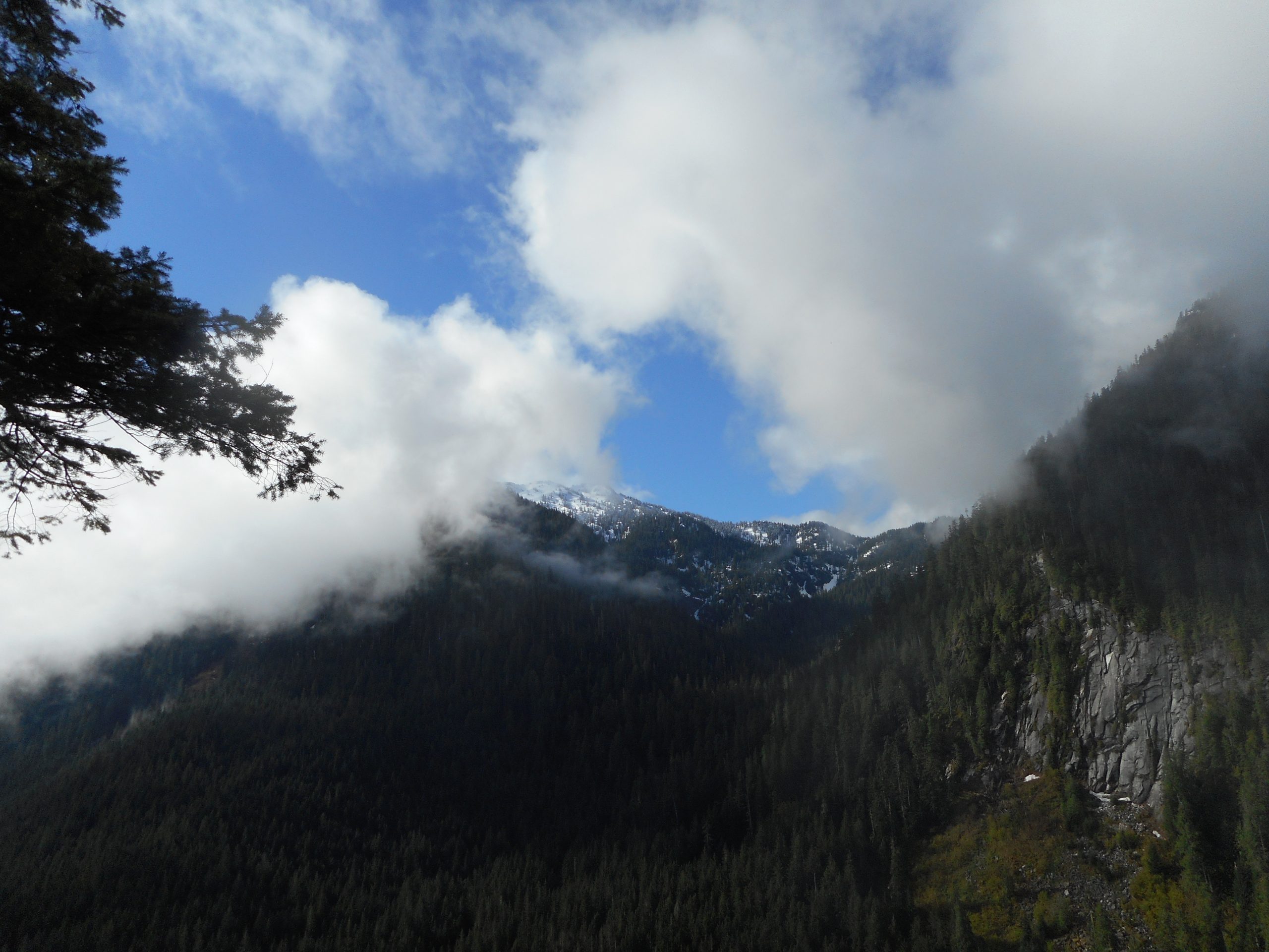
This is what the summit looks like; that is, if you turn around after oohing and ahhing about the views of the neighboring mountains, this is what you see:
The Summit Itself
Here is Derek on the way down:
Derek
Only 2.43 miles but an excellent workout. We had a great time and agreed we want to go back, particularly on a day when we won’t look like mud wrestlers when we are done.
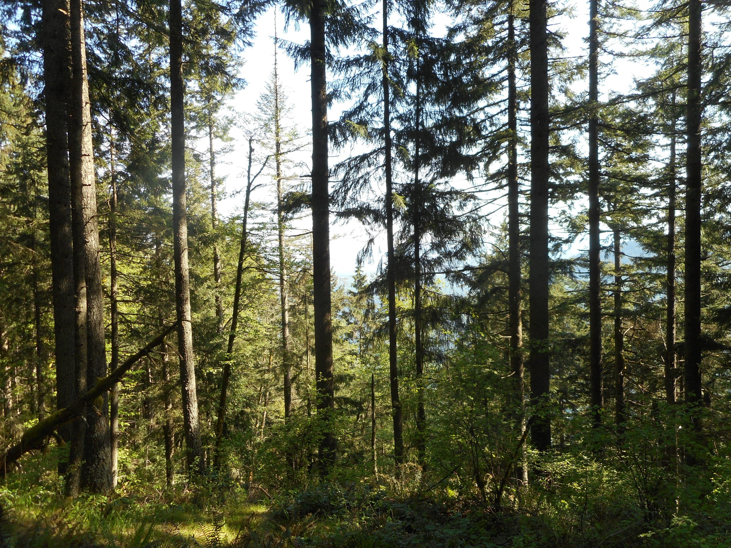
Once again I did my standard Tiger Mountain Section Line conditioning hike. Nothing special. And yet, along the way, I could not help but pause from time to time just to enjoy the forest. Not views that are exceptional within the context of Tiger Mountain State Forest, but exceptional within the context of every day life. Imagine being in downtown Seattle and stumbling across a view like above.
I hope to get out somewhere on Saturday. I guess I will have to check the weather to see what seems reasonable.